42:
1055:
1307:
136:
94:
115:
708:
In the CDP, the population was spread out, with 26.2% under the age of 18, 10.0% from 18 to 24, 38.4% from 25 to 44, 18.5% from 45 to 64, and 6.8% who were 65 years of age or older. The median age was 31 years. For every 100 females, there were 90.9 males. For every 100 females age 18 and over, there
664:
of 2000, there were 20,479 people, 8,260 households, and 5,055 families residing in the CDP. The population density was 4,785.1 inhabitants per square mile (1,847.5/km). There were 8,621 housing units at an average density of 2,014.4 per square mile (777.8/km). The racial makeup of the CDP was 38.68%
704:
living together, 17.2% had a female householder with no husband present, and 38.8% were non-families. 30.0% of all households were made up of individuals, and 5.1% had someone living alone who was 65 years of age or older. The average household size was 2.45 and the average family size was 3.06.
41:
1979:
431:
Note: the US Census treats
Hispanic/Latino as an ethnic category. This table excludes Latinos from the racial categories and assigns them to a separate category. Hispanics/Latinos may be of any race.
1198:
1170:. Retrieved on August 26, 2018. "In 1980 the college found its home in Laurel, Maryland. Within three years, Capitol purchased the 52-acre former site of the Beltsville Speedway, "
712:
The median income for a household in the CDP was $ 51,043, and the median income for a family was $ 60,028. Males had a median income of $ 38,559 versus $ 32,068 for females. The
1191:
331:, the CDP has a total area of 8.2 square miles (21.2 km), of which 8.2 square miles (21.2 km) is land and 0.04 square miles (0.1 km), or 0.42%, is water.
1901:
1841:
1644:
567:
1984:
1771:
1709:
1184:
1110:
1093:
1076:
746:
483:
55:
240:
1018:
1014:
1010:
1002:
1176:
503:
1123:
755:
Most residents are zoned to Dwight D. Eisenhower Middle School in South Laurel while some are zoned to Martin Luther King Middle School in
752:
Zoned elementary schools serving sections of the CDP include: Deerfield Run, James
Harrison, Laurel, Montpelier, Oaklands, and Vansville.
1208:
274:
250:
140:
1030:
1026:
1022:
296:
955:"P2 Hispanic or Latino, and Not Hispanic or Latino by Race – 2020: DEC Redistricting Data (PL 94-171) – South Laurel CDP, Maryland"
932:"P2 Hispanic or Latino, and Not Hispanic or Latino by Race – 2010: DEC Redistricting Data (PL 94-171) – South Laurel CDP, Maryland"
1437:
799:
215:
1042:
1038:
1034:
954:
931:
1801:
682:
670:
1167:
1150:
859:
775:
760:
674:
607:
463:
1836:
1639:
127:
1554:
1372:
978:
959:
936:
889:
863:
837:
686:
328:
1896:
1756:
1599:
1594:
1261:
547:
1629:
1528:
1402:
1392:
1342:
395:
380:
365:
282:
1866:
1604:
1513:
1407:
1397:
1382:
1377:
1327:
1291:
1230:
820:
700:
There were 8,260 households, out of which 33.6% had children under the age of 18 living with them, 38.6% were
1949:
1786:
1751:
1736:
1624:
1614:
1483:
1467:
1417:
1296:
1286:
270:
32:
1791:
1689:
1579:
1478:
1362:
1357:
1352:
1256:
690:
1871:
1851:
1699:
1694:
1684:
1664:
1654:
1523:
1503:
1387:
1332:
1276:
587:
1153:. Retrieved on August 26, 2018. "Capitol Technology University 11301 Springfield Road Laurel, MD 20708"
1072:
910:
1956:
1856:
1826:
1776:
1766:
1761:
1704:
1674:
1649:
1569:
1548:
1543:
1538:
1488:
1462:
1457:
1452:
756:
694:
225:
1926:
1891:
1876:
1816:
1796:
1724:
1634:
1559:
1472:
1367:
1337:
1271:
1266:
1089:
1059:
779:
729:
678:
666:
266:
1906:
1831:
1806:
1746:
1714:
1679:
1659:
1574:
1564:
1533:
1518:
1427:
1347:
1130:
1106:
1006:
1821:
1811:
1781:
1741:
1619:
1609:
1498:
1493:
1442:
1432:
713:
1886:
1861:
1584:
1281:
914:
832:
764:
716:
for the CDP was $ 24,564. About 3.5% of families and 5.9% of the population were below the
1589:
1508:
1447:
1251:
886:"Geographic Identifiers: 2010 Demographic Profile Data (DP-1): South Laurel CDP, Maryland"
527:
1163:
1846:
1973:
507:
99:
1881:
717:
821:
U.S. Geological Survey
Geographic Names Information System: South Laurel, Maryland
1223:
1062:. Retrieved on September 11, 2018. "12625 LAUREL BOWIE RD LAUREL, MD 20708-9998"
1916:
107:
311:
298:
232:
211:
70:
57:
206:
1940:‡This populated place also has portions in an adjacent county or counties
720:, including 8.9% of those under age 18 and 3.0% of those age 65 or over.
701:
278:
120:
1146:
661:
1073:
NEIGHBORHOOD ELEMENTARY SCHOOLS AND BOUNDARIES SCHOOL YEAR 2018-2019
1317:
1241:
1090:
NEIGHBORHOOD MIDDLE SCHOOLS AND BOUNDARIES SCHOOL YEAR 2018-2019
1021:. Note that the census-designated place was previously smaller:
1180:
1107:
NEIGHBORHOOD HIGH SCHOOLS AND BOUNDARIES SCHOOL YEAR 2018-2019
1980:
Census-designated places in Prince George's County, Maryland
1305:
1003:
2010 CENSUS - CENSUS BLOCK MAP (INDEX): South Laurel CDP, MD
425:
South Laurel CDP, Maryland – Racial and ethnic composition
974:
885:
732:
operates the
Montpelier Post Office in South Laurel CDP.
911:"Decennial Census of Population and Housing by Decades"
1124:"2020 CENSUS - CENSUS BLOCK MAP: South Laurel CDP, MD"
1935:
1915:
1723:
1416:
1316:
1240:
249:
239:
222:
205:
197:
189:
184:
176:
168:
160:
152:
147:
126:
106:
86:
23:
997:
995:
949:
947:
926:
924:
778:is in South Laurel, on the site of the former
1192:
1033:. In the 1990 map of Prince George's County (
745:South Laurel CDP is served by schools in the
8:
1199:
1185:
1177:
860:"US Gazetteer files: 2010, 2000, and 1990"
697:of any race were 5.26% of the population.
338:
20:
1009:. Retrieved on August 26, 2018. Pages:
782:(a.k.a. Baltimore-Washington Speedway).
422:
791:
238:
204:
183:
175:
146:
85:
50:
38:
358:
1111:Prince George's County Public Schools
1094:Prince George's County Public Schools
1077:Prince George's County Public Schools
747:Prince George's County Public Schools
248:
221:
196:
188:
167:
159:
151:
125:
105:
7:
1985:Census-designated places in Maryland
689:, and 3.23% from two or more races.
164:8.07 sq mi (20.90 km)
156:8.10 sq mi (20.99 km)
172:0.03 sq mi (0.09 km)
18:Census-designated place in Maryland
1207:Municipalities and communities of
348:
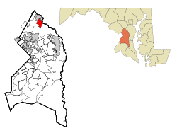
46:Location of South Laurel, Maryland
14:
201:3,668.15/sq mi (1,416.25/km)
1210:Prince George's County, Maryland
134:
113:
92:
40:
1113:. Retrieved on August 26, 2018.
1096:. Retrieved on August 26, 2018.
1079:. Retrieved on August 26, 2018.
324:(39.072741, −76.851007).
1:
1168:Capitol Technology University
1151:Capitol Technology University
802:. United States Census Bureau
776:Capitol Technology University
759:. All residents are zoned to
741:Primary and secondary schools
724:Government and infrastructure
285:, the population was 29,602.
1037:), South Laurel is on pages
833:"South Laurel CDP, Maryland"
979:United States Census Bureau
960:United States Census Bureau
937:United States Census Bureau
890:United States Census Bureau
864:United States Census Bureau
838:United States Census Bureau
800:"2020 U.S. Gazetteer Files"
329:United States Census Bureau
293:South Laurel is located at
2001:
588:Mixed Race or Multi-Racial
1945:
1303:
1221:
484:Black or African American
409:
394:
379:
364:
357:
352:
347:
344:
281:, United States. Per the
51:
39:
30:
1142:Capitol Technology Univ
271:census-designated place
180:161 ft (49 m)
33:Census-designated place
1310:
275:Prince George's County
25:South Laurel, Maryland
1309:
975:"U.S. Census website"
410:U.S. Decennial Census
340:Historical population
312:39.07278°N 76.85111°W
224: • Summer (
71:39.07278°N 76.85111°W
1958:United States portal
1802:Indian Creek Village
198: • Density
1060:U.S. Postal Service
866:. February 12, 2011
780:Beltsville Speedway
730:U.S. Postal Service
435:
341:
317:39.07278; -76.85111
308: /
267:unincorporated area
76:39.07278; -76.85111
67: /
1837:North College Park
1640:Peppermill Village
1311:
1131:U.S. Census Bureau
1007:U.S. Census Bureau
761:Laurel High School
608:Hispanic or Latino
423:
339:
190: • Total
169: • Water
153: • Total
1967:
1966:
1555:Hillcrest Heights
1373:Fairmount Heights
714:per capita income
709:were 86.6 males.
653:
652:
446:
443:NH = Non-Hispanic
439:Race / Ethnicity
434:
416:
415:
327:According to the
260:
259:
161: • Land
1992:
1959:
1952:
1919:
1897:West Hyattsville
1757:Carole Highlands
1729:
1600:Marlboro Village
1595:Marlboro Meadows
1420:
1320:
1308:
1262:District Heights
1244:
1233:
1226:
1216:
1211:
1201:
1194:
1187:
1178:
1171:
1160:
1154:
1144:
1139:
1137:
1128:
1120:
1114:
1103:
1097:
1086:
1080:
1069:
1063:
1052:
1046:
999:
990:
989:
987:
985:
971:
965:
964:
951:
942:
941:
928:
919:
918:
915:US Census Bureau
907:
901:
900:
898:
896:
882:
876:
875:
873:
871:
856:
850:
849:
847:
845:
829:
823:
818:
812:
811:
809:
807:
796:
683:Pacific Islander
671:African American
548:Pacific Islander
440:
436:
433:
428:
360:
355:
350:
342:
323:
322:
320:
319:
318:
313:
309:
306:
305:
304:
301:
229:
143:
139:
138:
137:
119:
117:
116:
102:
98:
96:
95:
82:
81:
79:
78:
77:
72:
68:
65:
64:
63:
60:
44:
21:
2000:
1999:
1995:
1994:
1993:
1991:
1990:
1989:
1970:
1969:
1968:
1963:
1957:
1951:Maryland portal
1950:
1941:
1931:
1917:
1911:
1727:
1725:
1719:
1630:National Harbor
1529:Fort Washington
1418:
1412:
1403:University Park
1393:North Brentwood
1343:Capitol Heights
1318:
1312:
1306:
1301:
1242:
1236:
1231:
1224:
1217:
1214:
1209:
1205:
1175:
1174:
1164:Capitol History
1161:
1157:
1145:
1135:
1133:
1126:
1122:
1121:
1117:
1104:
1100:
1087:
1083:
1070:
1066:
1053:
1049:
1000:
993:
983:
981:
973:
972:
968:
953:
952:
945:
930:
929:
922:
909:
908:
904:
894:
892:
884:
883:
879:
869:
867:
858:
857:
853:
843:
841:
831:
830:
826:
819:
815:
805:
803:
798:
797:
793:
788:
773:
743:
738:
726:
702:married couples
675:Native American
658:
568:Some Other Race
504:Native American
429:
427:
421:
411:
353:
337:
316:
314:
310:
307:
302:
299:
297:
295:
294:
291:
223:
141:Prince George's
135:
133:
132:
114:
112:
93:
91:
90:
75:
73:
69:
66:
61:
58:
56:
54:
53:
47:
35:
26:
19:
12:
11:
5:
1998:
1996:
1988:
1987:
1982:
1972:
1971:
1965:
1964:
1962:
1961:
1954:
1946:
1943:
1942:
1939:
1937:
1933:
1932:
1930:
1929:
1923:
1921:
1913:
1912:
1910:
1909:
1904:
1899:
1894:
1889:
1884:
1879:
1874:
1869:
1867:Rogers Heights
1864:
1859:
1854:
1849:
1844:
1839:
1834:
1829:
1824:
1819:
1814:
1809:
1804:
1799:
1794:
1789:
1784:
1779:
1774:
1769:
1764:
1759:
1754:
1749:
1744:
1739:
1733:
1731:
1721:
1720:
1718:
1717:
1712:
1707:
1702:
1697:
1692:
1687:
1682:
1677:
1672:
1667:
1662:
1657:
1652:
1647:
1642:
1637:
1632:
1627:
1622:
1617:
1612:
1607:
1605:Marlow Heights
1602:
1597:
1592:
1587:
1582:
1577:
1572:
1567:
1562:
1557:
1552:
1546:
1541:
1536:
1531:
1526:
1521:
1516:
1514:East Riverdale
1511:
1506:
1501:
1496:
1491:
1486:
1481:
1476:
1470:
1465:
1460:
1455:
1450:
1445:
1440:
1435:
1430:
1424:
1422:
1414:
1413:
1411:
1410:
1408:Upper Marlboro
1405:
1400:
1398:Riverdale Park
1395:
1390:
1385:
1383:Landover Hills
1380:
1378:Forest Heights
1375:
1370:
1365:
1360:
1355:
1350:
1345:
1340:
1335:
1330:
1328:Berwyn Heights
1324:
1322:
1314:
1313:
1304:
1302:
1300:
1299:
1294:
1292:New Carrollton
1289:
1284:
1279:
1274:
1269:
1264:
1259:
1254:
1248:
1246:
1238:
1237:
1232:Upper Marlboro
1222:
1219:
1218:
1206:
1204:
1203:
1196:
1189:
1181:
1173:
1172:
1155:
1115:
1098:
1081:
1064:
1047:
1023:2000 Index Map
991:
966:
943:
920:
902:
877:
851:
824:
813:
790:
789:
787:
784:
772:
769:
742:
739:
737:
734:
725:
722:
657:
654:
651:
650:
645:
640:
635:
630:
624:
623:
620:
617:
614:
611:
604:
603:
600:
597:
594:
591:
584:
583:
580:
577:
574:
571:
564:
563:
560:
557:
554:
551:
544:
543:
540:
537:
534:
531:
524:
523:
520:
517:
514:
511:
500:
499:
496:
493:
490:
487:
480:
479:
476:
473:
470:
467:
460:
459:
456:
453:
450:
447:
420:
417:
414:
413:
407:
406:
403:
401:
398:
392:
391:
388:
386:
383:
377:
376:
373:
371:
368:
362:
361:
356:
351:
346:
336:
333:
290:
287:
258:
257:
254:
247:
246:
243:
237:
236:
230:
220:
219:
209:
203:
202:
199:
195:
194:
191:
187:
186:
182:
181:
178:
174:
173:
170:
166:
165:
162:
158:
157:
154:
150:
149:
145:
144:
130:
124:
123:
110:
104:
103:
88:
84:
83:
49:
48:
45:
37:
36:
31:
28:
27:
24:
17:
13:
10:
9:
6:
4:
3:
2:
1997:
1986:
1983:
1981:
1978:
1977:
1975:
1960:
1955:
1953:
1948:
1947:
1944:
1938:
1934:
1928:
1925:
1924:
1922:
1920:
1914:
1908:
1905:
1903:
1900:
1898:
1895:
1893:
1890:
1888:
1885:
1883:
1880:
1878:
1875:
1873:
1870:
1868:
1865:
1863:
1860:
1858:
1855:
1853:
1850:
1848:
1845:
1843:
1840:
1838:
1835:
1833:
1830:
1828:
1825:
1823:
1820:
1818:
1815:
1813:
1810:
1808:
1805:
1803:
1800:
1798:
1795:
1793:
1790:
1788:
1787:Green Meadows
1785:
1783:
1780:
1778:
1775:
1773:
1770:
1768:
1765:
1763:
1760:
1758:
1755:
1753:
1752:Carmody Hills
1750:
1748:
1745:
1743:
1740:
1738:
1737:Andrews Manor
1735:
1734:
1732:
1730:
1722:
1716:
1713:
1711:
1708:
1706:
1703:
1701:
1698:
1696:
1693:
1691:
1688:
1686:
1683:
1681:
1678:
1676:
1673:
1671:
1668:
1666:
1663:
1661:
1658:
1656:
1653:
1651:
1648:
1646:
1643:
1641:
1638:
1636:
1633:
1631:
1628:
1626:
1625:Mitchellville
1623:
1621:
1618:
1616:
1615:Maryland Park
1613:
1611:
1608:
1606:
1603:
1601:
1598:
1596:
1593:
1591:
1588:
1586:
1583:
1581:
1578:
1576:
1573:
1571:
1568:
1566:
1563:
1561:
1558:
1556:
1553:
1550:
1547:
1545:
1542:
1540:
1537:
1535:
1532:
1530:
1527:
1525:
1522:
1520:
1517:
1515:
1512:
1510:
1507:
1505:
1502:
1500:
1497:
1495:
1492:
1490:
1487:
1485:
1484:Cedar Heights
1482:
1480:
1477:
1474:
1471:
1469:
1468:Brown Station
1466:
1464:
1461:
1459:
1456:
1454:
1451:
1449:
1446:
1444:
1441:
1439:
1436:
1434:
1431:
1429:
1426:
1425:
1423:
1421:
1415:
1409:
1406:
1404:
1401:
1399:
1396:
1394:
1391:
1389:
1386:
1384:
1381:
1379:
1376:
1374:
1371:
1369:
1366:
1364:
1361:
1359:
1356:
1354:
1351:
1349:
1346:
1344:
1341:
1339:
1336:
1334:
1331:
1329:
1326:
1325:
1323:
1321:
1315:
1298:
1297:Seat Pleasant
1295:
1293:
1290:
1288:
1287:Mount Rainier
1285:
1283:
1280:
1278:
1275:
1273:
1270:
1268:
1265:
1263:
1260:
1258:
1255:
1253:
1250:
1249:
1247:
1245:
1239:
1235:
1234:
1227:
1220:
1215:United States
1212:
1202:
1197:
1195:
1190:
1188:
1183:
1182:
1179:
1169:
1165:
1159:
1156:
1152:
1148:
1143:
1132:
1125:
1119:
1116:
1112:
1108:
1102:
1099:
1095:
1091:
1085:
1082:
1078:
1074:
1068:
1065:
1061:
1057:
1051:
1048:
1044:
1040:
1036:
1032:
1028:
1024:
1020:
1016:
1012:
1008:
1004:
998:
996:
992:
980:
976:
970:
967:
962:
961:
956:
950:
948:
944:
939:
938:
933:
927:
925:
921:
916:
912:
906:
903:
891:
887:
881:
878:
865:
861:
855:
852:
840:
839:
834:
828:
825:
822:
817:
814:
801:
795:
792:
785:
783:
781:
777:
770:
768:
766:
762:
758:
753:
750:
748:
740:
735:
733:
731:
723:
721:
719:
715:
710:
706:
703:
698:
696:
692:
688:
685:, 2.55% from
684:
680:
676:
672:
668:
663:
655:
649:
646:
644:
641:
639:
636:
634:
631:
629:
626:
625:
621:
618:
615:
612:
609:
606:
605:
601:
598:
595:
592:
589:
586:
585:
581:
578:
575:
572:
569:
566:
565:
561:
558:
555:
552:
549:
546:
545:
541:
538:
535:
532:
529:
526:
525:
521:
518:
515:
512:
509:
508:Alaska Native
505:
502:
501:
497:
494:
491:
488:
485:
482:
481:
477:
474:
471:
468:
465:
462:
461:
457:
454:
451:
448:
444:
438:
437:
432:
426:
418:
408:
404:
402:
399:
397:
393:
389:
387:
384:
382:
378:
374:
372:
369:
367:
363:
343:
334:
332:
330:
325:
321:
288:
286:
284:
280:
276:
272:
268:
264:
255:
252:
244:
242:
234:
231:
227:
217:
216:Eastern (EST)
213:
210:
208:
200:
192:
179:
171:
163:
155:
142:
131:
129:
122:
111:
109:
101:
100:United States
89:
80:
52:Coordinates:
43:
34:
29:
22:
16:
1792:Hillsborough
1690:Temple Hills
1670:South Laurel
1669:
1580:Langley Park
1479:Camp Springs
1363:Eagle Harbor
1358:Cottage City
1353:Colmar Manor
1257:College Park
1229:
1158:
1141:
1134:. Retrieved
1118:
1101:
1084:
1067:
1050:
982:. Retrieved
969:
958:
935:
905:
895:December 23,
893:. Retrieved
880:
868:. Retrieved
854:
842:. Retrieved
836:
827:
816:
804:. Retrieved
794:
774:
754:
751:
744:
727:
718:poverty line
711:
707:
699:
659:
647:
642:
637:
632:
627:
442:
430:
424:
335:Demographics
326:
292:
263:South Laurel
262:
261:
15:
1872:South Bowie
1852:Palmer Park
1728:communities
1700:West Laurel
1695:Walker Mill
1685:Summerfield
1665:Silver Hill
1655:Rosaryville
1524:Forestville
1504:Coral Hills
1438:Andrews AFB
1388:Morningside
1333:Bladensburg
1277:Hyattsville
1225:County seat
1136:February 7,
984:January 31,
687:other races
656:2010 Census
610:(any race)
570:alone (NH)
550:alone (NH)
530:alone (NH)
510:alone (NH)
486:alone (NH)
466:alone (NH)
419:2020 census
315: /
283:2020 census
233:UTC−4
212:UTC−5
74: /
1974:Categories
1918:Ghost town
1902:White Hall
1857:Piscataway
1842:Nottingham
1827:Montpelier
1777:Dodge Park
1767:Collington
1762:Cheltenham
1705:Westphalia
1675:Springdale
1650:Queensland
1645:Queen Anne
1570:Lake Arbor
1549:Hillandale
1544:Glenn Dale
1539:Glassmanor
1489:Cedarville
1463:Brock Hall
1458:Brandywine
1453:Beltsville
1147:Campus map
1056:MONTPELIER
1025:and pages
786:References
771:University
757:Beltsville
660:As of the
253:feature ID
185:Population
1936:Footnotes
1927:Good Luck
1892:Vansville
1877:Tantallon
1817:Lewisdale
1797:Horsehead
1635:Oxon Hill
1560:Kettering
1473:Calverton
1368:Edmonston
1338:Brentwood
1272:Greenbelt
1267:Glenarden
1035:see index
870:April 23,
844:April 15,
806:April 26,
736:Education
669:, 49.70%
452:Pop 2020
449:Pop 2010
412:2010 2020
303:76°51′4″W
300:39°4′22″N
289:Geography
273:(CDP) in
241:FIPS code
207:Time zone
177:Elevation
62:76°51′4″W
59:39°4′22″N
1907:Woodyard
1832:Muirkirk
1807:Kentland
1772:Danville
1747:Avondale
1715:Woodmore
1710:Woodlawn
1680:Suitland
1660:Seabrook
1575:Landover
1565:Konterra
1534:Friendly
1519:Fairwood
1428:Accokeek
1348:Cheverly
691:Hispanic
681:, 0.03%
677:, 5.61%
673:, 0.19%
279:Maryland
245:24-73650
121:Maryland
1822:Meadows
1812:Leeland
1782:Goddard
1742:Ardmore
1620:Melwood
1610:Marlton
1499:Clinton
1494:Chillum
1443:Aquasco
1433:Adelphi
648:100.00%
643:100.00%
622:20.45%
619:13.54%
498:56.11%
495:59.69%
492:16,609
489:15,586
478:13.21%
475:18.37%
458:% 2020
455:% 2010
256:1867303
87:Country
1887:Tuxedo
1862:Raljon
1585:Lanham
1282:Laurel
1243:Cities
1017:, and
765:Laurel
695:Latino
662:census
638:29,602
633:26,112
616:6,053
613:3,535
602:3.50%
599:2.73%
596:1,035
582:0.60%
579:0.33%
562:0.04%
559:0.02%
542:5.89%
539:5.13%
536:1,744
533:1,340
522:0.21%
519:0.19%
472:3,911
469:4,798
400:29,602
385:26,112
370:20,479
345:Census
265:is an
193:29,602
128:County
118:
97:
1726:Other
1590:Largo
1509:Croom
1448:Baden
1319:Towns
1252:Bowie
1127:(PDF)
679:Asian
667:White
628:Total
590:(NH)
528:Asian
464:White
405:13.4%
390:27.5%
235:(EDT)
108:State
1847:Orme
1419:CDPs
1138:2024
1041:and
1029:and
986:2008
897:2011
872:2011
846:2022
808:2022
728:The
593:712
576:177
396:2020
381:2010
366:2000
354:Note
349:Pop.
269:and
251:GNIS
148:Area
1166:."
1109:."
1092:."
1075:."
1058:."
1005:."
763:in
693:or
573:85
556:12
516:61
513:50
506:or
226:DST
1976::
1882:TB
1228::
1213:,
1149:.
1140:.
1129:.
1013:,
994:^
977:.
957:.
946:^
934:.
923:^
913:.
888:.
862:.
835:.
767:.
749:.
553:6
359:%±
277:,
1551:‡
1475:‡
1200:e
1193:t
1186:v
1162:"
1105:"
1088:"
1071:"
1054:"
1045:.
1043:5
1039:2
1031:2
1027:1
1019:3
1015:2
1011:1
1001:"
988:.
963:.
940:.
917:.
899:.
874:.
848:.
810:.
445:)
441:(
375:—
228:)
218:)
214:(
Text is available under the Creative Commons Attribution-ShareAlike License. Additional terms may apply.