62:
1215:
829:
338:
357:
815:
801:
45:
680:
living together, 9.8% had a female householder with no husband present, 2.8% had a male householder with no wife present, and 42.8% were non-families. 39.5% of all households were made up of individuals, and 23.3% had someone living alone who was 65 years of age or older. The average household size
729:
In the city, the population was spread out, with 21.7% under the age of 18, 6.5% from 18 to 24, 24.7% from 25 to 44, 18.1% from 45 to 64, and 29.0% who were 65 years of age or older. The median age was 43 years. For every 100 females, there were 86.6 males. For every 100 females age 18 and over,
725:
living together, 8.6% had a female householder with no husband present, and 39.9% were non-families. 36.3% of all households were made up of individuals, and 23.2% had someone living alone who was 65 years of age or older. The average household size was 2.12 and the average family size was 2.74.
697:
of 2000, there were 1,304 people, 581 households, and 349 families living in the city. The population density was 1,455.8 inhabitants per square mile (562.1/km). There were 610 housing units at an average density of 681.0 per square mile (262.9/km). The racial makeup of the city was 99.00%
684:
The median age in the city was 47 years. 21.3% of residents were under the age of 18; 5.2% were between the ages of 18 and 24; 21.4% were from 25 to 44; 23.1% were from 45 to 64; and 29% were 65 years of age or older. The gender makeup of the city was 46.2% male and 53.8% female.
61:
326:
733:
The median income for a household in the city was $ 29,643, and the median income for a family was $ 38,000. Males had a median income of $ 28,182 versus $ 18,125 for females. The
649:
was 1,385.4 inhabitants per square mile (534.9/km). There were 653 housing units at an average density of 680.2 per square mile (262.6/km). The racial makeup of the city was 97.8%
1122:
1284:
1249:
1294:
1234:
1279:
1269:
1239:
1304:
1309:
1264:
1244:
1489:
1274:
933:
75:
1314:
1289:
1259:
1299:
1254:
1005:
1115:
270:
348:
A post office has been in operation at Spring Grove since 1855. The community was named for a spring and a grove near the original town site.
341:
280:
1108:
869:
221:
1100:
654:
962:
703:
658:
129:
1494:
1435:
1405:
1061:
1009:
941:
912:
849:
364:
368:
1385:
1132:
615:
600:
585:
570:
555:
540:
525:
510:
495:
480:
465:
450:
435:
420:
405:
322:
314:
134:
1459:
258:
107:
893:
1390:
1339:
721:
There were 581 households, out of which 25.8% had children under the age of 18 living with them, 48.5% were
1400:
1354:
1198:
1173:
711:
666:
1013:
1410:
1364:
784:
756:
676:
There were 600 households, of which 25.0% had children under the age of 18 living with them, 44.5% were
828:
1466:
1349:
1178:
1154:
715:
670:
231:
1380:
1359:
1344:
1324:
750:
707:
699:
662:
650:
991:
1425:
1415:
1395:
1370:
1193:
780:
646:
1035:
1183:
774:
734:
337:
737:
for the city was $ 16,307. About 6.7% of families and 11.0% of the population were below the
1188:
768:
645:
of 2010, there were 1,330 people, 600 households, and 343 families living in the city. The
1375:
762:
985:
814:
800:
356:
1334:
1226:
44:
1483:
263:
894:
U.S. Geological Survey
Geographic Names Information System: Spring Grove, Minnesota
738:
1147:
117:
90:
77:
371:
and County
Highways 4 and 16 are three of the main routes in the community.
367:, the city has a total area of 0.96 square miles (2.49 km), all land.
318:
212:
122:
741:, including 10.3% of those under age 18 and 15.1% of those age 65 or over.
1450:‡This populated place also has portions in an adjacent county or counties
722:
677:
246:
295:
694:
642:
1214:
1095:
987:
Minnesota
Geographic Names: Their Origin and Historic Significance
355:
336:
238:
217:
934:"2010 Census Redistricting Data (Public Law 94-171) Summary File"
1165:
1085:
35:
1104:
1090:
1213:
1057:
908:
327:
La Crosse-Onalaska, WI-MN Metropolitan
Statistical Area
1445:
1424:
1323:
1225:
1164:
290:
279:
269:
257:
245:
228:
211:
203:
195:
190:
182:
174:
166:
158:
153:
145:
140:
128:
116:
106:
26:
321:, United States. The population was 1,330 at the
681:was 2.10 and the average family size was 2.78.
1116:
8:
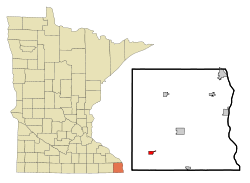
1218:Map of Minnesota highlighting Houston County
1123:
1109:
1101:
718:of any race were 0.23% of the population.
378:
23:
673:of any race were 1.0% of the population.
990:. Minnesota Historical Society. p.
861:
289:
268:
244:
210:
189:
181:
152:
139:
105:
70:
58:
50:
41:
889:
887:
398:
903:
901:
753:, businessman, farmer, and politician
278:
256:
227:
202:
194:
173:
165:
157:
144:
127:
115:
7:
710:, and 0.61% from two or more races.
1490:Cities in Houston County, Minnesota
665:, and 0.8% from two or more races.
342:Giants of the Earth Heritage Center
178:0.00 sq mi (0.00 km)
170:0.99 sq mi (2.57 km)
162:0.99 sq mi (2.58 km)
66:Location of Spring Grove, Minnesota
1131:Municipalities and communities of
1036:"Census of Population and Housing"
388:
14:
827:
813:
799:
60:
43:
21:City in Minnesota, United States
16:City in Minnesota, United States
207:1,263.58/sq mi (487.88/km)
1:
1086:Spring Grove, MN city website
872:. United States Census Bureau
759:, painter and art instructor
1436:Ho-Chunk Indian Reservation
1096:Spring Grove Public Schools
1091:Spring Grove Communications
1062:United States Census Bureau
1010:United States Census Bureau
942:United States Census Bureau
913:United States Census Bureau
870:"2020 U.S. Gazetteer Files"
850:Spring Grove Public Library
821:Spring Grove athletic field
365:United States Census Bureau
54:"pretty. neat. small town."
1511:
965:. Jim Forte Postal History
369:Minnesota State Highway 44
186:1,322 ft (403 m)
1455:
1211:
1145:
1134:Houston County, Minnesota
1006:"US Gazetteer files 2010"
629:
614:
599:
584:
569:
554:
539:
524:
509:
494:
479:
464:
449:
434:
419:
404:
397:
392:
387:
384:
71:
59:
51:
42:
33:
777:, academic and historian
730:there were 82.3 males.
1219:
984:Upham, Warren (1920).
360:
345:
1217:
1058:"U.S. Census website"
909:"U.S. Census website"
785:technology journalist
757:Lars Jonson Haukaness
630:U.S. Decennial Census
380:Historical population
359:
340:
230: • Summer (
91:43.56111°N 91.63722°W
1468:United States portal
807:Spring Grove schools
325:. It is part of the
204: • Density
1495:Cities in Minnesota
1016:on January 25, 2012
938:American FactFinder
751:Jerome O. Gunderson
381:
96:43.56111; -91.63722
87: /
1220:
835:Northern Engraving
783:, broadcaster and
781:John Stewart Socha
647:population density
379:
361:
346:
196: • Total
175: • Water
159: • Total
146: • Mayor
1477:
1476:
775:Carlton C. Qualey
735:per capita income
634:
633:
363:According to the
308:
307:
167: • Land
1502:
1469:
1462:
1461:Minnesota portal
1406:Willington Grove
1216:
1157:
1150:
1140:
1135:
1125:
1118:
1111:
1102:
1073:
1072:
1070:
1068:
1054:
1048:
1047:
1045:
1043:
1032:
1026:
1025:
1023:
1021:
1012:. Archived from
1002:
996:
995:
981:
975:
974:
972:
970:
963:"Houston County"
959:
953:
952:
950:
948:
930:
924:
923:
921:
919:
905:
896:
891:
882:
881:
879:
877:
866:
831:
817:
803:
769:Robert E. A. Lee
655:African American
400:
395:
390:
382:
304:
301:
299:
297:
235:
102:
101:
99:
98:
97:
92:
88:
85:
84:
83:
80:
64:
47:
24:
1510:
1509:
1505:
1504:
1503:
1501:
1500:
1499:
1480:
1479:
1478:
1473:
1467:
1460:
1451:
1441:
1427:
1420:
1326:
1319:
1221:
1209:
1160:
1155:
1148:
1141:
1138:
1133:
1129:
1082:
1077:
1076:
1066:
1064:
1056:
1055:
1051:
1041:
1039:
1034:
1033:
1029:
1019:
1017:
1004:
1003:
999:
983:
982:
978:
968:
966:
961:
960:
956:
946:
944:
932:
931:
927:
917:
915:
907:
906:
899:
892:
885:
875:
873:
868:
867:
863:
858:
846:
841:
840:
839:
838:
837:
836:
832:
824:
823:
822:
818:
810:
809:
808:
804:
793:
771:, film producer
763:Joseph Langland
747:
723:married couples
704:Native American
691:
678:married couples
659:Native American
639:
393:
377:
354:
344:in Spring Grove
335:
294:
253:
229:
95:
93:
89:
86:
81:
78:
76:
74:
73:
67:
55:
38:
29:
22:
17:
12:
11:
5:
1508:
1506:
1498:
1497:
1492:
1482:
1481:
1475:
1474:
1472:
1471:
1464:
1456:
1453:
1452:
1449:
1447:
1443:
1442:
1440:
1439:
1432:
1430:
1422:
1421:
1419:
1418:
1413:
1408:
1403:
1398:
1393:
1388:
1386:River Junction
1383:
1378:
1373:
1368:
1362:
1357:
1352:
1347:
1342:
1337:
1331:
1329:
1325:Unincorporated
1321:
1320:
1318:
1317:
1312:
1307:
1302:
1297:
1292:
1287:
1282:
1277:
1272:
1267:
1262:
1257:
1252:
1247:
1242:
1237:
1231:
1229:
1223:
1222:
1212:
1210:
1208:
1207:
1202:
1196:
1191:
1186:
1181:
1176:
1170:
1168:
1162:
1161:
1146:
1143:
1142:
1130:
1128:
1127:
1120:
1113:
1105:
1099:
1098:
1093:
1088:
1081:
1080:External links
1078:
1075:
1074:
1049:
1027:
997:
976:
954:
925:
897:
883:
860:
859:
857:
854:
853:
852:
845:
842:
834:
833:
826:
825:
820:
819:
812:
811:
806:
805:
798:
797:
796:
795:
794:
792:
789:
788:
787:
778:
772:
766:
760:
754:
746:
745:Notable people
743:
690:
687:
638:
635:
632:
631:
627:
626:
623:
621:
618:
612:
611:
608:
606:
603:
597:
596:
593:
591:
588:
582:
581:
578:
576:
573:
567:
566:
563:
561:
558:
552:
551:
548:
546:
543:
537:
536:
533:
531:
528:
522:
521:
518:
516:
513:
507:
506:
503:
501:
498:
492:
491:
488:
486:
483:
477:
476:
473:
471:
468:
462:
461:
458:
456:
453:
447:
446:
443:
441:
438:
432:
431:
428:
426:
423:
417:
416:
413:
411:
408:
402:
401:
396:
391:
386:
376:
373:
353:
350:
334:
331:
315:Houston County
306:
305:
292:
288:
287:
284:
277:
276:
273:
267:
266:
261:
255:
254:
251:
249:
243:
242:
236:
226:
225:
215:
209:
208:
205:
201:
200:
197:
193:
192:
188:
187:
184:
180:
179:
176:
172:
171:
168:
164:
163:
160:
156:
155:
151:
150:
149:Saundra Solum
147:
143:
142:
138:
137:
132:
126:
125:
120:
114:
113:
110:
104:
103:
69:
68:
65:
57:
56:
53:
49:
48:
40:
39:
34:
31:
30:
27:
20:
15:
13:
10:
9:
6:
4:
3:
2:
1507:
1496:
1493:
1491:
1488:
1487:
1485:
1470:
1465:
1463:
1458:
1457:
1454:
1448:
1444:
1437:
1434:
1433:
1431:
1429:
1423:
1417:
1414:
1412:
1409:
1407:
1404:
1402:
1399:
1397:
1394:
1392:
1389:
1387:
1384:
1382:
1379:
1377:
1374:
1372:
1369:
1366:
1363:
1361:
1358:
1356:
1353:
1351:
1348:
1346:
1343:
1341:
1338:
1336:
1333:
1332:
1330:
1328:
1322:
1316:
1313:
1311:
1308:
1306:
1303:
1301:
1298:
1296:
1293:
1291:
1288:
1286:
1285:Mound Prairie
1283:
1281:
1278:
1276:
1273:
1271:
1268:
1266:
1263:
1261:
1258:
1256:
1253:
1251:
1250:Crooked Creek
1248:
1246:
1243:
1241:
1238:
1236:
1233:
1232:
1230:
1228:
1224:
1206:
1203:
1200:
1197:
1195:
1192:
1190:
1187:
1185:
1182:
1180:
1177:
1175:
1172:
1171:
1169:
1167:
1163:
1159:
1158:
1151:
1144:
1139:United States
1136:
1126:
1121:
1119:
1114:
1112:
1107:
1106:
1103:
1097:
1094:
1092:
1089:
1087:
1084:
1083:
1079:
1063:
1059:
1053:
1050:
1037:
1031:
1028:
1015:
1011:
1007:
1001:
998:
993:
989:
988:
980:
977:
964:
958:
955:
943:
939:
935:
929:
926:
914:
910:
904:
902:
898:
895:
890:
888:
884:
871:
865:
862:
855:
851:
848:
847:
843:
830:
816:
802:
790:
786:
782:
779:
776:
773:
770:
767:
764:
761:
758:
755:
752:
749:
748:
744:
742:
740:
736:
731:
727:
724:
719:
717:
713:
709:
705:
701:
696:
688:
686:
682:
679:
674:
672:
668:
664:
660:
656:
652:
648:
644:
636:
628:
624:
622:
619:
617:
613:
609:
607:
604:
602:
598:
594:
592:
589:
587:
583:
579:
577:
574:
572:
568:
564:
562:
559:
557:
553:
549:
547:
544:
542:
538:
534:
532:
529:
527:
523:
519:
517:
514:
512:
508:
504:
502:
499:
497:
493:
489:
487:
484:
482:
478:
474:
472:
469:
467:
463:
459:
457:
454:
452:
448:
444:
442:
439:
437:
433:
429:
427:
424:
422:
418:
414:
412:
409:
407:
403:
383:
374:
372:
370:
366:
358:
351:
349:
343:
339:
332:
330:
328:
324:
320:
316:
313:is a city in
312:
303:
293:
285:
282:
274:
272:
265:
262:
260:
250:
248:
240:
237:
233:
223:
222:Central (CST)
219:
216:
214:
206:
198:
185:
177:
169:
161:
148:
136:
133:
131:
124:
121:
119:
112:United States
111:
109:
100:
72:Coordinates:
63:
46:
37:
32:
25:
19:
1391:Schechs Mill
1340:Black Hammer
1295:Spring Grove
1235:Black Hammer
1205:Spring Grove
1204:
1153:
1067:November 13,
1065:. Retrieved
1052:
1040:. Retrieved
1038:. Census.gov
1030:
1020:November 13,
1018:. Retrieved
1014:the original
1000:
986:
979:
967:. Retrieved
957:
945:. Retrieved
937:
928:
916:. Retrieved
874:. Retrieved
864:
739:poverty line
732:
728:
720:
692:
683:
675:
640:
375:Demographics
362:
347:
311:Spring Grove
310:
309:
298:.springgrove
52:Motto:
28:Spring Grove
18:
1428:reservation
1401:South Ridge
1355:Money Creek
1327:communities
1280:Money Creek
1270:La Crescent
1240:Brownsville
1199:La Crescent
1174:Brownsville
1149:County seat
918:January 31,
689:2000 census
637:2010 census
323:2010 census
94: /
1484:Categories
1411:Wilmington
1365:Pine Creek
1305:Wilmington
856:References
693:As of the
641:As of the
300:.govoffice
283:feature ID
191:Population
141:Government
82:91°38′14″W
79:43°33′40″N
1446:Footnotes
1350:Jefferson
1310:Winnebago
1265:Jefferson
1245:Caledonia
1227:Townships
1179:Caledonia
1156:Caledonia
947:April 27,
352:Geography
319:Minnesota
271:FIPS code
259:Area code
213:Time zone
183:Elevation
123:Minnesota
1381:Riceford
1360:Newhouse
1345:Freeburg
1275:Mayville
876:July 24,
844:See also
712:Hispanic
706:, 0.31%
702:, 0.08%
667:Hispanic
275:27-61852
247:ZIP code
1416:Yucatan
1396:Sheldon
1371:Perkins
1315:Yucatan
1290:Sheldon
1260:Houston
1194:Houston
1042:June 4,
969:July 5,
791:Gallery
661:, 0.6%
657:, 0.1%
653:, 0.7%
333:History
291:Website
286:2395931
135:Houston
108:Country
1426:Indian
1184:Eitzen
1166:Cities
765:, poet
716:Latino
695:census
671:Latino
643:census
385:Census
130:County
1300:Union
1255:Hokah
1189:Hokah
708:Asian
700:White
663:Asian
651:White
625:−5.6%
620:1,256
605:1,330
595:13.1%
590:1,304
580:−9.6%
575:1,153
565:−1.2%
560:1,275
550:−3.9%
545:1,290
535:22.8%
530:1,342
520:13.0%
515:1,093
505:11.5%
490:15.1%
475:21.5%
460:26.3%
445:24.6%
430:34.5%
252:55974
241:(CDT)
239:UTC-5
218:UTC-6
199:1,256
118:State
1376:Reno
1069:2012
1044:2015
1022:2012
971:2015
949:2011
920:2008
878:2022
616:2020
610:2.0%
601:2010
586:2000
571:1990
556:1980
541:1970
526:1960
511:1950
496:1940
481:1930
466:1920
451:1910
436:1900
421:1890
406:1880
394:Note
389:Pop.
302:.com
281:GNIS
154:Area
36:City
1335:Bee
992:240
714:or
669:or
500:967
485:867
470:753
455:620
440:491
425:394
410:293
296:www
264:507
232:DST
1486::
1152::
1137:,
1060:.
1008:.
940:.
936:.
911:.
900:^
886:^
399:%±
329:.
317:,
1438:‡
1367:‡
1201:‡
1124:e
1117:t
1110:v
1071:.
1046:.
1024:.
994:.
973:.
951:.
922:.
880:.
415:—
234:)
224:)
220:(
Text is available under the Creative Commons Attribution-ShareAlike License. Additional terms may apply.