59:
125:
87:
42:
148:
94:
66:
690:, opened in 1965 and, within a few years, had risen the water levels of Christopher Lake by 2.2 m (7 ft 3 in) above 1960 levels. At the southern end of Christopher Lake, a partially man-made, partially natural channel called Christopher Creek was constructed that connects with Spruce River farther downstream, south of
706:
in the
Waskesiu Hills. From there it heads east then south near the south-eastern boundary of the park. The park has multiple trails throughout and several of them run along or intersect with the Spruce River. The Spruce River Trail and the Freight Tait Springs Trail both follow sections of the river
447:
in Prince Albert
National Park. Sturgeon River parallels Spruce River south to the North Saskatchewan River ending up on the western side of Prince Albert. From its source, the Spruce River heads south out of the Nimrod Hills dropping over 60 metres (200 ft) in elevation into a valley. From
633:
to regulate flow along the river and to provide additional water for a diversion into the recreational lakes of Emma and
Christopher. About 2.5 km (1.6 mi) upstream was another dam that was built in 1939. The 1960 Spruce River Dam was built to replace that 1939 dam as it was prone to
681:
that flows into Emma Lake at its northern end. The diversion channel went into operation 1961 and, within a few years, Emma Lake water levels rose 1.8 m (5 ft 11 in) above 1960 levels. At the south-eastern corner of Emma Lake, a short channel was built connecting Emma to
727:
Little Red River Park is a Prince Albert city park located near the mouth of the Spruce River. It is a 500 ha (1,200 acres) forested park that provides year-round recreational opportunities. There are over 30 km (19 mi) of trails for hiking, cycling,
630:
638:'s Jacobsen Bay by .4 m (1 ft 4 in). With the building of the dam, Anglin Lake water levels increased from the original levels by 1 m (3 ft 3 in).
58:
657:
controls the water's flow between 1 April and 31 October to allow a riparian downstream flow of .14 m (4.9 cu ft)/second. Access to the dam is from
677:
that lifts water up eight metres at a maximum rate of .65 m (23 cu ft) through a 284 m (932 ft) long pipeline into a 10-kilometre long
719:. Most of Anglin Lake is in Great Blue Heron Provincial Park and there are several campgrounds, hiking trails, and fishing opportunities at the lake.
711:
at the river crossing. The Spruce River
Highlands Trail has a one-kilometre spur trail that connects up with 18 kilometres of trails in neighbouring
1403:
1209:
266:
86:
1383:
1292:
625:), located along the south-eastern boundary of Prince Albert National Park, was built in 1960 along the course of the Spruce River by the
512:
The following are the tributaries of Spruce River from its headwaters in the
Waskesiu Hills to its mouth at the North Saskatchewan River:
673:
project was built in conjunction with Spruce River Dam. About one kilometre north-east of the dam along Anglin Lake's eastern shore is a
373:
137:
1388:
1393:
597:
201:
634:
washouts. The building of the Spruce River Dam also over-flowed the Tower Road Dams that were used to control the water levels of
712:
465:
843:
1408:
1378:
687:
683:
566:
424:
427:, and Halkett are within its watershed. Anglin Lake was created by the building of Spruce River Dam along the river's course.
761:
1398:
444:
457:
703:
405:
385:
252:
187:
694:. Prior to the construction of the Emma Lake diversion, Emma and Christopher Lakes did not connect to Spruce River.
1344:
1278:
766:
708:
658:
570:
501:
420:
401:
1264:
1108:
1318:
1082:
771:
678:
389:
978:
485:
691:
497:
481:
473:
464:
and Spruce River Dam at the eastern boundary of Prince Albert
National Park and the western boundary of
1158:
729:
626:
670:
574:
544:
flows into McPhee Lake and its watershed is the farthest north in the Spruce River drainage basin.
535:
412:
477:
1238:
1183:
1056:
1030:
952:
926:
900:
817:
791:
874:
41:
1358:
641:
Spruce River Dam is 243 m (797 ft) long and 6.1 m (20 ft) high. It is an
468:. South of the dam, Spruce River leaves Prince Albert National Park and passes through three
674:
524:
begins at
Halkett Lake. Upstream from Halkett Lake are Kapesiwin and Witsukitshak Lakes.
642:
469:
440:
381:
175:
1372:
1133:
851:
749:
453:
439:
at an elevation of over 710 metres (2,330 ft) in the Nimrod Hills range of the
493:
436:
377:
153:
20:
538:
in Prince Albert
National Park and McPhee Lake flow southward into Trappers Lake.
488:. From the Little Red River Indian Reserves south, Spruce River is also known as
460:
watershed. From the portage, Spruce River turns south following a valley towards
1210:"Management of Spruce River Diversion Project Anglin / Emma / Christopher Lakes"
716:
635:
531:
461:
416:
237:
1004:
612:
599:
281:
268:
216:
203:
733:
650:
646:
745:
654:
449:
397:
452:
at
Beartrap Lake and Beartrap Creek. Beartrap Creek flows north into
393:
130:
500:
before entering the east end of Prince Albert and emptying into the
492:. Once in the RM, the river carries on southward passing through
1265:"Freight Tait Springs Trail - Prince Albert National Park"
707:
and the trailhead for Spruce River
Highlands Trail is on
1293:"Great Blue Heron Provincial Park - Anglin Lake Trails"
649:
made up of four 2.43 m (8 ft 0 in) wide
1279:"Spruce River Highlands - Prince Albert National Park"
702:
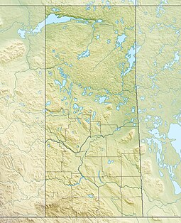
The Spruce River begins in the south-central area of
388:
and flows generally in a southward direction through
448:
there, it follows the valley east towards a natural
1011:. mindat.org and the Hudson Institute of Mineralogy
344:
328:
320:
315:
307:
297:
258:
246:
236:
193:
181:
171:
162:
136:
118:
113:
93:
65:
30:
411:Several lakes with recreational amenities such as
443:, just south of the source for the neighbouring
372:, is a river in the north-central region of the
8:
850:. University of Saskatchewan. Archived from
744:Fish commonly found in the river include
583:flows into Emma Lake from Marshall Lake.
1159:"Water Conveyance & Flood Controls"
783:
46:North Saskatchewan River drainage basin
27:
73:Location of the mouth in Saskatchewan
7:
1243:Canadian Geographical Names Database
1188:Canadian Geographical Names Database
1061:Canadian Geographical Names Database
1035:Canadian Geographical Names Database
1005:"Spruce River, Saskatchewan, Canada"
957:Canadian Geographical Names Database
931:Canadian Geographical Names Database
905:Canadian Geographical Names Database
822:Canadian Geographical Names Database
796:Canadian Geographical Names Database
534:from Trappers Lake. The creeks from
392:, glacier-carved hills and valleys,
101:Spruce River (Saskatchewan) (Canada)
311:1,668 km (644 sq mi)
1219:. Saskatchewan Watershed Authority
14:
1109:"Spruce River, Saskatchewan Map"
848:The Encyclopedia of Saskatchewan
713:Great Blue Heron Provincial Park
466:Great Blue Heron Provincial Park
146:
123:
92:
85:
64:
57:
40:
692:Little Red River Indian Reserve
404:at the east end of the city of
19:For the river in Michigan, see
1404:Buckland No. 491, Saskatchewan
762:List of rivers of Saskatchewan
631:Department of Northern Affairs
260: • coordinates
195: • coordinates
1:
163:Physical characteristics
16:River in Saskatchewan, Canada
1325:. Government of Saskatchewan
1299:. Government of Saskatchewan
1089:. Government of Saskatchewan
985:. Government of Saskatchewan
299: • elevation
1384:Prince Albert National Park
704:Prince Albert National Park
686:. This channel, called the
386:Prince Albert National Park
248: • location
188:Prince Albert National Park
183: • location
1425:
875:"North Saskatchewan River"
688:Christopher Lake diversion
435:Spruce River begins at an
303:415 m (1,362 ft)
18:
1389:Tributaries of Hudson Bay
1359:"Fishing in Spruce River"
1319:"Anglin Lake Campgrounds"
1083:"Namekus Lake Campground"
767:Hudson Bay drainage basin
232:
167:
51:
39:
1394:North Saskatchewan River
552:flows in from the west.
502:North Saskatchewan River
402:North Saskatchewan River
346: • right
242:North Saskatchewan River
76:Show map of Saskatchewan
1345:"Little Red River Park"
979:"Little Red River Park"
772:Tourism in Saskatchewan
494:Wahpaton Indian Reserve
330: • left
1409:Dams completed in 1960
1379:Rivers of Saskatchewan
1245:. Government of Canada
1190:. Government of Canada
1063:. Government of Canada
1037:. Government of Canada
959:. Government of Canada
933:. Government of Canada
907:. Government of Canada
881:. University of Regina
824:. Government of Canada
798:. Government of Canada
594:The Spruce River Dam (
486:RM of Buckland No. 491
484:) before entering the
431:Course and description
1163:Water Security Agency
1138:Water Security Agency
1134:"Dams and Reservoirs"
723:Little Red River Park
504:near Bateman Island.
498:Little Red River Park
482:Little Red River 106C
474:Little Red River 106D
1399:Dams in Saskatchewan
1323:Tourism Saskatchewan
1297:Tourism Saskatchewan
1239:"Spruce River Trail"
1087:Tourism Saskatchewan
983:Tourism Saskatchewan
730:cross-country skiing
698:Parks and recreation
627:Government of Canada
613:53.6663°N 106.0085°W
282:53.2184°N 105.7125°W
217:53.7896°N 106.3951°W
1281:. 18 November 2021.
1267:. 21 November 2019.
1184:"Christopher Creek"
671:Emma Lake diversion
665:Emma Lake diversion
609: /
575:Emma Lake diversion
573:and is part of the
456:and is part of the
380:. It begins in the
316:Basin features
278: /
213: /
618:53.6663; -106.0085
478:Montreal Lake 106B
287:53.2184; -105.7125
222:53.7896; -106.3951
104:Show map of Canada
1347:. 26 August 2022.
844:"Waskesiu Upland"
679:diversion channel
563:Christopher Creek
374:Canadian province
363:
362:
337:Christopher Creek
1416:
1363:
1362:
1355:
1349:
1348:
1341:
1335:
1334:
1332:
1330:
1315:
1309:
1308:
1306:
1304:
1289:
1283:
1282:
1275:
1269:
1268:
1261:
1255:
1254:
1252:
1250:
1235:
1229:
1228:
1226:
1224:
1214:
1206:
1200:
1199:
1197:
1195:
1180:
1174:
1173:
1171:
1169:
1155:
1149:
1148:
1146:
1144:
1130:
1124:
1123:
1121:
1119:
1105:
1099:
1098:
1096:
1094:
1079:
1073:
1072:
1070:
1068:
1053:
1047:
1046:
1044:
1042:
1027:
1021:
1020:
1018:
1016:
1001:
995:
994:
992:
990:
975:
969:
968:
966:
964:
953:"Beartrap Creek"
949:
943:
942:
940:
938:
927:"Sturgeon River"
923:
917:
916:
914:
912:
897:
891:
890:
888:
886:
870:
864:
863:
861:
859:
840:
834:
833:
831:
829:
818:"Waskesiu Hills"
814:
808:
807:
805:
803:
788:
684:Christopher Lake
645:with a concrete
624:
623:
621:
620:
619:
614:
610:
607:
606:
605:
602:
590:Spruce River Dam
490:Little Red River
400:en route to the
370:Little Red River
347:
331:
293:
292:
290:
289:
288:
283:
279:
276:
275:
274:
271:
228:
227:
225:
224:
223:
218:
214:
211:
210:
209:
206:
196:
184:
152:
150:
149:
129:
127:
126:
105:
96:
95:
89:
77:
68:
67:
61:
44:
34:Little Red River
28:
1424:
1423:
1419:
1418:
1417:
1415:
1414:
1413:
1369:
1368:
1367:
1366:
1357:
1356:
1352:
1343:
1342:
1338:
1328:
1326:
1317:
1316:
1312:
1302:
1300:
1291:
1290:
1286:
1277:
1276:
1272:
1263:
1262:
1258:
1248:
1246:
1237:
1236:
1232:
1222:
1220:
1212:
1208:
1207:
1203:
1193:
1191:
1182:
1181:
1177:
1167:
1165:
1157:
1156:
1152:
1142:
1140:
1132:
1131:
1127:
1117:
1115:
1107:
1106:
1102:
1092:
1090:
1081:
1080:
1076:
1066:
1064:
1055:
1054:
1050:
1040:
1038:
1029:
1028:
1024:
1014:
1012:
1003:
1002:
998:
988:
986:
977:
976:
972:
962:
960:
951:
950:
946:
936:
934:
925:
924:
920:
910:
908:
899:
898:
894:
884:
882:
872:
871:
867:
857:
855:
854:on 25 July 2021
842:
841:
837:
827:
825:
816:
815:
811:
801:
799:
790:
789:
785:
780:
758:
742:
725:
700:
667:
617:
615:
611:
608:
603:
600:
598:
596:
595:
592:
510:
470:Indian reserves
458:Churchill River
433:
359:
345:
340:
329:
300:
286:
284:
280:
277:
272:
269:
267:
265:
264:
261:
249:
221:
219:
215:
212:
207:
204:
202:
200:
199:
194:
182:
158:
147:
145:
124:
122:
109:
108:
107:
106:
103:
102:
99:
98:
97:
80:
79:
78:
75:
74:
71:
70:
69:
47:
35:
32:
24:
17:
12:
11:
5:
1422:
1420:
1412:
1411:
1406:
1401:
1396:
1391:
1386:
1381:
1371:
1370:
1365:
1364:
1350:
1336:
1310:
1284:
1270:
1256:
1230:
1201:
1175:
1150:
1125:
1100:
1074:
1057:"Bitter Creek"
1048:
1022:
996:
970:
944:
918:
901:"Nimrod Hills"
892:
873:Oegema, Bart.
865:
835:
809:
792:"Spruce River"
782:
781:
779:
776:
775:
774:
769:
764:
757:
754:
741:
738:
724:
721:
699:
696:
666:
663:
643:embankment dam
591:
588:
587:
586:
585:
584:
581:Montreal Creek
560:
559:
558:
547:
546:
545:
525:
522:McKenzie Creek
519:
509:
506:
445:Sturgeon River
441:Waskesiu Hills
432:
429:
390:boreal forests
382:Waskesiu Hills
368:, also called
361:
360:
358:
357:
354:
353:McKenzie Creek
350:
348:
342:
341:
339:
338:
334:
332:
326:
325:
322:
318:
317:
313:
312:
309:
305:
304:
301:
298:
295:
294:
262:
259:
256:
255:
250:
247:
244:
243:
240:
234:
233:
230:
229:
197:
191:
190:
185:
179:
178:
176:Waskesiu Hills
173:
169:
168:
165:
164:
160:
159:
157:
156:
142:
140:
134:
133:
120:
116:
115:
111:
110:
100:
91:
90:
84:
83:
82:
81:
72:
63:
62:
56:
55:
54:
53:
52:
49:
48:
45:
37:
36:
33:
15:
13:
10:
9:
6:
4:
3:
2:
1421:
1410:
1407:
1405:
1402:
1400:
1397:
1395:
1392:
1390:
1387:
1385:
1382:
1380:
1377:
1376:
1374:
1360:
1354:
1351:
1346:
1340:
1337:
1324:
1320:
1314:
1311:
1298:
1294:
1288:
1285:
1280:
1274:
1271:
1266:
1260:
1257:
1244:
1240:
1234:
1231:
1218:
1211:
1205:
1202:
1189:
1185:
1179:
1176:
1164:
1160:
1154:
1151:
1139:
1135:
1129:
1126:
1114:
1110:
1104:
1101:
1088:
1084:
1078:
1075:
1062:
1058:
1052:
1049:
1036:
1032:
1031:"Cowan Creek"
1026:
1023:
1010:
1006:
1000:
997:
984:
980:
974:
971:
958:
954:
948:
945:
932:
928:
922:
919:
906:
902:
896:
893:
880:
876:
869:
866:
853:
849:
845:
839:
836:
823:
819:
813:
810:
797:
793:
787:
784:
777:
773:
770:
768:
765:
763:
760:
759:
755:
753:
751:
750:northern pike
747:
739:
737:
735:
731:
722:
720:
718:
714:
710:
705:
697:
695:
693:
689:
685:
680:
676:
672:
664:
662:
660:
656:
652:
651:stop-log bays
648:
644:
639:
637:
632:
628:
622:
589:
582:
579:
578:
576:
572:
568:
564:
561:
557:
556:Kitigan Creek
554:
553:
551:
548:
543:
540:
539:
537:
533:
529:
526:
523:
520:
518:
515:
514:
513:
507:
505:
503:
499:
495:
491:
487:
483:
479:
475:
471:
467:
463:
459:
455:
454:Waskesiu Lake
451:
446:
442:
438:
430:
428:
426:
422:
418:
414:
409:
407:
406:Prince Albert
403:
399:
395:
391:
387:
383:
379:
375:
371:
367:
355:
352:
351:
349:
343:
336:
335:
333:
327:
323:
319:
314:
310:
306:
302:
296:
291:
263:
257:
254:
253:Prince Albert
251:
245:
241:
239:
235:
231:
226:
198:
192:
189:
186:
180:
177:
174:
170:
166:
161:
155:
144:
143:
141:
139:
135:
132:
121:
117:
112:
88:
60:
50:
43:
38:
29:
26:
22:
1353:
1339:
1327:. Retrieved
1322:
1313:
1301:. Retrieved
1296:
1287:
1273:
1259:
1247:. Retrieved
1242:
1233:
1221:. Retrieved
1217:Lakeland 521
1216:
1204:
1192:. Retrieved
1187:
1178:
1166:. Retrieved
1162:
1153:
1141:. Retrieved
1137:
1128:
1116:. Retrieved
1112:
1103:
1091:. Retrieved
1086:
1077:
1065:. Retrieved
1060:
1051:
1039:. Retrieved
1034:
1025:
1013:. Retrieved
1008:
999:
987:. Retrieved
982:
973:
961:. Retrieved
956:
947:
935:. Retrieved
930:
921:
909:. Retrieved
904:
895:
883:. Retrieved
878:
868:
856:. Retrieved
852:the original
847:
838:
826:. Retrieved
821:
812:
800:. Retrieved
795:
786:
743:
740:Fish species
726:
701:
668:
640:
593:
580:
562:
555:
549:
542:McPhee Creek
541:
536:Namekus Lake
528:Bitter Creek
527:
521:
516:
511:
489:
437:unnamed lake
434:
410:
378:Saskatchewan
369:
366:Spruce River
365:
364:
154:Saskatchewan
31:Spruce River
25:
21:Spruce River
1329:3 September
1303:3 September
1249:3 September
1223:3 September
1194:3 September
1168:3 September
1143:3 September
1118:3 September
1093:3 September
1067:3 September
1041:3 September
1015:3 September
989:3 September
963:3 September
937:3 September
911:4 September
858:3 September
828:3 September
802:3 September
734:snowshoeing
717:Anglin Lake
709:Highway 263
659:Highway 953
653:. A grated
636:Anglin Lake
616: /
604:106°00′31″W
567:Christopher
532:Anglin Lake
530:flows into
517:Cowan Creek
508:Tributaries
462:Anglin Lake
425:Christopher
321:Tributaries
285: /
273:105°42′45″W
220: /
208:106°23′42″W
1373:Categories
778:References
601:53°39′59″N
571:Emma Lakes
550:Bell Creek
415:, McPhee,
356:Bell Creek
308:Basin size
270:53°13′06″N
205:53°47′23″N
675:pumphouse
138:Provinces
756:See also
647:spillway
114:Location
1113:Geodata
746:walleye
655:culvert
565:drains
450:portage
413:Namekus
398:prairie
119:Country
1009:mindat
732:, and
480:, and
417:Anglin
396:, and
394:muskeg
324:
172:Source
151:
131:Canada
128:
1213:(PDF)
885:6 May
879:ESask
238:Mouth
1331:2022
1305:2022
1251:2022
1225:2022
1196:2022
1170:2022
1145:2022
1120:2022
1095:2022
1069:2022
1043:2022
1017:2022
991:2022
965:2022
939:2022
913:2022
887:2024
860:2022
830:2022
804:2022
748:and
669:The
569:and
496:and
421:Emma
715:by
629:'s
384:in
376:of
1375::
1321:.
1295:.
1241:.
1215:.
1186:.
1161:.
1136:.
1111:.
1085:.
1059:.
1033:.
1007:.
981:.
955:.
929:.
903:.
877:.
846:.
820:.
794:.
752:.
736:.
661:.
577:.
476:,
423:,
419:,
408:.
1361:.
1333:.
1307:.
1253:.
1227:.
1198:.
1172:.
1147:.
1122:.
1097:.
1071:.
1045:.
1019:.
993:.
967:.
941:.
915:.
889:.
862:.
832:.
806:.
472:(
23:.
Text is available under the Creative Commons Attribution-ShareAlike License. Additional terms may apply.