79:
51:
86:
58:
34:
459:
445:
428:
311:
During the early to middle Jōmon period (approximately 4000 to 2500 BC), sea levels were five to six meters higher than at present, and the ambient temperature was also 2 deg C higher. During this period, the Tōhoku region was inhabited by the
371:
Cylindrical pottery found at the site dates it to 4,500-6,000 years ago which corresponds to early to middle Jōmon period. Around this time, the surrounding area was submerged by the expanding brackish water of ancient
433:
There are no public facilities at the site, which has been backfilled and is now located under rice paddies. There is only a billboard with some explanatory text and photographs.
405:(Giycymeris albolineatus) clamshells were discovered, demonstrating that bracelets were made in the settlement. Such bracelets dating from the same period have also been found in
394:
have been unearthed. In addition, bone implements made of the bones of large mammals such as whales and dolphins as well as human bones have also been unearthed at the site.
78:
368:, on the southeastern tip of the tongue-shaped plateau with an elevation of 10 to 15 meters jutting out to the Tsugaru Plain, facing the Sea of Japan.
472:
618:
575:[Towards World Heritage Inscription of "Jōmon Archaeological Sites in Hokkaidō, Northern Tōhoku, and other regions"] (in Japanese).
135:
50:
623:
613:
524:
484:
382:
clams which were harvested from the brackish water; however, other shells, as well as the bones of fish including
608:
603:
299:
in 1944 by the
Japanese government. It is a rare example of a shell midden to be found near the coast of the
413:
from
Hokkaidō has been discovered at this site, indicating that production activities and trading across the
296:
489:
391:
341:
349:
424:
269:
377:
239:
397:
During excavation conducted by the Aomori
Prefectural Museum from 1990 to 1991, the remains of
387:
277:
497:
353:
281:
123:
361:
273:
109:
313:
289:
209:
520:
33:
450:
414:
570:
597:
373:
357:
329:
464:
398:
337:
300:
170:
545:
576:
406:
365:
440:
150:
137:
546:"Jômon Archaeological Sites in Hokkaidô, Northern Tôhoku, and other regions"
325:
429:
Jōmon
Archaeological Sites in Hokkaidō, Northern Tōhoku, and other regions
410:
356:
and habits of Jōmon society. Most of these middens are found along the
345:
376:
due to a rise in sea levels. The midden is almost exclusively made of
549:
421:
317:
292:
333:
285:
113:
383:
321:
348:
associated with the now-vanished inhabitants, and these
420:The site has been submitted for inscription on the
228:
220:
215:
205:
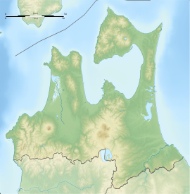
197:
192:
184:
176:
166:
129:
119:
105:
316:, many of whom lived in coastal settlements. The
401:, and more than 50 unfinished bracelets made of
390:and the bones of birds such as geese, ducks and
261:
523:[Tagoyano Shell Mound] (in Japanese).
255:
360:of Japan; however, this side is located on a
16:Archaeological site in Tsugaru, Tohoku, Japan
8:
85:
57:
19:
32:
18:
320:associated with such settlements contain
473:List of Historic Sites of Japan (Aomori)
512:
180:20,076.84 square metres (4.96110 acres)
577:Hokkaidō Government Board of Education
485:Historic Site Futatsumori Shell Midden
7:
352:, provide a useful source into the
572:「北海道・北東北を中心とした縄文遺跡群」の世界文化遺産登録をめざして
498:Aomori Prefectural government site
417:occurred during the Jōmon period.
14:
457:
443:
84:
77:
56:
49:
240:National Historic Site of Japan
295:. The site was designated a
25:
1:
68:Show map of Aomori Prefecture
619:History of Aomori Prefecture
93:Tagoyano Shell Mound (Japan)
525:Agency for Cultural Affairs
272:in what is now the city of
262:
232:Yes (no facilities at site)
640:
256:
236:
43:
31:
24:
571:
392:short-tailed albatrosses
364:on the left bank of the
624:Historic Sites of Japan
614:Shell middens in Japan
297:National Historic Site
188:15 metres (49 ft)
151:40.88806°N 140.33917°E
251:Tagoyano Shell Midden
221:Excavation dates
65:Tagoyano Shell Midden
20:Tagoyano Shell Midden
425:World Heritage List
270:archaeological site
156:40.88806; 140.33917
147: /
21:
229:Public access
38:A sign at the site
490:Tsugaru City site
388:Japanese sea bass
278:Aomori Prefecture
247:
246:
96:Show map of Japan
631:
588:
587:
585:
583:
567:
561:
560:
558:
556:
542:
536:
535:
533:
531:
517:
502:
494:
467:
462:
461:
460:
453:
448:
447:
446:
267:
265:
263:Tagoyano kaizuka
259:
258:
162:
161:
159:
158:
157:
152:
148:
145:
144:
143:
140:
97:
88:
87:
81:
69:
60:
59:
53:
36:
22:
639:
638:
634:
633:
632:
630:
629:
628:
609:Tsugaru, Aomori
594:
593:
592:
591:
581:
579:
573:
569:
568:
564:
554:
552:
544:
543:
539:
529:
527:
519:
518:
514:
509:
500:
492:
481:
463:
458:
456:
449:
444:
442:
439:
362:fluvial terrace
309:
253:
243:
242:
155:
153:
149:
146:
141:
138:
136:
134:
133:
110:Tsugaru, Aomori
101:
100:
99:
98:
95:
94:
91:
90:
89:
72:
71:
70:
67:
66:
63:
62:
61:
39:
27:
17:
12:
11:
5:
637:
635:
627:
626:
621:
616:
611:
606:
596:
595:
590:
589:
562:
537:
511:
510:
508:
505:
504:
503:
495:
487:
480:
479:External links
477:
476:
475:
469:
468:
454:
451:History portal
438:
435:
427:as one of the
415:Tsugaru Strait
379:Yamato-shijimi
330:mollusc shells
308:
305:
288:with an early
245:
244:
238:
237:
234:
233:
230:
226:
225:
222:
218:
217:
213:
212:
207:
203:
202:
201:4500 - 2500 BC
199:
195:
194:
190:
189:
186:
182:
181:
178:
174:
173:
168:
164:
163:
131:
127:
126:
121:
117:
116:
107:
103:
102:
92:
83:
82:
76:
75:
74:
73:
64:
55:
54:
48:
47:
46:
45:
44:
41:
40:
37:
29:
28:
15:
13:
10:
9:
6:
4:
3:
2:
636:
625:
622:
620:
617:
615:
612:
610:
607:
605:
602:
601:
599:
578:
574:
566:
563:
551:
547:
541:
538:
526:
522:
516:
513:
506:
501:(in Japanese)
499:
496:
493:(in Japanese)
491:
488:
486:
483:
482:
478:
474:
471:
470:
466:
455:
452:
441:
436:
434:
431:
430:
426:
423:
418:
416:
412:
408:
404:
400:
399:pit dwellings
395:
393:
389:
385:
381:
380:
375:
369:
367:
363:
359:
358:Pacific coast
355:
351:
347:
343:
339:
335:
331:
327:
323:
319:
315:
306:
304:
302:
298:
294:
291:
287:
283:
282:Tōhoku region
279:
275:
271:
264:
252:
241:
235:
231:
227:
223:
219:
214:
211:
208:
204:
200:
196:
191:
187:
183:
179:
175:
172:
169:
165:
160:
132:
128:
125:
124:Tōhoku region
122:
118:
115:
111:
108:
104:
80:
52:
42:
35:
30:
23:
604:Jōmon period
580:. Retrieved
565:
553:. Retrieved
540:
528:. Retrieved
515:
465:Japan portal
432:
419:
402:
396:
378:
370:
340:, and other
314:Jōmon people
310:
301:Sea of Japan
293:shell midden
290:Jōmon period
284:of northern
250:
248:
210:Jōmon period
171:shell midden
366:Iwaki River
154: /
142:140°20′21″E
130:Coordinates
598:Categories
582:9 November
507:References
374:Lake Jūsan
328:material,
216:Site notes
139:40°53′17″N
403:Benkeigai
342:artifacts
326:botanical
280:, in the
224:1990-1991
521:"田小屋野貝塚"
437:See also
411:obsidian
407:Hokkaidō
350:features
346:ecofacts
307:Overview
106:Location
555:19 June
530:12 June
338:lithics
318:middens
274:Tsugaru
206:Periods
198:Founded
193:History
550:UNESCO
422:UNESCO
409:, and
334:sherds
268:is an
257:田小屋野貝塚
185:Height
120:Region
26:田小屋野貝塚
354:diets
286:Japan
114:Japan
584:2013
557:2012
532:2012
386:and
384:carp
344:and
322:bone
249:The
177:Area
167:Type
600::
548:.
336:,
332:,
324:,
303:.
276:,
260:,
112:,
586:.
559:.
534:.
266:)
254:(
Text is available under the Creative Commons Attribution-ShareAlike License. Additional terms may apply.