285:
233:
46:
81:
53:
26:
512:
317:
This lone survivor caught the public's imagination as a symbol of hope and was widely reported upon by newspapers worldwide. Also, since one tree survived, the official designation as a "Place of Scenic Beauty" was not revoked. The lone surviving pine died in
December 2012 due to seawater
323:
74:
318:
contamination of the surrounding soil. Disaster recovery work began in
December 2013 with the building of a new sea wall and restoration of the beach, which had been buried in meters of
481:
546:
339:
117:
45:
270:
period (1716-1736) by his son
Shichizaemon and grandson Hachisaburo with an additional 70,000 trees, which were a mixture of Japanese red pine and
326:. Tree planting events were held in 2017 and 2018, during which time 2500 pine seedlings were planted by volunteers. The area is now part of the
531:
213:
307:
221:
310:, the tsunami was over 10 meters in height at this location, and almost the entire grove was completely swept away, with the exception of
284:
426:
422:
401:
73:
536:
232:
327:
541:
278:
206:
373:
516:
294:
The Takata
Matsubara served its purpose on several occasions, protecting the settlement from tsunami caused by the
303:
240:
The Takata
Matsubara was planted by local merchant-magnate Kanno Mokunosuke in 1667, under the instruction of
299:
295:
31:
194:
104:
486:
209:
167:
394:
349:
344:
311:
288:
430:
271:
255:
198:
453:
241:
525:
458:
251:
190:
322:. Cleanup efforts were hampered by fears that the wood of the fallen pines had been
369:
217:
267:
25:
132:
119:
482:"Sole surviving pine tree and symbol of Japan's post-tsunami hope is dying"
246:
511:
259:
263:
277:
The area was extolled for its scenic beauty and it became part of the
283:
231:
202:
319:
423:"Introducing places of interest: Rikuchukaigan National Park"
262:
to protect the port village from high winds, high tides and
236:
Rikuzentakata city center with Takata
Matsubara in 1977
281:
in 1964, drawing many thousands of visitors annually.
224:, tree planting efforts commenced in 2017 and 2018.
164:
156:
148:
111:
100:
18:
340:List of Places of Scenic Beauty of Japan (Iwate)
182:
8:
454:"Battle to protect sole surviving pine tree"
220:. After the grove was destroyed during the
15:
258:trees, and was intended to form a living
274:along a two kilometer stretch of beach.
80:
52:
547:Tourist attractions in Iwate Prefecture
480:Demetriou, Danielle (5 December 2011).
361:
266:. The pine grove was expanded in the
7:
99:
308:2011 Tōhoku earthquake and tsunami
254:, and initially consisted of 6200
222:2011 Tōhoku earthquake and tsunami
14:
510:
189:was a pine grove located on the
168:National Palace of Scenic Beauty
88:Takata-matsubara (Tohoku, Japan)
79:
72:
51:
44:
24:
155:
1:
532:Geography of Iwate Prefecture
452:Toru Asami (18 April 2011).
279:Rikuchū Kaigan National Park
63:Show map of Iwate Prefecture
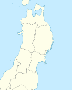
60:Location of Takata Matsubara
427:Ministry of the Environment
402:Ministry of the Environment
374:Agency for Cultural Affairs
328:Sanriku Fukkō National Park
563:
324:contaminated by radiation
183:
91:Show map of Tohoku, Japan
38:
23:
304:1960 Valdivia earthquake
212:in 1940. and one of the
30:Takata-matsubara before
537:Places of Scenic Beauty
300:1933 Sanriku earthquake
296:1896 Sanriku earthquake
214:100 Landscapes of Japan
152:2 km (1.2 mi)
291:
237:
210:Place of Scenic Beauty
205:. It was designated a
32:2011 Tohoku earthquake
519:at Wikimedia Commons
287:
235:
207:nationally designated
542:Rikuzentakata, Iwate
228:History and overview
133:39.0034°N 141.6251°E
105:Rikuzentakata, Iwate
487:The Daily Telegraph
272:Japanese black pine
129: /
433:on 8 February 2012
312:one lone pine tree
306:. However, in the
292:
238:
515:Media related to
395:"日本八景(昭和2年)の選定内容"
350:Miho no Matsubara
345:Miracle Pine Tree
289:Miracle Pine Tree
256:Japanese red pine
175:
174:
138:39.0034; 141.6251
554:
517:Takata Matsubara
514:
499:
498:
496:
494:
477:
471:
470:
468:
466:
449:
443:
442:
440:
438:
429:. Archived from
419:
413:
412:
410:
408:
399:
391:
385:
384:
382:
380:
366:
199:Iwate Prefecture
191:Pacific seashore
188:
186:
185:
178:Takata Matsubara
144:
143:
141:
140:
139:
134:
130:
127:
126:
125:
122:
92:
83:
82:
76:
64:
55:
54:
48:
28:
19:Takata Matsubara
16:
562:
561:
557:
556:
555:
553:
552:
551:
522:
521:
508:
503:
502:
492:
490:
479:
478:
474:
464:
462:
451:
450:
446:
436:
434:
421:
420:
416:
406:
404:
397:
393:
392:
388:
378:
376:
368:
367:
363:
358:
336:
230:
193:of the city of
180:
171:
170:
137:
135:
131:
128:
123:
120:
118:
116:
115:
96:
95:
94:
93:
90:
89:
86:
85:
84:
67:
66:
65:
62:
61:
58:
57:
56:
34:
12:
11:
5:
560:
558:
550:
549:
544:
539:
534:
524:
523:
507:
506:External links
504:
501:
500:
472:
444:
414:
386:
360:
359:
357:
354:
353:
352:
347:
342:
335:
332:
242:Date Tsunamune
229:
226:
173:
172:
166:
165:
162:
161:
158:
154:
153:
150:
146:
145:
113:
109:
108:
102:
98:
97:
87:
78:
77:
71:
70:
69:
68:
59:
50:
49:
43:
42:
41:
40:
39:
36:
35:
29:
21:
20:
13:
10:
9:
6:
4:
3:
2:
559:
548:
545:
543:
540:
538:
535:
533:
530:
529:
527:
520:
518:
513:
505:
489:
488:
483:
476:
473:
461:
460:
459:Asahi Shimbun
455:
448:
445:
432:
428:
424:
418:
415:
403:
396:
390:
387:
375:
371:
365:
362:
355:
351:
348:
346:
343:
341:
338:
337:
333:
331:
329:
325:
321:
315:
313:
309:
305:
301:
297:
290:
286:
282:
280:
275:
273:
269:
265:
261:
257:
253:
252:Sendai Domain
249:
248:
243:
234:
227:
225:
223:
219:
215:
211:
208:
204:
200:
196:
195:Rikuzentakata
192:
179:
169:
163:
159:
151:
147:
142:
114:
110:
106:
103:
75:
47:
37:
33:
27:
22:
17:
509:
491:. Retrieved
485:
475:
463:. Retrieved
457:
447:
435:. Retrieved
431:the original
417:
405:. Retrieved
389:
377:. Retrieved
364:
316:
293:
276:
245:
239:
177:
176:
493:10 February
465:10 February
437:10 February
407:10 February
216:during the
136: /
124:141°37′30″E
112:Coordinates
526:Categories
356:References
157:Designated
121:39°00′12″N
218:Shōwa era
379:10 April
334:See also
302:and the
260:sea wall
101:Location
264:tsunami
107:, Japan
370:"高田松原"
247:daimyō
244:, the
149:Length
398:(PDF)
268:Kyōhō
203:Japan
495:2012
467:2012
439:2012
409:2012
381:2020
320:silt
184:高田松原
160:1940
250:of
528::
484:.
456:.
425:.
400:.
372:.
330:.
314:.
298:,
201:,
197:,
497:.
469:.
441:.
411:.
383:.
187:)
181:(
Text is available under the Creative Commons Attribution-ShareAlike License. Additional terms may apply.