337:
105:
89:
811:
49:
74:
64:
862:
329:
112:
453:) characterized by warm summers and cold winters with heavy snowfall. The average annual temperature in Takayama is 6.7 °C. The average annual rainfall is 1548 mm with September as the wettest month. The temperatures are highest on average in August, at around 21.7 °C, and lowest in January, at around -5.7 °C.
646:
village council of 10 members. Takayama, collectively with the other municipalities in
Agatsuma District, contributes two members to the Gunma Prefectural Assembly. In terms of national politics, the village is part of
336:
104:
136:
675:
Takayama has one public elementary school and one public middle school operated by the village government. The village does not have a high school.
88:
810:
1139:
1120:
652:
48:
800:
73:
861:
778:
1009:
828:
698:
446:
63:
1144:
950:
679:
209:
180:
168:
870:
461:
Per
Japanese census data, the population of Takayama has remained relatively steady over the past century.
1026:
955:
382:
of 110 persons per km. The total area of the village is 64.18 square kilometres (24.78 sq mi).
987:
1087:
1070:
1058:
838:
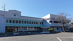
192:
630:
on April 1, 1889, the village of
Takayama was created within Agatsuma District of Gunma Prefecture.
793:
391:
259:
390:
Located at the easternmost point of
Agatsuma District, Takayama is surrounded by mountains at all
328:
929:
744:
648:
379:
204:
970:
623:
429:
627:
363:
39:
1097:
1046:
1019:
997:
924:
814:
424:
413:
367:
197:
1092:
1014:
419:
290:
280:
1107:
909:
185:
1036:
1031:
1002:
960:
934:
904:
786:
402:
1133:
1102:
1051:
919:
914:
899:
883:
656:
639:
434:
755:
1075:
1041:
992:
694:
1080:
965:
643:
613:
375:
151:
138:
250:
398:
Mountains: Mount Onoko (1208m), Junigadake (1200.9m), Mount
Komochi (1296m)
1063:
980:
851:
846:
823:
618:
878:
731:
770:
318:
255:
626:. With the creation of the modern municipalities system after the
371:
335:
327:
173:
374:. As of 1 September 2020, the village had an estimated
478:
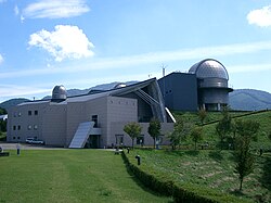
394:. The Gunma Telescope is located on Mount Komochi in the south.
308:
2856-1 Nakayama, Takayama-mura, Agatsuma-gun, Gunma-ken 377-0702
782:
270:
473:
697:
located in Gunma prefecture alone; the song played is "
642:
form of government with a directly elected mayor and a
943:
892:
869:
837:
667:The economy of Takayama is primarily agricultural.
312:
304:
296:
286:
276:
266:
249:
241:
233:
228:
220:
215:
203:
191:
179:
167:
21:
690:Takayama is served by a rail line from Nagoya.
355:
349:
27:
794:
8:
464:
616:, the area around Takayama was part of the
801:
787:
779:
713:Gunma Prefectural Astronomical Observatory
463:
18:
93:Location of Takayama in Gunma Prefecture
723:
311:
295:
248:
227:
214:
166:
131:
97:
85:
57:
45:
732:"Takayama village official statistics"
303:
285:
275:
265:
240:
232:
224:64.18 km (24.78 sq mi)
219:
202:
190:
178:
7:
1121:List of mergers in Gunma Prefecture
378:of 6,889 in 2449 households, and a
14:
860:
809:
111:
110:
103:
87:
72:
62:
47:
710:Marble Village Lockheart Castle
622:-administered territory within
340:Marble Village Lockheart Castle
756:Takayama population statistics
332:Gunma Astronomical Observatory
1:
693:It is also home to one of 10
1140:Villages in Gunma Prefecture
356:
1161:
409:Surrounding municipalities
1118:
858:
821:
699:When You Wish Upon a Star
491:—
447:Humid continental climate
350:
132:
98:
86:
58:
46:
37:
28:
680:Gumma Paz Gakuen College
152:36.617972°N 138.943583°E
25:
245:110/km (280/sq mi)
53:Takayama village office
16:Village in Kantō, Japan
341:
333:
745:Takayama climate data
734:(in Japanese). Japan.
465:Historical population
339:
331:
157:36.617972; 138.943583
242: • Density
466:
392:cardinal directions
260:Japan Standard Time
148: /
1010:Kitagunma District
649:Gunma 5th district
380:population density
342:
334:
234: • Total
221: • Total
1127:
1126:
951:Agatsuma District
832:
705:Local attractions
628:Meiji Restoration
605:
604:
326:
325:
297:Phone number
1152:
864:
826:
815:Gunma Prefecture
813:
803:
796:
789:
780:
775:
771:Official Website
758:
753:
747:
742:
736:
735:
728:
480:
475:
467:
414:Gunma Prefecture
368:Gunma Prefecture
361:
359:
353:
352:
322:
321:
319:Official website
281:Japanese Gentian
163:
162:
160:
159:
158:
153:
149:
146:
145:
144:
141:
114:
113:
107:
91:
76:
66:
51:
32:
31:
30:
19:
1160:
1159:
1155:
1154:
1153:
1151:
1150:
1149:
1145:Takayama, Gunma
1130:
1129:
1128:
1123:
1114:
956:Higashiagatsuma
939:
888:
865:
856:
833:
817:
807:
773:
767:
762:
761:
754:
750:
743:
739:
730:
729:
725:
720:
707:
688:
673:
665:
638:Takayama has a
636:
624:Kōzuke Province
610:
459:
445:Takayama has a
443:
411:
388:
347:
317:
316:
291:Copper pheasant
156:
154:
150:
147:
142:
139:
137:
135:
134:
128:
127:
126:
125:
122:
121:
120:
119:
115:
94:
82:
81:
80:
79:
70:
69:
54:
42:
33:
26:
24:
17:
12:
11:
5:
1158:
1156:
1148:
1147:
1142:
1132:
1131:
1125:
1124:
1119:
1116:
1115:
1113:
1112:
1111:
1110:
1105:
1100:
1095:
1085:
1084:
1083:
1078:
1068:
1067:
1066:
1056:
1055:
1054:
1049:
1044:
1039:
1034:
1024:
1023:
1022:
1017:
1007:
1006:
1005:
1000:
995:
988:Kanra District
985:
984:
983:
978:
973:
968:
963:
958:
947:
945:
941:
940:
938:
937:
932:
927:
922:
917:
912:
907:
902:
896:
894:
890:
889:
887:
886:
881:
875:
873:
871:Special cities
867:
866:
859:
857:
855:
854:
849:
843:
841:
835:
834:
822:
819:
818:
808:
806:
805:
798:
791:
783:
777:
776:
766:
765:External links
763:
760:
759:
748:
737:
722:
721:
719:
716:
715:
714:
711:
706:
703:
687:
686:Transportation
684:
683:
682:
672:
669:
664:
661:
635:
632:
609:
606:
603:
602:
599:
596:
592:
591:
588:
585:
581:
580:
577:
574:
570:
569:
566:
563:
559:
558:
555:
552:
548:
547:
544:
541:
537:
536:
533:
530:
526:
525:
522:
519:
515:
514:
511:
508:
504:
503:
500:
497:
493:
492:
489:
486:
482:
481:
476:
471:
458:
455:
442:
439:
438:
437:
432:
427:
422:
410:
407:
406:
405:
403:Agatsuma River
399:
387:
384:
324:
323:
314:
310:
309:
306:
302:
301:
298:
294:
293:
288:
284:
283:
278:
274:
273:
268:
264:
263:
253:
247:
246:
243:
239:
238:
235:
231:
230:
226:
225:
222:
218:
217:
213:
212:
207:
201:
200:
195:
189:
188:
183:
177:
176:
171:
165:
164:
130:
129:
123:
117:
116:
109:
108:
102:
101:
100:
99:
96:
95:
92:
84:
83:
77:
71:
67:
61:
60:
59:
56:
55:
52:
44:
43:
38:
35:
34:
22:
15:
13:
10:
9:
6:
4:
3:
2:
1157:
1146:
1143:
1141:
1138:
1137:
1135:
1122:
1117:
1109:
1106:
1104:
1101:
1099:
1096:
1094:
1091:
1090:
1089:
1088:Tone District
1086:
1082:
1079:
1077:
1074:
1073:
1072:
1071:Tano District
1069:
1065:
1062:
1061:
1060:
1059:Sawa District
1057:
1053:
1050:
1048:
1045:
1043:
1040:
1038:
1035:
1033:
1030:
1029:
1028:
1025:
1021:
1018:
1016:
1013:
1012:
1011:
1008:
1004:
1001:
999:
996:
994:
991:
990:
989:
986:
982:
979:
977:
974:
972:
969:
967:
964:
962:
959:
957:
954:
953:
952:
949:
948:
946:
942:
936:
933:
931:
928:
926:
923:
921:
918:
916:
913:
911:
908:
906:
903:
901:
898:
897:
895:
891:
885:
882:
880:
877:
876:
874:
872:
868:
863:
853:
850:
848:
845:
844:
842:
840:
836:
830:
825:
820:
816:
812:
804:
799:
797:
792:
790:
785:
784:
781:
774:(in Japanese)
772:
769:
768:
764:
757:
752:
749:
746:
741:
738:
733:
727:
724:
717:
712:
709:
708:
704:
702:
700:
696:
695:musical roads
691:
685:
681:
678:
677:
676:
670:
668:
662:
660:
658:
657:Diet of Japan
654:
650:
645:
641:
640:mayor-council
633:
631:
629:
625:
621:
620:
615:
607:
600:
597:
594:
593:
589:
586:
583:
582:
578:
575:
572:
571:
567:
564:
561:
560:
556:
553:
550:
549:
545:
542:
539:
538:
534:
531:
528:
527:
523:
520:
517:
516:
512:
509:
506:
505:
501:
498:
495:
494:
490:
487:
484:
483:
477:
472:
469:
468:
462:
456:
454:
452:
448:
440:
436:
433:
431:
428:
426:
423:
421:
418:
417:
416:
415:
408:
404:
400:
397:
396:
395:
393:
385:
383:
381:
377:
373:
369:
365:
358:
357:Takayama-mura
346:
338:
330:
320:
315:
307:
299:
292:
289:
282:
279:
272:
269:
261:
257:
254:
252:
244:
236:
223:
211:
208:
206:
199:
196:
194:
187:
184:
182:
175:
172:
170:
161:
143:138°56′36.9″E
133:Coordinates:
106:
90:
75:
65:
50:
41:
36:
20:
1027:Ōra District
975:
751:
740:
726:
692:
689:
674:
666:
637:
617:
611:
460:
457:Demographics
450:
444:
412:
389:
344:
343:
300:0279-63-2111
930:Tatebayashi
839:Core cities
653:lower house
612:During the
366:located in
155: /
140:36°37′4.7″N
1134:Categories
966:Naganohara
718:References
644:unicameral
634:Government
614:Edo period
376:population
229:Population
193:Prefecture
1098:Katashina
998:Shimonita
944:Districts
925:Shibukawa
671:Education
425:Shibukawa
386:Geography
251:Time zone
1093:Minakami
1064:Tamamura
1015:Yoshioka
981:Tsumagoi
976:Takayama
971:Nakanojō
852:Takasaki
847:Maebashi
824:Maebashi
619:hatamoto
449:(Köppen
430:Nakanojō
420:Minakami
401:Rivers:
345:Takayama
277:- Flower
210:Agatsuma
205:District
118:Takayama
23:Takayama
1037:Itakura
1032:Chiyoda
1003:Nanmoku
961:Kusatsu
935:Tomioka
905:Fujioka
879:Isesaki
829:capital
663:Economy
655:of the
651:of the
608:History
441:Climate
364:village
313:Website
305:Address
169:Country
40:Village
1103:Kawaba
1047:Ōizumi
1020:Shintō
920:Numata
915:Midori
900:Annaka
893:Cities
601:−10.2%
590:−10.1%
568:−14.6%
557:+15.1%
546:−13.5%
524:+23.4%
502:+12.2%
435:Numata
287:- Bird
267:- Tree
181:Region
124:
1108:Shōwa
1076:Kanna
1042:Meiwa
993:Kanra
910:Kiryū
598:3,511
595:2020
587:3,911
584:2010
579:+6.4%
576:4,348
573:2000
565:4,087
562:1990
554:4,788
551:1980
543:4,161
540:1970
535:−3.1%
532:4,813
529:1960
521:4,965
518:1950
513:+9.1%
510:4,025
507:1940
499:3,688
496:1930
488:3,286
485:1920
372:Japan
362:is a
256:UTC+9
237:6,889
198:Gunma
186:Kantō
174:Japan
1081:Ueno
474:Pop.
470:Year
216:Area
78:Seal
68:Flag
1052:Ōra
884:Ōta
701:."
451:Dfb
351:高山村
271:Oak
29:高山村
1136::
659:.
479:±%
370:,
354:,
831:)
827:(
802:e
795:t
788:v
360:)
348:(
262:)
258:(
Text is available under the Creative Commons Attribution-ShareAlike License. Additional terms may apply.