269:
94:
232:
61:
42:
379:, is a stone building with a standing seam metal roof. Originally built as a summer lodge providing residential space, its interior has largely been stripped of original features and its windows have been removed. The loft areas on the upper level surrounding the main room were probably intended as sleeping space. The building, a significant example of local summer estate architecture, is listed on the
101:
68:
372:. The road provides access to a picnic area, and a parking area further up the hill, from which there is access to hiking trails and the summit road. Dennis Hill stands at an elevation of 1,627 feet (496 m). The cleared summit area provides expansive views of the surrounding hills, and includes small pavilions and a large bungalow-style structure.
2265:
420:
2223:
357:
203:
565:
1909:
612:
2250:
1874:
645:
1429:
93:
2255:
617:
558:
2270:
1497:
60:
1136:
457:
1672:
551:
1667:
1151:
703:
655:
391:
The 240 acres (97 ha) that make up Dennis Hill State Park were once the estate of
Frederic S. Dennis (1850-1934). Dennis was a successful
2116:
1216:
781:
144:
1241:
574:
380:
255:
2245:
1980:
1929:
1839:
1482:
741:
448:
1939:
594:
1627:
1552:
1279:
1261:
841:
826:
786:
640:
1682:
1637:
866:
1687:
1547:
1542:
1512:
1502:
981:
906:
796:
713:
453:
213:
1712:
1622:
1572:
1522:
1487:
1844:
1527:
1507:
1462:
1041:
736:
1692:
1642:
1592:
1587:
1477:
399:
to design the bungalow at the summit of Dennis Hill. Here he hosted numerous luminaries of the day, including steel magnate
1707:
1582:
1577:
1537:
1447:
1437:
2260:
1879:
1632:
1612:
1607:
1492:
1457:
1452:
1294:
936:
911:
821:
801:
771:
2159:
1722:
1662:
1567:
1562:
1517:
2204:
1657:
1617:
1602:
1467:
1274:
1166:
1036:
1011:
901:
896:
746:
137:
1697:
1677:
1652:
1647:
1442:
2154:
1849:
1717:
1597:
1472:
1251:
1206:
1106:
1006:
791:
1702:
1557:
1532:
2144:
1949:
2199:
1748:
1246:
1236:
1226:
1221:
1181:
1171:
1156:
1131:
1111:
1091:
996:
956:
916:
876:
1954:
1399:
1191:
1101:
1051:
971:
941:
926:
886:
751:
726:
693:
2134:
1919:
1808:
1339:
1284:
1231:
1186:
1141:
1026:
976:
881:
831:
604:
395:
doctor who summered in
Norfolk for many years. He called his estate "Tamarac," and in 1908 retained architect
443:
2095:
1944:
1884:
1803:
1419:
1379:
1364:
1329:
1314:
1299:
1211:
1176:
1161:
1021:
986:
871:
856:
766:
731:
1894:
268:
2179:
2005:
1959:
1798:
1404:
1389:
1344:
1309:
1269:
1146:
1071:
1066:
1001:
991:
951:
931:
806:
761:
627:
2164:
1985:
1783:
1763:
1743:
1409:
1394:
1349:
1334:
1304:
1196:
1121:
1116:
1081:
1056:
1016:
966:
961:
891:
836:
756:
586:
369:
2194:
2189:
2169:
1758:
225:
1934:
1384:
1374:
1369:
1359:
1324:
1126:
1061:
776:
721:
345:
129:
2000:
1904:
1859:
1829:
1793:
1414:
1354:
1319:
1289:
1096:
1031:
921:
861:
811:
404:
396:
2209:
2075:
2030:
1990:
1914:
1834:
1788:
1738:
1201:
1086:
1076:
1046:
2020:
2015:
1964:
1768:
635:
502:
2090:
2065:
2055:
2010:
683:
678:
673:
341:
2174:
2080:
2070:
2040:
2025:
1995:
1869:
1778:
1753:
946:
688:
668:
408:
400:
1924:
231:
2184:
2149:
2139:
2045:
2035:
1899:
1773:
17:
317:
41:
2239:
2050:
1864:
851:
846:
698:
663:
392:
2085:
2060:
531:
476:
543:
1854:
578:
537:
349:
421:
National
Register of Historic Places listings in Litchfield County, Connecticut
2100:
1889:
353:
159:
146:
1813:
368:
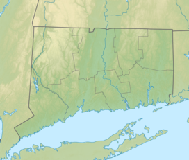
The park is located in southern
Norfolk, with its main access road off
356:
offers hiking, picnicking, and scenic views. It is administered by the
2266:
National
Register of Historic Places in Litchfield County, Connecticut
352:, that was once the estate of Dr. Frederick Shepard Dennis. The
547:
479:. Connecticut Department of Energy and Environmental Protection
2224:
Connecticut
Department of Energy and Environmental Protection
540:
Connecticut
Department of Energy and Environmental Protection
534:
Connecticut
Department of Energy and Environmental Protection
358:
Connecticut
Department of Energy and Environmental Protection
204:
Connecticut
Department of Energy and Environmental Protection
507:
National Register of Historic Places Registration Form
2125:
2109:
1973:
1822:
1731:
1428:
1260:
712:
654:
626:
603:
585:
323:
310:
302:
294:
286:
278:
219:
209:
199:
191:
183:
175:
136:
125:
34:
411:. Dennis gifted his estate to the state in 1935.
1875:Connecticut Audubon Society Center at Fairfield
1910:Joshua's Tract Conservation and Historic Trust
100:
67:
559:
8:
282:Dennis Hill State Park, Norfolk, Connecticut
27:State park in Litchfield County, Connecticut
340:is a public recreation area located in the
566:
552:
544:
230:
113:Dennis Hill State Park (the United States)
31:
646:Washington–Rochambeau Revolutionary Route
256:U.S. National Register of Historic Places
458:United States Department of the Interior
2251:Parks in Litchfield County, Connecticut
432:
496:
494:
471:
469:
467:
438:
436:
2117:List of nature centers in Connecticut
1668:Salmon River Cove and Haddam Neck WMA
1137:Satan's Kingdom State Recreation Area
7:
1242:Windsor Locks Canal State Park Trail
381:National Register of Historic Places
375:The bungalow, originally called the
2256:Protected areas established in 1935
2160:Happy Landings Protected Open Space
1981:American Legion State Forest Trails
1940:Stamford Museum & Nature Center
1840:Audubon Center at Bent of the River
1568:Little River Fish and Wildlife Area
742:Beckley Furnace Industrial Monument
449:Geographic Names Information System
2271:1935 establishments in Connecticut
595:Weir Farm National Historical Park
501:Clouette, Bruce (April 25, 1976).
25:
1648:Roger Tory Peterson Wildlife Area
641:New England National Scenic Trail
2155:Gurski Farm Protected Open Space
273:Tamarack Bungalow on Dennis Hill
267:
124:
99:
92:
66:
59:
40:
454:United States Geological Survey
198:
174:
2145:Burr Farm Protected Open Space
1950:Weantinoge Heritage Land Trust
1845:Bartlett Arboretum and Gardens
1042:Moosup Valley State Park Trail
737:Becket Hill State Park Reserve
312:
48:the park's southeast perimeter
1:
1880:Connecticut College Arboretum
116:Show map of the United States
2205:Webb Mountain Discovery Zone
46:Picnic pavilion overlooking
802:Connecticut Valley Railroad
2287:
2246:State parks of Connecticut
1628:Quinnipiac River Marsh WMA
1132:Salt Rock State Campground
917:Hop River State Park Trail
538:Dennis Hill State Park Map
187:1,631 ft (497 m)
2218:
2135:Bear Mountain Reservation
1955:White Memorial Foundation
1809:West Pequonnock Reservoir
1430:Wildlife Management Areas
847:Fort Griswold Battlefield
605:National Wildlife Refuges
503:"Tamarack Lodge Bungalow"
331:
311:NRHP reference
266:
262:
253:
246:
242:
238:
53:
39:
1920:New Canaan Nature Center
477:"Dennis Hill State Park"
2096:Whitestone Cliffs Trail
1804:West Hartford Reservoir
1683:Skiff Mountain Coop WMA
1638:Raymond Brook Marsh WMA
987:Larkin State Park Trail
509:. National Park Service
377:Tamarack Lodge Bungalow
248:Tamarack Lodge Bungalow
83:Show map of Connecticut
80:Location in Connecticut
18:Tamarack Lodge Bungalow
2006:Housatonic Range Trail
1960:Woodcock Nature Center
1945:Steep Rock Association
1553:King's Island Coop WMA
1498:Charles E. Wheeler WMA
807:Dart Island State Park
656:Wild and Scenic Rivers
532:Dennis Hill State Park
338:Dennis Hill State Park
214:Connecticut state park
179:240 acres (97 ha)
107:Dennis Hill State Park
74:Dennis Hill State Park
35:Dennis Hill State Park
2165:Lighthouse Point Park
1986:Aspetuck Valley Trail
1930:Pine Mountain Reserve
1895:Great Mountain Forest
1784:Mansfield Hollow Lake
1744:Barkhamsted Reservoir
1688:James V. Spignesi WMA
867:George Dudley Seymour
587:National Park Service
370:Connecticut Route 272
290:5 acres (2.0 ha)
160:41.94861°N 73.19889°W
2261:Norfolk, Connecticut
2180:Old Bridge Sanctuary
1935:Saltonstall Mountain
1885:Devil's Den Preserve
1799:Trap Falls Reservoir
1548:Housatonic River WMA
1543:Higganum Meadows WMA
1513:East River Marsh WMA
1503:Cromwell Meadows WMA
1280:Centennial Watershed
982:Lamentation Mountain
797:Collis P. Huntington
200:Administered by
130:Norfolk, Connecticut
2001:Hancock Brook Trail
1905:Highstead Arboretum
1860:Branford Land Trust
1830:Aspetuck Land Trust
1794:Saugatuck Reservoir
1713:Wangunk Meadows WMA
1623:Quinebaug River WMA
1523:Eightmile River WMA
1488:Candlewood Hill WMA
1152:Seth Low Pierrepont
618:Stewart B. McKinney
405:William Howard Taft
397:Alfredo S.G. Taylor
306:Alfredo S.G. Taylor
165:41.94861; -73.19889
156: /
2210:Webb Mountain Park
2076:Salmon River Trail
2031:Narragansett Trail
1991:Blue-Blazed Trails
1915:McLean Game Refuge
1764:Far Mill Reservoir
1739:Aspetuck Reservoir
1673:Sessions Woods WMA
1528:Franklin Swamp WMA
1508:Durham Meadows WMA
1463:Bartlett Brook WMA
1217:Trout Brook Valley
937:Housatonic Meadows
912:Higganum Reservoir
772:Brainard Homestead
327:September 16, 1977
2233:
2232:
2021:Menunkatuck Trail
2016:Mattabesett Trail
1965:Yale-Myers Forest
1769:Hemlock Reservoir
1693:Stanley Works WMA
1643:Robbins Swamp WMA
1593:Messerschmidt WMA
1588:Menunketesuck WMA
1478:Bishops Swamp WMA
1012:Mashamoquet Brook
907:Haystack Mountain
902:Harkness Memorial
897:Hammonasset Beach
636:Appalachian Trail
335:
334:
16:(Redirected from
2278:
2195:Salt Meadow Park
2190:Roosevelt Forest
2170:Lillinonah Woods
2126:Local Government
2091:Westwoods Trails
2066:Quinnipiac Trail
2056:Paugussett Trail
2011:Lillinonah Trail
1759:Easton Reservoir
1708:Tankerhoosen WMA
1583:Meadow Brook WMA
1578:Maromas Coop WMA
1538:Great Harbor WMA
1448:Babcock Pond WMA
1438:Aldo Leopold WMA
1295:James L. Goodwin
1252:Wooster Mountain
1207:Talcott Mountain
1107:Quinnipiac River
1007:Mansfield Hollow
842:Farmington Canal
792:Chatfield Hollow
684:Housatonic River
679:Green Fall River
674:Farmington River
568:
561:
554:
545:
519:
518:
516:
514:
498:
489:
488:
486:
484:
473:
462:
461:
440:
407:, and conductor
314:
271:
234:
229:
228:
226:Official website
171:
170:
168:
167:
166:
161:
157:
154:
153:
152:
149:
117:
103:
102:
96:
84:
70:
69:
63:
44:
32:
21:
2286:
2285:
2281:
2280:
2279:
2277:
2276:
2275:
2236:
2235:
2234:
2229:
2214:
2175:Mill River Park
2127:
2121:
2105:
2081:Shenipsit Trail
2071:Regicides Trail
2041:Naugatuck Trail
2026:Metacomet Trail
1996:Chatfield Trail
1969:
1870:Cathedral Pines
1818:
1779:Lake Lillinonah
1754:Candlewood Lake
1749:Beaver Dam Lake
1727:
1633:Ragged Rock WMA
1613:Pease Brook WMA
1608:Nott Island WMA
1573:Lord's Cove WMA
1493:Cedar Swamp WMA
1458:Barn Island WMA
1453:Barber Pond WMA
1424:
1275:American Legion
1256:
1247:Windsor Meadows
1237:Whittemore Glen
1227:West Rock Ridge
1222:Wadsworth Falls
1182:Stillwater Pond
1172:Southford Falls
1157:Sherwood Island
1112:River Highlands
1092:Putnam Memorial
1032:Mohawk Mountain
997:Macedonia Brook
957:John A. Minetto
877:Gillette Castle
822:Devil's Hopyard
708:
689:Pawcatuck River
669:Eightmile River
650:
628:National Trails
622:
613:Silvio O. Conte
599:
581:
575:Protected areas
572:
528:
523:
522:
512:
510:
500:
499:
492:
482:
480:
475:
474:
465:
442:
441:
434:
429:
417:
409:Walter Damrosch
401:Andrew Carnegie
389:
366:
274:
258:
249:
224:
223:
164:
162:
158:
155:
150:
147:
145:
143:
142:
132:, United States
121:
120:
119:
118:
115:
114:
111:
110:
109:
108:
104:
87:
86:
85:
82:
81:
78:
77:
76:
75:
71:
49:
47:
28:
23:
22:
15:
12:
11:
5:
2284:
2282:
2274:
2273:
2268:
2263:
2258:
2253:
2248:
2238:
2237:
2231:
2230:
2228:
2227:
2219:
2216:
2215:
2213:
2212:
2207:
2202:
2197:
2192:
2187:
2185:Pleasure Beach
2182:
2177:
2172:
2167:
2162:
2157:
2152:
2150:East Rock Park
2147:
2142:
2140:Beardsley Park
2137:
2131:
2129:
2123:
2122:
2120:
2119:
2113:
2111:
2110:Nature centers
2107:
2106:
2104:
2103:
2098:
2093:
2088:
2083:
2078:
2073:
2068:
2063:
2058:
2053:
2048:
2046:Nehantic Trail
2043:
2038:
2036:Natchaug Trail
2033:
2028:
2023:
2018:
2013:
2008:
2003:
1998:
1993:
1988:
1983:
1977:
1975:
1971:
1970:
1968:
1967:
1962:
1957:
1952:
1947:
1942:
1937:
1932:
1927:
1922:
1917:
1912:
1907:
1902:
1900:Higby Mountain
1897:
1892:
1887:
1882:
1877:
1872:
1867:
1862:
1857:
1852:
1847:
1842:
1837:
1832:
1826:
1824:
1820:
1819:
1817:
1816:
1811:
1806:
1801:
1796:
1791:
1786:
1781:
1776:
1774:Hop Brook Lake
1771:
1766:
1761:
1756:
1751:
1746:
1741:
1735:
1733:
1729:
1728:
1726:
1725:
1723:Zemko Pond WMA
1720:
1715:
1710:
1705:
1700:
1695:
1690:
1685:
1680:
1675:
1670:
1665:
1663:Ross Marsh WMA
1660:
1655:
1650:
1645:
1640:
1635:
1630:
1625:
1620:
1615:
1610:
1605:
1600:
1595:
1590:
1585:
1580:
1575:
1570:
1565:
1563:Larson Lot WMA
1560:
1555:
1550:
1545:
1540:
1535:
1530:
1525:
1520:
1518:East Swamp WMA
1515:
1510:
1505:
1500:
1495:
1490:
1485:
1483:Black Pond WMA
1480:
1475:
1470:
1465:
1460:
1455:
1450:
1445:
1440:
1434:
1432:
1426:
1425:
1423:
1422:
1417:
1412:
1407:
1402:
1397:
1392:
1387:
1382:
1377:
1372:
1367:
1362:
1357:
1352:
1347:
1342:
1337:
1332:
1327:
1322:
1317:
1312:
1307:
1302:
1297:
1292:
1287:
1282:
1277:
1272:
1266:
1264:
1258:
1257:
1255:
1254:
1249:
1244:
1239:
1234:
1229:
1224:
1219:
1214:
1209:
1204:
1199:
1194:
1192:Stratton Brook
1189:
1184:
1179:
1174:
1169:
1167:Sleeping Giant
1164:
1159:
1154:
1149:
1144:
1139:
1134:
1129:
1124:
1119:
1114:
1109:
1104:
1102:Quinebaug Lake
1099:
1094:
1089:
1084:
1079:
1074:
1069:
1064:
1059:
1054:
1052:Mount Bushnell
1049:
1044:
1039:
1034:
1029:
1024:
1019:
1014:
1009:
1004:
999:
994:
989:
984:
979:
974:
972:Killingly Pond
969:
964:
959:
954:
949:
944:
942:Humaston Brook
939:
934:
929:
927:Hopeville Pond
924:
919:
914:
909:
904:
899:
894:
889:
887:Haddam Meadows
884:
879:
874:
869:
864:
859:
854:
849:
844:
839:
834:
829:
824:
819:
814:
809:
804:
799:
794:
789:
787:Campbell Falls
784:
779:
774:
769:
764:
759:
754:
752:Bigelow Hollow
749:
747:Bennett's Pond
744:
739:
734:
729:
724:
718:
716:
710:
709:
707:
706:
701:
696:
691:
686:
681:
676:
671:
666:
660:
658:
652:
651:
649:
648:
643:
638:
632:
630:
624:
623:
621:
620:
615:
609:
607:
601:
600:
598:
597:
591:
589:
583:
582:
573:
571:
570:
563:
556:
548:
542:
541:
535:
527:
526:External links
524:
521:
520:
490:
463:
431:
430:
428:
425:
424:
423:
416:
413:
388:
385:
365:
362:
333:
332:
329:
328:
325:
321:
320:
315:
308:
307:
304:
300:
299:
296:
292:
291:
288:
284:
283:
280:
276:
275:
272:
264:
263:
260:
259:
254:
251:
250:
247:
244:
243:
240:
239:
236:
235:
221:
217:
216:
211:
207:
206:
201:
197:
196:
193:
189:
188:
185:
181:
180:
177:
173:
172:
140:
134:
133:
127:
123:
122:
112:
106:
105:
98:
97:
91:
90:
89:
88:
79:
73:
72:
65:
64:
58:
57:
56:
55:
54:
51:
50:
45:
37:
36:
26:
24:
14:
13:
10:
9:
6:
4:
3:
2:
2283:
2272:
2269:
2267:
2264:
2262:
2259:
2257:
2254:
2252:
2249:
2247:
2244:
2243:
2241:
2226:
2225:
2221:
2220:
2217:
2211:
2208:
2206:
2203:
2201:
2198:
2196:
2193:
2191:
2188:
2186:
2183:
2181:
2178:
2176:
2173:
2171:
2168:
2166:
2163:
2161:
2158:
2156:
2153:
2151:
2148:
2146:
2143:
2141:
2138:
2136:
2133:
2132:
2130:
2124:
2118:
2115:
2114:
2112:
2108:
2102:
2099:
2097:
2094:
2092:
2089:
2087:
2084:
2082:
2079:
2077:
2074:
2072:
2069:
2067:
2064:
2062:
2059:
2057:
2054:
2052:
2051:Nipmuck Trail
2049:
2047:
2044:
2042:
2039:
2037:
2034:
2032:
2029:
2027:
2024:
2022:
2019:
2017:
2014:
2012:
2009:
2007:
2004:
2002:
1999:
1997:
1994:
1992:
1989:
1987:
1984:
1982:
1979:
1978:
1976:
1972:
1966:
1963:
1961:
1958:
1956:
1953:
1951:
1948:
1946:
1943:
1941:
1938:
1936:
1933:
1931:
1928:
1926:
1923:
1921:
1918:
1916:
1913:
1911:
1908:
1906:
1903:
1901:
1898:
1896:
1893:
1891:
1888:
1886:
1883:
1881:
1878:
1876:
1873:
1871:
1868:
1866:
1865:Case Mountain
1863:
1861:
1858:
1856:
1853:
1851:
1850:Bear Mountain
1848:
1846:
1843:
1841:
1838:
1836:
1833:
1831:
1828:
1827:
1825:
1821:
1815:
1812:
1810:
1807:
1805:
1802:
1800:
1797:
1795:
1792:
1790:
1787:
1785:
1782:
1780:
1777:
1775:
1772:
1770:
1767:
1765:
1762:
1760:
1757:
1755:
1752:
1750:
1747:
1745:
1742:
1740:
1737:
1736:
1734:
1730:
1724:
1721:
1719:
1716:
1714:
1711:
1709:
1706:
1704:
1701:
1699:
1696:
1694:
1691:
1689:
1686:
1684:
1681:
1679:
1676:
1674:
1671:
1669:
1666:
1664:
1661:
1659:
1658:Rose Hill WMA
1656:
1654:
1651:
1649:
1646:
1644:
1641:
1639:
1636:
1634:
1631:
1629:
1626:
1624:
1621:
1619:
1618:Plum Bank WMA
1616:
1614:
1611:
1609:
1606:
1604:
1603:Nod Brook WMA
1601:
1599:
1596:
1594:
1591:
1589:
1586:
1584:
1581:
1579:
1576:
1574:
1571:
1569:
1566:
1564:
1561:
1559:
1556:
1554:
1551:
1549:
1546:
1544:
1541:
1539:
1536:
1534:
1531:
1529:
1526:
1524:
1521:
1519:
1516:
1514:
1511:
1509:
1506:
1504:
1501:
1499:
1496:
1494:
1491:
1489:
1486:
1484:
1481:
1479:
1476:
1474:
1471:
1469:
1468:Bear Hill WMA
1466:
1464:
1461:
1459:
1456:
1454:
1451:
1449:
1446:
1444:
1441:
1439:
1436:
1435:
1433:
1431:
1427:
1421:
1418:
1416:
1413:
1411:
1408:
1406:
1403:
1401:
1398:
1396:
1393:
1391:
1388:
1386:
1383:
1381:
1378:
1376:
1373:
1371:
1368:
1366:
1363:
1361:
1358:
1356:
1353:
1351:
1348:
1346:
1343:
1341:
1338:
1336:
1333:
1331:
1328:
1326:
1323:
1321:
1318:
1316:
1313:
1311:
1308:
1306:
1303:
1301:
1298:
1296:
1293:
1291:
1288:
1286:
1283:
1281:
1278:
1276:
1273:
1271:
1268:
1267:
1265:
1263:
1262:State Forests
1259:
1253:
1250:
1248:
1245:
1243:
1240:
1238:
1235:
1233:
1232:Wharton Brook
1230:
1228:
1225:
1223:
1220:
1218:
1215:
1213:
1210:
1208:
1205:
1203:
1200:
1198:
1195:
1193:
1190:
1188:
1187:Stoddard Hill
1185:
1183:
1180:
1178:
1175:
1173:
1170:
1168:
1165:
1163:
1160:
1158:
1155:
1153:
1150:
1148:
1145:
1143:
1142:Scantic River
1140:
1138:
1135:
1133:
1130:
1128:
1125:
1123:
1120:
1118:
1115:
1113:
1110:
1108:
1105:
1103:
1100:
1098:
1095:
1093:
1090:
1088:
1085:
1083:
1080:
1078:
1075:
1073:
1070:
1068:
1065:
1063:
1060:
1058:
1055:
1053:
1050:
1048:
1045:
1043:
1040:
1038:
1035:
1033:
1030:
1028:
1027:Minnie Island
1025:
1023:
1020:
1018:
1015:
1013:
1010:
1008:
1005:
1003:
1000:
998:
995:
993:
990:
988:
985:
983:
980:
978:
977:Lake Waramaug
975:
973:
970:
968:
965:
963:
960:
958:
955:
953:
950:
948:
945:
943:
940:
938:
935:
933:
930:
928:
925:
923:
920:
918:
915:
913:
910:
908:
905:
903:
900:
898:
895:
893:
890:
888:
885:
883:
882:Haddam Island
880:
878:
875:
873:
870:
868:
865:
863:
860:
858:
855:
853:
852:Fort Trumbull
850:
848:
845:
843:
840:
838:
835:
833:
832:Eagle Landing
830:
828:
825:
823:
820:
818:
815:
813:
810:
808:
805:
803:
800:
798:
795:
793:
790:
788:
785:
783:
782:Camp Columbia
780:
778:
775:
773:
770:
768:
765:
763:
760:
758:
755:
753:
750:
748:
745:
743:
740:
738:
735:
733:
730:
728:
725:
723:
720:
719:
717:
715:
711:
705:
702:
700:
699:Shunock River
697:
695:
692:
690:
687:
685:
682:
680:
677:
675:
672:
670:
667:
665:
664:Ashaway River
662:
661:
659:
657:
653:
647:
644:
642:
639:
637:
634:
633:
631:
629:
625:
619:
616:
614:
611:
610:
608:
606:
602:
596:
593:
592:
590:
588:
584:
580:
576:
569:
564:
562:
557:
555:
550:
549:
546:
539:
536:
533:
530:
529:
525:
508:
504:
497:
495:
491:
478:
472:
470:
468:
464:
459:
455:
451:
450:
445:
444:"Dennis Hill"
439:
437:
433:
426:
422:
419:
418:
414:
412:
410:
406:
402:
398:
394:
393:New York City
386:
384:
382:
378:
373:
371:
363:
361:
359:
355:
351:
347:
343:
339:
330:
326:
324:Added to NRHP
322:
319:
316:
309:
305:
301:
297:
293:
289:
285:
281:
277:
270:
265:
261:
257:
252:
245:
241:
237:
233:
227:
222:
218:
215:
212:
208:
205:
202:
194:
190:
186:
182:
178:
169:
141:
139:
135:
131:
128:
95:
62:
52:
43:
38:
33:
30:
19:
2222:
2200:Seaside Park
2128:Forest/Parks
2086:Tunxis Trail
2061:Pequot Trail
1925:Peter's Rock
1698:Suffield WMA
1678:Simsbury WMA
1653:Roraback WMA
1443:Assekonk WMA
1400:Salmon River
1212:Tri-Mountain
1177:Squantz Pond
1162:Silver Sands
1022:Millers Pond
1017:Mianus River
872:George Waldo
857:Gardner Lake
816:
767:Bolton Notch
732:Beaver Brook
694:Salmon Brook
511:. Retrieved
506:
481:. Retrieved
447:
403:, President
390:
376:
374:
367:
337:
336:
29:
1855:Beckley Bog
1835:Aton Forest
1789:Means Brook
1718:Wopowog WMA
1598:Newgate WMA
1473:Belding WMA
1340:Nathan Hale
1285:Cockaponset
1147:Selden Neck
1072:Osbornedale
1067:Old Furnace
1002:Machimoodus
992:Lovers Leap
952:Indian Well
932:Horse Guard
817:Dennis Hill
762:Bluff Point
714:State Parks
579:Connecticut
350:Connecticut
210:Designation
192:Established
163: /
138:Coordinates
2240:Categories
2101:Zoar Trail
1890:Earthplace
1732:Reservoirs
1703:Talbot WMA
1558:Kollar WMA
1533:Goshen WMA
1420:Wyantenock
1380:Paugussett
1365:Nye-Holman
1330:Nassahegon
1315:Meshomasic
1300:Housatonic
1197:Sunnybrook
1122:Rocky Neck
1117:Rocky Glen
1082:Platt Hill
1057:Mount Riga
967:Kettletown
962:Kent Falls
892:Haley Farm
837:Farm River
757:Black Rock
704:Wood River
427:References
354:state park
151:73°11′56″W
148:41°56′55″N
1814:Lake Zoar
1405:Shenipsit
1390:Pootatuck
1345:Naugatuck
1310:Mattatuck
1270:Algonquin
1127:Ross Pond
1062:Mount Tom
1037:Mono Pond
777:Burr Pond
722:Above All
513:March 14,
483:August 6,
303:Architect
184:Elevation
1410:Topsmead
1395:Quaddick
1385:People's
1350:Nehantic
1335:Natchaug
1305:Massacoe
1097:Quaddick
922:Hopemead
862:Gay City
827:Dinosaur
812:Day Pond
727:Air Line
415:See also
364:Features
318:77001499
279:Location
126:Location
1823:Private
1375:Paugnut
1370:Pachaug
1360:Nipmuck
1325:Mohegan
1202:Sunrise
1087:Pomeroy
1077:Penwood
1047:Mooween
387:History
346:Norfolk
220:Website
1974:Trails
1415:Tunxis
1355:Nepaug
1320:Mohawk
1290:Enders
295:Built
947:Hurd
515:2017
485:2024
342:town
298:1909
287:Area
195:1935
176:Area
577:of
344:of
313:No.
2242::
505:.
493:^
466:^
456:,
452:.
446:.
435:^
383:.
360:.
348:,
567:e
560:t
553:v
517:.
487:.
460:.
20:)
Text is available under the Creative Commons Attribution-ShareAlike License. Additional terms may apply.