116:
100:
1057:
85:
842:
807:
797:
1113:
75:
60:
330:
761:
825:
1002:
123:
687:. Tanagura Town was formed on April 1, 1889 with the creation of the modern municipalities system. The town expanded on January 1, 1950 by the annexation of the neighboring villages of Yashirogawa, Chikaatsu, Yamaoka and Takano.
703:
Tanagura has five public elementary schools and one public junior high school operated by the town government, and one public high school operated by the
Fukushima Prefectural Board of Education.
651:). The average annual temperature in Tanagura is 11.6 °C (52.9 °F). The average annual rainfall is 1,408 mm (55.4 in) with September as the wettest month.
115:
99:
1056:
147:
474:
Per
Japanese census data, the population of Tanagura was relatively constant throughout the late 20th century but has begun to decline in the 21st.
1515:
1562:
1269:
676:
220:
1046:
1394:
1112:
84:
645:
846:
1024:
1367:
1006:
1557:
1345:
1296:
74:
983:
965:
1448:
1465:
1222:
1188:
764:
1328:
1074:
641:
1482:
1200:
810:
800:
191:
179:
59:
1502:
1039:
921:
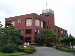
781:
482:
478:
1333:
1152:
684:
1414:
1377:
876:
1497:
1404:
1387:
1284:
1157:
1084:
1060:
421:
416:
362:
208:
203:
1441:
1431:
1409:
1321:
1311:
1306:
1289:
1262:
1257:
1247:
1205:
1193:
1167:
1147:
1137:
870:
456:
426:
270:
1453:
1436:
1355:
1301:
1252:
1032:
431:
390:
386:
374:
215:
1162:
1487:
1470:
1458:
1421:
1399:
1382:
1360:
1338:
1316:
1274:
1242:
1232:
1227:
1215:
1172:
672:
436:
377:
of 86 persons per km². The total area of the town was 159.93 km (61.75 sq mi).
281:
477:
Tanagura has been recognized by Japan's Office for the
Promotion of Regional Revitalization (
1237:
1210:
1097:
1092:
1069:
777:
773:
196:
1132:
864:
829:
664:
695:
Tanagura has a mixed economy with agriculture and precision manufacturing predominating.
909:
1475:
660:
446:
358:
50:
481:), which promotes the development of new technologies to combat depopulation, for its
385:
Tanagura is located in the southernmost portion of
Fukushima prefecture, bordering on
1551:
1142:
1127:
461:
329:
309:
33 Nakayano, Tanagura, Tanagura-machi, Higashishirakawa-gun, Fukushima-ken 963-6131
979:
489:
infrastructure. Related projects have been awarded over ¥6M in government grants.
961:
1536:
1531:
1102:
949:
768:
680:
486:
1492:
1426:
1372:
668:
401:
370:
162:
149:
1350:
850:
841:
760:
261:
1001:
1014:
319:
895:
17:
833:
824:
291:
266:
366:
328:
184:
1526:
506:
1028:
501:
369:. As of 1 April 2020, the town had an estimated
659:
The area of present-day
Tanagura was part of ancient
1181:
1120:
1083:
313:
305:
297:
287:
277:
260:
252:
244:
239:
231:
226:
214:
202:
190:
178:
32:
348:
342:
38:
1040:
8:
492:
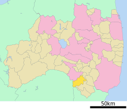
104:Location of Tanagura in Fukushima Prefecture
1047:
1033:
1025:
836:, friendship city since September 23, 1986
663:. The area formed part of the holdings of
491:
29:
1516:List of mergers in Fukushima Prefecture
888:
312:
296:
259:
238:
225:
177:
142:
108:
96:
68:
56:
235:159.93 km (61.75 sq mi)
304:
286:
276:
251:
243:
230:
213:
201:
189:
7:
373:of 13,827 in 5053 households, and a
25:
1111:
1055:
1000:
840:
823:
805:
795:
759:
122:
121:
114:
98:
83:
73:
58:
847:Lake Macquarie, New South Wales
910:Tanagura population statistics
397:Mountains: Yamizosan (1021.8m)
1:
1563:Towns in Fukushima Prefecture
922:"地方創生テレワーク交付金の交付対象事業一覧(新規事業)"
735:Yashirogawa Elementary School
646:Köppen climate classification
896:Tanagura official statistics
675:, it was organized as part
984:Agency for Cultural Affairs
966:Agency for Cultural Affairs
722:Tanagura Junior High School
479:Kishida Cabinet Secretariat
349:
1579:
738:Chikatsu Elementary School
732:Tanagura Elementary School
408:Neighboring municipalities
1513:
1270:Higashishirakawa District
1109:
1067:
744:Yamaoka Elementary School
677:Higashishirakawa District
519:—
343:
143:
109:
97:
69:
57:
48:
39:
873:, National Historic Site
867:, National Historic Site
741:Takabo Elementary School
163:37.029861°N 140.379583°E
36:
1395:Nishishirakawa District
853:, since October 8, 2002
817:International relations
811:National Route 289
801:National Route 118
333:Site of Tanagura Castle
483:digital transformation
334:
256:86/km (220/sq mi)
950:Tanagura climate data
493:Historical population
413:Fukushima Prefecture
332:
168:37.029861; 140.379583
27:Town in Tōhoku, Japan
1061:Fukushima Prefecture
1009:at Wikimedia Commons
712:Tanagura High School
363:Fukushima Prefecture
253: • Density
1558:Tanagura, Fukushima
1368:Minamiaizu District
1007:Tanagura, Fukushima
871:Nagare temple ruins
494:
453:Tochigi Prefecture
443:Ibaraki Prefecture
271:Japan Standard Time
159: /
727:Elementary schools
717:Junior High school
391:Ibaraki Prefecture
387:Tochigi Prefecture
375:population density
335:
245: • Total
232: • Total
64:Tanagura Town Hall
1545:
1544:
1346:Kawanuma District
1297:Ishikawa District
1005:Media related to
931:. August 10, 2021
877:Tsutsuwake Shrine
858:Local attractions
673:Meiji Restoration
633:
632:
327:
326:
298:Phone number
282:Japanese Red Pine
16:(Redirected from
1570:
1523:
1115:
1078:
1059:
1049:
1042:
1035:
1026:
1021:
1018:
1017:
1015:Official website
1004:
988:
987:
976:
970:
969:
958:
952:
947:
941:
940:
938:
936:
926:
918:
912:
907:
901:
900:
893:
845:
844:
828:
827:
809:
808:
799:
798:
763:
508:
503:
495:
389:to the west and
356:
355:
352:
346:
345:
323:
322:
320:Official website
221:Higashishirakawa
174:
173:
171:
170:
169:
164:
160:
157:
156:
155:
152:
125:
124:
118:
102:
87:
77:
62:
43:
42:
41:
30:
21:
1578:
1577:
1573:
1572:
1571:
1569:
1568:
1567:
1548:
1547:
1546:
1541:
1521:
1518:
1509:
1466:Tamura District
1223:Futaba District
1189:Adachi District
1177:
1116:
1107:
1079:
1072:
1063:
1053:
1019:
1013:
1012:
997:
992:
991:
982:(in Japanese).
978:
977:
973:
964:(in Japanese).
960:
959:
955:
948:
944:
934:
932:
924:
920:
919:
915:
908:
904:
898:
894:
890:
885:
865:Tanagura Castle
860:
839:
822:
819:
806:
796:
792:
756:
751:
729:
719:
709:
701:
693:
665:Tanagura Domain
657:
640:Tanagura has a
638:
472:
410:
393:to the south.
383:
353:
340:
318:
317:
167:
165:
161:
158:
153:
150:
148:
146:
145:
139:
138:
137:
136:
133:
132:
131:
130:
126:
105:
93:
92:
91:
90:
81:
80:
65:
53:
44:
37:
35:
28:
23:
22:
15:
12:
11:
5:
1576:
1574:
1566:
1565:
1560:
1550:
1549:
1543:
1542:
1540:
1539:
1534:
1529:
1524:
1514:
1511:
1510:
1508:
1507:
1506:
1505:
1500:
1495:
1490:
1480:
1479:
1478:
1473:
1463:
1462:
1461:
1456:
1446:
1445:
1444:
1439:
1434:
1429:
1422:Ōnuma District
1419:
1418:
1417:
1412:
1407:
1402:
1392:
1391:
1390:
1385:
1380:
1375:
1365:
1364:
1363:
1358:
1353:
1343:
1342:
1341:
1336:
1329:Iwase District
1326:
1325:
1324:
1319:
1314:
1309:
1304:
1294:
1293:
1292:
1287:
1282:
1277:
1267:
1266:
1265:
1260:
1255:
1250:
1245:
1240:
1235:
1230:
1220:
1219:
1218:
1213:
1208:
1198:
1197:
1196:
1185:
1183:
1179:
1178:
1176:
1175:
1170:
1165:
1160:
1155:
1150:
1145:
1140:
1135:
1130:
1124:
1122:
1118:
1117:
1110:
1108:
1106:
1105:
1100:
1095:
1089:
1087:
1081:
1080:
1068:
1065:
1064:
1054:
1052:
1051:
1044:
1037:
1029:
1023:
1022:
1010:
996:
995:External links
993:
990:
989:
971:
953:
942:
913:
902:
887:
886:
884:
881:
880:
879:
874:
868:
859:
856:
855:
854:
837:
818:
815:
814:
813:
803:
791:
788:
787:
786:
785:
784:
782:Iwaki-Tanakura
755:
752:
750:
749:Transportation
747:
746:
745:
742:
739:
736:
733:
728:
725:
724:
723:
718:
715:
714:
713:
708:
705:
700:
697:
692:
689:
685:Iwaki Province
661:Mutsu Province
656:
653:
637:
634:
631:
630:
627:
624:
620:
619:
616:
613:
609:
608:
605:
602:
598:
597:
594:
591:
587:
586:
583:
580:
576:
575:
572:
569:
565:
564:
561:
558:
554:
553:
550:
547:
543:
542:
539:
536:
532:
531:
528:
525:
521:
520:
517:
514:
510:
509:
504:
499:
471:
468:
467:
466:
465:
464:
459:
451:
450:
449:
441:
440:
439:
434:
429:
424:
419:
409:
406:
405:
404:
398:
382:
379:
350:Tanagura-machi
325:
324:
315:
311:
310:
307:
303:
302:
299:
295:
294:
289:
285:
284:
279:
275:
274:
264:
258:
257:
254:
250:
249:
246:
242:
241:
237:
236:
233:
229:
228:
224:
223:
218:
212:
211:
206:
200:
199:
194:
188:
187:
182:
176:
175:
141:
140:
134:
128:
127:
120:
119:
113:
112:
111:
110:
107:
106:
103:
95:
94:
88:
82:
78:
72:
71:
70:
67:
66:
63:
55:
54:
49:
46:
45:
33:
26:
24:
14:
13:
10:
9:
6:
4:
3:
2:
1575:
1564:
1561:
1559:
1556:
1555:
1553:
1538:
1535:
1533:
1530:
1528:
1525:
1520:
1519:
1517:
1512:
1504:
1501:
1499:
1496:
1494:
1491:
1489:
1486:
1485:
1484:
1483:Yama District
1481:
1477:
1474:
1472:
1469:
1468:
1467:
1464:
1460:
1457:
1455:
1452:
1451:
1450:
1449:Sōma District
1447:
1443:
1440:
1438:
1435:
1433:
1430:
1428:
1425:
1424:
1423:
1420:
1416:
1413:
1411:
1408:
1406:
1403:
1401:
1398:
1397:
1396:
1393:
1389:
1386:
1384:
1381:
1379:
1376:
1374:
1371:
1370:
1369:
1366:
1362:
1359:
1357:
1354:
1352:
1349:
1348:
1347:
1344:
1340:
1337:
1335:
1332:
1331:
1330:
1327:
1323:
1320:
1318:
1315:
1313:
1310:
1308:
1305:
1303:
1300:
1299:
1298:
1295:
1291:
1288:
1286:
1283:
1281:
1278:
1276:
1273:
1272:
1271:
1268:
1264:
1261:
1259:
1256:
1254:
1251:
1249:
1246:
1244:
1241:
1239:
1236:
1234:
1231:
1229:
1226:
1225:
1224:
1221:
1217:
1214:
1212:
1209:
1207:
1204:
1203:
1202:
1201:Date District
1199:
1195:
1192:
1191:
1190:
1187:
1186:
1184:
1180:
1174:
1171:
1169:
1166:
1164:
1161:
1159:
1156:
1154:
1151:
1149:
1146:
1144:
1141:
1139:
1136:
1134:
1131:
1129:
1128:Aizuwakamatsu
1126:
1125:
1123:
1119:
1114:
1104:
1101:
1099:
1096:
1094:
1091:
1090:
1088:
1086:
1082:
1076:
1071:
1066:
1062:
1058:
1050:
1045:
1043:
1038:
1036:
1031:
1030:
1027:
1020:(in Japanese)
1016:
1011:
1008:
1003:
999:
998:
994:
985:
981:
975:
972:
967:
963:
957:
954:
951:
946:
943:
935:September 17,
930:
923:
917:
914:
911:
906:
903:
899:(in Japanese)
897:
892:
889:
882:
878:
875:
872:
869:
866:
862:
861:
857:
852:
848:
843:
838:
835:
831:
826:
821:
820:
816:
812:
804:
802:
794:
793:
789:
783:
779:
775:
772:
771:
770:
766:
762:
758:
757:
753:
748:
743:
740:
737:
734:
731:
730:
726:
721:
720:
716:
711:
710:
706:
704:
698:
696:
690:
688:
686:
682:
678:
674:
670:
666:
662:
654:
652:
650:
647:
643:
642:humid climate
635:
628:
625:
622:
621:
617:
614:
611:
610:
606:
603:
600:
599:
595:
592:
589:
588:
584:
581:
578:
577:
573:
570:
567:
566:
562:
559:
556:
555:
551:
548:
545:
544:
540:
537:
534:
533:
529:
526:
523:
522:
518:
515:
512:
511:
505:
500:
497:
496:
490:
488:
484:
480:
475:
469:
463:
460:
458:
455:
454:
452:
448:
445:
444:
442:
438:
435:
433:
430:
428:
425:
423:
420:
418:
415:
414:
412:
411:
407:
403:
399:
396:
395:
394:
392:
388:
380:
378:
376:
372:
368:
364:
360:
351:
339:
331:
321:
316:
308:
300:
293:
290:
283:
280:
272:
268:
265:
263:
255:
247:
234:
222:
219:
217:
210:
207:
205:
198:
195:
193:
186:
183:
181:
172:
154:140°22′46.5″E
144:Coordinates:
117:
101:
86:
76:
61:
52:
47:
31:
19:
1503:Kitashiobara
1279:
974:
956:
945:
933:. Retrieved
928:
916:
905:
891:
707:High schools
702:
694:
671:. After the
658:
648:
639:
476:
473:
470:Demographics
384:
337:
336:
301:0247-33-3111
151:37°01′47.5″N
1085:Core cities
769:Suigun Line
679:within the
361:located in
166: /
1552:Categories
1493:Inawashiro
1427:Aizumisato
1373:Minamiaizu
1334:Kagamiishi
1153:Nihonmatsu
1143:Minamisōma
929:内閣府地方創生推進室
883:References
683:region of
669:Edo period
402:Kuji River
371:population
240:Population
204:Prefecture
1498:Nishiaizu
1405:Izumizaki
1388:Hinoemata
1351:Aizubange
1285:Yamatsuri
1182:Districts
1158:Shirakawa
1093:Fukushima
1070:Fukushima
851:Australia
699:Education
667:, in the
422:Yamatsuri
417:Shirakawa
381:Geography
262:Time zone
209:Fukushima
1537:Nakadōri
1532:Hamadōri
1432:Kaneyama
1410:Nakajima
1322:Tamakawa
1312:Ishikawa
1307:Furudono
1290:Samegawa
1280:Tanagura
1263:Kawauchi
1258:Katsurao
1206:Kawamata
1168:Sukagawa
1148:Motomiya
1138:Kitakata
1103:Kōriyama
863:Site of
778:Nakatoyo
774:Chikatsu
681:Nakadōri
487:telework
427:Samegawa
400:Rivers:
338:Tanagura
288:- Flower
216:District
129:Tanagura
34:Tanagura
18:Tanagura
1522:Regions
1454:Shinchi
1437:Mishima
1415:Nishigō
1378:Shimogō
1356:Yanaizu
1302:Asakawa
1253:Tomioka
1075:capital
790:Highway
765:JR East
754:Railway
691:Economy
655:History
636:Climate
457:Ōtawara
432:Asakawa
314:Website
306:Address
180:Country
1488:Bandai
1471:Miharu
1459:Iitate
1400:Yabuki
1383:Tadami
1361:Yugawa
1339:Ten-ei
1317:Hirata
1275:Hanawa
1243:Naraha
1233:Hirono
1228:Futaba
1216:Kunimi
1173:Tamura
1121:Cities
980:"流廃寺跡"
962:"棚倉城跡"
834:Greece
830:Sparta
629:−11.4%
626:13,343
615:15,054
604:16,376
593:16,606
582:16,105
574:−11.4%
571:16,621
560:18,755
552:+33.9%
549:19,865
538:14,835
530:+12.9%
527:14,150
516:12,536
437:Hanawa
292:Azalea
278:- Tree
248:13,827
197:Tōhoku
192:Region
135:
1442:Shōwa
1248:Ōkuma
1238:Namie
1211:Koori
1194:Ōtama
1098:Iwaki
925:(PDF)
623:2020
618:−8.1%
612:2010
607:−1.4%
601:2000
596:+3.1%
590:1990
585:−3.1%
579:1980
568:1970
563:−5.6%
557:1960
546:1950
541:+4.8%
535:1940
524:1930
513:1920
447:Daigo
367:Japan
357:is a
267:UTC+9
185:Japan
1527:Aizu
1163:Sōma
1133:Date
937:2022
502:Pop.
498:Year
462:Nasu
359:town
227:Area
89:Seal
79:Flag
51:Town
1476:Ono
649:Cfa
344:棚倉町
40:棚倉町
1554::
927:.
849:,
832:,
780:-
776:-
767:–
507:±%
365:,
347:,
1077:)
1073:(
1048:e
1041:t
1034:v
986:.
968:.
939:.
644:(
485:/
354:)
341:(
273:)
269:(
20:)
Text is available under the Creative Commons Attribution-ShareAlike License. Additional terms may apply.