57:
961:
41:
625:
108:
276:
The name
Tancanhuitz was already in use by the time of the 1826 constitution of San Luis Potosí, which named Tancanhuitz as one of ten sections of the state. In 1932, the state government established the location as a city with the name
504:
7. En lo sucesivo se dividirá el Estado en los partidos siguientes: á saber, en los de
Catorce, Guadalcazar, San Luis, Santa Maria del Rio, Ojo-caliente, Rioverde, Tancanhuitz, Valle del Maiz, Venado, y Villa de
394:
517:
357:,* and the land is used primarily for raising livestock, forestry, and agriculture. The municipality belongs to the Panuco hydrologic region. Its water resources are supplied by the
314:
Tancanhuitz is located in the southeastern part of the state, at 21° 36’ northern latitude, and 98° 58’ western longitude. It is at an average height of 200 meters above sea level.
353:
The territory covered by the municipality is mostly rugged, although there is a small flat region to the north of the municipal capital. *The geology of the region is classified as
40:
469:
980:
830:
591:
569:
338:
613:
56:
70:
543:
521:
432:
915:
250:
386:
935:
648:
234:
940:
825:
120:
745:
141:
835:
890:
730:
606:
221:
200:
800:
330:
685:
845:
760:
780:
415:
950:
815:
790:
700:
785:
740:
710:
599:
573:
465:
900:
695:
735:
249:. It is located in the southeastern part of the state, approximately 330 km (210 mi) from the city of
675:
238:
30:
820:
885:
840:
810:
639:
301:
As of the 2005 census, it had a total population of 20,495, of which 10,180 were men and 10,315 were women.
369:
Rivers. There are also some seasonal creeks there, such as the
Tancanhuitz, as well as several springs.
960:
547:
436:
865:
775:
210:
720:
358:
805:
795:
705:
715:
630:
624:
242:
125:
366:
680:
409:
910:
362:
920:
905:
262:
930:
925:
46:
974:
750:
725:
334:
855:
755:
491:
880:
670:
342:
326:
322:
318:
468:(in Spanish). INAFED Instituto para el Federalismo y el Desarrollo Municipal.
85:
72:
765:
665:
660:
191:
870:
289:
in 1981. Another change in 2003 established the current official name as
860:
850:
354:
945:
895:
770:
690:
246:
113:
217:
196:
492:"Constitucion Política del Estado Libre de S. Luis Potosí (1826)"
395:
Instituto
Nacional para el Federalismo y el Desarrollo Municipal
595:
397:. 2002. Archived from the original on September 19, 2004
49:
317:
The municipality is bordered by the municipalities of
253:. The municipality covers an area of 134.05 km².
647:
207:
190:
182:
174:
169:
161:
153:
148:
136:
131:
119:
101:
21:
518:"Principales resultados por localidad 2005 (ITER)"
16:Municipality and Town in San Luis Potosí, Mexico
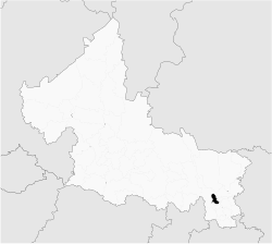
61:Location of the municipality in San Luis Potosí
607:
427:
425:
8:
614:
600:
592:
18:
435:(in Spanish). Pacificosur. Archived from
460:
458:
456:
454:
391:Enciclopedia de los Municipios de México
378:
189:
168:
160:
147:
130:
100:
65:
53:
37:
407:
281:. The name was officially changed to
157:134.05 km (51.76 sq mi)
206:
181:
173:
152:
135:
118:
7:
261:The name Tancanhuitz comes from the
572:(in Spanish). INEGI. Archived from
546:(in Spanish). INEGI. Archived from
520:(in Spanish). INEGI. Archived from
14:
981:Municipalities of San Luis Potosí
959:
623:
137: • Municipal President
106:
55:
39:
570:"Mapa de Regiones Hidrológicas"
472:from the original on 2018-05-01
1:
233:is a town and one of the 58
186:152.89/km (396.0/sq mi)
846:Soledad de Graciano Sánchez
387:"Estado De San Luis Potosí"
997:
957:
816:San Martín Chalchicuautla
637:
544:"Elevaciones Principales"
414:: CS1 maint: unfit URL (
349:Orography and Hydrography
66:
54:
38:
28:
676:Armadillo de los Infante
165:200 m (656 ft)
841:San Vicente Tancuayalab
466:"Tancanhuitz de Santos"
271:Canoe of yellow flowers
876:Tancanhuitz de Santos
821:San Nicolás Tolentino
287:Tancanhuitz de Santos
222:Central Daylight Time
209: • Summer (
201:Central Standard Time
140:Rafael Cruz Mendoza (
886:Tanquián de Escobedo
776:Mexquitic de Carmona
550:on February 21, 2009
439:on February 21, 2009
433:"División Municipal"
279:Pedro Antonio Santos
183: • Density
831:Santa María del Río
576:on February 7, 2009
82: /
916:Villa de Guadalupe
806:San Ciro de Acosta
796:Salinas de Hidalgo
706:Cerro de San Pedro
494:(in Spanish). 1826
341:to the south, and
175: • Total
154: • Total
968:
967:
866:Tampamolón Corona
681:Axtla de Terrazas
285:in 1975, then to
228:
227:
86:21.600°N 98.967°W
988:
963:
936:Villa de Hidalgo
911:Villa de Arriaga
721:Ciudad Fernández
628:
627:
616:
609:
602:
593:
586:
585:
583:
581:
566:
560:
559:
557:
555:
540:
534:
533:
531:
529:
524:on June 13, 2011
514:
508:
507:
501:
499:
488:
482:
481:
479:
477:
462:
449:
448:
446:
444:
429:
420:
419:
413:
405:
403:
402:
383:
267:Place of Flowers
214:
112:
110:
109:
97:
96:
94:
93:
92:
87:
83:
80:
79:
78:
75:
59:
43:
19:
996:
995:
991:
990:
989:
987:
986:
985:
971:
970:
969:
964:
955:
921:Villa de La Paz
906:Villa de Arista
811:San Luis Potosí
716:Ciudad del Maíz
653:municipal seats
652:
650:
643:
640:San Luis Potosí
633:
631:San Luis Potosí
622:
620:
590:
589:
579:
577:
568:
567:
563:
553:
551:
542:
541:
537:
527:
525:
516:
515:
511:
497:
495:
490:
489:
485:
475:
473:
464:
463:
452:
442:
440:
431:
430:
423:
406:
400:
398:
385:
384:
380:
375:
351:
312:
307:
299:
263:Wastek language
259:
251:San Luis Potosí
243:San Luis Potosí
208:
126:San Luis Potosí
107:
105:
91:21.600; -98.967
90:
88:
84:
81:
76:
73:
71:
69:
68:
62:
50:
34:
24:
17:
12:
11:
5:
994:
992:
984:
983:
973:
972:
966:
965:
958:
956:
954:
953:
948:
943:
938:
933:
931:Villa de Reyes
928:
926:Villa de Ramos
923:
918:
913:
908:
903:
898:
893:
888:
883:
878:
873:
868:
863:
858:
853:
848:
843:
838:
833:
828:
826:Santa Catarina
823:
818:
813:
808:
803:
798:
793:
788:
783:
778:
773:
768:
763:
758:
753:
748:
743:
738:
733:
728:
723:
718:
713:
708:
703:
698:
693:
688:
683:
678:
673:
668:
663:
657:
655:
649:Municipalities
645:
644:
638:
635:
634:
621:
619:
618:
611:
604:
596:
588:
587:
561:
535:
509:
483:
450:
421:
393:(in Spanish).
377:
376:
374:
371:
350:
347:
325:to the north,
311:
308:
306:
303:
298:
295:
258:
255:
235:municipalities
226:
225:
215:
205:
204:
194:
188:
187:
184:
180:
179:
176:
172:
171:
167:
166:
163:
159:
158:
155:
151:
150:
146:
145:
138:
134:
133:
129:
128:
123:
117:
116:
103:
99:
98:
64:
63:
60:
52:
51:
44:
36:
35:
29:
26:
25:
22:
15:
13:
10:
9:
6:
4:
3:
2:
993:
982:
979:
978:
976:
962:
952:
949:
947:
944:
942:
939:
937:
934:
932:
929:
927:
924:
922:
919:
917:
914:
912:
909:
907:
904:
902:
899:
897:
894:
892:
889:
887:
884:
882:
879:
877:
874:
872:
869:
867:
864:
862:
859:
857:
854:
852:
849:
847:
844:
842:
839:
837:
836:Santo Domingo
834:
832:
829:
827:
824:
822:
819:
817:
814:
812:
809:
807:
804:
802:
799:
797:
794:
792:
789:
787:
784:
782:
779:
777:
774:
772:
769:
767:
764:
762:
759:
757:
754:
752:
749:
747:
744:
742:
739:
737:
734:
732:
729:
727:
726:Ciudad Valles
724:
722:
719:
717:
714:
712:
709:
707:
704:
702:
699:
697:
694:
692:
689:
687:
684:
682:
679:
677:
674:
672:
669:
667:
664:
662:
659:
658:
656:
654:
646:
641:
636:
632:
626:
617:
612:
610:
605:
603:
598:
597:
594:
575:
571:
565:
562:
549:
545:
539:
536:
523:
519:
513:
510:
506:
493:
487:
484:
471:
467:
461:
459:
457:
455:
451:
438:
434:
428:
426:
422:
417:
411:
396:
392:
388:
382:
379:
372:
370:
368:
364:
360:
356:
348:
346:
345:to the west.
344:
340:
336:
333:to the east,
332:
328:
324:
320:
315:
309:
304:
302:
296:
294:
292:
288:
284:
283:Ciudad Santos
280:
274:
272:
268:
264:
256:
254:
252:
248:
244:
240:
236:
232:
223:
219:
216:
212:
202:
198:
195:
193:
185:
177:
164:
156:
143:
139:
127:
124:
122:
115:
104:
95:
67:Coordinates:
58:
48:
42:
32:
27:
20:
941:Villa Juárez
891:Tierra Nueva
875:
856:Tamazunchale
756:Huichihuayan
580:November 29,
578:. Retrieved
574:the original
564:
554:November 29,
552:. Retrieved
548:the original
538:
528:November 29,
526:. Retrieved
522:the original
512:
503:
496:. Retrieved
486:
474:. Retrieved
443:November 29,
441:. Retrieved
437:the original
399:. Retrieved
390:
381:
352:
316:
313:
300:
290:
286:
282:
278:
275:
270:
266:
265:, and means
260:
230:
229:
45:Traditional
31:Municipality
801:San Antonio
746:Guadalcazar
498:November 6,
476:November 6,
331:San Antonio
291:Tancanhuitz
245:in central
231:Tancanhuitz
89: /
23:Tancanhuitz
761:Lagunillas
751:Huehuetlán
741:El Naranjo
401:2023-04-17
373:References
335:Huehuetlán
297:Demography
170:Population
132:Government
781:Moctezuma
766:Matehuala
731:Coxcatlán
666:Alaquines
661:Ahualulco
642:(capital)
629:State of
339:Coxcatlán
305:Geography
192:Time zone
162:Elevation
975:Category
951:Zaragoza
881:Tanlajás
861:Tampacan
851:Tamasopo
791:Rioverde
701:Cerritos
686:Cárdenas
671:Aquismón
470:Archived
410:cite web
355:Mesozoic
343:Aquismón
327:Tanlajás
323:Tanlajás
319:Aquismón
310:Location
33:and Town
946:Xilitla
896:Vanegas
771:Matlapa
711:Charcas
691:Catorce
505:Valles.
363:Tampaón
359:Oxitipa
237:of the
102:Country
77:98°58′W
74:21°36′N
47:Huastec
901:Venado
871:Tamuín
696:Cedral
365:, and
247:Mexico
178:25,055
114:Mexico
111:
786:Rayón
736:Ebano
239:state
218:UTC-5
197:UTC-6
121:State
582:2008
556:2008
530:2008
500:2018
478:2018
445:2008
416:link
337:and
329:and
321:and
257:Name
149:Area
651:and
367:Coy
269:or
241:of
211:DST
142:PRI
977::
502:.
453:^
424:^
412:}}
408:{{
389:.
361:,
293:.
273:.
615:e
608:t
601:v
584:.
558:.
532:.
480:.
447:.
418:)
404:.
224:)
220:(
213:)
203:)
199:(
144:)
Text is available under the Creative Commons Attribution-ShareAlike License. Additional terms may apply.