458:
35:
59:
301:
202:
249:
573:
433:. Extending 8 by 6 kilometres (5.0 mi × 3.7 mi), the island covers an area of 12.1 square kilometres (4.7 sq mi). Relatively low-lying, 16 metres (52 ft) at its highest point, the island has a number of short streams and lagoon lakes. Along the coast, with its capes and bays, there are grassy meadows. Tanfiliev lies within the "
66:
562:
of salmon, trout, crabs, and shrimp. At the end of the war, the population stood at 986, in 154 households, along with 325 horses. Currently, the
Habomai Islands as a whole are uninhabited, other than the stationing of Russian guards.
457:
1498:
584:
589:
649:"The beetles of the families Helophoridae, Georissidae, Hydrophilidae, Hydraenidae, and Elmidae (Insecta: Coleoptera) of Kunashir Island and the Lesser Kurils"
34:
964:
837:
529:
1004:
58:
788:
1508:
860:
918:
126:
1471:
807:
1466:
1486:
997:
794:
1424:
577:
274:
216:
1570:
1549:
1529:
386:
363:
233:
1409:
343:
1481:
990:
865:
617:
446:
414:
1503:
933:
394:
44:
518:
1087:
959:
695:
425:
The southernmost island in the Lesser
Kuriles, Tanfiliev lies some 7.8 kilometres (4.8 mi) from
406:
279:
262:
40:
442:
317:
25:
1476:
1388:
1243:
1233:
783:
670:
545:
526:
500:
495:
434:
378:
165:
1491:
1358:
1348:
1027:
803:
549:
533:
354:
95:
1353:
688:
1383:
900:
723:
660:
541:
514:
430:
334:
313:
305:
87:
322:
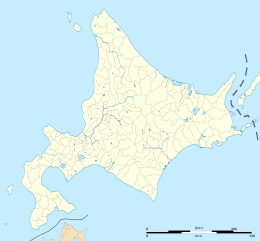
1534:
1303:
1283:
1258:
1213:
1112:
1082:
1062:
1052:
1037:
390:
374:
221:
161:
830:
300:
1539:
1450:
1445:
1168:
1097:
1032:
799:
889:"A Newly Compiled Checklist of the Vascular Plants of the Habomais, the Little Kurils"
887:
Gage, S.; Joneson, S.L.; Barkalov, V.Yu.; Eremenko, N.A.; Takahashi, H. (March 2006).
1564:
1544:
1419:
1404:
1333:
1273:
1188:
1013:
888:
674:
648:
490:
169:
114:
1288:
1248:
426:
309:
1524:
1414:
1298:
1278:
1268:
1198:
1193:
1127:
1077:
1047:
537:
522:
665:
1368:
1313:
1253:
1183:
1173:
1107:
1092:
609:
141:
128:
1308:
1293:
1228:
718:
572:
1378:
1338:
1238:
1178:
1147:
1142:
1132:
1102:
1042:
509:
438:
410:
402:
267:
748:
1440:
1373:
1343:
1328:
1323:
1318:
1208:
1137:
1122:
1117:
559:
904:
647:
Ryndevich, S.K.; Prokin, A.A.; Makarov, K.V.; Sundukov, Yu.N. (2021).
409:. The island and its surrounding waters form part of the Malye Kurily
1363:
1223:
1203:
1067:
1057:
382:
207:
1263:
1218:
1072:
554:
456:
398:
299:
254:
228:
1152:
982:
986:
558:(kelp) was the most important product, and there was also
445:, the island's flora and fauna protected as part of the
544:; they were joined by migrant workers from the area of
368:
1499:
Japanese evacuation of
Karafuto and the Kuril Islands
348:
1517:
1459:
1433:
1397:
1161:
1020:
585:
List of protected areas of Russia (Sakhalin Oblast)
290:
285:
273:
261:
239:
227:
215:
191:
183:
175:
157:
120:
110:
105:
83:
24:
525:the island formed part of the village of Goyōmai
489:The Japanese name for the island, Suishō, is of
471:(third column from the left) listed under Nemoro
521:and written about in his diaries, in the early
540:, most of the population were involved in the
474:
464:
998:
8:
798:] (in Japanese). Vol. 1: Hokkaido.
19:
954:
952:
835:[Overview of the Habomai Islands].
778:
776:
774:
772:
1005:
991:
983:
893:Bulletin of the Hokkaido University Museum
642:
640:
638:
636:
18:
960:"An Overview of the Northern Territories"
825:
823:
821:
819:
664:
590:Soviet–Japanese Joint Declaration of 1956
861:"Lesser Kuril Ridge and Kunashir Island"
601:
308:map showing "Suishō-Tō" separated from
965:Northern Territories Issue Association
838:Northern Territories Issue Association
743:
741:
610:"Outline of the Northern Territories"
513:, Suishō is listed as a settlement of
7:
653:Journal of Asia-Pacific Biodiversity
443:Important Bird and Biodiversity Area
1509:Seaboard World Airlines Flight 253A
693:[Overview of Nemuro: Map].
415:Lesser Kurils State Nature Preserve
373:) is an uninhabited island in the
179:12.1 km (4.7 sq mi)
14:
1472:Treaty of Saint Petersburg (1875)
65:
571:
247:
200:
64:
57:
33:
47:) satellite image of Tanfiliev
1:
1487:Invasion of the Kuril Islands
16:Disputed island in the Kurils
381:. It is administered by the
1398:Other geographical features
795:Nihon Rekishi Chimei Taikei
369:
349:
316:by the "Goyōmai-kaikyō" or
1587:
1467:Menashi–Kunashir rebellion
753:[Lesser Kurils].
666:10.1016/j.japb.2021.06.007
429:at the eastern end of the
1550:Maarten Gerritszoon Vries
508:Village Registers of the
475:
465:
358:
338:
244:
196:
99:
91:
52:
32:
1530:William Robert Broughton
919:
831:
787:
754:
749:
689:
611:
387:Yuzhno-Kurilsky District
142:43.436784°N 145.916760°E
1410:Ilya Muromets Waterfall
1425:Kuril–Kamchatka Trench
866:Birdlife International
618:Cabinet Office (Japan)
486:
447:Lesser Kurils Zakaznik
327:
187:16 m (52 ft)
184:Highest elevation
1504:Kuril Islands dispute
934:National Diet Library
580:at Wikimedia Commons
460:
303:
147:43.436784; 145.916760
696:Nemuro Subprefecture
493:origin. In the 1834
407:Nemuro Subprefecture
937:(in Japanese). 1834
138: /
21:
1477:Russo-Japanese War
1389:Zavaritski Caldera
1244:Goryashchaya Sopka
1234:Golets-Torny Group
546:Niigata Prefecture
519:Matsuura Takeshirō
487:
435:Lesser Kuril Ridge
383:Russian Federation
379:Lesser Kuril Chain
328:
166:Lesser Kuril Chain
1558:
1557:
1492:Battle of Shumshu
1359:Tao-Rusyr Caldera
1028:Antsiferov Island
576:Media related to
550:Toyama Prefecture
367:
347:
298:
297:
1578:
1571:Southern Kuriles
1482:Hawaii Operation
1434:Cities and towns
1384:Vernadskii Ridge
1007:
1000:
993:
984:
977:
976:
974:
972:
956:
947:
946:
944:
942:
915:
909:
908:
884:
878:
877:
875:
873:
857:
851:
850:
848:
846:
827:
814:
813:
802:. p. 1544.
780:
767:
766:
764:
762:
745:
736:
735:
733:
731:
724:Protected Planet
715:
709:
708:
706:
704:
685:
679:
678:
668:
644:
631:
630:
628:
626:
606:
578:Tanfiliev Island
575:
542:fishing industry
504:
480:
478:
477:
470:
468:
467:
431:Nemuro Peninsula
372:
362:
360:
352:
342:
340:
326:
314:Nemuro Peninsula
253:
251:
250:
206:
204:
203:
153:
152:
150:
149:
148:
143:
139:
136:
135:
134:
131:
101:
93:
68:
67:
61:
37:
22:
1586:
1585:
1581:
1580:
1579:
1577:
1576:
1575:
1561:
1560:
1559:
1554:
1535:Vasily Golovnin
1513:
1455:
1429:
1393:
1304:Milna (volcano)
1284:Lomonosov Group
1259:Karpinsky Group
1157:
1113:Polonsky Island
1088:Lowuschki Rocks
1083:Kunashir Island
1063:Habomai Islands
1053:Chyornye Bratya
1016:
1011:
981:
980:
970:
968:
958:
957:
950:
940:
938:
921:
917:
916:
912:
886:
885:
881:
871:
869:
859:
858:
854:
844:
842:
833:
829:
828:
817:
810:
791:
786:, ed. (2003).
782:
781:
770:
760:
758:
756:
751:
747:
746:
739:
729:
727:
717:
716:
712:
702:
700:
691:
687:
686:
682:
646:
645:
634:
624:
622:
613:
608:
607:
603:
598:
569:
498:
472:
462:
455:
439:Kunashir Island
423:
391:Sakhalin Oblast
375:Habomai Islands
320:
257:
248:
246:
234:Yuzhno-Kurilsky
222:Sakhalin Oblast
217:Federal subject
211:
201:
199:
162:Habomai Islands
146:
144:
140:
137:
132:
129:
127:
125:
124:
94:
79:
78:
77:
76:
75:
74:
73:
69:
48:
28:
26:Disputed island
17:
12:
11:
5:
1584:
1582:
1574:
1573:
1563:
1562:
1556:
1555:
1553:
1552:
1547:
1542:
1540:Takadaya Kahei
1537:
1532:
1527:
1521:
1519:
1515:
1514:
1512:
1511:
1506:
1501:
1496:
1495:
1494:
1484:
1479:
1474:
1469:
1463:
1461:
1457:
1456:
1454:
1453:
1451:Yuzhno-Kurilsk
1448:
1446:Severo-Kurilsk
1443:
1437:
1435:
1431:
1430:
1428:
1427:
1422:
1417:
1412:
1407:
1401:
1399:
1395:
1394:
1392:
1391:
1386:
1381:
1376:
1371:
1366:
1361:
1356:
1351:
1346:
1341:
1336:
1331:
1326:
1321:
1316:
1311:
1306:
1301:
1296:
1291:
1286:
1281:
1276:
1271:
1266:
1261:
1256:
1251:
1246:
1241:
1236:
1231:
1226:
1221:
1216:
1211:
1206:
1201:
1196:
1191:
1186:
1181:
1176:
1171:
1165:
1163:
1159:
1158:
1156:
1155:
1150:
1145:
1140:
1135:
1130:
1125:
1120:
1115:
1110:
1105:
1100:
1095:
1090:
1085:
1080:
1075:
1070:
1065:
1060:
1055:
1050:
1045:
1040:
1035:
1033:Atlasov Island
1030:
1024:
1022:
1018:
1017:
1012:
1010:
1009:
1002:
995:
987:
979:
978:
948:
929:Matsumae gōchō
910:
879:
852:
815:
808:
768:
737:
719:"Malye Kurily"
710:
680:
659:(4): 461–491.
632:
600:
599:
597:
594:
593:
592:
587:
568:
565:
454:
451:
422:
419:
377:, part of the
296:
295:
292:
288:
287:
283:
282:
277:
271:
270:
265:
259:
258:
245:
242:
241:
237:
236:
231:
225:
224:
219:
213:
212:
197:
194:
193:
192:Administration
189:
188:
185:
181:
180:
177:
173:
172:
159:
155:
154:
122:
118:
117:
112:
108:
107:
103:
102:
85:
81:
80:
71:
70:
63:
62:
56:
55:
54:
53:
50:
49:
38:
30:
29:
15:
13:
10:
9:
6:
4:
3:
2:
1583:
1572:
1569:
1568:
1566:
1551:
1548:
1546:
1545:Matsumae clan
1543:
1541:
1538:
1536:
1533:
1531:
1528:
1526:
1523:
1522:
1520:
1516:
1510:
1507:
1505:
1502:
1500:
1497:
1493:
1490:
1489:
1488:
1485:
1483:
1480:
1478:
1475:
1473:
1470:
1468:
1465:
1464:
1462:
1458:
1452:
1449:
1447:
1444:
1442:
1439:
1438:
1436:
1432:
1426:
1423:
1421:
1420:Cape Koritsky
1418:
1416:
1413:
1411:
1408:
1406:
1405:Bussol Strait
1403:
1402:
1400:
1396:
1390:
1387:
1385:
1382:
1380:
1377:
1375:
1372:
1370:
1367:
1365:
1362:
1360:
1357:
1355:
1352:
1350:
1347:
1345:
1342:
1340:
1337:
1335:
1334:Sarychev Peak
1332:
1330:
1327:
1325:
1322:
1320:
1317:
1315:
1312:
1310:
1307:
1305:
1302:
1300:
1297:
1295:
1292:
1290:
1287:
1285:
1282:
1280:
1277:
1275:
1274:Kolokol Group
1272:
1270:
1267:
1265:
1262:
1260:
1257:
1255:
1252:
1250:
1247:
1245:
1242:
1240:
1237:
1235:
1232:
1230:
1227:
1225:
1222:
1220:
1217:
1215:
1212:
1210:
1207:
1205:
1202:
1200:
1197:
1195:
1192:
1190:
1189:Bogatyr Ridge
1187:
1185:
1182:
1180:
1177:
1175:
1172:
1170:
1167:
1166:
1164:
1160:
1154:
1151:
1149:
1146:
1144:
1141:
1139:
1136:
1134:
1131:
1129:
1126:
1124:
1121:
1119:
1116:
1114:
1111:
1109:
1106:
1104:
1101:
1099:
1096:
1094:
1091:
1089:
1086:
1084:
1081:
1079:
1076:
1074:
1071:
1069:
1066:
1064:
1061:
1059:
1056:
1054:
1051:
1049:
1046:
1044:
1041:
1039:
1036:
1034:
1031:
1029:
1026:
1025:
1023:
1019:
1015:
1014:Kuril Islands
1008:
1003:
1001:
996:
994:
989:
988:
985:
967:
966:
961:
955:
953:
949:
936:
935:
930:
926:
922:
920:天保郷帳>松前島郷帳
914:
911:
906:
902:
898:
894:
890:
883:
880:
868:
867:
862:
856:
853:
841:(in Japanese)
840:
839:
834:
826:
824:
822:
820:
816:
811:
809:4-582-49001-8
805:
801:
797:
796:
790:
785:
779:
777:
775:
773:
769:
752:
744:
742:
738:
726:
725:
720:
714:
711:
699:(in Japanese)
698:
697:
692:
684:
681:
676:
672:
667:
662:
658:
654:
650:
643:
641:
639:
637:
633:
621:(in Japanese)
620:
619:
614:
605:
602:
595:
591:
588:
586:
583:
582:
581:
579:
574:
566:
564:
561:
557:
556:
552:each spring.
551:
547:
543:
539:
536:. Before the
535:
531:
527:
524:
520:
517:. Visited by
516:
512:
511:
505:
502:
497:
492:
484:
459:
452:
450:
448:
444:
440:
436:
432:
428:
420:
418:
416:
412:
408:
404:
401:, as part of
400:
396:
392:
388:
384:
380:
376:
371:
365:
356:
351:
345:
336:
332:
324:
319:
318:Soviet Strait
315:
311:
307:
302:
293:
289:
284:
281:
278:
276:
275:Subprefecture
272:
269:
266:
264:
260:
256:
243:
238:
235:
232:
230:
226:
223:
220:
218:
214:
210:
209:
195:
190:
186:
182:
178:
174:
171:
170:Kuril Islands
167:
163:
160:
156:
151:
123:
119:
116:
115:Pacific Ocean
113:
109:
104:
97:
89:
86:
82:
60:
51:
46:
42:
36:
31:
27:
23:
1289:Lvinaya Past
1249:Grozny Group
969:. Retrieved
963:
939:. Retrieved
932:
928:
924:
913:
896:
892:
882:
870:. Retrieved
864:
855:
843:. Retrieved
836:
793:
759:. Retrieved
757:(in Russian)
750:Малые Курилы
728:. Retrieved
722:
713:
701:. Retrieved
694:
683:
656:
652:
623:. Retrieved
616:
604:
570:
553:
523:Meiji period
507:
494:
488:
482:
427:Cape Nosappu
424:
330:
329:
310:Cape Nosappu
286:Demographics
198:
1525:Ainu people
1415:Kasatka Bay
1299:Mendeleyeva
1279:Kuntomintar
1269:Kharimkotan
1199:Chirinkotan
1194:Chikurachki
1128:Shiashkotan
1078:Kharimkotan
1048:Chirinkotan
925:Tenpō gōchō
784:Tagai Hideo
755:ООПТ России
538:Pacific War
499: [
496:Tenpō gōchō
483:Tenpō gōchō
385:as part of
321: [
158:Archipelago
145: /
133:145°55′00″E
121:Coordinates
84:Other names
1369:Tri Sestry
1314:Prevo Peak
1254:Ivao Group
1184:Berutarube
1174:Atsonupuri
1108:Paramushir
1093:Makanrushi
905:2115/47827
596:References
350:Tanfilyeva
339:Танфильева
291:Population
263:Prefecture
240:Claimed by
130:43°26′12″N
92:Танфильева
41:Copernicus
1309:Nemo Peak
1294:Medvezhya
1229:Fuss Peak
1162:Volcanoes
899:: 67–91.
800:Heibonsha
675:237895269
510:Tenpō Era
421:Geography
370:Suishō-tō
364:romanized
344:romanized
331:Tanfiliev
106:Geography
72:Tanfiliev
20:Tanfiliev
1565:Category
1379:Ushishur
1339:Shirinki
1239:Golovnin
1179:Baransky
1148:Ushishir
1143:Simushir
1133:Shikotan
1103:Onekotan
1043:Broutona
789:日本歴史地名大系
690:根室の概要 地図
567:See also
528:, later
411:zakaznik
403:Hokkaidō
393:. It is
355:Japanese
268:Hokkaido
229:District
111:Location
96:Japanese
1441:Kurilsk
1374:Uratman
1354:Srednii
1349:Smirnov
1344:Sinarka
1329:Rudakov
1324:Rasshua
1319:Raikoke
1209:Chirpoi
1138:Shumshu
1123:Rasshua
1118:Raikoke
1021:Islands
931:].
832:歯舞群島の概要
560:canning
534:Habomai
485:of 1834
481:in the
466:「スイショウ」
453:History
395:claimed
366::
346::
335:Russian
312:on the
88:Russian
1518:People
1460:Events
1364:Tyatya
1224:Ekarma
1204:Chirip
1068:Iturup
1058:Ekarma
971:18 May
941:18 May
872:18 May
845:18 May
806:
761:18 May
730:18 May
703:18 May
673:
625:18 May
612:北方領土の姿
530:merged
515:Nemoro
461:Suishō
306:US AMS
280:Nemuro
252:
208:Russia
205:
1264:Ketoi
1219:Ebeko
1214:Demon
1169:Alaid
1098:Matua
1073:Ketoy
923:[
792:[
671:S2CID
555:Konbu
532:into
503:]
399:Japan
325:]
304:1954
255:Japan
39:2016
1153:Urup
1038:Awos
973:2022
943:2022
927:>
874:2022
847:2022
804:ISBN
763:2022
732:2022
705:2022
627:2022
548:and
491:Ainu
437:and
176:Area
901:hdl
661:doi
506:or
476:子モロ
413:or
405:'s
397:by
359:水晶島
100:水晶島
45:ESA
1567::
962:.
951:^
895:.
891:.
863:.
818:^
771:^
740:^
721:.
669:.
657:14
655:.
651:.
635:^
615:.
501:ja
449:.
441:"
417:.
389:,
361:,
357::
353:;
341:,
337::
323:it
168:,
164:,
98::
90::
1006:e
999:t
992:v
975:.
945:.
907:.
903::
897:3
876:.
849:.
812:.
765:.
734:.
707:.
677:.
663::
629:.
479:)
473:(
469:)
463:(
333:(
294:0
43:(
Text is available under the Creative Commons Attribution-ShareAlike License. Additional terms may apply.