158:
33:
481:
455:. There were 630 households, comprising 1,005 males and 963 females, giving a sex ratio of 1.04 males per female. The median age was 41.3 years (compared with 37.4 years nationally), with 465 people (23.7%) aged under 15 years, 288 (14.7%) aged 15 to 29, 1,008 (51.3%) aged 30 to 64, and 204 (10.4%) aged 65 or older.
354:. There were 45 households, comprising 60 males and 72 females, giving a sex ratio of 0.83 males per female. The median age was 42.2 years (compared with 37.4 years nationally), with 36 people (27.3%) aged under 15 years, 18 (13.6%) aged 15 to 29, 63 (47.7%) aged 30 to 64, and 21 (15.9%) aged 65 or older.
471:
Of those at least 15 years old, 258 (17.2%) people had a bachelor's or higher degree, and 252 (16.8%) people had no formal qualifications. The median income was $ 34,400, compared with $ 31,800 nationally. 297 people (19.8%) earned over $ 70,000 compared to 17.2% nationally. The employment status of
215:
The Tauhoa block, together with the Hoteo block inland of it, together comprising 41,400 acres (16,800 ha), were purchased from the Māori chief Te Keene and others in March 1867. Land at Tauhoa was first offered for sale to settlers in 1868, but in 1875 some of the land was still being surveyed
367:
Of those at least 15 years old, 21 (21.9%) people had a bachelor's or higher degree, and 15 (15.6%) people had no formal qualifications. The median income was $ 27,600, compared with $ 31,800 nationally. 15 people (15.6%) earned over $ 70,000 compared to 17.2% nationally. The employment status of
903:
896:
246:
in 1899. In the late 1920s, the road from Tauhoa to the railway station at Hoteo was designated a highway, and metalled. Other roads in the area were mostly metalled by the mid-1930s.
889:
1158:
1153:
458:
Ethnicities were 87.6% European/Pākehā, 18.5% Māori, 1.7% Pacific peoples, 2.9% Asian, and 1.8% other ethnicities. People may identify with more than one ethnicity.
357:
Ethnicities were 90.9% European/Pākehā, 27.3% Māori, 2.3% Pacific peoples, 4.5% Asian, and 0.0% other ethnicities. People may identify with more than one ethnicity.
255:
Tauhoa is a productive area for agriculture but historically fortunes were not so grand. Some settlers called the area around Linton Road 'Strugglers Gully'.
238:
A Highway Board operated in the area from 1876 to 1906. A road north to Port Albert was described as "a good summer road" in 1880. By 1886, a route south to
279:
Tauhoa is in an SA1 statistical area which covers 43.10 km (16.64 sq mi). The SA1 area is part of the larger
Kaipara Hills statistical area.
380:, covers 282.62 km (109.12 sq mi) and had an estimated population of 2,240 as of June 2023, with a population density of 7.9 people per km.
360:
Although some people chose not to answer the census's question about religious affiliation, 59.1% had no religion, 27.3% were
Christian and 6.8% had
1082:
464:
Although some people chose not to answer the census's question about religious affiliation, 59.2% had no religion, 26.1% were
Christian, 4.0% had
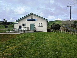
773:
731:
626:
Ryburn, pp 50, 112, 138. Ryburn says the steamer was operating in 1881 on page 50, but also says it was constructed in 1884 on page 138.
501:
684:
602:
577:
552:
703:
472:
those at least 15 was that 843 (56.2%) people were employed full-time, 261 (17.4%) were part-time, and 30 (2.0%) were unemployed.
50:
1148:
1036:
183:
497:
1077:
830:
264:
913:
523:
Tauhoa School is a coeducational full primary (years 1-8) school with a roll of 64 students as of August 2024.
945:
232:
1092:
851:
1126:
1087:
778:
452:
448:
444:
351:
347:
343:
268:
745:
157:
749:
881:
242:
was complete and bridged, but was still impassable in winter. A small portion of the road at Tauhoa was
32:
216:
for future settlement. Some of the land occupied by settlers in the 1870s was abandoned in the 1880s.
126:
863:
368:
those at least 15 was that 51 (53.1%) people were employed full-time and 18 (18.8%) were part-time.
1113:
105:
1026:
493:
1001:
798:
680:
598:
573:
548:
505:
465:
361:
220:
1108:
1006:
243:
149:
1061:
1016:
227:
was stranded and wrecked in the Tauhoa River with a load of kauri. The small steamer S.S.
199:
169:
95:
1021:
489:
1011:
996:
131:
468:, 0.5% were Hindu, 0.2% were Muslim, 0.6% were Buddhist and 2.0% had other religions.
1142:
1056:
1051:
1041:
1046:
1031:
195:
177:
223:
logs down to Te Pahi Stream, where sailing ships could take them away. The barque
461:
The percentage of people born overseas was 22.0, compared with 27.1% nationally.
231:
was built at Tauhoa and transported goods between Te Pahi Creek and the northern
1118:
991:
935:
921:
249:
239:
173:
85:
960:
65:
52:
975:
480:
194:
12 km to the south. Te Pahi Stream flows through the area and into the
187:
950:
940:
970:
917:
512:
965:
397:
296:
377:
191:
488:
The local
Puatahi Marae is a traditional meeting ground for local
479:
156:
161:
View of farmland in Rodney
District, near the township of Tauhoa
885:
776:. Statistics New Zealand. March 2020. Kaipara Hills (110800).
812:
392:
291:
263:
Tauhoa was part of the
Kourawhero/Tauhoa riding as part of
790:
342:
The SA1 statistical area had a population of 132 at the
376:
Kaipara Hills statistical area, which also includes
1101:
1070:
984:
928:
145:
140:
119:
111:
101:
91:
81:
23:
451:, and an increase of 492 people (33.4%) since the
768:
766:
526:The school celebrated its 125th jubilee in 2004.
443:Kaipara Hills had a population of 1,965 at the
350:, and an increase of 6 people (4.8%) since the
267:until 1989 when the county was replaced by the
734:. Statistics New Zealand. March 2020. 7001185.
726:
724:
447:, an increase of 279 people (16.5%) since the
283:Historical population for Tauhoa and surrounds
897:
219:A tramway operated during the 1880s to bring
8:
774:"Statistical area 1 dataset for 2018 Census"
732:"Statistical area 1 dataset for 2018 Census"
383:
282:
1159:Populated places around the Kaipara Harbour
346:, an increase of 9 people (7.3%) since the
904:
890:
882:
382:
281:
20:
1083:Cape Rodney-Okakari Point Marine Reserve
779:2018 Census place summary: Kaipara Hills
670:
668:
252:were active in the area up before 1910.
1154:Populated places in the Auckland Region
698:
696:
535:
384:Historical population for Kaipara Hills
139:
118:
80:
45:
41:
29:
746:"Population estimate tables - NZ.Stat"
186:runs through the area, connecting to
144:
110:
100:
90:
18:Place in Auckland Region, New Zealand
7:
833:. New Zealand Ministry of Education
570:The Geographic Atlas of New Zealand
511:The marae includes Te Manawanui, a
572:. Robbie Burton. pp. map 31.
146: • Territorial Authority
14:
1127:Rodney District Council (defunct)
198:, which drains into the southern
190:15 km to the north-east and
31:
852:Education Counts: Tauhoa School
831:"New Zealand Schools Directory"
568:Roger Smith, GeographX (2005).
547:. Reed Books. pp. map 11.
595:Tall Spars, Steamers & Gum
372:Kaipara Hills statistical area
1:
868:Education Gazette New Zealand
864:"Tauhoa School 125th Jubilee"
168:is a rural community in the
819:. Te Potiki National Trust.
791:"Te Kāhui Māngai directory"
543:Peter Dowling, ed. (2004).
1175:
1071:Facilities and attractions
436:
410:—
335:
309:—
46:
42:
30:
1078:Ātiu Creek Regional Park
912:Wellsford Subdivision -
704:"ArcGIS Web Application"
675:Bioletti, Harry (1992).
492:. It is affiliated with
1149:Rodney Local Board Area
708:statsnz.maps.arcgis.com
466:Māori religious beliefs
445:2018 New Zealand census
362:Māori religious beliefs
344:2018 New Zealand census
269:Rodney District Council
750:Statistics New Zealand
593:Ryburn, Wayne (1999).
545:Reed New Zealand Atlas
498:Ngāti Whātua o Kaipara
485:
162:
66:36.37722°S 174.45222°E
37:Tauhoa (Victoria) Hall
1093:Te Ārai Regional Park
677:Rodney Coast to Coast
484:Tauhoa primary school
483:
160:
115:Wellsford subdivision
1088:Pākiri Regional Park
506:Ngāti Rāngo or Rongo
235:in the early 1880s.
127:Kaipara ki Mahurangi
71:-36.37722; 174.45222
985:Geographic features
662:Ryburn, pp 131, 201
500:, and their iwi of
385:
284:
211:European settlement
206:History and culture
62: /
1114:Rodney Local Board
635:Ryburn, pp 37, 187
515:or meeting house.
486:
163:
106:Rodney Local Board
1136:
1135:
1002:Kaiwakawaka River
874:(8). 10 May 2004.
679:. p. 91–94.
441:
440:
340:
339:
155:
154:
1166:
1109:Auckland Council
1007:Manukapua Island
929:Populated places
906:
899:
892:
883:
876:
875:
860:
854:
849:
843:
842:
840:
838:
827:
821:
820:
809:
803:
802:
787:
781:
777:
770:
761:
760:
758:
756:
742:
736:
735:
728:
719:
718:
716:
714:
700:
691:
690:
672:
663:
660:
654:
651:
645:
644:Ryburn, pp 87-89
642:
636:
633:
627:
624:
618:
615:
609:
608:
590:
584:
583:
565:
559:
558:
540:
399:
394:
386:
298:
293:
285:
184:State Highway 16
150:Auckland Council
77:
76:
74:
73:
72:
67:
63:
60:
59:
58:
55:
35:
21:
1174:
1173:
1169:
1168:
1167:
1165:
1164:
1163:
1139:
1138:
1137:
1132:
1097:
1066:
1062:Wharehine River
1027:Pāpakanui River
1017:Oruawharo River
980:
924:
910:
880:
879:
862:
861:
857:
850:
846:
836:
834:
829:
828:
824:
811:
810:
806:
789:
788:
784:
772:
771:
764:
754:
752:
744:
743:
739:
730:
729:
722:
712:
710:
702:
701:
694:
687:
674:
673:
666:
661:
657:
652:
648:
643:
639:
634:
630:
625:
621:
616:
612:
605:
592:
591:
587:
580:
567:
566:
562:
555:
542:
541:
537:
532:
521:
478:
374:
277:
261:
213:
208:
200:Kaipara Harbour
170:Auckland Region
136:
96:Auckland Region
70:
68:
64:
61:
56:
53:
51:
49:
48:
38:
26:
19:
12:
11:
5:
1172:
1170:
1162:
1161:
1156:
1151:
1141:
1140:
1134:
1133:
1131:
1130:
1123:
1122:
1121:
1116:
1105:
1103:
1099:
1098:
1096:
1095:
1090:
1085:
1080:
1074:
1072:
1068:
1067:
1065:
1064:
1059:
1054:
1049:
1044:
1039:
1037:Spectacle Lake
1034:
1029:
1024:
1019:
1014:
1009:
1004:
999:
994:
988:
986:
982:
981:
979:
978:
973:
968:
963:
958:
953:
948:
943:
938:
932:
930:
926:
925:
911:
909:
908:
901:
894:
886:
878:
877:
855:
844:
822:
804:
799:Te Puni Kōkiri
782:
762:
737:
720:
692:
685:
664:
655:
646:
637:
628:
619:
610:
603:
597:. p. 26.
585:
578:
560:
553:
534:
533:
531:
528:
520:
517:
477:
474:
439:
438:
434:
433:
430:
427:
423:
422:
419:
416:
412:
411:
408:
405:
401:
400:
395:
390:
373:
370:
338:
337:
333:
332:
329:
326:
322:
321:
318:
315:
311:
310:
307:
304:
300:
299:
294:
289:
276:
273:
260:
257:
212:
209:
207:
204:
153:
152:
147:
143:
142:
138:
137:
135:
134:
132:Te Tai Tokerau
129:
123:
121:
117:
116:
113:
109:
108:
103:
99:
98:
93:
89:
88:
83:
79:
78:
44:
43:
40:
39:
36:
28:
27:
24:
17:
13:
10:
9:
6:
4:
3:
2:
1171:
1160:
1157:
1155:
1152:
1150:
1147:
1146:
1144:
1129:
1128:
1124:
1120:
1117:
1115:
1112:
1111:
1110:
1107:
1106:
1104:
1100:
1094:
1091:
1089:
1086:
1084:
1081:
1079:
1076:
1075:
1073:
1069:
1063:
1060:
1058:
1057:Whanaki River
1055:
1053:
1052:Waireia River
1050:
1048:
1045:
1043:
1042:Tomarata Lake
1040:
1038:
1035:
1033:
1030:
1028:
1025:
1023:
1020:
1018:
1015:
1013:
1010:
1008:
1005:
1003:
1000:
998:
995:
993:
990:
989:
987:
983:
977:
974:
972:
969:
967:
964:
962:
959:
957:
954:
952:
949:
947:
944:
942:
939:
937:
934:
933:
931:
927:
923:
919:
915:
907:
902:
900:
895:
893:
888:
887:
884:
873:
869:
865:
859:
856:
853:
848:
845:
832:
826:
823:
818:
817:maorimaps.com
814:
808:
805:
800:
796:
792:
786:
783:
780:
775:
769:
767:
763:
751:
747:
741:
738:
733:
727:
725:
721:
709:
705:
699:
697:
693:
688:
686:0-473-01296-0
682:
678:
671:
669:
665:
659:
656:
653:Ryburn, p 189
650:
647:
641:
638:
632:
629:
623:
620:
614:
611:
606:
604:0-473-06176-7
600:
596:
589:
586:
581:
579:1-877333-20-4
575:
571:
564:
561:
556:
554:0-7900-0952-8
550:
546:
539:
536:
529:
527:
524:
518:
516:
514:
509:
507:
503:
499:
495:
491:
482:
475:
473:
469:
467:
462:
459:
456:
454:
450:
446:
435:
431:
428:
425:
424:
420:
417:
414:
413:
409:
406:
403:
402:
396:
391:
388:
387:
381:
379:
371:
369:
365:
363:
358:
355:
353:
349:
345:
334:
330:
327:
324:
323:
319:
316:
313:
312:
308:
305:
302:
301:
295:
290:
287:
286:
280:
274:
272:
270:
266:
265:Rodney County
258:
256:
253:
251:
247:
245:
241:
236:
234:
230:
226:
222:
217:
210:
205:
203:
202:to the west.
201:
197:
193:
189:
185:
181:
179:
175:
171:
167:
159:
151:
148:
133:
130:
128:
125:
124:
122:
114:
107:
104:
97:
94:
87:
84:
75:
47:Coordinates:
34:
22:
16:
1125:
1047:Topuni River
1032:Slipper Lake
1022:Pākiri River
955:
871:
867:
858:
847:
837:17 September
835:. Retrieved
825:
816:
813:"Māori Maps"
807:
794:
785:
753:. Retrieved
740:
711:. Retrieved
707:
676:
658:
649:
640:
631:
622:
617:Ryburn, p 87
613:
594:
588:
569:
563:
544:
538:
525:
522:
510:
494:Ngāti Whātua
487:
470:
463:
460:
457:
442:
375:
366:
359:
356:
341:
278:
275:Demographics
262:
254:
248:
237:
233:Wairoa River
228:
225:Mary Mildred
224:
218:
214:
196:Tauhoa River
182:
178:North Island
165:
164:
15:
1119:Rodney ward
1012:Ōpatu River
997:Hōteo River
992:Dome Forest
946:Port Albert
936:Dome Valley
922:New Zealand
795:tkm.govt.nz
713:28 December
453:2006 census
449:2013 census
352:2006 census
348:2013 census
250:Gum-diggers
240:Kaukapakapa
174:New Zealand
120:Electorates
112:Subdivision
102:Local board
86:New Zealand
69: /
1143:Categories
1102:Government
755:25 October
502:Ngāti Hine
229:Mary Allen
141:Government
57:174°27′8″E
54:36°22′38″S
976:Wellsford
519:Education
188:Wellsford
971:Tomarata
918:Auckland
513:wharenui
437:Source:
336:Source:
259:Politics
244:metalled
966:Te Hana
961:Te Ārai
398:±% p.a.
297:±% p.a.
82:Country
956:Tauhoa
951:Tāpora
941:Pākiri
914:Rodney
683:
601:
576:
551:
432:+3.11%
421:+1.95%
378:Glorit
331:+1.42%
320:−0.34%
192:Glorit
166:Tauhoa
92:Region
25:Tauhoa
530:Notes
490:Māori
476:Marae
429:1,965
418:1,686
407:1,473
221:kauri
839:2024
757:2023
715:2023
681:ISBN
599:ISBN
574:ISBN
549:ISBN
504:and
496:and
426:2018
415:2013
404:2006
393:Pop.
389:Year
325:2018
314:2013
303:2006
292:Pop.
288:Year
328:132
317:123
306:126
176:'s
172:of
1145::
920:,
916:,
872:83
870:.
866:.
815:.
797:.
793:.
765:^
748:.
723:^
706:.
695:^
667:^
508:.
364:.
271:.
180:.
905:e
898:t
891:v
841:.
801:.
759:.
717:.
689:.
607:.
582:.
557:.
Text is available under the Creative Commons Attribution-ShareAlike License. Additional terms may apply.