82:
63:
2535:
99:
3555:
120:
373:. Its terrain consists of rolling hills, sloped toward the east. A local drainage, Big Sandy Creek, flows southeast and east through the northern part of the county, and another drainage, Rose Creek, flows northeastward through the SE corner of the county (they converge east of Thayer County's east boundary line). The planar portions of the terrain are partially used for agriculture.
2400:
2417:
2392:
2375:
2116:
2102:
398:
388:
438:
428:
418:
408:
844:
The county population contained 24.10% under the age of 18, 4.90% from 18 to 24, 22.30% from 25 to 44, 24.20% from 45 to 64, and 24.50% who were 65 years of age or older. The median age was 44 years. For every 100 females there were 95.80 males. For every 100 females age 18 and over, there were 92.80
840:
living together, 5.00% had a female householder with no husband present, and 33.50% were non-families. 31.50% of all households were made up of individuals, and 18.20% had someone living alone who was 65 years of age or older. The average household size was 2.31 and the average family size was 2.90.
2058:
801:
was 10 people per square mile (3.9 people/km). There were 2,828 housing units at an average density of 5 units per square mile (1.9/km). The racial makeup of the county was 98.70%
1894:
848:
The median income for a household in the county was $ 30,740, and the median income for a family was $ 38,346. Males had a median income of $ 26,964 versus $ 18,275 for females. The
361:, Thayer County is represented by the prefix 32 (it had the thirty-second-largest number of vehicles registered in the state when the license plate system was established in 1922).
1859:
1830:
1801:
1772:
1743:
1714:
1685:
1656:
1627:
1598:
1569:
1540:
1511:
1482:
1453:
1424:
1395:
1366:
1337:
1308:
1279:
1250:
1221:
1192:
1163:
1134:
1105:
1076:
1047:
1018:
989:
2468:
3572:
376:
Thayer County has an area of 575 square miles (1,490 km), of which 574 square miles (1,490 km) is land and 1.2 square miles (3.1 km) (0.2%) is water.
81:
2763:
2337:
3621:
62:
2748:
939:
Thayer County voters are reliably
Republican. In only one national election since 1936 has the county selected the Democratic Party candidate (as of 2020).
2914:
2073:
2204:
3616:
2795:
2738:
358:
288:
1967:
2904:
2768:
2461:
350:. The county was created in 1856 and originally named Jefferson County. It was organized in 1870-1871 and renamed for General and Governor
2881:
2007:
2909:
299:
2718:
2677:
2330:
3611:
2454:
956:
951:
2753:
2899:
2790:
2446:
1943:
3470:
2733:
2323:
1992:
276:
3072:
2785:
369:
Thayer County lies on the south line of
Nebraska. Its south boundary line abuts the north boundary line of the state of
1916:
3520:
3445:
3440:
2077:
961:
830:
826:
822:
818:
814:
810:
806:
802:
3375:
3350:
3335:
3315:
3295:
3110:
3057:
2959:
2821:
2406:
461:
401:
3510:
3480:
3465:
3400:
3280:
3255:
3235:
3230:
3225:
3160:
3085:
2831:
2433:
2384:
2359:
794:
747:
732:
717:
702:
687:
672:
657:
642:
627:
612:
597:
582:
567:
552:
537:
485:
479:
467:
391:
339:
2081:
836:
There were 2,541 households, out of which 27.70% had children under the age of 18 living with them, 58.80% were
3535:
3530:
3495:
3485:
3415:
3385:
3380:
3370:
3355:
3340:
3325:
3320:
3270:
3215:
3125:
2861:
2836:
2197:
305:
3515:
3505:
3475:
3455:
3430:
3425:
3420:
3410:
3395:
3310:
3305:
3285:
3260:
3250:
3240:
3195:
3185:
3180:
3175:
3170:
3155:
3135:
3100:
3095:
3090:
2866:
2635:
2428:
2364:
473:
455:
3525:
3490:
3460:
3390:
3360:
3330:
3290:
3265:
3220:
3210:
3205:
3200:
3190:
3150:
3145:
3120:
3105:
3080:
3037:
2997:
2758:
2728:
2670:
327:
281:
53:
3540:
3450:
3435:
3405:
3365:
3345:
3300:
3275:
3245:
3165:
3140:
3130:
3115:
3052:
2894:
2851:
2846:
2939:
2871:
2856:
2816:
2811:
2743:
2642:
2554:
888:
257:
1973:. Nebraska State Historical Society. August 1, 1991. Archived from the original on November 16, 2006
3047:
3017:
2929:
2841:
2775:
2710:
2584:
2559:
918:
893:
441:
1968:"Nebraska Historic Buildings Survey Reconnaissance Survey Final Report of Thayer County, Nebraska"
3012:
3002:
2982:
2977:
2972:
2967:
2924:
2622:
2617:
2574:
2546:
2037:
908:
852:
for the county was $ 17,043. About 7.60% of families and 10.70% of the population were below the
798:
431:
421:
411:
351:
145:
2131:
2015:
3032:
3022:
3007:
2987:
2826:
2780:
2700:
2663:
2594:
2579:
2564:
2519:
1986:
928:
913:
898:
870:
849:
268:
247:
2315:
1948:. Lincoln: University of Nebraska Studies in Language, Literature, and Criticism. p. 138
3027:
2992:
2919:
2589:
2524:
2500:
923:
875:
784:
347:
157:
31:
2175:
3559:
3042:
2934:
2612:
2569:
2511:
903:
2229:
3062:
2251:
3605:
2949:
2889:
104:
853:
797:, there were 6,055 people, 2,541 households, and 1,689 families in the county. The
2493:
780:
343:
152:
2686:
2604:
331:
112:
3587:
3574:
856:, including 14.80% of those under age 18 and 11.00% of those age 65 or over.
264:
243:
17:
2944:
238:
2723:
2690:
837:
335:
140:
125:
943:
United States presidential election results for Thayer County, Nebraska
2294:
370:
2655:
2153:
2534:
2309:
397:
2198:"Census 2000 PHC-T-4. Ranking Tables for Counties: 1990 and 2000"
1895:
National
Register of Historic Places listings in Thayer County NE
825:, and 0.56% from two or more races. 1.01% of the population were
387:
2659:
2450:
2319:
437:
2118:
Prairie Marsh West State
Wildlife Management Area, Carleton NE
427:
417:
407:
315:
2533:
2176:"Population of Counties by Decennial Census: 1900 to 1990"
2273:
2104:
Prairie Marsh State
Wildlife Management Area, Bruning NE
1911:
1909:
3071:
2958:
2880:
2804:
2709:
2603:
2545:
2510:
311:
298:
287:
275:
254:
237:
229:
221:
216:
208:
200:
192:
184:
176:
171:
163:
151:
139:
131:
111:
91:
44:
502:Prairie Marsh West State Wildlife Management Area
2671:
2462:
2331:
8:
499:Prairie Marsh State Wildlife Management Area
2008:"Andreas' History of the State of Nebraska"
2678:
2664:
2656:
2538:Map of Nebraska highlighting Thayer County
2469:
2455:
2447:
2346:Places adjacent to Thayer County, Nebraska
2338:
2324:
2316:
2040:. Nebraska Association of County Officials
941:
510:
196:1.2 sq mi (3 km) 0.2%
86:Location within the U.S. state of Nebraska
41:
1905:
310:
286:
274:
236:
215:
207:
199:
170:
150:
130:
90:
71:
59:
2120:Google Maps (accessed 25 January 2019)
2106:Google Maps (accessed 25 January 2019)
2062:Google Maps (accessed 25 January 2019)
1984:
530:
2905:Kearney Micropolitan Statistical Area
1917:"County Population Totals: 2020-2021"
960:
955:
950:
947:
297:
253:
228:
220:
191:
183:
175:
162:
138:
110:
78:
7:
3622:Populated places established in 1871
2353:
2210:from the original on March 27, 2010
1942:Fitzpatrick, Lilian Linder (1925).
188:574 sq mi (1,490 km)
180:575 sq mi (1,490 km)
2477:Municipalities and communities of
2254:. National Association of Counties
520:
67:Thayer County Courthouse in Hebron
25:
2080:. August 22, 2012. Archived from
342:, the population was 5,034. Its
27:County in Nebraska, United States
3553:
2415:
2398:
2390:
2373:
2156:. University of Virginia Library
436:
426:
416:
406:
396:
386:
118:
97:
80:
74:Interactive map of Thayer County
61:
3617:1871 establishments in Nebraska
2230:"State & County QuickFacts"
2900:Grand Island metropolitan area
1:
2416:
2374:
2074:"2010 Census Gazetteer Files"
359:Nebraska license plate system
2399:
2391:
2749:Speakers of the Legislature
2154:"Historical Census Browser"
2078:United States Census Bureau
222: • Estimate
3638:
212:1,142 ft (348 m)
204:1,545 ft (471 m)
29:
3549:
2910:Lincoln metropolitan area
2697:
2631:
2531:
2491:
2434:Washington County, Kansas
2351:
1991:: CS1 maint: unfit URL (
982:
979:
976:
973:
970:
795:2000 United States Census
774:
761:
746:
731:
716:
701:
686:
671:
656:
641:
626:
611:
596:
581:
566:
551:
536:
529:
524:
519:
516:
468:Washington County, Kansas
340:2020 United States Census
79:
72:
60:
51:
779:1990-2000 2010-2013 Its
30:Not to be confused with
3612:Thayer County, Nebraska
2915:Omaha metropolitan area
2769:Congressional districts
2480:Thayer County, Nebraska
2429:Republic County, Kansas
2396:Thayer County, Nebraska
2006:Andreas, A. T. (1882).
474:Republic County, Kansas
233:8.8/sq mi (3.4/km)
2764:Supreme Court justices
2539:
201:Highest elevation
2895:Dissected Till Plains
2537:
2274:"U.S. Census website"
2132:"US Decennial Census"
2012:The Kansas Collection
512:Historical population
256: • Summer (
209:Lowest elevation
2644:United States portal
2203:. US Census Bureau.
2084:on November 13, 2013
1945:Nebraska Place-Names
230: • Density
3584: /
3560:Nebraska portal
2796:Tourist attractions
2018:on January 29, 2003
944:
777:1790-1960 1900-1990
775:US Decennial Census
513:
442:Nebraska Highway 53
2540:
2276:. US Census Bureau
2232:. US Census Bureau
2178:. US Census Bureau
2134:. US Census Bureau
1923:. US Census Bureau
942:
799:population density
511:
432:Nebraska Highway 8
422:Nebraska Highway 5
412:Nebraska Highway 4
352:John Milton Thayer
316:thayercountyne.gov
193: • Water
177: • Total
146:John Milton Thayer
39:County in Nebraska
3567:
3566:
2653:
2652:
2444:
2443:
2439:
2438:
1886:
1885:
850:per capita income
791:
790:
449:Adjacent counties
321:
320:
185: • Land
16:(Redirected from
3629:
3599:
3598:
3596:
3595:
3594:
3589:
3585:
3582:
3581:
3580:
3577:
3558:
3557:
3556:
3058:South Sioux City
2680:
2673:
2666:
2657:
2645:
2638:
2536:
2503:
2496:
2486:
2481:
2471:
2464:
2457:
2448:
2419:
2418:
2407:Jefferson County
2402:
2401:
2394:
2393:
2377:
2376:
2354:
2340:
2333:
2326:
2317:
2313:
2312:
2310:Official website
2297:
2295:Election Results
2292:
2286:
2285:
2283:
2281:
2270:
2264:
2263:
2261:
2259:
2248:
2242:
2241:
2239:
2237:
2226:
2220:
2219:
2217:
2215:
2209:
2202:
2194:
2188:
2187:
2185:
2183:
2172:
2166:
2165:
2163:
2161:
2150:
2144:
2143:
2141:
2139:
2128:
2122:
2114:
2108:
2100:
2094:
2093:
2091:
2089:
2070:
2064:
2060:Thayer County NE
2056:
2050:
2049:
2047:
2045:
2034:
2028:
2027:
2025:
2023:
2014:. Archived from
2003:
1997:
1996:
1990:
1982:
1980:
1978:
1972:
1964:
1958:
1957:
1955:
1953:
1939:
1933:
1932:
1930:
1928:
1913:
962:Third party(ies)
945:
811:African American
532:
527:
522:
514:
462:Jefferson County
440:
430:
420:
410:
402:U.S. Highway 136
400:
390:
261:
124:
122:
121:
107:
103:
101:
100:
84:
65:
42:
32:Thayer, Nebraska
21:
3637:
3636:
3632:
3631:
3630:
3628:
3627:
3626:
3602:
3601:
3592:
3590:
3588:40.18°N 97.59°W
3586:
3583:
3578:
3575:
3573:
3571:
3570:
3568:
3563:
3554:
3552:
3545:
3067:
2954:
2935:Rainwater Basin
2876:
2800:
2705:
2693:
2684:
2654:
2649:
2643:
2637:Nebraska portal
2636:
2627:
2599:
2541:
2529:
2506:
2501:
2494:
2487:
2484:
2479:
2475:
2445:
2440:
2403:
2385:Nuckolls County
2360:Fillmore County
2347:
2344:
2308:
2307:
2305:
2300:
2293:
2289:
2279:
2277:
2272:
2271:
2267:
2257:
2255:
2252:"Find a County"
2250:
2249:
2245:
2235:
2233:
2228:
2227:
2223:
2213:
2211:
2207:
2200:
2196:
2195:
2191:
2181:
2179:
2174:
2173:
2169:
2159:
2157:
2152:
2151:
2147:
2137:
2135:
2130:
2129:
2125:
2115:
2111:
2101:
2097:
2087:
2085:
2072:
2071:
2067:
2057:
2053:
2043:
2041:
2038:"Thayer County"
2036:
2035:
2031:
2021:
2019:
2005:
2004:
2000:
1983:
1976:
1974:
1970:
1966:
1965:
1961:
1951:
1949:
1941:
1940:
1936:
1926:
1924:
1915:
1914:
1907:
1903:
1891:
937:
885:
867:
862:
838:married couples
815:Native American
778:
776:
525:
509:
496:
494:Protected areas
491:
486:Fillmore County
480:Nuckolls County
451:
446:
392:U.S. Highway 81
382:
367:
255:
119:
117:
98:
96:
95:
87:
75:
68:
56:
47:
40:
35:
28:
23:
22:
15:
12:
11:
5:
3635:
3633:
3625:
3624:
3619:
3614:
3604:
3603:
3565:
3564:
3550:
3547:
3546:
3544:
3543:
3538:
3533:
3528:
3523:
3518:
3513:
3508:
3503:
3498:
3493:
3488:
3483:
3478:
3473:
3468:
3463:
3458:
3453:
3448:
3443:
3438:
3433:
3428:
3423:
3418:
3413:
3408:
3403:
3398:
3393:
3388:
3383:
3378:
3373:
3368:
3363:
3358:
3353:
3348:
3343:
3338:
3333:
3328:
3323:
3318:
3313:
3308:
3303:
3298:
3293:
3288:
3283:
3278:
3273:
3268:
3263:
3258:
3253:
3248:
3243:
3238:
3233:
3228:
3223:
3218:
3213:
3208:
3203:
3198:
3193:
3188:
3183:
3178:
3173:
3168:
3163:
3158:
3153:
3148:
3143:
3138:
3133:
3128:
3123:
3118:
3113:
3108:
3103:
3098:
3093:
3088:
3083:
3077:
3075:
3069:
3068:
3066:
3065:
3060:
3055:
3050:
3045:
3040:
3035:
3030:
3025:
3020:
3015:
3010:
3005:
3000:
2995:
2990:
2985:
2980:
2975:
2970:
2964:
2962:
2960:Largest cities
2956:
2955:
2953:
2952:
2947:
2942:
2937:
2932:
2927:
2922:
2917:
2912:
2907:
2902:
2897:
2892:
2886:
2884:
2878:
2877:
2875:
2874:
2869:
2864:
2859:
2854:
2849:
2844:
2839:
2834:
2829:
2824:
2822:Climate change
2819:
2814:
2808:
2806:
2802:
2801:
2799:
2798:
2793:
2788:
2783:
2778:
2773:
2772:
2771:
2766:
2761:
2756:
2754:State senators
2751:
2746:
2741:
2736:
2726:
2721:
2715:
2713:
2707:
2706:
2698:
2695:
2694:
2685:
2683:
2682:
2675:
2668:
2660:
2651:
2650:
2648:
2647:
2640:
2632:
2629:
2628:
2626:
2625:
2620:
2615:
2609:
2607:
2601:
2600:
2598:
2597:
2592:
2587:
2582:
2577:
2572:
2567:
2562:
2557:
2551:
2549:
2543:
2542:
2532:
2530:
2528:
2527:
2522:
2516:
2514:
2508:
2507:
2492:
2489:
2488:
2476:
2474:
2473:
2466:
2459:
2451:
2442:
2441:
2437:
2436:
2431:
2426:
2423:
2422:
2420:
2413:
2410:
2409:
2404:
2389:
2387:
2381:
2380:
2378:
2371:
2368:
2367:
2362:
2357:
2352:
2349:
2348:
2345:
2343:
2342:
2335:
2328:
2320:
2304:
2303:External links
2301:
2299:
2298:
2287:
2265:
2243:
2221:
2189:
2167:
2145:
2123:
2109:
2095:
2065:
2051:
2029:
1998:
1959:
1934:
1904:
1902:
1899:
1898:
1897:
1890:
1887:
1884:
1883:
1880:
1877:
1874:
1871:
1866:
1863:
1855:
1854:
1851:
1848:
1845:
1842:
1837:
1834:
1826:
1825:
1822:
1819:
1816:
1813:
1808:
1805:
1797:
1796:
1793:
1790:
1785:
1782:
1779:
1776:
1768:
1767:
1764:
1761:
1758:
1755:
1750:
1747:
1739:
1738:
1735:
1732:
1729:
1726:
1721:
1718:
1710:
1709:
1706:
1703:
1700:
1697:
1692:
1689:
1681:
1680:
1677:
1674:
1671:
1668:
1663:
1660:
1652:
1651:
1648:
1645:
1640:
1637:
1634:
1631:
1623:
1622:
1619:
1616:
1611:
1608:
1605:
1602:
1594:
1593:
1590:
1587:
1584:
1581:
1576:
1573:
1565:
1564:
1561:
1558:
1555:
1552:
1547:
1544:
1536:
1535:
1532:
1529:
1526:
1523:
1518:
1515:
1507:
1506:
1503:
1500:
1497:
1494:
1489:
1486:
1478:
1477:
1474:
1471:
1468:
1465:
1460:
1457:
1449:
1448:
1445:
1442:
1439:
1436:
1431:
1428:
1420:
1419:
1416:
1413:
1408:
1405:
1402:
1399:
1391:
1390:
1387:
1384:
1381:
1378:
1373:
1370:
1362:
1361:
1358:
1355:
1352:
1349:
1344:
1341:
1333:
1332:
1329:
1326:
1323:
1320:
1315:
1312:
1304:
1303:
1300:
1297:
1294:
1291:
1286:
1283:
1275:
1274:
1271:
1268:
1265:
1262:
1257:
1254:
1246:
1245:
1242:
1239:
1236:
1233:
1228:
1225:
1217:
1216:
1213:
1210:
1207:
1204:
1199:
1196:
1188:
1187:
1184:
1181:
1178:
1175:
1170:
1167:
1159:
1158:
1155:
1152:
1149:
1146:
1141:
1138:
1130:
1129:
1126:
1123:
1120:
1117:
1112:
1109:
1101:
1100:
1097:
1094:
1091:
1088:
1083:
1080:
1072:
1071:
1068:
1065:
1062:
1059:
1054:
1051:
1043:
1042:
1039:
1036:
1033:
1030:
1025:
1022:
1014:
1013:
1010:
1007:
1004:
1001:
996:
993:
985:
984:
981:
978:
975:
972:
969:
965:
964:
959:
954:
949:
936:
933:
932:
931:
926:
921:
916:
911:
906:
901:
896:
891:
884:
881:
880:
879:
873:
866:
863:
861:
858:
789:
788:
772:
771:
768:
766:
763:
759:
758:
755:
753:
750:
744:
743:
740:
738:
735:
729:
728:
725:
723:
720:
714:
713:
710:
708:
705:
699:
698:
695:
693:
690:
684:
683:
680:
678:
675:
669:
668:
665:
663:
660:
654:
653:
650:
648:
645:
639:
638:
635:
633:
630:
624:
623:
620:
618:
615:
609:
608:
605:
603:
600:
594:
593:
590:
588:
585:
579:
578:
575:
573:
570:
564:
563:
560:
558:
555:
549:
548:
545:
543:
540:
534:
533:
528:
523:
518:
508:
505:
504:
503:
500:
495:
492:
490:
489:
483:
477:
471:
465:
459:
452:
450:
447:
445:
444:
434:
424:
414:
404:
394:
383:
381:
380:Major highways
378:
366:
363:
319:
318:
313:
309:
308:
303:
296:
295:
292:
285:
284:
279:
273:
272:
262:
252:
251:
241:
235:
234:
231:
227:
226:
223:
219:
218:
214:
213:
210:
206:
205:
202:
198:
197:
194:
190:
189:
186:
182:
181:
178:
174:
173:
169:
168:
165:
161:
160:
155:
149:
148:
143:
137:
136:
133:
129:
128:
115:
109:
108:
93:
89:
88:
85:
77:
76:
73:
70:
69:
66:
58:
57:
52:
49:
48:
45:
38:
26:
24:
14:
13:
10:
9:
6:
4:
3:
2:
3634:
3623:
3620:
3618:
3615:
3613:
3610:
3609:
3607:
3600:
3597:
3593:40.18; -97.59
3562:
3561:
3548:
3542:
3539:
3537:
3534:
3532:
3529:
3527:
3524:
3522:
3519:
3517:
3514:
3512:
3509:
3507:
3504:
3502:
3499:
3497:
3494:
3492:
3489:
3487:
3484:
3482:
3479:
3477:
3474:
3472:
3469:
3467:
3464:
3462:
3459:
3457:
3454:
3452:
3449:
3447:
3444:
3442:
3439:
3437:
3434:
3432:
3429:
3427:
3424:
3422:
3419:
3417:
3414:
3412:
3409:
3407:
3404:
3402:
3399:
3397:
3394:
3392:
3389:
3387:
3384:
3382:
3379:
3377:
3374:
3372:
3369:
3367:
3364:
3362:
3359:
3357:
3354:
3352:
3349:
3347:
3344:
3342:
3339:
3337:
3334:
3332:
3329:
3327:
3324:
3322:
3319:
3317:
3314:
3312:
3309:
3307:
3304:
3302:
3299:
3297:
3294:
3292:
3289:
3287:
3284:
3282:
3279:
3277:
3274:
3272:
3269:
3267:
3264:
3262:
3259:
3257:
3254:
3252:
3249:
3247:
3244:
3242:
3239:
3237:
3234:
3232:
3229:
3227:
3224:
3222:
3219:
3217:
3214:
3212:
3209:
3207:
3204:
3202:
3199:
3197:
3194:
3192:
3189:
3187:
3184:
3182:
3179:
3177:
3174:
3172:
3169:
3167:
3164:
3162:
3159:
3157:
3154:
3152:
3149:
3147:
3144:
3142:
3139:
3137:
3134:
3132:
3129:
3127:
3124:
3122:
3119:
3117:
3114:
3112:
3109:
3107:
3104:
3102:
3099:
3097:
3094:
3092:
3089:
3087:
3084:
3082:
3079:
3078:
3076:
3074:
3070:
3064:
3061:
3059:
3056:
3054:
3051:
3049:
3046:
3044:
3041:
3039:
3036:
3034:
3031:
3029:
3026:
3024:
3021:
3019:
3016:
3014:
3011:
3009:
3006:
3004:
3001:
2999:
2996:
2994:
2991:
2989:
2986:
2984:
2981:
2979:
2976:
2974:
2971:
2969:
2966:
2965:
2963:
2961:
2957:
2951:
2950:Wildcat Hills
2948:
2946:
2943:
2941:
2938:
2936:
2933:
2931:
2928:
2926:
2923:
2921:
2918:
2916:
2913:
2911:
2908:
2906:
2903:
2901:
2898:
2896:
2893:
2891:
2890:Bohemian Alps
2888:
2887:
2885:
2883:
2879:
2873:
2870:
2868:
2865:
2863:
2860:
2858:
2855:
2853:
2850:
2848:
2845:
2843:
2840:
2838:
2835:
2833:
2830:
2828:
2825:
2823:
2820:
2818:
2815:
2813:
2810:
2809:
2807:
2803:
2797:
2794:
2792:
2789:
2787:
2784:
2782:
2779:
2777:
2774:
2770:
2767:
2765:
2762:
2760:
2759:Supreme Court
2757:
2755:
2752:
2750:
2747:
2745:
2742:
2740:
2739:Lt. governors
2737:
2735:
2732:
2731:
2730:
2727:
2725:
2722:
2720:
2717:
2716:
2714:
2712:
2708:
2703:
2702:
2696:
2692:
2688:
2681:
2676:
2674:
2669:
2667:
2662:
2661:
2658:
2646:
2641:
2639:
2634:
2633:
2630:
2624:
2621:
2619:
2616:
2614:
2611:
2610:
2608:
2606:
2602:
2596:
2593:
2591:
2588:
2586:
2583:
2581:
2578:
2576:
2573:
2571:
2568:
2566:
2563:
2561:
2558:
2556:
2553:
2552:
2550:
2548:
2544:
2526:
2523:
2521:
2518:
2517:
2515:
2513:
2509:
2505:
2504:
2497:
2490:
2485:United States
2482:
2472:
2467:
2465:
2460:
2458:
2453:
2452:
2449:
2435:
2432:
2430:
2427:
2425:
2424:
2421:
2414:
2412:
2411:
2408:
2405:
2397:
2388:
2386:
2383:
2382:
2379:
2372:
2370:
2369:
2366:
2365:Saline County
2363:
2361:
2358:
2356:
2355:
2350:
2341:
2336:
2334:
2329:
2327:
2322:
2321:
2318:
2314:
2311:
2302:
2296:
2291:
2288:
2275:
2269:
2266:
2253:
2247:
2244:
2236:September 22,
2231:
2225:
2222:
2206:
2199:
2193:
2190:
2177:
2171:
2168:
2155:
2149:
2146:
2133:
2127:
2124:
2121:
2119:
2113:
2110:
2107:
2105:
2099:
2096:
2083:
2079:
2075:
2069:
2066:
2063:
2061:
2055:
2052:
2039:
2033:
2030:
2017:
2013:
2009:
2002:
1999:
1994:
1988:
1969:
1963:
1960:
1947:
1946:
1938:
1935:
1922:
1918:
1912:
1910:
1906:
1900:
1896:
1893:
1892:
1888:
1881:
1878:
1875:
1872:
1870:
1867:
1864:
1862:
1861:
1857:
1856:
1852:
1849:
1846:
1843:
1841:
1838:
1835:
1833:
1832:
1828:
1827:
1823:
1820:
1817:
1814:
1812:
1809:
1806:
1804:
1803:
1799:
1798:
1794:
1791:
1789:
1786:
1783:
1780:
1777:
1775:
1774:
1770:
1769:
1765:
1762:
1759:
1756:
1754:
1751:
1748:
1746:
1745:
1741:
1740:
1736:
1733:
1730:
1727:
1725:
1722:
1719:
1717:
1716:
1712:
1711:
1707:
1704:
1701:
1698:
1696:
1693:
1690:
1688:
1687:
1683:
1682:
1678:
1675:
1672:
1669:
1667:
1664:
1661:
1659:
1658:
1654:
1653:
1649:
1646:
1644:
1641:
1638:
1635:
1632:
1630:
1629:
1625:
1624:
1620:
1617:
1615:
1612:
1609:
1606:
1603:
1601:
1600:
1596:
1595:
1591:
1588:
1585:
1582:
1580:
1577:
1574:
1572:
1571:
1567:
1566:
1562:
1559:
1556:
1553:
1551:
1548:
1545:
1543:
1542:
1538:
1537:
1533:
1530:
1527:
1524:
1522:
1519:
1516:
1514:
1513:
1509:
1508:
1504:
1501:
1498:
1495:
1493:
1490:
1487:
1485:
1484:
1480:
1479:
1475:
1472:
1469:
1466:
1464:
1461:
1458:
1456:
1455:
1451:
1450:
1446:
1443:
1440:
1437:
1435:
1432:
1429:
1427:
1426:
1422:
1421:
1417:
1414:
1412:
1409:
1406:
1403:
1400:
1398:
1397:
1393:
1392:
1388:
1385:
1382:
1379:
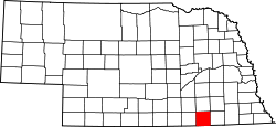
1377:
1374:
1371:
1369:
1368:
1364:
1363:
1359:
1356:
1353:
1350:
1348:
1345:
1342:
1340:
1339:
1335:
1334:
1330:
1327:
1324:
1321:
1319:
1316:
1313:
1311:
1310:
1306:
1305:
1301:
1298:
1295:
1292:
1290:
1287:
1284:
1282:
1281:
1277:
1276:
1272:
1269:
1266:
1263:
1261:
1258:
1255:
1253:
1252:
1248:
1247:
1243:
1240:
1237:
1234:
1232:
1229:
1226:
1224:
1223:
1219:
1218:
1214:
1211:
1208:
1205:
1203:
1200:
1197:
1195:
1194:
1190:
1189:
1185:
1182:
1179:
1176:
1174:
1171:
1168:
1166:
1165:
1161:
1160:
1156:
1153:
1150:
1147:
1145:
1142:
1139:
1137:
1136:
1132:
1131:
1127:
1124:
1121:
1118:
1116:
1113:
1110:
1108:
1107:
1103:
1102:
1098:
1095:
1092:
1089:
1087:
1084:
1081:
1079:
1078:
1074:
1073:
1069:
1066:
1063:
1060:
1058:
1055:
1052:
1050:
1049:
1045:
1044:
1040:
1037:
1034:
1031:
1029:
1026:
1023:
1021:
1020:
1016:
1015:
1011:
1008:
1005:
1002:
1000:
997:
994:
992:
991:
987:
986:
967:
966:
963:
958:
953:
946:
940:
934:
930:
927:
925:
922:
920:
917:
915:
912:
910:
907:
905:
902:
900:
897:
895:
892:
890:
887:
886:
882:
878:(county seat)
877:
874:
872:
869:
868:
864:
859:
857:
855:
851:
846:
842:
839:
834:
833:of any race.
832:
828:
824:
821:, 0.33% from
820:
816:
812:
808:
804:
800:
796:
786:
782:
773:
769:
767:
764:
760:
756:
754:
751:
749:
745:
741:
739:
736:
734:
730:
726:
724:
721:
719:
715:
711:
709:
706:
704:
700:
696:
694:
691:
689:
685:
681:
679:
676:
674:
670:
666:
664:
661:
659:
655:
651:
649:
646:
644:
640:
636:
634:
631:
629:
625:
621:
619:
616:
614:
610:
606:
604:
601:
599:
595:
591:
589:
586:
584:
580:
576:
574:
571:
569:
565:
561:
559:
556:
554:
550:
546:
544:
541:
539:
535:
515:
506:
501:
498:
497:
493:
487:
484:
481:
478:
475:
472:
469:
466:
463:
460:
457:
456:Saline County
454:
453:
448:
443:
439:
435:
433:
429:
425:
423:
419:
415:
413:
409:
405:
403:
399:
395:
393:
389:
385:
384:
379:
377:
374:
372:
364:
362:
360:
355:
353:
349:
345:
341:
337:
333:
329:
325:
324:Thayer County
317:
314:
307:
304:
301:
293:
290:
283:
280:
278:
270:
266:
263:
259:
249:
245:
242:
240:
232:
224:
211:
203:
195:
187:
179:
166:
159:
156:
154:
147:
144:
142:
134:
127:
116:
114:
106:
105:United States
94:
83:
64:
55:
50:
46:Thayer County
43:
37:
33:
19:
18:Thayer County
3569:
3551:
3500:
3471:Scotts Bluff
3038:North Platte
2998:Grand Island
2862:Homelessness
2837:Demographics
2699:
2499:
2478:
2395:
2306:
2290:
2278:. Retrieved
2268:
2256:. Retrieved
2246:
2234:. Retrieved
2224:
2214:December 12,
2212:. Retrieved
2192:
2182:December 12,
2180:. Retrieved
2170:
2160:December 12,
2158:. Retrieved
2148:
2138:December 12,
2136:. Retrieved
2126:
2117:
2112:
2103:
2098:
2088:December 12,
2086:. Retrieved
2082:the original
2068:
2059:
2054:
2044:December 17,
2042:. Retrieved
2032:
2022:December 17,
2020:. Retrieved
2016:the original
2011:
2001:
1977:December 17,
1975:. Retrieved
1962:
1952:December 17,
1950:. Retrieved
1944:
1937:
1925:. Retrieved
1920:
1868:
1858:
1839:
1829:
1810:
1800:
1787:
1771:
1752:
1742:
1723:
1713:
1694:
1684:
1665:
1655:
1642:
1626:
1613:
1597:
1578:
1568:
1549:
1539:
1520:
1510:
1491:
1481:
1462:
1452:
1433:
1423:
1410:
1394:
1375:
1365:
1346:
1336:
1317:
1307:
1288:
1278:
1259:
1249:
1230:
1220:
1201:
1191:
1172:
1162:
1143:
1133:
1114:
1104:
1085:
1075:
1056:
1046:
1027:
1017:
998:
988:
938:
854:poverty line
847:
843:
835:
792:
507:Demographics
375:
368:
356:
338:. As of the
323:
322:
164:Largest city
36:
3591: /
3053:Scottsbluff
2867:LGBT rights
2744:Legislature
2605:Ghost towns
2495:County seat
2280:January 31,
1927:October 21,
860:Communities
823:other races
781:county seat
762:2021 (est.)
470:– southeast
458:– northeast
344:county seat
265:UTC−5
244:UTC−6
153:County seat
135:May 9, 1871
132:Established
3606:Categories
3521:Washington
3446:Richardson
3441:Red Willow
2930:Pine Ridge
2729:Government
2555:Alexandria
1921:Census.gov
1901:References
980:No.
974:No.
968:No.
957:Democratic
952:Republican
889:Alexandria
793:As of the
332:U.S. state
302:feature ID
217:Population
3376:McPherson
3351:Lancaster
3336:Keya Paha
3316:Jefferson
3296:Hitchcock
3111:Box Butte
3048:Papillion
3018:Lexington
2945:Siouxland
2940:Sandhills
2925:Panhandle
2852:Elections
2847:Education
2734:Governors
2724:Geography
2704:(capital)
2585:Davenport
2560:Belvidere
919:Davenport
894:Belvidere
365:Geography
277:Area code
239:Time zone
141:Named for
3511:Thurston
3481:Sheridan
3466:Saunders
3401:Nuckolls
3281:Hamilton
3256:Garfield
3236:Frontier
3231:Franklin
3226:Fillmore
3161:Cheyenne
3086:Antelope
3073:Counties
3013:La Vista
3003:Hastings
2983:Columbus
2978:Bellevue
2973:Beatrice
2968:Alliance
2872:Politics
2857:Gun laws
2817:Cannabis
2812:Abortion
2691:Nebraska
2623:Williams
2618:Stoddard
2575:Carleton
2547:Villages
2205:Archived
1987:cite web
1889:See also
935:Politics
909:Carleton
883:Villages
827:Hispanic
817:, 0.12%
813:, 0.28%
805:, 0.02%
336:Nebraska
126:Nebraska
3579:97°35′W
3576:40°11′N
3536:Wheeler
3531:Webster
3496:Stanton
3486:Sherman
3416:Perkins
3386:Morrill
3381:Merrick
3371:Madison
3356:Lincoln
3341:Kimball
3326:Kearney
3321:Johnson
3271:Greeley
3216:Douglas
3126:Buffalo
3033:Norfolk
3023:Lincoln
3008:Kearney
2988:Fremont
2920:Outback
2882:Regions
2842:Economy
2832:Culture
2805:Society
2791:Symbols
2776:History
2701:Lincoln
2595:Hubbell
2580:Chester
2565:Bruning
2520:Deshler
2258:June 7,
1876:44.93%
1853:11.23%
1847:26.29%
1818:48.75%
1795:33.34%
1781:21.37%
1760:45.73%
1731:23.76%
1708:15.43%
1702:31.84%
1673:37.80%
1636:32.33%
1607:42.91%
1586:34.79%
1557:31.63%
1528:42.61%
1499:24.08%
1470:30.19%
1441:32.62%
1404:48.13%
1383:29.73%
1354:30.07%
1325:39.14%
1296:25.37%
1267:26.64%
1238:39.75%
1215:32.11%
1209:27.10%
1186:11.98%
1180:31.21%
1151:27.31%
1122:26.55%
1093:32.34%
1064:27.38%
1035:18.55%
1006:20.88%
929:Hubbell
914:Chester
899:Bruning
871:Deshler
845:males.
488:– north
476:– south
357:In the
330:in the
312:Website
282:402/531
248:Central
92:Country
3516:Valley
3506:Thomas
3501:Thayer
3476:Seward
3456:Saline
3431:Platte
3426:Pierce
3421:Phelps
3411:Pawnee
3396:Nemaha
3311:Howard
3306:Hooker
3286:Harlan
3261:Gosper
3251:Garden
3241:Furnas
3196:Dawson
3186:Dakota
3181:Custer
3176:Cuming
3171:Colfax
3156:Cherry
3136:Butler
3101:Blaine
3096:Banner
3091:Arthur
3028:McCook
2993:Gering
2786:People
2711:Topics
2590:Gilead
2525:Hebron
2512:Cities
2502:Hebron
1882:0.98%
1873:1,516
1869:54.09%
1865:1,825
1840:62.48%
1836:1,930
1824:2.18%
1815:1,703
1811:49.07%
1807:1,714
1792:1,097
1788:45.29%
1784:1,490
1766:3.01%
1757:1,581
1753:51.26%
1749:1,772
1737:2.93%
1728:1,120
1724:73.31%
1720:3,456
1699:1,719
1695:52.73%
1691:2,847
1679:0.40%
1670:2,173
1666:61.80%
1662:3,552
1650:1.55%
1643:66.12%
1639:3,841
1633:1,878
1621:1.29%
1614:55.80%
1610:3,418
1604:2,628
1592:0.00%
1583:2,077
1579:65.21%
1575:3,893
1563:0.00%
1554:1,644
1550:68.37%
1546:3,554
1534:0.00%
1525:1,931
1521:57.39%
1517:2,601
1505:0.00%
1496:1,266
1492:75.92%
1488:3,992
1476:0.00%
1467:1,447
1463:69.81%
1459:3,346
1447:0.00%
1438:1,550
1434:67.38%
1430:3,202
1418:0.00%
1411:51.87%
1407:2,298
1401:2,132
1389:4.96%
1380:1,061
1376:65.31%
1372:2,331
1360:0.00%
1347:69.93%
1343:2,274
1331:1.52%
1322:1,315
1318:59.35%
1314:1,994
1302:5.75%
1289:68.88%
1285:2,514
1273:0.70%
1260:72.66%
1256:2,580
1244:0.69%
1235:1,322
1231:59.56%
1227:1,981
1212:1,095
1202:40.79%
1198:1,391
1173:56.81%
1169:1,698
1157:2.96%
1144:69.73%
1140:2,096
1128:1.36%
1115:72.10%
1111:2,075
1099:1.88%
1086:65.78%
1082:1,749
1070:2.14%
1057:70.48%
1053:1,874
1041:5.20%
1028:76.25%
1024:2,051
1012:1.91%
999:77.22%
995:2,308
924:Gilead
876:Hebron
865:Cities
831:Latino
785:Hebron
742:−13.7%
712:−12.5%
682:−14.7%
667:−13.7%
652:−13.9%
647:10,563
637:−10.4%
632:12,262
617:13,684
602:13,976
587:14,775
572:14,325
562:108.4%
557:12,738
517:Census
482:– west
464:– east
371:Kansas
348:Hebron
328:county
306:835906
167:Hebron
158:Hebron
123:
102:
54:County
3526:Wayne
3491:Sioux
3461:Sarpy
3391:Nance
3361:Logan
3331:Keith
3291:Hayes
3266:Grant
3221:Dundy
3211:Dodge
3206:Dixon
3201:Deuel
3191:Dawes
3151:Chase
3146:Cedar
3121:Brown
3106:Boone
3081:Adams
3043:Omaha
2827:Crime
2781:Music
2719:Index
2687:State
2613:Kiowa
2570:Byron
2208:(PDF)
2201:(PDF)
1971:(PDF)
948:Year
904:Byron
819:Asian
807:Black
803:White
770:−2.4%
765:4,913
757:−3.7%
752:5,034
737:5,228
727:−8.7%
722:6,055
707:6,635
697:−2.5%
692:7,582
677:7,779
662:9,118
622:−2.1%
607:−5.4%
577:12.5%
542:6,113
326:is a
294:31169
225:4,913
113:State
3541:York
3451:Rock
3436:Polk
3406:Otoe
3366:Loup
3346:Knox
3301:Holt
3276:Hall
3246:Gage
3166:Clay
3141:Cass
3131:Burt
3116:Boyd
3063:York
2282:2008
2260:2011
2238:2013
2216:2014
2184:2014
2162:2014
2140:2014
2090:2014
2046:2014
2024:2014
1993:link
1979:2014
1954:2014
1929:2022
1860:1900
1850:347
1844:812
1831:1904
1802:1908
1778:703
1773:1912
1763:104
1744:1916
1734:138
1715:1920
1705:833
1686:1924
1657:1928
1628:1932
1599:1936
1570:1940
1541:1944
1512:1948
1483:1952
1454:1956
1425:1960
1396:1964
1386:177
1367:1968
1351:978
1338:1972
1309:1976
1299:210
1293:926
1280:1980
1264:946
1251:1984
1222:1988
1206:924
1193:1992
1183:358
1177:933
1164:1996
1148:821
1135:2000
1119:764
1106:2004
1090:860
1077:2008
1061:728
1048:2012
1038:140
1032:499
1019:2016
1003:624
990:2020
748:2020
733:2010
718:2000
703:1990
688:1980
673:1970
658:1960
643:1950
628:1940
613:1930
598:1920
592:3.1%
583:1910
568:1900
553:1890
538:1880
526:Note
521:Pop.
300:GNIS
291:code
289:FIPS
172:Area
2689:of
1879:33
1821:76
1676:23
1647:90
1618:79
1328:51
1270:25
1241:23
1154:89
1125:39
1096:50
1067:57
1009:57
829:or
809:or
783:is
346:is
334:of
269:CDT
258:DST
3608::
2498::
2483:,
2076:.
2010:.
1989:}}
1985:{{
1919:.
1908:^
1589:0
1560:0
1531:0
1502:0
1473:0
1444:0
1415:0
1357:0
983:%
531:%±
354:.
2679:e
2672:t
2665:v
2470:e
2463:t
2456:v
2339:e
2332:t
2325:v
2284:.
2262:.
2240:.
2218:.
2186:.
2164:.
2142:.
2092:.
2048:.
2026:.
1995:)
1981:.
1956:.
1931:.
977:%
971:%
787:.
547:—
271:)
267:(
260:)
250:)
246:(
34:.
20:)
Text is available under the Creative Commons Attribution-ShareAlike License. Additional terms may apply.