310:
108:
941:
92:
799:
77:
67:
52:
788:
777:
652:
515:
889:
115:
309:
813:
Tomiya has two mascots, Buruberi Musume (ブルベリッ娘, lit: Blueberry Girl) and
Burupiyo (ブルピヨ). The characters where created in 2016, alongside the city's founding. Buruberi Musume is a girl and Burupiyos gender is unknown. Tomiya makes a lot of merchandise of the mascots, including stickers on the
752:
Tomiya has eight public elementary schools and five public middle schools operated by the city government, and one public high school operated by the Miyagi
Prefectural Board of Education. The prefectural also operations one special education school for the handicapped.
405:). The average annual temperature in Tomiya is 12.1 °C. The average annual rainfall is 1251 mm with September as the wettest month. The temperatures are highest on average in August, at around 24.8 °C, and lowest in January, at around 0.6 °C.
720:
city legislature of 20 members. Tomita, together with
Kurokawa District collectively contributes two seats to the Miyagi Prefectural legislature. In terms of national politics, the city is part of
51:
107:
1311:
940:
91:
740:
Tomiya has a mixed economy with five industrial parks, but is also noted for its production of blueberries and bean sprouts. The city is also a
638:
establishment of the modern municipalities system. It was raised to town status on April 1, 1963 and raised to city status on
October 10, 2016.
139:
1306:
1282:
725:
699:
562:
930:
399:
673:
536:
677:
540:
357:
of 1,100 persons per km in 19,535 households. The total area of the city is 49.18 square kilometres (18.99 sq mi).
76:
908:
662:
525:
1191:
681:
666:
544:
529:
1147:
958:
893:
1215:
183:
171:
1242:
66:
1301:
1259:
1203:
1130:
1005:
802:
1135:
1113:
365:
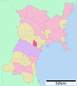
Tomiya is located in central Miyagi
Prefecture, bordered by the Sendai metropolitan area to the south.
1101:
923:
780:
195:
995:
721:
250:
624:
1174:
1000:
791:
616:
354:
1230:
413:
Per
Japanese census data, the population of Tomiya has expanded rapidly over the past 50 years.
1070:
1025:
944:
741:
635:
592:
342:
200:
1269:
1220:
1162:
1152:
1106:
1060:
1050:
990:
188:
1235:
1208:
1169:
1123:
985:
916:
815:
338:
56:
Left: Okameyama
Shinrin Park; Right: View from Symphony Tower, Uchigasaki Shozo, Kame Sugi
42:
580:
1264:
1247:
1225:
1140:
1055:
1040:
977:
596:
576:
1295:
1196:
1157:
859:
729:
713:
608:
382:
271:
1184:
1118:
1080:
588:
848:
651:
514:
1030:
717:
612:
350:
154:
141:
1045:
604:
398:
The city has a climate characterized by cool summers and long cold winters (
241:
1075:
871:
888:
1065:
1035:
620:
600:
1252:
968:
953:
584:
377:
246:
900:
299:
834:
346:
308:
176:
634:
The village of Tomiya was created on April 1, 1889 with the post-
1179:
430:
387:
261:
912:
645:
628:
508:
425:
349:. As of 31 May 2020, the city had an estimated
716:
form of government with a directly elected mayor and a
289:
30 Tomiyasaka
Matsuda, Tomiya-shi, Miyagi-ken 981-3392
766:
Tomiya does not have any passenger railway service.
603:
clans before the area came under the control of the
1094:
1018:
976:
967:
575:The area of present-day Tomiya was part of ancient
293:
285:
277:
267:
257:
240:
232:
224:
219:
211:
206:
194:
182:
170:
24:
328:
322:
30:
924:
8:
416:
680:. Unsourced material may be challenged and
543:. Unsourced material may be challenged and
973:
931:
917:
909:
744:for the neighboring metropolis of Sendai.
579:, and has been settled since at least the
415:
21:
700:Learn how and when to remove this message
563:Learn how and when to remove this message
827:
292:
276:
239:
218:
205:
169:
134:
100:
96:Location of Tomiya in Miyagi Prefecture
88:
60:
48:
794:– Tomiya Junction – Tomiya Interchange
619:. During the Edo period, Tomiya was a
284:
266:
256:
231:
223:
215:49.18 km (18.99 sq mi)
210:
193:
181:
7:
1312:Populated places established in 2016
1283:List of mergers in Miyagi Prefecture
678:adding citations to reliable sources
599:, the area was contested by various
587:people. During later portion of the
541:adding citations to reliable sources
14:
939:
887:
797:
786:
775:
650:
513:
113:
106:
90:
75:
65:
50:
16:City in Miyagi Prefecture, Japan
835:Tomita city official statistics
114:
1:
400:Köppen climate classification
860:Tomita population statistics
591:, the area was ruled by the
1307:Cities in Miyagi Prefecture
329:
236:1,100/km (2,800/sq mi)
1328:
369:Neighboring municipalities
1280:
951:
443:—
323:
135:
101:
89:
61:
49:
40:
31:
28:
814:Japanese social media
314:
896:at Wikimedia Commons
803:National Route 4
631:with northern Japan.
417:Historical population
312:
19:City in Tōhoku, Japan
674:improve this section
537:improve this section
233: • Density
849:Tomiya climate data
722:Miyagi 4th district
627:highway connecting
418:
341:located in central
251:Japan Standard Time
151: /
1192:Motoyoshi District
792:Sendai-Hokubu Road
617:Tokugawa shogunate
373:Miyagi Prefecture
355:population density
315:
225: • Total
212: • Total
155:38.400°N 140.883°E
1289:
1288:
1148:Kurokawa District
1026:Higashimatsushima
1014:
1013:
962:
945:Miyagi Prefecture
892:Media related to
783:– Tomiya Junction
781:Tōhoku Expressway
742:bedroom community
710:
709:
702:
636:Meiji restoration
593:Northern Fujiwara
573:
572:
565:
502:
501:
353:of 52,433, and a
343:Miyagi Prefecture
307:
306:
278:Phone number
1319:
1216:Shibata District
974:
956:
943:
933:
926:
919:
910:
905:
901:Official Website
891:
876:
875:
868:
862:
857:
851:
846:
840:
839:
832:
801:
800:
790:
789:
779:
778:
705:
698:
694:
691:
685:
654:
646:
568:
561:
557:
554:
548:
517:
509:
432:
427:
419:
336:
335:
332:
326:
325:
313:Tomiya City Hall
303:
302:
300:Official website
166:
165:
163:
162:
161:
156:
152:
149:
148:
147:
144:
117:
116:
110:
94:
79:
69:
54:
35:
34:
33:
22:
1327:
1326:
1322:
1321:
1320:
1318:
1317:
1316:
1292:
1291:
1290:
1285:
1276:
1260:Watari District
1204:Oshika District
1170:Miyagi District
1090:
1010:
963:
947:
937:
903:
885:
880:
879:
870:
869:
865:
858:
854:
847:
843:
837:
833:
829:
824:
811:
798:
787:
776:
772:
764:
759:
750:
738:
706:
695:
689:
686:
671:
655:
644:
569:
558:
552:
549:
534:
518:
507:
411:
396:
371:
363:
333:
320:
298:
297:
160:38.400; 140.883
159:
157:
153:
150:
145:
142:
140:
138:
137:
131:
130:
129:
128:
125:
124:
123:
122:
118:
97:
85:
84:
83:
82:
73:
72:
57:
45:
36:
29:
27:
20:
17:
12:
11:
5:
1325:
1323:
1315:
1314:
1309:
1304:
1302:Tomiya, Miyagi
1294:
1293:
1287:
1286:
1281:
1278:
1277:
1275:
1274:
1273:
1272:
1267:
1257:
1256:
1255:
1250:
1240:
1239:
1238:
1233:
1228:
1223:
1213:
1212:
1211:
1201:
1200:
1199:
1189:
1188:
1187:
1182:
1177:
1167:
1166:
1165:
1160:
1155:
1145:
1144:
1143:
1138:
1131:Katta District
1128:
1127:
1126:
1121:
1111:
1110:
1109:
1098:
1096:
1092:
1091:
1089:
1088:
1083:
1078:
1073:
1068:
1063:
1058:
1053:
1048:
1043:
1038:
1033:
1028:
1022:
1020:
1016:
1015:
1012:
1011:
1009:
1008:
1003:
998:
993:
988:
982:
980:
971:
965:
964:
952:
949:
948:
938:
936:
935:
928:
921:
913:
907:
906:
894:Tomiya, Miyagi
884:
883:External links
881:
878:
877:
863:
852:
841:
826:
825:
823:
820:
810:
807:
806:
805:
795:
784:
771:
768:
763:
760:
758:
757:Transportation
755:
749:
746:
737:
734:
708:
707:
658:
656:
649:
643:
640:
597:Sengoku period
577:Mutsu Province
571:
570:
521:
519:
512:
506:
503:
500:
499:
496:
493:
489:
488:
485:
482:
478:
477:
474:
471:
467:
466:
463:
460:
456:
455:
452:
449:
445:
444:
441:
438:
434:
433:
428:
423:
410:
407:
395:
392:
391:
390:
385:
380:
370:
367:
362:
359:
305:
304:
295:
291:
290:
287:
283:
282:
279:
275:
274:
269:
265:
264:
259:
255:
254:
244:
238:
237:
234:
230:
229:
226:
222:
221:
217:
216:
213:
209:
208:
204:
203:
198:
192:
191:
186:
180:
179:
174:
168:
167:
133:
132:
126:
120:
119:
112:
111:
105:
104:
103:
102:
99:
98:
95:
87:
86:
80:
74:
70:
64:
63:
62:
59:
58:
55:
47:
46:
41:
38:
37:
25:
18:
15:
13:
10:
9:
6:
4:
3:
2:
1324:
1313:
1310:
1308:
1305:
1303:
1300:
1299:
1297:
1284:
1279:
1271:
1268:
1266:
1263:
1262:
1261:
1258:
1254:
1251:
1249:
1246:
1245:
1244:
1243:Tōda District
1241:
1237:
1234:
1232:
1229:
1227:
1224:
1222:
1219:
1218:
1217:
1214:
1210:
1207:
1206:
1205:
1202:
1198:
1197:Minamisanriku
1195:
1194:
1193:
1190:
1186:
1183:
1181:
1178:
1176:
1173:
1172:
1171:
1168:
1164:
1161:
1159:
1156:
1154:
1151:
1150:
1149:
1146:
1142:
1139:
1137:
1136:Shichikashuku
1134:
1133:
1132:
1129:
1125:
1122:
1120:
1117:
1116:
1115:
1114:Kami District
1112:
1108:
1105:
1104:
1103:
1100:
1099:
1097:
1093:
1087:
1084:
1082:
1079:
1077:
1074:
1072:
1069:
1067:
1064:
1062:
1059:
1057:
1054:
1052:
1049:
1047:
1044:
1042:
1039:
1037:
1034:
1032:
1029:
1027:
1024:
1023:
1021:
1017:
1007:
1004:
1002:
999:
997:
994:
992:
989:
987:
984:
983:
981:
979:
975:
972:
970:
966:
960:
955:
950:
946:
942:
934:
929:
927:
922:
920:
915:
914:
911:
904:(in Japanese)
902:
899:
898:
897:
895:
890:
882:
873:
867:
864:
861:
856:
853:
850:
845:
842:
838:(in Japanese)
836:
831:
828:
821:
819:
817:
808:
804:
796:
793:
785:
782:
774:
773:
769:
767:
761:
756:
754:
747:
745:
743:
735:
733:
731:
730:Diet of Japan
727:
723:
719:
715:
714:mayor-council
712:Tomita has a
704:
701:
693:
683:
679:
675:
669:
668:
664:
659:This section
657:
653:
648:
647:
641:
639:
637:
632:
630:
626:
622:
618:
614:
610:
609:Sendai Domain
606:
602:
598:
595:. During the
594:
590:
586:
582:
578:
567:
564:
556:
546:
542:
538:
532:
531:
527:
522:This section
520:
516:
511:
510:
504:
497:
494:
491:
490:
486:
483:
480:
479:
475:
472:
469:
468:
464:
461:
458:
457:
453:
450:
447:
446:
442:
439:
436:
435:
429:
424:
421:
420:
414:
408:
406:
404:
401:
393:
389:
386:
384:
381:
379:
376:
375:
374:
368:
366:
360:
358:
356:
352:
348:
344:
340:
331:
319:
311:
301:
296:
288:
280:
273:
272:Chrysanthemum
270:
263:
260:
252:
248:
245:
243:
235:
227:
214:
202:
199:
197:
190:
187:
185:
178:
175:
173:
164:
136:Coordinates:
109:
93:
78:
68:
53:
44:
39:
23:
1185:Shichigahama
1102:Igu District
1085:
886:
866:
855:
844:
830:
812:
765:
751:
739:
711:
696:
687:
672:Please help
660:
633:
615:, under the
589:Heian period
581:Jōmon period
574:
559:
550:
535:Please help
523:
412:
409:Demographics
402:
397:
372:
364:
317:
316:
281:022-345-1111
1006:Wakabayashi
872:"富谷市ホームページ"
726:lower house
690:August 2024
611:during the
553:August 2024
158: /
1296:Categories
1175:Matsushima
1031:Ishinomaki
822:References
718:unicameral
642:Government
625:Ōshū Kaidō
613:Edo period
351:population
330:Tomiya-shi
220:Population
196:Prefecture
1095:Districts
1071:Shiroishi
1046:Kesennuma
748:Education
661:does not
621:post town
605:Date clan
524:does not
361:Geography
242:Time zone
1270:Yamamoto
1221:Kawasaki
1107:Marumori
1066:Shiogama
1051:Kurihara
996:Miyagino
268:- Flower
146:140°53′E
1236:Shibata
1231:Ōgawara
1209:Onagawa
1124:Shikama
1036:Iwanuma
1001:Taihaku
959:capital
809:Mascots
770:Highway
762:Railway
736:Economy
728:of the
724:of the
682:removed
667:sources
623:on the
601:samurai
583:by the
545:removed
530:sources
505:History
454:+183.6%
394:Climate
294:Website
286:Address
172:Country
143:38°24′N
1265:Watari
1253:Wakuya
1248:Misato
1226:Murata
1086:Tomiya
1076:Tagajō
1056:Natori
1041:Kakuda
1019:Cities
969:Sendai
954:Sendai
585:Emishi
495:51,651
487:+31.0%
484:47,042
476:+45.9%
473:35,909
465:+76.7%
462:24,611
451:13,930
378:Sendai
318:Tomiya
258:- Tree
228:52,433
201:Miyagi
189:Tōhoku
184:Region
127:
121:Tomiya
26:Tomiya
1163:Ōhira
1158:Taiwa
1153:Ōsato
1061:Ōsaki
991:Izumi
978:Wards
498:+9.8%
492:2020
481:2010
470:2000
459:1990
448:1980
440:4,912
437:1970
383:Taiwa
347:Japan
337:is a
247:UTC+9
177:Japan
1180:Rifu
1119:Kami
1081:Tome
986:Aoba
816:LINE
665:any
663:cite
528:any
526:cite
426:Pop.
422:Year
388:Rifu
339:city
262:Pine
207:Area
81:Seal
71:Flag
43:City
1141:Zaō
676:by
629:Edo
607:of
539:by
403:Cfa
324:富谷市
32:富谷市
1298::
818:.
732:.
431:±%
345:,
327:,
961:)
957:(
932:e
925:t
918:v
874:.
703:)
697:(
692:)
688:(
684:.
670:.
566:)
560:(
555:)
551:(
547:.
533:.
334:)
321:(
253:)
249:(
Text is available under the Creative Commons Attribution-ShareAlike License. Additional terms may apply.