692:. Opened in 1959, this bridge is 1,020 m (3,348 ft) long, with a main span of 243.8 m, rising 43.27 m above high water. It forms part of the Northern Motorway and is the critical link between the North Shore and central Auckland. The bridge was extended in 1969 by constructing cantilevered 'clip-on' lanes at both outer sides of the original construction, giving it 8 lanes in total (from 4 lanes before). As this eventually was still not enough to manage growing traffic loads, a traffic management solution involving a movable barrier was installed, giving it 5 lanes per dominant direction depending on the time of day.
980:
323:
833:
1179:
1292:
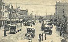
203:, opened on 24 November 1902. As the system grew, it facilitated the expansion of Auckland's built-up area in two ways: in an intermittent linear pattern to the west and south along the railway line, and in a more continuous manner along the main routes. The demand for more living space from people who had been confined to the crowded downtown area coupled with an affordable and reliable transport network led to the creation of many of Auckland's original
161:
841:
3294:
1363:. These upgrades aimed to improve the ability of pedestrians, cyclists and (slow-speed) motor vehicles to share the same transport spaces. Elliott Street, Darby Street, Lorne Street, Fort Street, Jean Batten Place, and Fort Lane have been converted into shared spaces since 2011. The portion of Federal Street between
1342:
have developed a ten-year investment programme for cycling in
Auckland that focuses on rolling out high quality cycling infrastructure to different parts of the city. AT partners with community organisations to operate 10 'Bike Hubs' in the city to repair, refurbish and sell bikes as well as provide
792:
Providing new roading connections in
Auckland, or widening existing corridors, is becoming increasingly difficult and expensive. This means that most new roading projects are likely to be located in greenfield growth areas at the periphery of the Auckland urban area. Major roading projects currently
60:
was high until the 1950s but subsequently declined during the second half of the 20th century, before experiencing a strong resurgence from the early 2000s. With the motorway network now largely completed, major efforts are underway to increase public transport use to address
Auckland's congestion.
255:
The number of cars in New
Zealand skyrocketed from 69,521 in 1925 (when registration was first established) to 194,217 in 1938. This growing popularity meant that urban development could break free from the constraints of transport networks and occur anywhere roads were built. This led to a rapid
263:
The tram system was dismantled in the 1950s and subsequent efforts to improve the rail network were not implemented. Meanwhile, a substantial motorway network was developed that facilitated urban growth to the north, northwest and south. These decisions led to
Auckland becoming a highly car
242:
on the North Shore. Auckland's urban development in the early twentieth century is intrinsically linked to its transport networks, and because of their limited reach the city developed in a fairly compact manner to maximise the efficiency of the tram, railway and ferry systems. However, this
175:
cities, with lack of transportation options limiting development to locations within walking distance of each other. The overcrowding of the inner city eventually created a demand for expansion made viable when new transportation technology appeared around 1900 in the form of
260:, in the 30 years after World War II. In an effort to compete with increasingly popular suburban shopping malls, parking lots and later parking buildings were built in the city centre. The first municipal parking building (Britomart Place) was completed in 1958.
309:, an Australian academic who had advocated for greater public transport adoption said Auckland had "the most unbalanced transport policies of just about in the world" alongside other academics who believed the city had underinvested in public transportation.
1351:
All travel begins and ends with a walking trip, even though a relatively small proportion of "journeys to work" are made primarily by walking or jogging. At the 2013 census 4.5% of
Aucklanders walked or jogged to work, up from 3.9% in 2001.
783:. This increased the importance of this bridge and both state highways, and relieved pressure on the Auckland Harbour Bridge and the central motorway system by providing an alternative route for north–south traffic not bound for the city.
1223:, to the northwest of the Auckland conurbation. The proposals became a political issue, partly resolved by the election of an anti-airport mayor in North Shore City, and finally resolved by the amalgamation of all Auckland councils into
1333:
These improvements have already led to growth in the uptake of cycling. The northwest cycleway, which links with a number of projects delivered in recent years, saw its usage increase by 44% as a result of these improvements.
724:
all converge in central
Auckland in a motorway junction (known locally as Spaghetti Junction due to its complexity). A series of upgrades were completed in 2007 to complete links between all motorways and improve access to
1053:
in
Auckland's city centre, is New Zealand's largest and busiest container port. The 55 hectares of wharves and storage areas (mostly for containers, cars and other large shipments) are almost exclusively situated on
739:. This 440 metre long tunnel carries three lanes of northbound traffic on the Northern Motorway heading towards the Auckland Harbour Bridge. The tunnel was completed in 2012, alleviating a major bottleneck on the
932:
on behalf of AT under the AT brand. Since the early 2000s, there has been a substantial increase in services, with trains now operating every 10 minutes on the
Western, Southern and Eastern lines at peak times.
1726:
539:. These roads generally have a speed limit of 50 km/h in urban areas and serve a wide variety of functions, providing for the movement of people, goods and services as well as public transport services,
365:) are classified as state highways and are owned and operated by the New Zealand Transport Agency. These routes range from multi-lane arterial roads with over 50,000 vehicles a day to unsealed rural roads.
936:
Starting with the opening of
Waitematā station in 2003, a series of investments has increased ridership to over 20 million annual boardings. These included double-tracking the Western Line, reopening the
1440:
527:, which regulate the flow of traffic onto the motorway. While this causes delays and vehicle queues when getting onto the motorway, it produces smoother through flows on the motorway itself.
286:
In response to growing congestion, central and local government increased transport investment from around $ 500 million a year in 2000 to over $ 2 billion in 2015. This increased investment
1283:
has been vacated and is currently under redevelopment primarily as a residential area, although some light commercial and industrial uses (for example super-yacht building) are present.
305:
Despite these improvements, rapid population growth means that transport is still a major challenge for Auckland, with congestion costing the city around $ 1.3 billion a year. In 2009,
384:, between Penrose and Mt Wellington, that was opened in 1953. By 2017 there was over 220 km of motorways in Auckland, carrying over 900,000 trips per day on the following routes:
3069:
33:
character of much of the urban area, a history (since World War II) of focusing investment on roading projects rather than public transport, and high car-ownership rates.
994:
commuters who work in the Auckland CBD catch ferry services from Devonport, Stanley Bay, Bayswater, Beach Haven or Birkenhead. Services also connect the city with
3049:
1084:
highlighted that in the longer-term future the port will either need to expand in its current location or move to a different location, most likely either in the
757:. The original viaduct was opened in 1966 but was replaced with a completely new structure with higher earthquake standards and an extra southbound lane in 2012.
677:
To best balance their wide variety of different functions, at peak times some roads have bus or carpool lanes, while on-street parking is frequently restricted.
171:
As a port city, Auckland's initial (19th century) urban growth occurred in an intense fashion, concentrated around the harbour in a similar manner to most other
1371:
has also been made into a shared space. AT promotes 'Walking School Buses' to encourage children to walk to and from school in groups under adult supervision.
283:
Continued strong population growth, combined with cheaper car imports, led to growing traffic congestion across much of Auckland in the 1990s and early 2000s.
702:. The original two lane bridge, opened in the 1970s, was substantially upgraded in 2007 as part of the Greenhithe Deviation project. It now forms part of the
1679:
1816:
1437:
2006:
2521:
1623:
Presentation to joint conference of New Zealand Geographical Society / Australian Institute of Geographers conference, University of Otago, Dunedin
1933:
1896:
1230:
Most private flights and light aircraft operate from the three smaller General Aviation (GA) airfields at the edges of the Auckland conurbation;
2757:
3269:
3064:
1208:. A new runway is planned north of the main airport area, with a shorter length well suitable for the booming intra-New Zealand flight market.
1116:
With Auckland being the largest city of New Zealand, a great number of international and national flight connections exist. Main routes are to
2239:
2565:
2048:
380:
An extensive motorway network was planned for Auckland in the 1950s and 1960s. Auckland's first motorway was a 3.2 kilometre section of the
3084:
2864:
823:. This project has both a road and public transport component and is currently scheduled for construction in the late 2030s or early 2040s.
222:
Auckland first railway, to Onehunga, opened in 1873. Expansion of the railway network facilitated growth in more distant locations such as
685:
Key bridges, tunnels and interchanges are critical to the functioning of Auckland's road network. Major pieces of infrastructure include:
2352:
2327:
2023:
2995:
2456:
857:
Public transport in Auckland consists of bus, ferry and commuter rail services. The hub of Auckland's public transport network is the
56:
act as the backbone of the city's road network, with the busiest section of motorway carrying over 200,000 vehicles a day. The use of
2909:
2504:
2478:
1856:
1764:
968:
816:
806:
375:
1535:
1463:
3249:
3171:
2377:
1912:
1330:(the Lightpath) between 2015 and 2017. Overall, 52 kilometres of new cycleways is planned to be delivered between 2015 and 2018.
942:
295:
2886:
2835:
698:. This bridge in the northwest of Auckland is an important connection between west Auckland and the North Shore and carries the
3274:
1133:
1108:
regularly being used as cruise ship terminals, especially during summer months. Over 100 cruise ships annually visit Auckland.
247:
the car was becoming an integral part of life for many New Zealanders, opening up previously unreachable land for development.
3234:
2739:
3318:
3037:
1792:
1490:
1319:
945:
between Swanson in the west and Papakura in the south. On 20 July 2015 the rollout of electric train services was completed.
2309:
2782:
2169:
1273:
1253:
1231:
802:
637:
608:
392:
813:
and its coalition partners abandoning it, with other strategies being proposed to relieve pressure on the existing route.
1390:
858:
852:
845:
798:
776:
764:
488:
448:
57:
2658:
2403:
3244:
3224:
3194:
3119:
3074:
810:
621:
212:
760:
671:
Highbrook Drive, East Tamaki Road, Chapel Road, Great South Road, Harris Road, Mill Road, Redoubt Road, Mangere Road
508:
873:
Bus services, the bulk of public transport in the city, are provided by privately owned bus companies contracted to
3161:
1101:
750:
717:
713:
599:
474:
418:
388:
381:
347:
208:
53:
41:
3254:
3209:
3146:
2118:
1780:
1752:
882:
709:
430:
299:
192:
2609:
3129:
3032:
2543:
1395:
917:
890:
571:
478:
408:
3219:
112:, short traversable sections of land that connected the bodies of water. Some of the most major portages were
2808:
2281:
1590:
1562:
1508:
3279:
3042:
2705:
1318:
in the mid-2010s led to the development of higher quality cycling infrastructure in Auckland, including the
1105:
1019:
1003:
983:
953:
921:
913:
897:
820:
740:
689:
400:
361:(AT). Some arterial roads (mainly in rural areas but also state highways 20A and 20B that provide access to
239:
141:
129:
121:
113:
109:
2195:
3229:
2988:
2840:
2813:
2710:
2408:
2286:
2200:
2075:
2053:
1812:
1595:
1567:
1513:
1423:
1327:
1311:
1220:
1144:. However, smaller planes fly to almost all other cities and to many small airports all over New Zealand.
979:
832:
754:
699:
641:
587:
575:
563:
540:
492:
470:
354:. These routes have multiple lanes in each direction, speed limits of 80–100 km/h and limited access.
322:
231:
164:
805:
at Mount Wellington, primarily to reduce travel time for freight trucking. A change of government at the
2255:
1941:
1364:
1261:
1235:
721:
629:
444:
196:
45:
1930:
523:
functions and are used for short-distance trips. Access to the motorway network is controlled through r
3184:
3020:
2955:
1808:
1368:
1248:
near the city centre, was the first international airport, and was used for many years as a base for
1168:
1050:
1023:
1007:
772:
736:
695:
645:
482:
93:
3264:
3239:
3141:
3027:
3015:
2144:
2104:
1625:. Urban Planning Program, Faculty of Architecture, Building & Planning, University of Melbourne
1618:
1449:
1418:
1339:
1305:
1257:
1080:
In 2010 the Ports of Auckland contributed around $ 250 million per year to the Auckland economy. A
1010:
are less regular, with services every 1–2 days, depending on the time of the year and the weather.
862:
591:
579:
351:
1178:
219:, Mt Eden Road, Manukau Road and Remuera Road, forming a new arc of suburban development by 1915.
3189:
1696:
1335:
1265:
874:
780:
703:
500:
464:
396:
358:
287:
61:
Recent efforts have also focused on making cycling a safer and more attractive transport option.
49:
3079:
2583:
1980:
1645:
1291:
3297:
3204:
2981:
2667:
2235:
2205:
1852:
1788:
1760:
1688:
1385:
1323:
1239:
1046:
1035:
960:
929:
886:
746:
730:
426:
291:
160:
68:
2359:
971:. A service operates three times per week in each direction between Auckland and Wellington.
535:
Around 16% of Auckland's overall road network is classified as either a primary or secondary
473:(State Highway 18 between Westgate and Albany). This motorway is the main connection between
3199:
3102:
1722:
1704:
1438:
Backtracking Auckland: Bureaucratic rationality and public preferences in transport planning
1380:
1315:
1224:
1193:
1182:
1160:
1055:
1011:
991:
616:
512:
504:
460:
456:
412:
404:
362:
244:
200:
76:
72:
26:
952:
project, which will improve network capacity and significantly reduce travel times between
3134:
3054:
2941:
2662:
2431:
1954:
1937:
1494:
1444:
1205:
1197:
1089:
1085:
938:
768:
145:
97:
1873:
101:
36:
These factors have contributed to a transport system that is highly dependent on private
455:). This motorway is the main connection to the northwest part of Auckland, links to the
3156:
3151:
3124:
1891:
1076:
Multi-cargo facilities on Captain Cook, Marsden, Jellicoe, Wynyard and Freyberg wharves
1059:
1015:
995:
949:
840:
666:
567:
524:
438:
1751:
Paterson, Malcolm (2009). "Ko Ngā Kurī Purepure o Tāmaki, e Kore e Ngari i te Pō". In
3312:
3259:
3114:
1844:
1840:
1245:
1148:
1063:
925:
726:
653:
625:
536:
520:
335:
216:
137:
37:
1674:
117:
29:(with its harbours creating chokepoints and long distances for land transport), the
3107:
2378:"SH18 Hobsonville Deviation and SH16 Brigham Creek Extension | NZ Transport Agency"
1670:
1360:
1356:
1156:
1141:
999:
901:
900:
and its subsidiary Newmans, link Auckland with all the main centres throughout the
422:
257:
105:
3214:
1487:
819:. A proposed tunnel between the city centre and the North Shore to complement the
519:
Because of Auckland's geography and road network layout, many motorways also have
3179:
1280:
1152:
604:
22:
2680:
1497:(from the Travel Survey Highlights 1997–98, New Zealand Ministry of Transport)
1201:
1164:
1137:
583:
268:
177:
172:
125:
2209:
1692:
1355:
Efforts are being made to improve the attractiveness of walking. A number of
2964:
Harbour Cruises and trips to Tiritiri Matangi Island, Motuihe and Coromandel
2655:
1212:
1172:
1125:
1121:
1117:
658:
452:
331:
306:
272:
2630:
1708:
1147:
Historically, Auckland had first been served by flying boat services from
1081:
3004:
2783:"Journey to Work Patterns in the Auckland Region | Ministry of Transport"
1269:
1249:
1211:
There were proposals in the 2000–2007 period to redevelop the airport at
964:
878:
235:
227:
149:
92:
Throughout Auckland's pre-European period, its strategic location on the
64:
30:
1700:
1234:
south of the city which is NZ's busiest airfield in terms of movements,
330:
There are over 7,000 km of roads in the Auckland region made up of
2951:
2505:"Auckland Transport Alignment Project – Recommended Strategic Approach"
1619:"The American Heresy: Half a century of transport planning in Auckland"
1536:"Waterview Tunnel Opens, Motorway Network Completed – Greater Auckland"
633:
496:
434:
223:
204:
181:
2967:
607:
Road, Brigham Creek Road, Don Buck Road, Lincoln Road, Te Atatu Road,
2522:"New Government bins Auckland's East-West link, after PM meets Mayor"
1892:"Cars and the motor industry - A motorised society - Cars registered"
339:
133:
25:'s largest city, is defined by factors that include the shape of the
1163:
were replaced by land-based planes, the first airport was opened at
797:
East West Link. A proposed $ 1.85 billion four-lane highway linking
2024:"Traffic congestion costs Auckland's economy $ 1.3b a year: Report"
1448:– Mees, Paul; Dodson, Jago; Urban Research Program Issues Paper 5,
1509:"Standing room only as Aucklanders embrace a transport revolution"
1415:
Record number of roading projects on the go in Auckland in 2007/08
1290:
1216:
1177:
1129:
978:
839:
831:
321:
159:
2961:
1979:
Taonga, New Zealand Ministry for Culture and Heritage Te Manatu.
1295:
Typical example of pre-2015 on-street cycle lane. Mt Albert Road.
1136:. Within New Zealand, the main connections are to the capital in
1874:"Transport Timeline: key events in Auckland's transport history"
1464:"State highway frequently asked questions | NZ Transport Agency"
1227:
in 2010. The proposals had also been opposed by the government.
1100:
Auckland is an increasingly popular cruise ship port, with both
357:
Most arterial roads and local streets are owned and operated by
188:
2977:
2310:"Auckland Transport Alignment Project – Arterial Roads Report"
865:, opened July 2003, where ferry, bus and train services meet.
586:
Highway, Oteha Valley Road, Constellation Drive, Wairau Road,
298:
of the city's rail network, and supported construction of the
2170:"The transport plan that changed Auckland – Greater Auckland"
543:, on-street parking and access to businesses and residences.
256:
decentralisation of urban growth, today often referred to as
2947:
2937:
1026:
have services usually focused on weekend and tourist trips.
2973:
959:
Auckland has only one long-distance passenger service: the
71:(mostly used for international commerce) and the country's
2007:"Auckland Transport Alignment Project – Foundation Report"
421:(State Highway 1 between the Auckland city centre and the
2970:(a private website covering the Auckland motorway system)
896:
Frequent long-distance services, principally operated by
459:(thereby being the key route between the city centre and
912:
There are four suburban railway lines in Auckland – the
167:
in 1919, with trams, cars and horse-drawn taxis visible.
1675:"The Excavation of Westfield (R11/898), South Auckland"
943:
electrification of the entire Auckland suburban network
648:
Highway, Te Horeta Road, Neilson Street, Church Street
243:
situation was not to last for long, as even before the
326:
Auckland's downtown has a number of parking buildings.
2479:"Auckland's Waterview Tunnel open to traffic at last"
1849:
The Māori history and legends of the Waitākere Ranges
661:
Road, Ti Rakau Drive, Botany Road, Te Irirangi Drive
3170:
3095:
2944:
company is the main provider for commuter services.
2049:"Auckland one of most 'car-biased' cities in world"
1811:; The Trustees of Te Kawerau Iwi Settlement Trust;
749:. This 700 metre long motorway viaduct carries the
503:that bypasses central Auckland, provides access to
136:portage which connected the Manukau Harbour to the
2706:"Government won't back Whenuapai airport proposal"
2353:"The Auckland Harbour Bridge Authority: 1951–1961"
1488:Mode of Transport, Figure for New Zealand Regions
2432:"SH1 Victoria Park Tunnel | NZ Transport Agency"
1911:"Registration and Licensing of Motor-Vehicles".
1359:projects were planned in several streets in the
779:(the North-Western Motorway), and completed the
632:Road, St Lukes Road, Greenlane (East and West),
433:and is the main connection between Auckland and
403:and is the main connection between Auckland and
267:Auckland Airport moved to its current site near
144:in the north-west, connecting the Waitematā and
2631:"Port Future Study | Port Future Study reports"
1817:"Te Kawerau ā Maki Deed of Settlement Schedule"
100:harbours had important transport implications.
2989:
2566:"Rail tunnel Auckland's only option – report"
1196:, New Zealand's largest airport, lies beside
8:
1680:Records of the Auckland Institute and Museum
1617:Mees, Paul; Dodson, Jago (1 February 2001).
2887:"Auckland's side streets too 'car-centric'"
2836:"Auckland's side streets too 'car-centric'"
2610:"Economic Impacts of the Ports of Auckland"
1421:, article / public service announcement in
928:Lines. Urban rail services are operated by
499:). This motorway forms a large part of the
271:in 1966, having been previously located in
2996:
2982:
2974:
2809:"$ 43.4m bill to mix cars and pedestrians"
2256:"Auckland Motorways - Network Information"
1279:A Royal New Zealand Air Force facility at
1140:and to the main city of the South Island,
941:line, a programme of station upgrades and
2503:Ministry of Transport (September 2016).
2308:Ministry of Transport (September 2016).
1926:
1924:
545:
290:Auckland's motorway network, funded the
75:. It also has the Southern Hemisphere's
2005:Ministry of Transport (February 2016).
1897:Te Ara: The Encyclopedia of New Zealand
1407:
1310:Increased funding for cycling from the
407:, as well as the key route linking the
2544:"Auckland's trains going all-electric"
2404:"Spaghetti Junction comes to the boil"
2950:Formerly Subritzky, ferry service to
2733:
2731:
2729:
2656:Spectacular cruise ship season begins
2498:
2496:
2402:Dearnaley, Mathew (4 December 2006).
2280:Dearnaley, Mathew (4 December 2006).
2230:New Zealand Transport Agency (2008).
451:between the Auckland city centre and
395:between the Auckland city centre and
40:. Several motorways radiating to the
7:
2889:. Radio New Zealand. 17 January 2015
2738:Auckland Transport (1 August 2017).
2608:Market Economics (11 October 2011).
1931:History of Auckland City – Chapter 4
2807:Orsman, Bernard (19 January 2010).
1589:Orsman, Bernard (24 October 2008).
1167:, supplanting earlier airfields at
885:(opened in February 2008) provides
624:, Carrington Road, Mt Albert Road,
437:, as well as the key route linking
3070:Skyscrapers and tallest structures
2546:. Auckland Transport. 13 July 2015
2328:"Bus & transit priority lanes"
1851:. The Lodestar Press. p. 10.
1591:"Big steps to change City of Cars"
1563:"Welcome to our traffic nightmare"
1417:– Jackson, Bryan; Acting Chairman
116:, the shortest portage located at
14:
2740:"Cycling Programme Business Case"
2358:. 7 February 2007. Archived from
2282:"Motorway ramp lights turning on"
2076:"Solving Auckland's traffic mess"
1890:Pawson, Eric (15 December 2014).
1785:From Tamaki-makau-rau to Auckland
1646:"Cycling & walking programme"
969:The Great Journeys of New Zealand
590:Road, Onewa Road, Taharoto Road,
376:New Zealand State Highway network
108:(canoes) between the harbours at
3293:
3292:
2457:"Viaduct upgrade gets under way"
1759:. Random House. pp. 49–62.
1427:, Saturday 30 June 2007, Page C6
1073:Bledisloe multi-purpose terminal
1066:. The main port facilities are:
948:In 2015–16, work started on the
1944:website. Accessed 7 June 2008.)
2524:. Stuff.co.nz. 2 November 2017
2103:– McKinnon, Malcolm (Editor);
1914:New Zealand Official Year Book
1757:West: The History of Waitakere
1561:Savage, Jared (29 July 2007).
1507:Rudman, Brian (1 April 2011).
956:stations and the city centre.
767:over the Māngere Inlet of the
636:Road, Manukau Road, Broadway,
425:). This motorway includes the
399:). This motorway includes the
346:All motorways in Auckland are
1:
2681:"Contributing to New Zealand"
2196:"How Auckland missed the bus"
1787:. Auckland University Press.
1274:Auckland Marine Rescue Centre
793:planned or proposed include:
775:in July 2017 linked SH 20 to
73:largest international airport
2101:New Zealand Historical Atlas
1727:Whau Neighbourhood Greenways
1391:Public transport in Auckland
1340:New Zealand Transport Agency
1200:, in the southern suburb of
853:Public transport in Auckland
611:, Rata Street, Clark Street
352:New Zealand Transport Agency
350:, owned and operated by the
58:public transport in Auckland
1070:Ferguson container terminal
156:19th and early 20th century
3335:
2481:. Stuff.co.nz. 2 July 2017
2459:. Stuff.co.nz. 8 July 2009
1303:
1155:. As aircraft such as the
1033:
850:
578:Highway, East Coast Road,
491:(State Highway 20 between
441:with the Auckland isthmus.
373:
3288:
3011:
2670:website, 25 October 2006)
2635:www.portfuturestudy.co.nz
2260:www.aucklandmotorways.com
1955:"Rapid rail vs motorways"
1493:27 September 2007 at the
1204:. It is a major base for
859:Waitematā railway station
846:Waitematā railway station
710:Central Motorway Junction
431:Central Motorway junction
2119:"Asset Management Plans"
1396:Transport in New Zealand
1343:advice and information.
463:) and forms part of the
2661:14 October 2008 at the
1268:. The area now holds a
1058:, mostly in the former
1020:Tiritiri Matangi Island
984:Auckland Ferry Terminal
821:Auckland Harbour Bridge
817:Second Harbour Crossing
690:Auckland Harbour Bridge
401:Auckland Harbour Bridge
230:, while ferries served
69:largest commercial port
2841:The New Zealand Herald
2814:The New Zealand Herald
2711:The New Zealand Herald
2430:Agency, NZ Transport.
2409:The New Zealand Herald
2376:Agency, NZ Transport.
2287:The New Zealand Herald
2201:The New Zealand Herald
2054:The New Zealand Herald
1596:The New Zealand Herald
1568:The New Zealand Herald
1514:The New Zealand Herald
1462:Agency, NZ Transport.
1424:The New Zealand Herald
1320:Grafton Gully cycleway
1312:New Zealand Government
1296:
1185:
1082:2015 Port Future Study
1062:, Official Bay and in
987:
877:(AT) under the AT and
848:
837:
763:. This bridge carries
700:Upper Harbour Motorway
568:Hibiscus Coast Highway
471:Upper Harbour Motorway
327:
184:arriving in Auckland.
168:
3319:Transport in Auckland
3185:Aotea / Great Barrier
2962:360 Discovery Cruises
2908:Transport, Auckland.
2787:www.transport.govt.nz
2756:Transport, Auckland.
2685:Ports of Auckland Ltd
2617:Ports of Auckland Ltd
2588:Ports of Auckland Ltd
2326:Transport, Auckland.
2143:Transport, Auckland.
2117:Transport, Auckland.
1981:"Auckland congestion"
1942:Auckland City Council
1755:; Kerr, Ruth (eds.).
1644:Transport, Auckland.
1443:13 April 2008 at the
1365:Wellesley Street West
1294:
1236:North Shore Aerodrome
1181:
982:
967:under the brand name
843:
836:An AT bus in Auckland
835:
807:2017 general election
771:. The opening of the
722:Northwestern Motorway
489:Southwestern Motorway
445:Northwestern Motorway
429:, passes through the
325:
163:
148:harbours overland at
128:portage), as well as
19:Transport in Auckland
2910:"Walking School Bus"
1872:Auckland Transport.
1815:(22 February 2014).
1369:Victoria Street West
1324:Quay Street cycleway
1008:Great Barrier Island
773:Waterview Connection
737:Victoria Park Tunnel
696:Upper Harbour Bridge
554:Major arterial roads
531:Major arterial roads
483:Upper Harbour Bridge
215:, Sandringham Road,
3230:Maungakiekie-Tāmaki
2572:. 23 November 2012.
2365:on 7 February 2007.
1936:13 May 2008 at the
1450:Griffith University
1419:Transit New Zealand
1306:Cycling in Auckland
1287:Walking and cycling
1242:to the north west.
1041:Commercial shipping
863:Auckland waterfront
547:
88:Pre-European period
3190:Devonport-Takapuna
2968:Auckland Motorways
2914:Auckland Transport
2867:. Auckland Council
2865:"Council projects"
2762:Auckland Transport
2714:. 13 December 2004
2332:Auckland Transport
2232:Auckland motorways
2149:Auckland Transport
2123:Auckland Transport
1650:Auckland Transport
1336:Auckland Transport
1297:
1262:Tourist Air Travel
1186:
988:
875:Auckland Transport
849:
838:
781:Western Ring Route
704:Western Ring Route
681:Key infrastructure
560:Northern Auckland
546:
501:Western Ring Route
465:Western Ring Route
359:Auckland Transport
328:
169:
165:Lower Queen Street
140:in the south, and
67:has New Zealand's
3306:
3305:
3205:Hibiscus and Bays
3172:Local board areas
2845:. 17 January 2015
2668:Ports of Auckland
2241:978-0-478-10554-4
1845:Hayward, Bruce W.
1809:Te Kawerau ā Maki
1753:Macdonald, Finlay
1386:Ports of Auckland
1238:to the north and
1051:Waitematā Harbour
1049:, located on the
1047:Ports of Auckland
1036:Ports of Auckland
961:Northern Explorer
930:Auckland One Rail
887:bus rapid transit
801:at Onehunga with
751:Southern Motorway
747:Newmarket Viaduct
731:Ports of Auckland
718:Southern Motorway
714:Northern Motorway
675:
674:
564:Whangaparaoa Road
507:and includes the
427:Newmarket viaduct
419:Southern Motorway
389:Northern Motorway
382:Southern Motorway
288:largely completed
251:Late 20th century
187:Auckland's first
3326:
3296:
3295:
3270:Waitākere Ranges
3240:Ōtara-Papatoetoe
3200:Henderson-Massey
3142:Pōhutukawa Coast
3103:Auckland isthmus
2998:
2991:
2984:
2975:
2925:
2924:
2922:
2920:
2905:
2899:
2898:
2896:
2894:
2883:
2877:
2876:
2874:
2872:
2861:
2855:
2854:
2852:
2850:
2843:– nzherald.co.nz
2832:
2826:
2825:
2823:
2821:
2804:
2798:
2797:
2795:
2793:
2779:
2773:
2772:
2770:
2768:
2753:
2747:
2746:
2744:
2735:
2724:
2723:
2721:
2719:
2702:
2696:
2695:
2693:
2691:
2677:
2671:
2652:
2646:
2645:
2643:
2641:
2627:
2621:
2620:
2614:
2605:
2599:
2598:
2596:
2594:
2584:"Cargo Handling"
2580:
2574:
2573:
2562:
2556:
2555:
2553:
2551:
2540:
2534:
2533:
2531:
2529:
2518:
2512:
2511:
2509:
2500:
2491:
2490:
2488:
2486:
2475:
2469:
2468:
2466:
2464:
2453:
2447:
2446:
2444:
2442:
2427:
2421:
2420:
2418:
2416:
2399:
2393:
2392:
2390:
2388:
2382:www.nzta.govt.nz
2373:
2367:
2366:
2364:
2357:
2349:
2343:
2342:
2340:
2338:
2323:
2317:
2316:
2314:
2305:
2299:
2298:
2296:
2294:
2277:
2271:
2270:
2268:
2266:
2252:
2246:
2245:
2227:
2221:
2220:
2218:
2216:
2204:. 30 June 2000.
2192:
2186:
2185:
2183:
2181:
2174:Greater Auckland
2166:
2160:
2159:
2157:
2155:
2145:"Traffic counts"
2140:
2134:
2133:
2131:
2129:
2114:
2108:
2107:, 1997, Plate 75
2098:
2092:
2091:
2089:
2087:
2072:
2066:
2065:
2063:
2061:
2045:
2039:
2038:
2036:
2034:
2020:
2014:
2013:
2011:
2002:
1996:
1995:
1993:
1991:
1976:
1970:
1969:
1967:
1965:
1951:
1945:
1928:
1919:
1918:
1908:
1902:
1901:
1887:
1881:
1880:
1878:
1869:
1863:
1862:
1841:Diamond, John T.
1837:
1831:
1830:
1828:
1826:
1821:
1805:
1799:
1798:
1777:
1771:
1770:
1748:
1742:
1741:
1739:
1737:
1731:
1723:Whau Local Board
1719:
1713:
1712:
1667:
1661:
1660:
1658:
1656:
1641:
1635:
1634:
1632:
1630:
1614:
1608:
1607:
1605:
1603:
1586:
1580:
1579:
1577:
1575:
1558:
1552:
1551:
1549:
1547:
1540:Greater Auckland
1532:
1526:
1525:
1523:
1521:
1504:
1498:
1485:
1479:
1478:
1476:
1474:
1459:
1453:
1434:
1428:
1412:
1381:Auckland Airport
1316:Auckland Council
1240:Parakai Airfield
1225:Auckland Council
1194:Auckland Airport
1183:Auckland Airport
1161:Short Sunderland
828:Public transport
799:State Highway 20
777:State Highway 16
765:State Highway 20
638:Great South Road
617:Central Auckland
609:Great North Road
594:Road, Lake Road
548:
513:Waterview Tunnel
505:Auckland Airport
461:Auckland Airport
457:Waterview Tunnel
449:State Highway 16
413:Auckland isthmus
370:Motorway network
363:Auckland Airport
264:dependent city.
245:Second World War
209:Great North Road
201:Karangahape Road
130:Te Pai o Kaiwaka
27:Auckland isthmus
3334:
3333:
3329:
3328:
3327:
3325:
3324:
3323:
3309:
3308:
3307:
3302:
3284:
3220:Māngere-Ōtāhuhu
3166:
3135:East Coast Bays
3091:
3050:Historic places
3007:
3002:
2942:Fullers Ferries
2934:
2929:
2928:
2918:
2916:
2907:
2906:
2902:
2892:
2890:
2885:
2884:
2880:
2870:
2868:
2863:
2862:
2858:
2848:
2846:
2834:
2833:
2829:
2819:
2817:
2806:
2805:
2801:
2791:
2789:
2781:
2780:
2776:
2766:
2764:
2755:
2754:
2750:
2742:
2737:
2736:
2727:
2717:
2715:
2704:
2703:
2699:
2689:
2687:
2679:
2678:
2674:
2663:Wayback Machine
2653:
2649:
2639:
2637:
2629:
2628:
2624:
2612:
2607:
2606:
2602:
2592:
2590:
2582:
2581:
2577:
2564:
2563:
2559:
2549:
2547:
2542:
2541:
2537:
2527:
2525:
2520:
2519:
2515:
2507:
2502:
2501:
2494:
2484:
2482:
2477:
2476:
2472:
2462:
2460:
2455:
2454:
2450:
2440:
2438:
2429:
2428:
2424:
2414:
2412:
2401:
2400:
2396:
2386:
2384:
2375:
2374:
2370:
2362:
2355:
2351:
2350:
2346:
2336:
2334:
2325:
2324:
2320:
2312:
2307:
2306:
2302:
2292:
2290:
2279:
2278:
2274:
2264:
2262:
2254:
2253:
2249:
2242:
2229:
2228:
2224:
2214:
2212:
2194:
2193:
2189:
2179:
2177:
2176:. 1 August 2011
2168:
2167:
2163:
2153:
2151:
2142:
2141:
2137:
2127:
2125:
2116:
2115:
2111:
2099:
2095:
2085:
2083:
2082:. 31 March 2009
2074:
2073:
2069:
2059:
2057:
2047:
2046:
2042:
2032:
2030:
2022:
2021:
2017:
2009:
2004:
2003:
1999:
1989:
1987:
1978:
1977:
1973:
1963:
1961:
1953:
1952:
1948:
1938:Wayback Machine
1929:
1922:
1910:
1909:
1905:
1889:
1888:
1884:
1876:
1871:
1870:
1866:
1859:
1839:
1838:
1834:
1824:
1822:
1819:
1807:
1806:
1802:
1795:
1781:Stone, R. C. J.
1779:
1778:
1774:
1767:
1750:
1749:
1745:
1735:
1733:
1729:
1725:(August 2015).
1721:
1720:
1716:
1669:
1668:
1664:
1654:
1652:
1643:
1642:
1638:
1628:
1626:
1616:
1615:
1611:
1601:
1599:
1588:
1587:
1583:
1573:
1571:
1560:
1559:
1555:
1545:
1543:
1534:
1533:
1529:
1519:
1517:
1506:
1505:
1501:
1495:Wayback Machine
1486:
1482:
1472:
1470:
1461:
1460:
1456:
1445:Wayback Machine
1435:
1431:
1413:
1409:
1404:
1377:
1349:
1308:
1302:
1289:
1232:Ardmore Airport
1206:Air New Zealand
1198:Manukau Harbour
1191:
1114:
1098:
1090:Firth of Thames
1086:Manukau Harbour
1043:
1038:
1032:
977:
939:Onehunga Branch
910:
883:Northern Busway
871:
855:
830:
803:State Highway 1
790:
788:Future projects
769:Manukau Harbour
683:
533:
393:State Highway 1
378:
372:
320:
315:
300:Northern Busway
296:electrification
281:
253:
191:line, from the
158:
90:
85:
12:
11:
5:
3332:
3330:
3322:
3321:
3311:
3310:
3304:
3303:
3301:
3300:
3289:
3286:
3285:
3283:
3282:
3277:
3272:
3267:
3262:
3257:
3252:
3247:
3242:
3237:
3232:
3227:
3222:
3217:
3212:
3207:
3202:
3197:
3192:
3187:
3182:
3176:
3174:
3168:
3167:
3165:
3164:
3159:
3157:Waiheke Island
3154:
3152:South Auckland
3149:
3144:
3139:
3138:
3137:
3127:
3125:Hibiscus Coast
3122:
3117:
3112:
3111:
3110:
3099:
3097:
3093:
3092:
3090:
3089:
3088:
3087:
3077:
3072:
3067:
3062:
3057:
3052:
3047:
3046:
3045:
3043:Volcanic field
3035:
3030:
3025:
3024:
3023:
3012:
3009:
3008:
3003:
3001:
3000:
2993:
2986:
2978:
2972:
2971:
2965:
2959:
2945:
2933:
2932:External links
2930:
2927:
2926:
2900:
2878:
2856:
2827:
2799:
2774:
2748:
2725:
2697:
2672:
2647:
2622:
2600:
2575:
2557:
2535:
2513:
2492:
2470:
2448:
2422:
2394:
2368:
2344:
2318:
2300:
2272:
2247:
2240:
2222:
2187:
2161:
2135:
2109:
2093:
2067:
2040:
2015:
1997:
1971:
1959:City Rail Link
1946:
1920:
1903:
1882:
1864:
1857:
1832:
1800:
1793:
1772:
1765:
1743:
1714:
1662:
1636:
1609:
1581:
1553:
1527:
1499:
1480:
1454:
1429:
1406:
1405:
1403:
1400:
1399:
1398:
1393:
1388:
1383:
1376:
1373:
1348:
1345:
1328:Te Ara I Whiti
1301:
1298:
1288:
1285:
1190:
1187:
1113:
1110:
1097:
1094:
1078:
1077:
1074:
1071:
1060:Commercial Bay
1056:reclaimed land
1042:
1039:
1034:Main article:
1031:
1028:
1016:Motuihe Island
996:Waiheke Island
976:
975:Ferry services
973:
963:, operated by
950:City Rail Link
909:
906:
889:to Auckland's
870:
867:
851:Main article:
829:
826:
825:
824:
814:
789:
786:
785:
784:
761:Māngere Bridge
758:
744:
734:
707:
693:
682:
679:
673:
672:
669:
667:South Auckland
663:
662:
656:
650:
649:
622:New North Road
619:
613:
612:
602:
596:
595:
561:
557:
556:
551:
532:
529:
517:
516:
509:Māngere Bridge
486:
468:
442:
439:South Auckland
416:
371:
368:
367:
366:
355:
348:state highways
336:arterial roads
319:
316:
314:
313:Road transport
311:
280:
277:
252:
249:
213:New North Road
157:
154:
122:Te Tōanga Waka
89:
86:
84:
81:
77:largest marina
38:motor vehicles
13:
10:
9:
6:
4:
3:
2:
3331:
3320:
3317:
3316:
3314:
3299:
3291:
3290:
3287:
3281:
3278:
3276:
3273:
3271:
3268:
3266:
3263:
3261:
3260:Upper Harbour
3258:
3256:
3253:
3251:
3248:
3246:
3243:
3241:
3238:
3236:
3233:
3231:
3228:
3226:
3223:
3221:
3218:
3216:
3213:
3211:
3208:
3206:
3203:
3201:
3198:
3196:
3193:
3191:
3188:
3186:
3183:
3181:
3178:
3177:
3175:
3173:
3169:
3163:
3162:West Auckland
3160:
3158:
3155:
3153:
3150:
3148:
3145:
3143:
3140:
3136:
3133:
3132:
3131:
3128:
3126:
3123:
3121:
3118:
3116:
3115:East Auckland
3113:
3109:
3106:
3105:
3104:
3101:
3100:
3098:
3094:
3086:
3083:
3082:
3081:
3078:
3076:
3073:
3071:
3068:
3066:
3063:
3061:
3058:
3056:
3053:
3051:
3048:
3044:
3041:
3040:
3039:
3036:
3034:
3031:
3029:
3026:
3022:
3019:
3018:
3017:
3014:
3013:
3010:
3006:
2999:
2994:
2992:
2987:
2985:
2980:
2979:
2976:
2969:
2966:
2963:
2960:
2957:
2956:Great Barrier
2953:
2949:
2946:
2943:
2939:
2936:
2935:
2931:
2915:
2911:
2904:
2901:
2888:
2882:
2879:
2866:
2860:
2857:
2844:
2842:
2837:
2831:
2828:
2816:
2815:
2810:
2803:
2800:
2788:
2784:
2778:
2775:
2763:
2759:
2752:
2749:
2741:
2734:
2732:
2730:
2726:
2713:
2712:
2707:
2701:
2698:
2686:
2682:
2676:
2673:
2669:
2665:
2664:
2660:
2657:
2651:
2648:
2636:
2632:
2626:
2623:
2618:
2611:
2604:
2601:
2589:
2585:
2579:
2576:
2571:
2567:
2561:
2558:
2545:
2539:
2536:
2523:
2517:
2514:
2506:
2499:
2497:
2493:
2480:
2474:
2471:
2458:
2452:
2449:
2437:
2433:
2426:
2423:
2411:
2410:
2405:
2398:
2395:
2383:
2379:
2372:
2369:
2361:
2354:
2348:
2345:
2333:
2329:
2322:
2319:
2311:
2304:
2301:
2289:
2288:
2283:
2276:
2273:
2261:
2257:
2251:
2248:
2243:
2237:
2233:
2226:
2223:
2211:
2207:
2203:
2202:
2197:
2191:
2188:
2175:
2171:
2165:
2162:
2150:
2146:
2139:
2136:
2124:
2120:
2113:
2110:
2106:
2105:David Bateman
2102:
2097:
2094:
2081:
2077:
2071:
2068:
2056:
2055:
2050:
2044:
2041:
2029:
2025:
2019:
2016:
2008:
2001:
1998:
1986:
1985:teara.govt.nz
1982:
1975:
1972:
1960:
1956:
1950:
1947:
1943:
1939:
1935:
1932:
1927:
1925:
1921:
1916:
1915:
1907:
1904:
1899:
1898:
1893:
1886:
1883:
1875:
1868:
1865:
1860:
1858:9781877431210
1854:
1850:
1846:
1842:
1836:
1833:
1818:
1814:
1810:
1804:
1801:
1796:
1790:
1786:
1782:
1776:
1773:
1768:
1766:9781869790080
1762:
1758:
1754:
1747:
1744:
1728:
1724:
1718:
1715:
1710:
1706:
1702:
1698:
1694:
1690:
1686:
1682:
1681:
1676:
1672:
1671:Furey, Louise
1666:
1663:
1651:
1647:
1640:
1637:
1624:
1620:
1613:
1610:
1598:
1597:
1592:
1585:
1582:
1570:
1569:
1564:
1557:
1554:
1542:. 3 July 2017
1541:
1537:
1531:
1528:
1516:
1515:
1510:
1503:
1500:
1496:
1492:
1489:
1484:
1481:
1469:
1465:
1458:
1455:
1451:
1447:
1446:
1442:
1439:
1433:
1430:
1426:
1425:
1420:
1416:
1411:
1408:
1401:
1397:
1394:
1392:
1389:
1387:
1384:
1382:
1379:
1378:
1374:
1372:
1370:
1366:
1362:
1358:
1353:
1346:
1344:
1341:
1338:(AT) and the
1337:
1331:
1329:
1325:
1321:
1317:
1313:
1307:
1299:
1293:
1286:
1284:
1282:
1277:
1275:
1271:
1267:
1263:
1259:
1255:
1251:
1247:
1246:Mechanics Bay
1243:
1241:
1237:
1233:
1228:
1226:
1222:
1218:
1214:
1209:
1207:
1203:
1199:
1195:
1188:
1184:
1180:
1176:
1174:
1170:
1166:
1162:
1158:
1154:
1150:
1149:Mechanics Bay
1145:
1143:
1139:
1135:
1134:US West Coast
1132:, and to the
1131:
1127:
1123:
1119:
1112:Air transport
1111:
1109:
1107:
1106:Princes Wharf
1103:
1095:
1093:
1091:
1087:
1083:
1075:
1072:
1069:
1068:
1067:
1065:
1064:Mechanics Bay
1061:
1057:
1052:
1048:
1040:
1037:
1030:Sea transport
1029:
1027:
1025:
1021:
1017:
1013:
1009:
1006:. Ferries to
1005:
1004:Half Moon Bay
1001:
997:
993:
985:
981:
974:
972:
970:
966:
962:
957:
955:
951:
946:
944:
940:
934:
931:
927:
923:
919:
915:
908:Rail services
907:
905:
903:
899:
894:
892:
888:
884:
880:
876:
868:
866:
864:
860:
854:
847:
842:
834:
827:
822:
818:
815:
812:
808:
804:
800:
796:
795:
794:
787:
782:
778:
774:
770:
766:
762:
759:
756:
752:
748:
745:
742:
741:Victoria Park
738:
735:
732:
728:
727:Grafton Gully
723:
719:
715:
711:
708:
705:
701:
697:
694:
691:
688:
687:
686:
680:
678:
670:
668:
665:
664:
660:
657:
655:
654:East Auckland
652:
651:
647:
643:
639:
635:
631:
627:
626:Dominion Road
623:
620:
618:
615:
614:
610:
606:
603:
601:
600:West Auckland
598:
597:
593:
589:
585:
581:
577:
573:
569:
565:
562:
559:
558:
555:
552:
550:
549:
544:
542:
538:
537:arterial road
530:
528:
526:
522:
521:arterial road
514:
510:
506:
502:
498:
494:
490:
487:
484:
480:
476:
475:West Auckland
472:
469:
466:
462:
458:
454:
450:
446:
443:
440:
436:
432:
428:
424:
420:
417:
414:
410:
406:
402:
398:
394:
390:
387:
386:
385:
383:
377:
369:
364:
360:
356:
353:
349:
345:
344:
343:
341:
340:local streets
337:
333:
324:
317:
312:
310:
308:
303:
301:
297:
293:
289:
284:
278:
276:
274:
270:
265:
261:
259:
250:
248:
246:
241:
237:
233:
229:
225:
220:
218:
217:Dominion Road
214:
210:
206:
202:
198:
194:
190:
185:
183:
179:
174:
166:
162:
155:
153:
151:
147:
143:
139:
138:Waikato River
135:
131:
127:
123:
119:
115:
111:
107:
103:
99:
95:
87:
82:
80:
78:
74:
70:
66:
62:
59:
55:
51:
47:
43:
39:
34:
32:
28:
24:
20:
16:
3080:Tāmaki Māori
3059:
3033:Demographics
2917:. Retrieved
2913:
2903:
2891:. Retrieved
2881:
2869:. Retrieved
2859:
2847:. Retrieved
2839:
2830:
2818:. Retrieved
2812:
2802:
2790:. Retrieved
2786:
2777:
2765:. Retrieved
2761:
2751:
2716:. Retrieved
2709:
2700:
2688:. Retrieved
2684:
2675:
2654:
2650:
2638:. Retrieved
2634:
2625:
2616:
2603:
2591:. Retrieved
2587:
2578:
2569:
2560:
2548:. Retrieved
2538:
2526:. Retrieved
2516:
2483:. Retrieved
2473:
2461:. Retrieved
2451:
2439:. Retrieved
2436:nzta.govt.nz
2435:
2425:
2413:. Retrieved
2407:
2397:
2385:. Retrieved
2381:
2371:
2360:the original
2347:
2335:. Retrieved
2331:
2321:
2303:
2291:. Retrieved
2285:
2275:
2263:. Retrieved
2259:
2250:
2231:
2225:
2213:. Retrieved
2199:
2190:
2178:. Retrieved
2173:
2164:
2152:. Retrieved
2148:
2138:
2126:. Retrieved
2122:
2112:
2100:
2096:
2084:. Retrieved
2079:
2070:
2058:. Retrieved
2052:
2043:
2031:. Retrieved
2027:
2018:
2000:
1988:. Retrieved
1984:
1974:
1962:. Retrieved
1958:
1949:
1913:
1906:
1895:
1885:
1867:
1848:
1835:
1823:. Retrieved
1803:
1784:
1775:
1756:
1746:
1734:. Retrieved
1717:
1684:
1678:
1665:
1653:. Retrieved
1649:
1639:
1627:. Retrieved
1622:
1612:
1600:. Retrieved
1594:
1584:
1572:. Retrieved
1566:
1556:
1544:. Retrieved
1539:
1530:
1518:. Retrieved
1512:
1502:
1483:
1471:. Retrieved
1468:nzta.govt.nz
1467:
1457:
1452:, April 2006
1436:
1432:
1422:
1414:
1410:
1361:Auckland CBD
1357:shared space
1354:
1350:
1332:
1309:
1278:
1250:flying boats
1244:
1229:
1210:
1192:
1157:Short Solent
1146:
1142:Christchurch
1115:
1102:Queens Wharf
1099:
1096:Cruise ships
1079:
1044:
1000:Gulf Harbour
990:A number of
989:
958:
954:Western Line
947:
935:
911:
902:North Island
895:
881:brands. The
872:
869:Bus services
856:
791:
684:
676:
553:
534:
518:
423:Bombay Hills
379:
329:
304:
285:
282:
279:21st century
266:
262:
258:urban sprawl
254:
221:
186:
180:(trams) and
170:
142:Te Tōangaroa
91:
63:
35:
18:
17:
15:
3180:Albert-Eden
3130:North Shore
3108:City Centre
3096:Major areas
2849:26 November
2792:27 December
2758:"Bike Hubs"
2690:29 December
2640:29 December
2593:29 December
2441:27 December
2415:24 November
2387:27 December
2337:27 December
2293:24 November
2265:27 December
2215:27 December
2180:27 December
2154:27 December
2128:27 December
2086:30 November
2060:30 November
2033:27 December
1990:27 December
1964:27 December
1655:27 December
1602:24 November
1574:24 November
1546:27 December
1473:27 December
1281:Hobsonville
1266:Sea Bee Air
1219:airbase in
1153:Hobsonville
992:North Shore
891:North Shore
844:A train at
605:Hobsonville
572:Coatesville
525:amp signals
479:North Shore
409:North Shore
23:New Zealand
3250:Puketāpapa
2666:(from the
2528:2 November
1940:(from the
1794:1869402596
1629:9 February
1402:References
1304:See also:
1258:amphibians
1138:Wellington
1024:Coromandel
584:Dairy Flat
481:, via the
374:See also:
240:Birkenhead
178:streetcars
173:mercantile
126:Whau River
114:Te Tō Waka
3275:Waitematā
3215:Kaipātiki
3060:Transport
2570:3 News NZ
2210:1170-0777
1813:The Crown
1709:Q58677261
1693:0067-0464
1221:Waitakere
1213:Whenuapai
1173:Whenuapai
1126:Hong Kong
1122:Singapore
1118:Australia
1012:Rangitoto
898:Intercity
861:near the
755:Newmarket
659:Pakuranga
642:Ellerslie
592:Northcote
588:Glenfield
582:Highway,
576:Riverhead
541:cycleways
493:Waterview
453:Whenuapai
411:with the
405:Northland
332:motorways
307:Paul Mees
273:Whenuapai
232:Devonport
94:Waitematā
50:southwest
46:northwest
3313:Category
3298:Category
3245:Papakura
3225:Manurewa
3195:Franklin
3120:Franklin
3021:Timeline
3005:Auckland
2919:13 April
2820:15 March
2767:13 April
2659:Archived
2463:25 April
1934:Archived
1847:(1979).
1783:(2001).
1732:(Report)
1705:Wikidata
1701:42906356
1687:: 1–24.
1673:(1986).
1491:Archived
1441:Archived
1375:See also
1272:and the
1270:heliport
1189:Airports
1022:and the
965:KiwiRail
926:Onehunga
918:Southern
879:AT Metro
743:viaduct.
729:and the
630:Balmoral
477:and the
318:Overview
236:Takapuna
228:New Lynn
207:, along
197:Ponsonby
182:railways
110:portages
65:Auckland
31:suburban
3265:Waiheke
3075:Suburbs
3065:Schools
3038:Geology
3028:Culture
3016:History
2952:Waiheke
2948:SeaLink
2938:Fullers
2893:28 July
2871:24 July
2718:17 July
1917:. 1939.
1736:21 July
1520:11 July
1347:Walking
1300:Cycling
1202:Māngere
1169:Ardmore
1165:Māngere
1088:or the
922:Eastern
914:Western
646:Panmure
634:Remuera
497:Manukau
435:Waikato
292:upgrade
269:Māngere
224:Otahuhu
205:suburbs
146:Kaipara
118:Ōtāhuhu
104:hauled
98:Manukau
83:History
3255:Rodney
3235:Ōrākei
3210:Howick
3147:Rodney
3055:Region
2485:2 July
2238:
2208:
1855:
1825:10 May
1791:
1763:
1707:
1699:
1691:
1322:, the
986:, 2006
811:Labour
712:. The
580:Albany
134:Waiuku
132:, the
3085:Marae
2743:(PDF)
2613:(PDF)
2550:3 May
2508:(PDF)
2363:(PDF)
2356:(PDF)
2313:(PDF)
2080:Stuff
2028:Stuff
2010:(PDF)
1877:(PDF)
1820:(PDF)
1730:(PDF)
1697:JSTOR
1217:RNZAF
1215:, an
1130:Japan
753:over
397:Puhoi
150:Kumeū
124:(the
102:Māori
54:south
42:north
3280:Whau
2954:and
2940:The
2921:2024
2895:2017
2873:2016
2851:2017
2822:2010
2794:2017
2769:2024
2720:2017
2692:2017
2642:2017
2595:2017
2552:2017
2530:2017
2487:2017
2465:2017
2443:2017
2417:2011
2389:2017
2339:2017
2295:2011
2267:2017
2236:ISBN
2217:2017
2206:ISSN
2182:2017
2156:2017
2130:2017
2088:2020
2062:2020
2035:2017
1992:2017
1966:2017
1853:ISBN
1827:2022
1789:ISBN
1761:ISBN
1738:2022
1689:ISSN
1657:2017
1631:2011
1604:2011
1576:2011
1548:2017
1522:2011
1475:2017
1367:and
1326:and
1314:and
1264:and
1256:and
1254:TEAL
1171:and
1159:and
1151:and
1104:and
1045:The
1018:and
1002:and
924:and
809:saw
720:and
511:and
495:and
338:and
294:and
238:and
226:and
199:via
189:tram
106:waka
96:and
52:and
1260:of
1252:of
342:.
195:to
193:CBD
3315::
2912:.
2838:.
2811:.
2785:.
2760:.
2728:^
2708:.
2683:.
2633:.
2615:.
2586:.
2568:.
2495:^
2434:.
2406:.
2380:.
2330:.
2284:.
2258:.
2234:.
2198:.
2172:.
2147:.
2121:.
2078:.
2051:.
2026:.
1983:.
1957:.
1923:^
1894:.
1843:;
1703:.
1695:.
1685:23
1683:.
1677:.
1648:.
1621:.
1593:.
1565:.
1538:.
1511:.
1466:.
1276:.
1175:.
1128:,
1124:,
1120:,
1092:.
1014:,
998:,
920:,
916:,
904:.
893:.
716:,
640:,
628:,
570:,
566:,
334:,
302:.
275:.
234:,
211:,
152:.
120:,
79:.
48:,
44:,
21:,
2997:e
2990:t
2983:v
2958:.
2923:.
2897:.
2875:.
2853:.
2824:.
2796:.
2771:.
2745:.
2722:.
2694:.
2644:.
2619:.
2597:.
2554:.
2532:.
2510:.
2489:.
2467:.
2445:.
2419:.
2391:.
2341:.
2315:.
2297:.
2269:.
2244:.
2219:.
2184:.
2158:.
2132:.
2090:.
2064:.
2037:.
2012:.
1994:.
1968:.
1900:.
1879:.
1861:.
1829:.
1797:.
1769:.
1740:.
1711:.
1659:.
1633:.
1606:.
1578:.
1550:.
1524:.
1477:.
733:.
706:.
644:-
574:-
515:.
485:.
467:.
447:(
415:.
391:(
Text is available under the Creative Commons Attribution-ShareAlike License. Additional terms may apply.