43:
94:
172:. It covers 24,460 square kilometres (9,444 sq mi) of which 4,927 square kilometres (1,902 sq mi) is in forest reserves. Ulanga District is bordered to the north and west by the
520:
377:
369:
358:
350:
42:
594:
264:
56:
446:
513:
478:
228:
For parliamentary elections, Tanzania is divided into constituencies. As of the 2015 elections Ulanga
District had one constituency:
192:
As of 2022, the population of the Ulanga
District was 232,895. The Wapogoro are the majority ethnic group in Ulanga District.
506:
405:
529:
33:
423:"Tanzania: Administrative Division (Regions and Districts) - Population Statistics, Charts and Map"
373:
354:
212:
201:
106:
404:. The Planning Commission, Dar es Salaam, and The Regional Commissioner's Office, Morogoro. 1997.
205:
553:
173:
450:
563:
568:
464:
485:
558:
533:
161:
111:
498:
548:
588:
181:
422:
177:
71:
58:
398:
537:
165:
99:
169:
204:, although there is some traditional fishing. Some mining is done in
241:
Ulanga
District is administratively divided into four divisions.
211:
Roads are poor. There is one gravelled airstrip located in the
502:
447:"2002 Population and Housing General Report: Morogoro: Ulanga"
263:
Ulanga
District is administratively divided into twenty-one
232:
Ulanga
Mashariki Constituency (Ulanga East Constituency)
465:"Organisations located in Ulanga District - Tanzania"
378:
United States
National Geospatial-Intelligence Agency
359:
United States
National Geospatial-Intelligence Agency
143:
135:
130:
122:
117:
105:
87:
21:
393:
391:
389:
387:
385:
514:
8:
521:
507:
499:
18:
399:"Morogoro Region Socio-Economic Profile"
200:Most people are employed in herding and
343:
129:
116:
86:
51:
39:
126:15,751 km (6,081 sq mi)
160:) is one of the six districts of the
142:
134:
121:
104:
16:District in Morogoro Region, Tanzania
7:
467:. African Development Information.
47:Ulanga District of Morogoro Region
14:
479:"Postcodes Morogoro Region 67000"
411:from the original on 30 May 2004.
168:. the administrative seat is in
92:
41:
1:
595:Districts of Morogoro Region
219:Administrative subdivisions
611:
370:Mahenge District (Variant)
351:Ulanga District (Approved)
544:
52:
40:
31:
180:and to the south by the
484:. 2012. Archived from
427:www.citypopulation.de
176:, to the east by the
147:15/km (38/sq mi)
144: • Density
374:GEOnet Names Server
355:GEOnet Names Server
213:Selous Game Reserve
202:subsistence farming
68: /
174:Kilombero District
136: • Total
123: • Total
582:
581:
453:on 20 March 2004.
151:
150:
602:
523:
516:
509:
500:
493:
492:
490:
483:
475:
469:
468:
461:
455:
454:
449:. Archived from
443:
437:
436:
434:
433:
419:
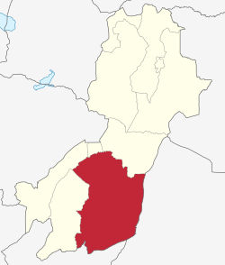
413:
412:
410:
403:
395:
380:
367:
361:
348:
158:Mahenge District
98:
96:
95:
83:
82:
80:
79:
78:
73:
72:9.000°S 36.667°E
69:
66:
65:
64:
61:
45:
26:Mahenge District
19:
610:
609:
605:
604:
603:
601:
600:
599:
585:
584:
583:
578:
540:
534:Morogoro Region
527:
497:
496:
488:
481:
477:
476:
472:
463:
462:
458:
445:
444:
440:
431:
429:
421:
420:
416:
408:
401:
397:
396:
383:
368:
364:
349:
345:
340:
335:
261:
239:
226:
221:
198:
190:
162:Morogoro Region
154:Ulanga District
112:Morogoro Region
93:
91:
76:
74:
70:
67:
62:
59:
57:
55:
54:
48:
36:
27:
24:
23:Ulanga District
17:
12:
11:
5:
608:
606:
598:
597:
587:
586:
580:
579:
577:
576:
571:
566:
561:
556:
551:
545:
542:
541:
528:
526:
525:
518:
511:
503:
495:
494:
491:on 2012-09-02.
470:
456:
438:
414:
381:
362:
342:
341:
339:
336:
334:
333:
330:
327:
324:
321:
318:
315:
312:
309:
306:
303:
300:
297:
294:
291:
288:
285:
282:
279:
276:
273:
269:
260:
257:
256:
255:
252:
249:
246:
238:
235:
234:
233:
225:
224:Constituencies
222:
220:
217:
197:
194:
189:
186:
149:
148:
145:
141:
140:
137:
133:
132:
128:
127:
124:
120:
119:
115:
114:
109:
103:
102:
89:
85:
84:
77:-9.000; 36.667
50:
49:
46:
38:
37:
32:
29:
28:
25:
22:
15:
13:
10:
9:
6:
4:
3:
2:
607:
596:
593:
592:
590:
575:
572:
570:
567:
565:
562:
560:
557:
555:
552:
550:
547:
546:
543:
539:
535:
531:
524:
519:
517:
512:
510:
505:
504:
501:
487:
480:
474:
471:
466:
460:
457:
452:
448:
442:
439:
428:
424:
418:
415:
407:
400:
394:
392:
390:
388:
386:
382:
379:
375:
371:
366:
363:
360:
356:
352:
347:
344:
337:
331:
328:
325:
322:
319:
316:
313:
310:
307:
304:
301:
298:
295:
292:
289:
286:
283:
280:
277:
274:
271:
270:
268:
266:
258:
253:
250:
247:
244:
243:
242:
236:
231:
230:
229:
223:
218:
216:
214:
209:
207:
203:
195:
193:
187:
185:
183:
182:Ruvuma Region
179:
175:
171:
167:
163:
159:
155:
146:
138:
125:
113:
110:
108:
101:
90:
81:
53:Coordinates:
44:
35:
30:
20:
573:
486:the original
473:
459:
451:the original
441:
430:. Retrieved
426:
417:
365:
346:
262:
240:
227:
210:
206:Lukande Ward
199:
191:
188:Demographics
178:Lindi Region
157:
153:
152:
302:Mawasiliano
75: /
432:2024-02-11
290:Kichangani
272:Chirombola
131:Population
554:Kilombero
530:Districts
237:Divisions
589:Category
564:Morogoro
538:Tanzania
406:Archived
287:Ketaketa
166:Tanzania
100:Tanzania
63:036°40′E
34:District
569:Mvomero
329:Uponera
320:Nawenge
314:Msogezi
299:Mahenge
293:Lukande
196:Economy
170:Mahenge
139:232,895
88:Country
60:09°00′S
574:Ulanga
559:Kilosa
311:Minepa
308:Milola
296:Lupiro
284:Isongo
281:Iragua
278:Ilonga
245:Lupiro
107:Region
97:
549:Gairo
489:(PDF)
482:(PDF)
409:(PDF)
402:(pdf)
338:Notes
332:Vigoi
323:Ruaha
317:Mwaya
305:Mbuga
265:wards
259:Wards
254:Mwaya
251:Ruaha
248:Vigoi
326:Sali
275:Euga
118:Area
532:of
372:at
353:at
164:of
591::
536:,
425:.
384:^
376:,
357:,
267::
215:.
208:.
184:.
522:e
515:t
508:v
435:.
156:(
Text is available under the Creative Commons Attribution-ShareAlike License. Additional terms may apply.