47:
76:
54:
338:
zone is longer (up to 800 m), while it is shorter (50–350 m) on the seaward side. North of Ulenge Island, the intertidal is rock, with large algae mats in the lower intertidal zones. On the lower intertidal zone on the seaward side, algae mats were also discovered. Along the Ulenge-Kwale channel,
275:
people from the north, led by Chief Mwinyi Ulenge, are said to have been the initial inhabitants of Ulenge Island. They were compelled to travel to the mainland due to a water deficit on the island. The majority of them relocated to
312:, predominate. Numerous plant (trees and grass) and animal (unstudied) populations can be found on Ulenge Island. Daily tidal wash through in the mangrove ecosystem on Ulenge results in a relatively thin layer of silt buildup.
346:
Turbidity and bottom sediment type, which are regulated by rainfall/river discharge patterns and oceanic conditions, determine the amount and distribution of seagrass. On the seaward side,
331:, migrating waders, and many more. Despite being threatened by human activity and climate change-related reasons, mangroves and coral reefs are not actually in danger.
319:, the Ulenge and Kwale Island Marine Reserves are located in IBM 35, an important bird region. This bird area contains a diverse range of bird species, including
239:
and Ulenge Island are the only islands in the marine reserve that are seasonally inhabited. Of Tanga's whole marine reserves system, Ulenge Island is the most
501:
426:
473:
Muhando, C. A. "Biophysical
Features in the Northern Tanga Marine Reserves, Tanzania." Marine Parks and Reserves Unit, Dar es Salaam, Tanzania. vi (2011).
464:
Muhando, C. A. "Biophysical
Features in the Northern Tanga Marine Reserves, Tanzania." Marine Parks and Reserves Unit, Dar es Salaam, Tanzania. vi (2011).
455:
Muhando, C. A. "Biophysical
Features in the Northern Tanga Marine Reserves, Tanzania." Marine Parks and Reserves Unit, Dar es Salaam, Tanzania. vi (2011).
446:
Muhando, C. A. "Biophysical
Features in the Northern Tanga Marine Reserves, Tanzania." Marine Parks and Reserves Unit, Dar es Salaam, Tanzania. vi (2011).
407:
Muhando, C. A. "Biophysical
Features in the Northern Tanga Marine Reserves, Tanzania." Marine Parks and Reserves Unit, Dar es Salaam, Tanzania. vi (2011).
378:
Muhando, C. A. "Biophysical
Features in the Northern Tanga Marine Reserves, Tanzania." Marine Parks and Reserves Unit, Dar es Salaam, Tanzania. vi (2011).
1372:
172:
46:
113:
1367:
1326:
790:
281:
339:
beyond the algal mats, to the south and south-west of Ulenge (in Tanga Bay), and in the lower intertidal zones of Kwale Bay, one can see
1331:
795:
285:
1377:
828:
358:
cover surveys showed a relatively small area of patchy coral reefs that were stressed by sediments from Tanga Bay and nearby
220:
28:
1362:
1191:
1186:
702:
494:
487:
1352:
594:
256:
224:
1357:
609:
574:
534:
886:
634:
589:
316:
821:
259:
are nearby, which has a greater negative human impact. Ulenge Island is nicknamed by
English speakers as
1226:
1181:
1176:
1101:
216:
1171:
871:
549:
305:
240:
1116:
304:
vegetation. Despite the presence of all mangrove species, species with robust root systems, such as
1091:
320:
280:
ward of Tanga city. The island is also the location of two of Tanga's most famous lighthouses; the
1284:
614:
1111:
388:
996:
906:
891:
881:
876:
866:
861:
324:
204:
1086:
901:
896:
847:
744:
624:
335:
309:
101:
1289:
1106:
1045:
927:
911:
814:
728:
644:
510:
272:
183:
91:
1346:
1256:
1076:
1060:
978:
947:
942:
686:
619:
212:
32:
1279:
1261:
1251:
1241:
1236:
1231:
1096:
1055:
1050:
1040:
1035:
1025:
1009:
986:
962:
957:
932:
837:
765:
723:
718:
355:
236:
228:
86:
937:
670:
539:
328:
277:
1081:
749:
544:
520:
347:
418:
128:
115:
639:
629:
599:
569:
362:. In most of the Ulenge Island waters, there was less than 10% coral cover.
252:
251:
cover and species diversity (5-7%, 16 coral genera). This is mostly because
208:
604:
579:
351:
340:
301:
232:
81:
1155:
1150:
1145:
1140:
991:
649:
584:
554:
297:
1135:
952:
665:
564:
559:
1004:
359:
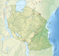
248:
479:
244:
810:
806:
483:
16:
Protected island and marine reserve in Tanga Region of
Tanzania
1307:
1272:
1164:
1128:
1069:
1018:
971:
920:
854:
774:
758:
737:
711:
695:
679:
658:
527:
207:) is a protected, seasonally habited island in the
178:
168:
160:
152:
144:
107:
97:
69:
21:
173:Marine Parks & Reserves Authority (Tanzania)
263:due to its importance as a seabird sanctuary.
822:
495:
8:
334:On the west and south of Ulenge Island, the
427:University of North Carolina at Chapel Hill
247:had the lowest fish numbers and the lowest
829:
815:
807:
502:
488:
480:
18:
371:
53:
7:
1327:Ulenge Island Front Range Lighthouse
791:Ulenge Island Front Range Lighthouse
282:Ulenge Island Front Range Lighthouse
68:
1332:Ulenge Island Rear Range Lighthouse
796:Ulenge Island Rear Range Lighthouse
300:at Ulenge Island Marine Reserve is
286:Ulenge Island Rear Range Lighthouse
201:Kisiwa cha Hifadhi Akiba cha Ulenge
696:National Parks and Forest Reserves
14:
389:"Mwewe Island, Mkinga elevation"
74:
52:
45:
1373:Uninhabited islands of Tanzania
1187:Handeni National Forest Reserve
159:
96:
417:Rowlett, Russ (12 June 2005).
1:
1320:Shabaan Robert Museum, Machui
787:Shabaan Robert Museum, Machui
1317:Shabaan Robert's House, Duga
1192:Tanga Coelacanth Marine Park
784:Shabaan Robert's House, Duga
703:Tanga Coelacanth Marine Park
350:are few. The results of the
197:Ulenge Island Marine Reserve
184:Tanga Marine Reserves System
1368:Coastal islands of Tanzania
1308:Heritage Monuments of Tanga
1214:Kisima Gonja Forest Reserve
1165:National Parks and Reserves
775:Heritage Monuments of Tanga
1394:
156:0.2 km (0.12 mi)
148:1.0 km (0.62 mi)
844:
517:
419:"Lighthouses of Tanzania"
40:
26:
423:The Lighthouse Directory
1378:Islands of Tanga Region
1196:Magoroto Forest Reserve
972:National Historic Sites
680:National Historic Sites
1300:Chambolo Peak (2,289m)
1220:Kitumbi Forest Reserve
1217:Shagayu Forest Reserve
1211:Ndelemi Forest Reserve
1208:Magamba Forest Reserve
1129:Major Cities and Towns
887:Korogwe Urban District
317:Birdlife International
1199:Mhamba Forest Reserve
1182:Saadani National Park
1177:Mkomazi National Park
292:Geography and ecology
217:Tanga Marine Reserves
1172:Amani Nature Reserve
872:Handeni Town Council
306:Rhizophora mucronata
129:5.00778°S 39.16167°E
61:location in Tanzania
1363:Islands of Tanzania
1314:Urithi Tanga Museum
1223:Gole Forest Reserve
1205:Baga Forest Reserve
1202:Nilo Forest Reserve
781:Urithi Tanga Museum
321:Greater Sand Plover
169:Governing body
125: /
1285:Usambara Mountains
1273:Landmarks of Tanga
759:Landmarks of Tanga
615:Ngamiani Kaskazini
257:Tanga City Council
225:Tanga City Council
134:-5.00778; 39.16167
1340:
1339:
804:
803:
190:
189:
98:Nearest city
1385:
1353:IUCN Category II
1070:Rivers and Lakes
907:Pangani District
892:Lushoto District
882:Korogwe District
877:Kilindi District
867:Handeni District
862:Bumbuli District
831:
824:
817:
808:
738:Rivers and Lakes
504:
497:
490:
481:
474:
471:
465:
462:
456:
453:
447:
444:
438:
437:
435:
433:
414:
408:
405:
399:
398:
396:
395:
385:
379:
376:
325:Curlew Sandpiper
221:IUCN category II
219:(TMRS) with the
186:
140:
139:
137:
136:
135:
130:
126:
123:
122:
121:
118:
80:
78:
77:
56:
55:
49:
19:
1393:
1392:
1388:
1387:
1386:
1384:
1383:
1382:
1343:
1342:
1341:
1336:
1303:
1268:
1160:
1124:
1087:Mkulumuzi River
1065:
1014:
967:
916:
902:Muheza District
897:Mkinga District
850:
840:
835:
805:
800:
770:
754:
745:Mkulumuzi River
733:
707:
691:
675:
654:
625:Ngamiani Kusini
523:
513:
508:
478:
477:
472:
468:
463:
459:
454:
450:
445:
441:
431:
429:
416:
415:
411:
406:
402:
393:
391:
387:
386:
382:
377:
373:
368:
310:Sonneratia alba
294:
269:
223:located within
182:
133:
131:
127:
124:
119:
116:
114:
112:
111:
90:
85:
75:
73:
65:
64:
63:
62:
59:
58:
57:
36:
17:
12:
11:
5:
1391:
1389:
1381:
1380:
1375:
1370:
1365:
1360:
1358:Tanga District
1355:
1345:
1344:
1338:
1337:
1335:
1334:
1329:
1324:
1321:
1318:
1315:
1311:
1309:
1305:
1304:
1302:
1301:
1298:
1295:
1292:
1290:Nguu Mountains
1287:
1282:
1276:
1274:
1270:
1269:
1267:
1266:
1265:
1264:
1259:
1254:
1249:
1244:
1239:
1234:
1224:
1221:
1218:
1215:
1212:
1209:
1206:
1203:
1200:
1197:
1194:
1189:
1184:
1179:
1174:
1168:
1166:
1162:
1161:
1159:
1158:
1153:
1148:
1143:
1138:
1132:
1130:
1126:
1125:
1123:
1122:
1119:
1117:Lwengera River
1114:
1109:
1107:Msangazi River
1104:
1099:
1094:
1089:
1084:
1079:
1073:
1071:
1067:
1066:
1064:
1063:
1058:
1053:
1048:
1046:Karange Island
1043:
1038:
1033:
1028:
1022:
1020:
1016:
1015:
1013:
1012:
1007:
1002:
999:
994:
989:
984:
981:
975:
973:
969:
968:
966:
965:
960:
955:
950:
945:
940:
935:
930:
924:
922:
921:Native Peoples
918:
917:
915:
914:
912:Tanga District
909:
904:
899:
894:
889:
884:
879:
874:
869:
864:
858:
856:
852:
851:
845:
842:
841:
836:
834:
833:
826:
819:
811:
802:
801:
799:
798:
793:
788:
785:
782:
778:
776:
772:
771:
769:
768:
762:
760:
756:
755:
753:
752:
747:
741:
739:
735:
734:
732:
731:
729:Karange Island
726:
721:
715:
713:
709:
708:
706:
705:
699:
697:
693:
692:
690:
689:
683:
681:
677:
676:
674:
673:
668:
662:
660:
659:Native Peoples
656:
655:
653:
652:
647:
642:
637:
632:
627:
622:
617:
612:
607:
602:
597:
592:
587:
582:
577:
572:
567:
562:
557:
552:
547:
542:
537:
531:
529:
525:
524:
518:
515:
514:
511:Tanga District
509:
507:
506:
499:
492:
484:
476:
475:
466:
457:
448:
439:
409:
400:
380:
370:
369:
367:
364:
293:
290:
268:
265:
188:
187:
180:
176:
175:
170:
166:
165:
162:
158:
157:
154:
150:
149:
146:
142:
141:
109:
105:
104:
99:
95:
94:
92:Tanga District
71:
67:
66:
60:
51:
50:
44:
43:
42:
41:
38:
37:
27:
24:
23:
15:
13:
10:
9:
6:
4:
3:
2:
1390:
1379:
1376:
1374:
1371:
1369:
1366:
1364:
1361:
1359:
1356:
1354:
1351:
1350:
1348:
1333:
1330:
1328:
1325:
1322:
1319:
1316:
1313:
1312:
1310:
1306:
1299:
1296:
1293:
1291:
1288:
1286:
1283:
1281:
1278:
1277:
1275:
1271:
1263:
1260:
1258:
1255:
1253:
1250:
1248:
1245:
1243:
1240:
1238:
1235:
1233:
1230:
1229:
1228:
1225:
1222:
1219:
1216:
1213:
1210:
1207:
1204:
1201:
1198:
1195:
1193:
1190:
1188:
1185:
1183:
1180:
1178:
1175:
1173:
1170:
1169:
1167:
1163:
1157:
1154:
1152:
1149:
1147:
1144:
1142:
1139:
1137:
1134:
1133:
1131:
1127:
1120:
1118:
1115:
1113:
1110:
1108:
1105:
1103:
1100:
1098:
1095:
1093:
1092:Mligasi River
1090:
1088:
1085:
1083:
1080:
1078:
1077:Pangani River
1075:
1074:
1072:
1068:
1062:
1061:Maziwe Island
1059:
1057:
1054:
1052:
1049:
1047:
1044:
1042:
1039:
1037:
1034:
1032:
1031:Ulenge Island
1029:
1027:
1024:
1023:
1021:
1017:
1011:
1008:
1006:
1003:
1000:
998:
995:
993:
990:
988:
985:
982:
980:
979:Tongoni Ruins
977:
976:
974:
970:
964:
961:
959:
956:
954:
951:
949:
946:
944:
941:
939:
936:
934:
931:
929:
926:
925:
923:
919:
913:
910:
908:
905:
903:
900:
898:
895:
893:
890:
888:
885:
883:
880:
878:
875:
873:
870:
868:
865:
863:
860:
859:
857:
853:
849:
843:
839:
832:
827:
825:
820:
818:
813:
812:
809:
797:
794:
792:
789:
786:
783:
780:
779:
777:
773:
767:
764:
763:
761:
757:
751:
748:
746:
743:
742:
740:
736:
730:
727:
725:
722:
720:
717:
716:
714:
710:
704:
701:
700:
698:
694:
688:
687:Tongoni Ruins
685:
684:
682:
678:
672:
669:
667:
664:
663:
661:
657:
651:
648:
646:
643:
641:
638:
636:
633:
631:
628:
626:
623:
621:
620:Ngamiani Kati
618:
616:
613:
611:
608:
606:
603:
601:
598:
596:
593:
591:
588:
586:
583:
581:
578:
576:
573:
571:
568:
566:
563:
561:
558:
556:
553:
551:
548:
546:
543:
541:
538:
536:
533:
532:
530:
526:
522:
516:
512:
505:
500:
498:
493:
491:
486:
485:
482:
470:
467:
461:
458:
452:
449:
443:
440:
428:
424:
420:
413:
410:
404:
401:
390:
384:
381:
375:
372:
365:
363:
361:
357:
354:and swimming
353:
349:
344:
342:
337:
332:
330:
326:
322:
318:
315:According to
313:
311:
307:
303:
299:
291:
289:
287:
283:
279:
274:
266:
264:
262:
258:
254:
250:
246:
242:
238:
234:
230:
226:
222:
218:
214:
213:Pemba Channel
210:
206:
202:
198:
195:officially,
194:
193:Ulenge Island
185:
181:
177:
174:
171:
167:
163:
155:
151:
147:
143:
138:
110:
106:
103:
100:
93:
88:
83:
72:
48:
39:
34:
33:national park
30:
29:IUCN category
25:
22:Ulenge Island
20:
1294:Irente Views
1280:Amboni Caves
1262:Tanga Island
1246:
1097:Saunyi River
1056:Tanga Island
1051:Yambe Island
1041:Kwale Island
1036:Kirui Island
1030:
1026:Mwewe Island
1010:Yambe Island
987:Tanga Island
983:Bombo Kaburi
838:Tanga Region
766:Amboni Caves
724:Yambe Island
719:Tanga Island
469:
460:
451:
442:
430:. Retrieved
422:
412:
403:
392:. Retrieved
383:
374:
345:
333:
314:
296:The primary
295:
270:
260:
237:Kwale Island
229:Tanga Region
200:
196:
192:
191:
87:Tanga Region
1323:Old Korogwe
1297:Mkuzi Falls
540:Chongoleani
348:coral reefs
329:Crab Plover
278:Chongoleani
261:Bird Island
243:. Ulenge's
161:Established
132: /
108:Coordinates
1347:Categories
1121:Lake Manka
1112:Soni River
1102:Umba River
1082:Sigi River
750:Sigi River
545:Chumbageni
521:Chumbageni
432:6 February
394:2023-09-15
366:References
336:intertidal
215:under the
855:Districts
846:Capital:
640:Tangasisi
630:Nguvumali
600:Mwanzange
595:Msambweni
570:Mabokweni
519:Capital:
352:manta tow
253:Tanga Bay
209:Tanga Bay
120:39°9′42″E
605:Mzingani
580:Makorora
341:seagrass
302:mangrove
284:and the
241:degraded
233:Tanzania
117:5°0′28″S
82:Tanzania
70:Location
1156:Handeni
1151:Lushoto
1146:Korogwe
1141:Pangani
1019:Islands
997:Mnarani
992:Muhembo
712:Islands
650:Usagara
645:Tongoni
610:Mzizima
585:Marungu
575:Majengo
555:Kiomoni
535:Central
356:benthic
298:biotope
273:Swahili
267:History
205:Swahili
179:Website
1257:Maziwi
1247:Ulenge
1136:Muheza
953:Bondei
948:Segeju
943:Dhaiso
928:Sambaa
666:Segeju
635:Pongwe
590:Maweni
565:Mabawa
560:Kirare
360:rivers
343:beds.
145:Length
79:
1252:Yambe
1242:Kwale
1237:Mwewe
1232:Kirui
1227:Tanga
1005:Vugha
1001:Ndumi
963:Mbugu
958:Ngulu
933:Zigua
848:Tanga
528:Wards
249:coral
245:reefs
203:, in
153:Width
102:Tanga
938:Digo
671:Digo
550:Duga
434:2014
308:and
271:The
255:and
164:2010
31:II (
231:in
227:of
211:of
1349::
425:.
421:.
327:,
323:,
288:.
235:.
830:e
823:t
816:v
503:e
496:t
489:v
436:.
397:.
199:(
89:,
84:,
35:)
Text is available under the Creative Commons Attribution-ShareAlike License. Additional terms may apply.