20:
74:
The economy is based on agriculture with emphasis on cattle raising. There were 35,000 head in 2006. The main agricultural crops were coffee, coconuts, manioc, and corn. The GDP was R$ 39,297,000 in 2005. In 2006 there were 4,300 people connected to agriculture among whom were 700 salaried
78:
This municipality is extremely isolated from major population centers and suffers from drought and poor soils. It is one of the poorest in the state and in the country. Like many impoverished districts it fought for municipal autonomy to apply for government assistance programs.
49:. As of 2020 the population was 17,173 in an area of 2,072 km (800 sq mi). The elevation of the municipal seat is 498 meters. It became a municipality in 1993. The postal code (CEP) is 39315-000 and it belongs to the statistical microregion of
103:
The social and health indicators were: degree of urbanization—44.9%; Literacy rate: 77.6; coverage of sewage system in the urban area—0.10%; coverage of garbage collection in the urban area—67.9; and infant mortality—18.60.
266:
113:
227:
168:
143:
60:
34:
84:
71:
the São
Francisco River. It lies on the left bank of the Urucuia Rivers, a tributary of the São Francisco.
56:
217:
19:
96:
Health clinics and hospitals: 1 basic clinics, 2 health centers, and 1 hospital with 36 beds
38:
131:
68:
172:
260:
147:
42:
24:
203:
50:
192:
242:
229:
64:
46:
18:
93:
National ranking: 3,372 out of 5,138 municipalities as of 2000
90:
State ranking: 653 out of 853 municipalities as of 2000
55:
Urucuia is located in an isolated region between the
8:
213:
211:
75:workers. There were no banking agencies.
124:
114:List of municipalities in Minas Gerais
7:
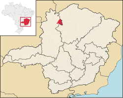
23:Location of Urucuia in the state of
14:
63:It is connected by dirt road to
267:Municipalities in Minas Gerais
1:
99:Life expectancy: 69.2 (2004)
283:
16:Human settlement in Brazil
85:Human Development Index
27:
243:16.13083°S 45.74250°W
22:
248:-16.13083; -45.74250
37:in the north of the
239: /
57:São Francisco River
169:"Mapa de Estradas"
28:
274:
254:
253:
251:
250:
249:
244:
240:
237:
236:
235:
232:
220:
215:
206:
201:
195:
190:
184:
183:
181:
180:
171:. Archived from
165:
159:
158:
156:
155:
146:. Archived from
140:
134:
129:
61:Distrito Federal
282:
281:
277:
276:
275:
273:
272:
271:
257:
256:
247:
245:
241:
238:
233:
230:
228:
226:
225:
223:
216:
209:
202:
198:
191:
187:
178:
176:
167:
166:
162:
153:
151:
142:
141:
137:
130:
126:
122:
110:
17:
12:
11:
5:
280:
278:
270:
269:
259:
258:
222:
221:
207:
196:
185:
160:
135:
123:
121:
118:
117:
116:
109:
106:
101:
100:
97:
94:
91:
88:
15:
13:
10:
9:
6:
4:
3:
2:
279:
268:
265:
264:
262:
255:
252:
219:
214:
212:
208:
205:
200:
197:
194:
189:
186:
175:on 2008-05-12
174:
170:
164:
161:
150:on 2008-02-04
149:
145:
139:
136:
133:
128:
125:
119:
115:
112:
111:
107:
105:
98:
95:
92:
89:
87:: .675 (2000)
86:
82:
81:
80:
76:
72:
70:
66:
62:
58:
53:
52:
48:
44:
40:
36:
32:
26:
21:
224:
199:
188:
177:. Retrieved
173:the original
163:
152:. Retrieved
148:the original
144:"Citybrazil"
138:
127:
102:
77:
73:
54:
43:Minas Gerais
35:municipality
30:
29:
25:Minas Gerais
246: /
69:São Romãoon
234:45°44′33″W
231:16°07′51″S
218:Indicators
204:Frigoletto
179:2008-05-23
154:2008-02-04
120:References
83:Municipal
132:IBGE 2020
261:Category
108:See also
59:and the
51:Januária
67:and to
31:Urucuia
65:Arinos
47:Brazil
39:state
33:is a
193:IBGE
45:in
41:of
263::
210:^
182:.
157:.
Text is available under the Creative Commons Attribution-ShareAlike License. Additional terms may apply.