901:: selecting Mesa Air Group, Inc., d/b/a Air Midwest to provide essential air service at Franklin/Oil City, Pennsylvania, consisting of two round trips each weekday and each weekend to Pittsburgh with 19-passenger Fairchild Metro III/23 aircraft, for two years for an annual subsidy rate of $ 683,636. Also setting a subsidy rate of $ 969,136 on an annual basis, for Mesa/Air Midwest¿s provision of three-round-trip service at Franklin/Oil City from January 1, 2005, until the carrier inaugurates two-round-trip service, or 60 days from the date of service of this order, whichever occurs first.
205:
913:: selecting Gulfstream International Airlines, Inc. to provide subsidized essential air service (EAS) at DuBois and Franklin/Oil City, Pennsylvania, Greenbrier/White Sulphur Springs/Lewisburg, West Virginia, and Athens, Georgia, at a total annual subsidy rate of $ 4,077,792 ($ 1,159,229 for DuBois, $ 763,741 for Franklin/Oil City, $ 1,329,477 for Greenbrier/White Sulphur Springs/Lewisburg, and $ 825,345 for Athens) for the two-year period beginning when Gulfstream inaugurates service through the end of the 24th month thereafter.
979:
240:
567:
919:: selecting Gulfstream International Airlines, Inc. to provide subsidized essential air service (EAS) at DuBois and Franklin/Oil City, Pennsylvania, and Greenbrier/White Sulphur Springs/Lewisburg (Lewisburg), West Virginia, at a total annual subsidy rate of $ 5,577,594 ($ 2,020,095 for DuBois, $ 1,226,773 for Franklin/Oil City, and $ 2,330,725 for Lewisburg) for the two-year period beginning when Gulfstream inaugurates service through the end of the 24th month thereafter.
895:: establishes a final rate for the essential air service operated by Air Midwest, Inc., d/b/a US Airways Express at Franklin/Oil City, Pennsylvania, for the period from October 1, 2001, through December 31, 2002; tentatively reselects Air Midwest at the community for the two-year period beginning January 1, 2003, but reducing the level of subsidized service from 24 to 18 round trips a week no later than 60 days after the service date of this order
247:
212:
931:: selecting Silver Airways to provide Essential Air Service (EAS) at Bradford, DuBois, Franklin/Oil City, Pennsylvania, Jamestown, New York, and Parkersburg, West Virginia/Marietta, Ohio, for a combined annual subsidy of $ 10,348,117 ($ 1,940,272 for Bradford; $ 2,587,029 for DuBois, $ 1,293,515 for Franklin, $ 1,940,272 for Jamestown, and $ 2,587,029 for Parkersburg), from October 1, 2012, through September 30, 2014.
947:(PIT), a medium hub, and, thus, is subject to the 10-enplanement statutory criterion. We also find that during fiscal year 2013, Franklin/Oil City generated a total of 3,134 passengers (inbound plus outbound). Consistent with the methodology described above, that results in an average of 5.0 enplanements per day, below the 10-enplanement statutory criterion necessary to remain eligible in the EAS program.
925:: re-selecting Gulfstream International Airlines to provide essential air service (EAS) at Bradford, DuBois, and Oil City/Franklin, Pennsylvania, and Jamestown, New York, for a combined annual subsidy of $ 5,870,657 ($ 1,087,306 for Bradford, $ 2,228,996 for DuBois, $ 915,101 for Oil City/Franklin, and $ 1,639,254 for Jamestown), from October 1, 2010, through September 30, 2012.
943:: directing interested persons to show cause as to why the Department should not terminate the eligibility ... under the Essential Air Service (EAS) program based on criteria passed by Congress in the FAA Modernization and Reform Act of 2012 (Public Law No. 112-95). We find that Franklin/Oil City is within 175 miles of a large or medium hub,
483:. The airport was supported by local businessmen who formed a corporation some time later, under their stewardship the airport continued in existence until its abandonment in 1938. Thereafter, local aviators flew from the Splane Memorial Airport in Oil City from 1941 until 1950.
937:: of Silver Airways Corp. to discontinue scheduled air service between Cleveland, Ohio (CLE) and: Jamestown, New York (JHW), Bradford, Pennsylvania (BFD), DuBois, Pennsylvania (DUJ), Franklin/Oil City, Pennsylvania (FKL), and Parkersburg, West Virginia/Marietta, Ohio (PKB).
1327:
1214:
907:: re-selecting Air Midwest, Inc. to provide subsidized essential air service (EAS) at Franklin/Oil City, Pennsylvania, at an annual subsidy rate of $ 741,346, for the two-year period of April 1, 2007, through March 31, 2009.
478:
Aviation in
Franklin area originated in 1929 when two local businessmen, Wayne W. Bleakley and Joseph McElhinney, Jr. became interested in aviation and went on to construct the first airport in what was then
149:
1322:
453:
35:
1008:
994:
1317:
774:
753:
732:
204:
984:
1145:
239:
1281:
1312:
1092:
886:
944:
684:
667:
486:
Construction of Chess
Lamberton Airport as it was originally known, began in 1950. The airport was named after the grandson of
445:
403:
374:
68:
525:
For the 12-month period ending
December 31, 2011, the airport had 14,826 aircraft operations, an average of 40 per day: 83.5%
1181:
1140:
795:
1102:
490:
of
Franklin, Pa., founder of the first bank in Venango County and later reformed as The Lamberton Savings Bank in 1887.
434:
142:
124:
1286:
1266:
846:
863:
1130:
1125:
1018:
714:
480:
958:
487:
457:
430:
426:
132:
114:
110:
1209:
1191:
1085:
940:
934:
928:
922:
916:
910:
904:
898:
892:
438:
1276:
1261:
1230:
1201:
710:
437:, which operates the airport. The airport had limited airline service, which was subsidized by the
406:
71:
34:
1030:
522:
surfaces: 3/21 is 5,201 by 150 feet (1,585 x 46 m) and 12/30 is 3,592 by 100 feet (1,095 x 30 m).
1186:
882:
1271:
534:
395:
387:
57:
46:
1196:
1135:
1078:
1002:
988:
526:
519:
462:
1070:
1120:
728:
619:
538:
819:
978:
580:
Please help update this article to reflect recent events or newly available information.
1046:
511:
1306:
1171:
1166:
449:
1176:
1106:
546:
422:
1050:
1036:
1161:
662:
550:
542:
164:
151:
1256:
1240:
1056:
1040:
507:
452:
2008, 1,583 enplanements in 2009, and 1,380 in 2010. It is included in the
537:. At that time there were 40 aircraft based at this airport: 82.5% single-
1235:
530:
1328:
Transportation buildings and structures in
Venango County, Pennsylvania
503:
418:
1024:
515:
290:
277:
1060:
448:
records, the airport had 681 passenger boardings (enplanements) in
998:
499:
1074:
718:. Federal Aviation Administration. Effective November 15, 2012.
800:
560:
972:
185:
729:"IATA Airport Code Search (FKL: Franklin / Chess-Lambertin)"
835:. Franklin & Oil City, Pennsylvania. January 9, 1976.
470:
category requires at least 2,500 enplanements per year).
763:. Federal Aviation Administration. December 18, 2009.
1249:
1223:
1154:
1113:
809:. Federal Aviation Administration. October 4, 2010.
784:. Federal Aviation Administration. October 4, 2011.
610:
359:
351:
342:
276:
192:
180:
141:
130:
120:
106:
98:
90:
85:
21:
640:Top domestic destinations: Mar 2017 – Feb 2018
498:Venango Regional Airport covers an area of 420
858:
856:
1086:
782:CY 2010 Passenger Boarding and All-Cargo Data
761:CY 2008 Passenger Boarding and All-Cargo Data
429:and about 10 miles (16 km) southwest of
8:
831:"Interested in saving some old buildings".
807:National Plan of Integrated Airport Systems
597:No scheduled airline service at this time.
454:National Plan of Integrated Airport Systems
1093:
1079:
1071:
977:
348:
18:
638:
604:
733:International Air Transport Association
696:
16:Airport in Venango County, Pennsylvania
1323:Former Essential Air Service airports
706:
704:
702:
700:
7:
1215:National Register of Historic Places
935:Notice of Intent (February 14, 2014)
929:Order 2012-9-23 (September 27, 2012)
820:Venago County Pennsylvania Genealogy
796:"2011–2015 NPIAS Report, Appendix A"
614:Passengers (arriving and departing)
606:Carrier shares: Mar 2017 – Feb 2018
1282:Oil Region Astronomical Observatory
923:Order 2010-9-12 (September 9, 2010)
425:, 2 miles (3 km) southwest of
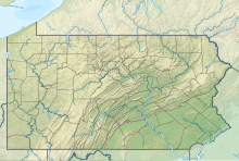
226:Location of airport in Pennsylvania
14:
887:U.S. Department of Transportation
881:Essential Air Service documents (
945:Pittsburgh International Airport
941:Order 2014-4-26 (April 24, 2014)
905:Order 2007-3-12 (March 14, 2007)
685:List of airports in Pennsylvania
668:Pittsburgh International Airport
565:
245:
238:
210:
203:
33:
1318:County airports in Pennsylvania
1045:NOAA/NWS weather observations:
1009:FAA Terminal Procedures for FKL
911:Order 2007-7-21 (July 26, 2007)
446:Federal Aviation Administration
375:Federal Aviation Administration
97:
899:Order 2005-4-5 (April 6, 2005)
893:Order 2003-5-24 (May 22, 2003)
1:
1011:, effective September 5, 2024
995:Aerial image as of April 1993
847:"The Lamberton National Bank"
711:FAA Airport Form 5010 for FKL
651:Airport name & IATA code
267:Show map of the United States
1025:airport information for KFKL
1014:Resources for this airport:
917:Order 2008-5-3 (May 6, 2008)
510:of 1,540 feet (469 m) above
441:program until October 2019.
125:Venango County, Pennsylvania
1287:Franklin Silver Cornet Band
1267:DeBence Antique Music World
1019:airport information for FKL
246:
211:
1344:
775:"Enplanements for CY 2010"
754:"Enplanements for CY 2008"
137:1,540 ft / 469 m
618:
613:
574:This section needs to be
371:
347:
297:
294:
289:
285:
197:
41:
32:
1313:Airports in Pennsylvania
1292:Venango Regional Airport
1131:Cornplanter State Forest
1126:Clear Creek State Forest
1031:accident history for FKL
985:Venango Regional Airport
961:blew a tire on landing.
864:"RITA - BTS - Transtats"
545:, 5% multi-engine, 2.5%
384:Venango Regional Airport
229:Show map of Pennsylvania
23:Venango Regional Airport
959:Cessna Citation Mustang
557:Airline and destination
494:Facilities and aircraft
488:Judge Robert Lamberton
115:Oil City, Pennsylvania
111:Franklin, Pennsylvania
1210:Wamsutta Oil Refinery
456:for 2011–2015, which
439:Essential Air Service
433:. Both cities are in
415:Chess Lamberton Field
165:41.37778°N 79.86028°W
27:Chess Lamberton Field
1277:Oil Creek State Park
1231:Joy Mining Machinery
883:Docket OST-1997-2523
611:Carrier
1197:Pontiac's Rebellion
1061:Terminal Procedures
1041:live flight tracker
1037:airport information
641:
607:
481:Sugarcreek Township
352:Aircraft operations
264:(the United States)
170:41.37778; -79.86028
161: /
1187:Petroleum industry
1057:aeronautical chart
991:Bureau of Aviation
639:
605:
468:commercial service
1300:
1299:
1272:Drake Well Museum
717:
676:
675:
637:
636:
595:
594:
413:), also known as
381:
380:
367:
366:
343:Statistics (2011)
338:
337:
1335:
1182:McClintocksville
1136:East Sandy Creek
1095:
1088:
1081:
1072:
1003:The National Map
989:Pennsylvania DOT
981:
976:
975:
973:Official website
868:
867:
860:
851:
850:
843:
837:
836:
828:
822:
817:
811:
810:
804:
792:
786:
785:
779:
771:
765:
764:
758:
750:
744:
743:
741:
739:
725:
719:
713:
708:
642:
632:
631:
630:
608:
590:
587:
581:
569:
568:
561:
527:general aviation
463:general aviation
349:
287:
286:
280:
268:
249:
248:
242:
230:
214:
213:
207:
188:
176:
175:
173:
172:
171:
166:
162:
159:
158:
157:
154:
78:
77:
64:
63:
53:
52:
37:
19:
1343:
1342:
1338:
1337:
1336:
1334:
1333:
1332:
1303:
1302:
1301:
1296:
1245:
1219:
1150:
1121:Allegheny River
1109:
1099:
1068:
1051:past three days
971:
970:
967:
952:
877:
872:
871:
862:
861:
854:
845:
844:
840:
833:The News Herald
830:
829:
825:
818:
814:
798:
794:
793:
789:
777:
773:
772:
768:
756:
752:
751:
747:
737:
735:
727:
726:
722:
709:
698:
693:
681:
633:
628:
626:
625:
603:
591:
585:
582:
579:
570:
566:
559:
496:
476:
377:
278:
272:
271:
270:
269:
266:
265:
259:
258:
257:
256:
250:
233:
232:
231:
228:
227:
224:
223:
222:
221:
215:
186:FlyFranklin.org
184:
169:
167:
163:
160:
155:
152:
150:
148:
147:
131:Elevation
113:
81:
75:
67:
61:
56:
50:
45:
28:
25:
24:
17:
12:
11:
5:
1341:
1339:
1331:
1330:
1325:
1320:
1315:
1305:
1304:
1298:
1297:
1295:
1294:
1289:
1284:
1279:
1274:
1269:
1264:
1262:Custaloga Town
1259:
1253:
1251:
1247:
1246:
1244:
1243:
1238:
1233:
1227:
1225:
1221:
1220:
1218:
1217:
1212:
1207:
1199:
1194:
1189:
1184:
1179:
1174:
1169:
1164:
1158:
1156:
1152:
1151:
1149:
1148:
1143:
1138:
1133:
1128:
1123:
1117:
1115:
1111:
1110:
1103:Venango County
1100:
1098:
1097:
1090:
1083:
1075:
1066:
1065:
1064:
1063:
1053:
1043:
1033:
1027:
1021:
1012:
1006:
992:
982:
966:
965:External links
963:
951:
950:
949:
948:
938:
932:
926:
920:
914:
908:
902:
896:
878:
876:
873:
870:
869:
852:
838:
823:
812:
787:
766:
745:
720:
695:
694:
692:
689:
688:
687:
680:
677:
674:
673:
670:
665:
663:Pittsburgh, PA
660:
656:
655:
652:
649:
646:
635:
634:
624:
622:
616:
615:
612:
602:
599:
593:
592:
573:
571:
564:
558:
555:
512:mean sea level
495:
492:
475:
472:
466:facility (the
435:Venango County
417:, is a public
379:
378:
372:
369:
368:
365:
364:
361:
360:Based aircraft
357:
356:
353:
345:
344:
340:
339:
336:
335:
332:
329:
326:
322:
321:
318:
315:
312:
308:
307:
304:
300:
299:
296:
293:
283:
282:
274:
273:
260:
252:
251:
244:
243:
237:
236:
235:
234:
225:
217:
216:
209:
208:
202:
201:
200:
199:
198:
195:
194:
190:
189:
182:
178:
177:
145:
139:
138:
135:
128:
127:
122:
118:
117:
108:
104:
103:
102:Venango County
100:
96:
95:
92:
88:
87:
83:
82:
80:
79:
65:
54:
42:
39:
38:
30:
29:
26:
22:
15:
13:
10:
9:
6:
4:
3:
2:
1340:
1329:
1326:
1324:
1321:
1319:
1316:
1314:
1311:
1310:
1308:
1293:
1290:
1288:
1285:
1283:
1280:
1278:
1275:
1273:
1270:
1268:
1265:
1263:
1260:
1258:
1255:
1254:
1252:
1248:
1242:
1239:
1237:
1234:
1232:
1229:
1228:
1226:
1222:
1216:
1213:
1211:
1208:
1206:
1205:
1200:
1198:
1195:
1193:
1190:
1188:
1185:
1183:
1180:
1178:
1175:
1173:
1172:Fort Machault
1170:
1168:
1167:Fort Le Boeuf
1165:
1163:
1160:
1159:
1157:
1153:
1147:
1144:
1142:
1139:
1137:
1134:
1132:
1129:
1127:
1124:
1122:
1119:
1118:
1116:
1112:
1108:
1104:
1096:
1091:
1089:
1084:
1082:
1077:
1076:
1073:
1069:
1062:
1058:
1054:
1052:
1048:
1044:
1042:
1038:
1034:
1032:
1028:
1026:
1022:
1020:
1016:
1015:
1013:
1010:
1007:
1005:
1004:
1000:
996:
993:
990:
986:
983:
980:
974:
969:
968:
964:
962:
960:
955:
946:
942:
939:
936:
933:
930:
927:
924:
921:
918:
915:
912:
909:
906:
903:
900:
897:
894:
891:
890:
888:
884:
880:
879:
875:Other sources
874:
865:
859:
857:
853:
848:
842:
839:
834:
827:
824:
821:
816:
813:
808:
802:
797:
791:
788:
783:
778:(PDF, 189 KB)
776:
770:
767:
762:
757:(PDF, 1.0 MB)
755:
749:
746:
734:
730:
724:
721:
716:
712:
707:
705:
703:
701:
697:
690:
686:
683:
682:
678:
671:
669:
666:
664:
661:
658:
657:
653:
650:
647:
644:
643:
623:
621:
617:
609:
600:
598:
589:
577:
572:
563:
562:
556:
554:
552:
548:
544:
540:
536:
532:
528:
523:
521:
517:
514:. It has two
513:
509:
505:
501:
493:
491:
489:
484:
482:
473:
471:
469:
465:
464:
459:
455:
451:
450:calendar year
447:
442:
440:
436:
432:
428:
424:
420:
416:
412:
408:
405:
401:
397:
393:
389:
385:
376:
370:
362:
358:
354:
350:
346:
341:
333:
330:
327:
324:
323:
319:
316:
313:
310:
309:
305:
302:
301:
292:
288:
284:
281:
275:
263:
255:
241:
220:
206:
196:
191:
187:
183:
179:
174:
146:
144:
140:
136:
134:
129:
126:
123:
119:
116:
112:
109:
105:
101:
93:
89:
84:
73:
70:
66:
59:
55:
48:
44:
43:
40:
36:
31:
20:
1291:
1241:Quaker State
1203:
1177:Fort Venango
1162:Drake's Well
1141:French Creek
1107:Pennsylvania
1101:Features of
1067:
1035:FlightAware
1001:
956:
953:
841:
832:
826:
815:
806:
790:
781:
769:
760:
748:
736:. Retrieved
723:
596:
586:January 2022
583:
575:
524:
497:
485:
477:
467:
461:
443:
423:Pennsylvania
414:
410:
399:
391:
383:
382:
261:
253:
218:
91:Airport type
1250:Attractions
957:In 2012, a
954:ACCIDENTS:
885:) from the
654:Passengers
549:, and 2.5%
533:, and 0.2%
458:categorized
421:in western
168: /
156:079°51′37″W
143:Coordinates
1307:Categories
1055:SkyVector
803:, 2.03 MB)
691:References
601:Statistics
551:helicopter
543:ultralight
153:41°22′40″N
1257:Applefest
1146:Oil Creek
1114:Geography
629:(100.00%)
508:elevation
291:Direction
1236:Pennzoil
1224:Industry
679:See also
535:military
531:air taxi
529:, 16.3%
506:) at an
460:it as a
431:Oil City
427:Franklin
373:Source:
334:Asphalt
320:Asphalt
298:Surface
121:Location
1204:Venango
1192:Pithole
1155:History
1047:current
1023:AirNav
738:June 5,
576:updated
541:, 7.5%
520:asphalt
516:runways
474:History
419:airport
295:Length
279:Runways
181:Website
86:Summary
672:1,500
539:engine
355:14,826
331:1,095
328:3,592
325:12/30
317:1,585
314:5,201
107:Serves
94:Public
997:from
648:City
645:Rank
627:2,620
518:with
502:(170
500:acres
311:3/21
99:Owner
1202:USS
1039:and
1029:ASN
1017:FAA
999:USGS
740:2014
444:Per
400:KFKL
396:ICAO
388:IATA
133:AMSL
62:KFKL
58:ICAO
47:IATA
987:at
801:PDF
715:PDF
620:Sun
547:jet
411:FKL
407:LID
404:FAA
392:FKL
303:ft
262:FKL
254:FKL
219:FKL
193:Map
76:FKL
72:LID
69:FAA
51:FKL
1309::
1105:,
1059:,
1049:,
889::
855:^
805:.
780:.
759:.
731:.
699:^
659:1
553:.
504:ha
409::
402:,
398::
394:,
390::
363:40
306:m
74::
60::
49::
1094:e
1087:t
1080:v
866:.
849:.
799:(
742:.
588:)
584:(
578:.
386:(
Text is available under the Creative Commons Attribution-ShareAlike License. Additional terms may apply.