38:
66:
73:
45:
502:
The stream was named due to the temperature difference between its waters and the cold springwaters entering from
Mammoth Spring. This is the only stream of this name in the United States.
704:
65:
743:
37:
728:
723:
445:
County Road M, unnamed road (x4), Oregon County 327, unnamed road, MO 19, E Adams Street, Warm Fork Road, US 63, W Walnut Street, US 63, unnamed road
576:
260:
397:
375:
371:
511:
183:
748:
697:
602:
690:
484:
738:
733:
533:
528:
246:
559:
488:
468:
460:
367:
348:
335:
234:
124:
119:
169:
492:
379:
674:
135:
631:
656:
496:
419:
391:
383:
717:
480:
433:
155:
560:
U.S. Geological Survey
Geographic Names Information System: Warm Fork Spring River
229:
657:
Oregon County Place Names, 1928–1945, The State
Historical Society of Missouri
476:
275:
262:
198:
185:
472:
464:
456:
347:
317.46 cu ft/s (8.989 m/s) at mouth with
678:
475:. The stream begins in western Oregon County at the
441:
427:
411:
403:
389:
363:
358:
341:
329:
321:
309:
301:
291:
252:
240:
228:
214:
175:
162:
150:
141:
131:
115:
105:
97:
92:
21:
673:This article related to a river in Arkansas is a
72:
44:
698:
632:"Watershed Report | Office of Water | US EPA"
8:
626:
624:
705:
691:
514:, it has also been known historically as:
80:Warm Fork Spring River (the United States)
545:
571:
569:
567:
555:
553:
551:
549:
18:
577:"Geographic Names Information System"
16:Stream in Missouri and Arkansas, U.S.
7:
670:
668:
512:Geographic Names Information System
313:238.04 square miles (616.5 km)
744:Southern United States river stubs
677:. You can help Knowledge (XXG) by
14:
729:Rivers of Fulton County, Arkansas
724:Rivers of Oregon County, Missouri
491:at its confluence with the cold
71:
64:
43:
36:
254: • coordinates
177: • coordinates
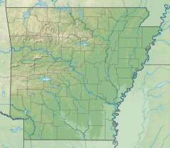
52:Location of Spring River mouth
1:
305:19.21 mi (30.92 km)
142:Physical characteristics
83:Show map of the United States
293: • elevation
216: • elevation
499:in northern Fulton County.
487:and the stream becomes the
331: • location
242: • location
168:about 3 miles northeast of
164: • location
765:
667:
534:List of rivers of Arkansas
529:List of rivers of Missouri
343: • average
354:
317:
276:36.4945083°N 91.3859750°W
224:
199:36.6766306°N 91.6499000°W
146:
30:
25:Tributary to Spring River
749:Arkansas geography stubs
603:"ArcGIS Web Application"
429: • right
297:492 ft (150 m)
247:Mammoth Spring, Arkansas
220:750 ft (230 m)
413: • left
281:36.4945083; -91.3859750
204:36.6766306; -91.6499000
583:. US Geological Survey
453:Warm Fork Spring River
22:Warm Fork Spring River
581:edits.nationalmap.gov
170:Brandsville, Missouri
55:Show map of Arkansas
607:epa.maps.arcgis.com
359:Basin features
272: /
195: /
739:Rivers of Arkansas
734:Rivers of Missouri
686:
685:
636:watersgeo.epa.gov
510:According to the
449:
448:
380:Mississippi River
756:
707:
700:
693:
669:
659:
654:
648:
647:
645:
643:
628:
619:
618:
616:
614:
599:
593:
592:
590:
588:
573:
562:
557:
430:
414:
394:
344:
332:
287:
286:
284:
283:
282:
277:
273:
270:
269:
268:
265:
217:
210:
209:
207:
206:
205:
200:
196:
193:
192:
191:
188:
178:
165:
84:
75:
74:
68:
56:
47:
46:
40:
19:
764:
763:
759:
758:
757:
755:
754:
753:
714:
713:
712:
711:
665:
663:
662:
655:
651:
641:
639:
630:
629:
622:
612:
610:
601:
600:
596:
586:
584:
575:
574:
565:
558:
547:
542:
525:
508:
436:
428:
422:
418:
412:
390:
342:
330:
294:
280:
278:
274:
271:
266:
263:
261:
259:
258:
255:
243:
215:
203:
201:
197:
194:
189:
186:
184:
182:
181:
176:
163:
123:
110:
88:
87:
86:
85:
82:
81:
78:
77:
76:
59:
58:
57:
54:
53:
50:
49:
48:
26:
23:
17:
12:
11:
5:
762:
760:
752:
751:
746:
741:
736:
731:
726:
716:
715:
710:
709:
702:
695:
687:
684:
683:
661:
660:
649:
620:
594:
563:
544:
543:
541:
538:
537:
536:
531:
524:
521:
520:
519:
507:
504:
497:Mammoth Spring
447:
446:
443:
439:
438:
431:
425:
424:
420:Anthony Branch
415:
409:
408:
405:
401:
400:
395:
387:
386:
384:Gulf of Mexico
365:
361:
360:
356:
355:
352:
351:
345:
339:
338:
333:
327:
326:
323:
319:
318:
315:
314:
311:
307:
306:
303:
299:
298:
295:
292:
289:
288:
256:
253:
250:
249:
244:
241:
238:
237:
232:
226:
225:
222:
221:
218:
212:
211:
190:091°38′59.64″W
179:
173:
172:
166:
160:
159:
154:confluence of
152:
148:
147:
144:
143:
139:
138:
133:
129:
128:
117:
113:
112:
107:
103:
102:
99:
95:
94:
90:
89:
79:
70:
69:
63:
62:
61:
60:
51:
42:
41:
35:
34:
33:
32:
31:
28:
27:
24:
15:
13:
10:
9:
6:
4:
3:
2:
761:
750:
747:
745:
742:
740:
737:
735:
732:
730:
727:
725:
722:
721:
719:
708:
703:
701:
696:
694:
689:
688:
682:
680:
676:
671:
666:
658:
653:
650:
637:
633:
627:
625:
621:
608:
604:
598:
595:
582:
578:
572:
570:
568:
564:
561:
556:
554:
552:
550:
546:
539:
535:
532:
530:
527:
526:
522:
517:
516:
515:
513:
506:Variant names
505:
503:
500:
498:
494:
490:
486:
482:
478:
474:
470:
469:Fulton County
467:and northern
466:
462:
461:Oregon County
458:
454:
444:
440:
435:
432:
426:
421:
416:
410:
406:
402:
399:
396:
393:
388:
385:
381:
377:
373:
369:
366:
362:
357:
353:
350:
346:
340:
337:
334:
328:
324:
320:
316:
312:
308:
304:
300:
296:
290:
285:
267:091°23′9.51″W
264:36°29′40.23″N
257:
251:
248:
245:
239:
236:
233:
231:
227:
223:
219:
213:
208:
187:36°40′35.87″N
180:
174:
171:
167:
161:
158:and Elk Creek
157:
153:
149:
145:
140:
137:
134:
130:
126:
121:
118:
114:
108:
104:
101:United States
100:
96:
91:
67:
39:
29:
20:
679:expanding it
672:
664:
652:
640:. Retrieved
635:
611:. Retrieved
606:
597:
585:. Retrieved
580:
518:Spring River
509:
501:
493:springwaters
489:Spring River
481:Howell Creek
452:
450:
434:Howell Creek
392:River system
368:Spring River
349:Spring River
336:Spring River
235:Spring River
156:Howell Creek
613:January 14,
404:Tributaries
398:White River
376:White River
372:Black River
364:Progression
279: /
202: /
718:Categories
642:14 January
587:14 January
540:References
477:confluence
310:Basin size
136:Thayer, MO
485:Elk Creek
437:Bay Creek
423:Cox Creek
417:Elk Creek
322:Discharge
638:. US EPA
609:. US EPA
523:See also
473:Arkansas
465:Missouri
111:Arkansas
109:Missouri
93:Location
442:Bridges
98:Country
457:stream
407:
325:
302:Length
151:Source
125:Oregon
120:Fulton
116:County
455:is a
230:Mouth
106:State
675:stub
644:2023
615:2023
589:2023
483:and
451:The
132:City
127:(MO)
122:(AR)
495:of
479:of
459:in
720::
634:.
623:^
605:.
579:.
566:^
548:^
471:,
463:,
382:→
378:→
374:→
370:→
706:e
699:t
692:v
681:.
646:.
617:.
591:.
Text is available under the Creative Commons Attribution-ShareAlike License. Additional terms may apply.