29:
42:
306:
49:
187:
The
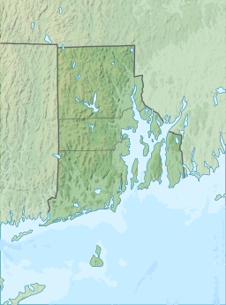
Waterman Reservoir was created in 1838 on the site of a swamp and is 318 acres (129 ha) when full with an average depth of nine feet (2.7 m). It was named after Resolved Waterman, an early eighteenth century Greenville resident and landowner. Prior to the creation of the reservoir, the
28:
347:
41:
88:
192:) was built so travelers no longer had to go around the swamp using Austin Avenue, which prior to the 1930s was known as (Old) Killingly Road.
371:
340:
181:
74:
366:
333:
201:
259:
234:
188:
area was swampy, so a dam was constructed to create the reservoir and at the same time a causeway (now part of the
177:
288:
283:
Jim
Ignasher, "Smithfield’s “Powder Mill” Turnpike," February 1, 2015, Originally published in
317:
305:
125:
360:
120:
313:
221:
189:
169:
263:
238:
103:
90:
173:
70:
289:
https://smithapplebyhouse.org/smithfields-powder-mill-turnpike/
220:
Rhode Island
Department of Environmental Management <
321:
151:
143:
135:
131:
119:
80:
66:
21:
81:
222:http://www.dem.ri.gov/maps/mapfile/pondbath.pdf
341:
8:
348:
334:
48:
18:
213:
7:
302:
300:
320:. You can help Knowledge (XXG) by
14:
304:
47:
40:
27:
182:Providence County, Rhode Island
150:
142:
134:
75:Providence County, Rhode Island
16:Reservoir in Rhode Island, U.S.
1:
202:List of lakes in Rhode Island
65:
372:Rhode Island geography stubs
316:state location article is a
388:
299:
285:Your Smithfield Magazine,
35:
26:
168:) is a large lake along
139:318 acres (129 ha)
147:9 ft (2.7 m)
367:Lakes of Rhode Island
155:12 ft (4 m)
104:41.87905°N 71.58194°W
166:Waterman's Reservoir
109:41.87905; -71.58194
100: /
162:Waterman Reservoir
55:Waterman Reservoir
22:Waterman Reservoir
329:
328:
159:
158:
379:
350:
343:
336:
308:
301:
291:
287:February – 2012
281:
275:
274:
272:
271:
262:. Archived from
256:
250:
249:
247:
246:
237:. Archived from
231:
225:
218:
115:
114:
112:
111:
110:
105:
101:
98:
97:
96:
93:
83:
51:
50:
44:
31:
19:
387:
386:
382:
381:
380:
378:
377:
376:
357:
356:
355:
354:
297:
295:
294:
282:
278:
269:
267:
258:
257:
253:
244:
242:
233:
232:
228:
219:
215:
210:
198:
164:(also known as
126:Artificial lake
108:
106:
102:
99:
94:
91:
89:
87:
86:
62:
61:
60:
59:
58:
57:
56:
52:
17:
12:
11:
5:
385:
383:
375:
374:
369:
359:
358:
353:
352:
345:
338:
330:
327:
326:
309:
293:
292:
276:
251:
226:
212:
211:
209:
206:
205:
204:
197:
194:
157:
156:
153:
149:
148:
145:
141:
140:
137:
133:
132:
129:
128:
123:
117:
116:
84:
78:
77:
68:
64:
63:
54:
53:
46:
45:
39:
38:
37:
36:
33:
32:
24:
23:
15:
13:
10:
9:
6:
4:
3:
2:
384:
373:
370:
368:
365:
364:
362:
351:
346:
344:
339:
337:
332:
331:
325:
323:
319:
315:
310:
307:
303:
298:
290:
286:
280:
277:
266:on 2021-05-17
265:
261:
255:
252:
241:on 2021-05-17
240:
236:
230:
227:
223:
217:
214:
207:
203:
200:
199:
195:
193:
191:
185:
183:
179:
175:
171:
167:
163:
154:
146:
144:Average depth
138:
130:
127:
124:
122:
118:
113:
85:
79:
76:
72:
69:
43:
34:
30:
25:
20:
322:expanding it
314:Rhode Island
311:
296:
284:
279:
268:. Retrieved
264:the original
254:
243:. Retrieved
239:the original
229:
216:
186:
165:
161:
160:
136:Surface area
190:Putnam Pike
170:Putnam Pike
107: /
82:Coordinates
361:Categories
270:2020-11-22
245:2020-11-22
208:References
178:Greenville
152:Max. depth
95:71°34′55″W
92:41°52′45″N
260:"History"
235:"History"
174:Glocester
71:Glocester
196:See also
67:Location
312:This
318:stub
224:>
176:and
121:Type
180:in
172:in
363::
184:.
73:,
349:e
342:t
335:v
324:.
273:.
248:.
Text is available under the Creative Commons Attribution-ShareAlike License. Additional terms may apply.