69:
690:
53:
129:
149:
471:
In the CDP, the population was spread out, with 25.0% under the age of 18, 7.3% from 18 to 24, 24.5% from 25 to 44, 25.1% from 45 to 64, and 18.3% who were 65 years of age or older. The median age was 40 years. For every 100 females, there were 93.0 males. For every 100 females age 18 and over,
467:
living together, 15.2% had a female householder with no husband present, and 36.0% were non-families. 31.4% of all households were made up of individuals, and 15.7% had someone living alone who was 65 years of age or older. The average household size was 2.41 and the average family size was 3.00.
427:
of 2000, there were 2,837 people, 1,164 households, and 744 families residing in the CDP. The population density was 1,186.3 inhabitants per square mile (458.0/km), containing 1,339 housing units at an average density of 559.9 per square mile (216.2/km). The racial makeup of the CDP was 66.94%
68:
804:
475:
The median income for a household in the CDP was $ 29,402, and the median income for a family was $ 36,179. Males had a median income of $ 30,353 versus $ 21,339 for females. The
628:
809:
323:, the CDP has a total area of 2.5 square miles (6.5 km), of which 2.4 square miles (6.2 km) is land and 0.1 square miles (0.26 km) is water.
268:
621:
52:
89:
278:
483:. Out of the total population, 18.7% of those under the age of 18 and 14.7% of those 65 and older were living below the poverty line.
614:
499:
243:
445:
433:
606:
563:
437:
567:
542:
320:
301:, United States. It had a population of 3,018 at the 2020 census, up from 2,829 at the 2010 census. It is part of the
161:
402:
387:
372:
357:
638:
305:
298:
169:
121:
74:
463:
There were 1,164 households, out of which 25.5% had children under the age of 18 living with them, 42.4% were
523:
718:
294:
43:
774:
453:
781:
726:
457:
253:
761:
751:
741:
708:
441:
429:
679:
660:
449:
302:
476:
479:
for the CDP was $ 13,044. 17.1% of the population and 12.9% of families were below the
798:
756:
134:
58:
480:
316:
Watertown is located at 30°11'11" North, 82°36'30" West (30.186499, -82.608312).
653:
589:
524:
U.S. Geological Survey
Geographic Names Information System: Watertown, Florida
141:
104:
91:
17:
234:
464:
154:
78:
424:
452:, and 1.76% from two or more races. 1.34% of the population were
260:
239:
700:
671:
610:
688:
538:
805:
Census-designated places in
Columbia County, Florida
740:
717:
699:
670:
277:
267:
250:
233:
225:
217:
212:
204:
196:
188:
180:
175:
160:
140:
120:
34:
622:
8:
629:
615:
607:
564:"US Gazetteer files: 2010, 2000, and 1990"
330:
31:
491:
266:
232:
211:
203:
174:
119:
84:
65:
49:
519:
517:
350:
533:
531:
276:
249:
224:
216:
195:
187:
179:
159:
139:
7:
810:Census-designated places in Florida
200:0.05 sq mi (0.13 km)
192:2.48 sq mi (6.42 km)
184:2.53 sq mi (6.55 km)
637:Municipalities and communities of
590:"Census of Population and Housing"
340:
25:
147:
127:
67:
51:
229:1,216.94/sq mi (469.88/km)
1:
502:. United States Census Bureau
306:Micropolitan Statistical Area
29:CDP in Florida, United States
568:United States Census Bureau
543:United States Census Bureau
500:"2020 U.S. Gazetteer Files"
321:United States Census Bureau
826:
770:
686:
651:
416:
401:
386:
371:
356:
349:
344:
339:
336:
85:
66:
61:and HWY 100 in Watertown.
50:
41:
640:Columbia County, Florida
299:Columbia County, Florida
472:there were 91.8 males.
295:census-designated place
208:184 ft (56 m)
693:
692:
539:"U.S. Census website"
417:U.S. Decennial Census
332:Historical population
252: • Summer (
105:30.18639°N 82.60833°W
783:United States portal
226: • Density
570:. February 12, 2011
333:
110:30.18639; -82.60833
101: /
694:
331:
303:Lake City, Florida
218: • Total
197: • Water
181: • Total
36:Watertown, Florida
792:
791:
477:per capita income
421:
420:
319:According to the
288:
287:
189: • Land
77:and the state of
16:(Redirected from
817:
784:
777:
691:
663:
656:
646:
641:
631:
624:
617:
608:
602:
601:
599:
597:
586:
580:
579:
577:
575:
560:
554:
553:
551:
549:
535:
526:
521:
512:
511:
509:
507:
496:
446:Pacific Islander
434:African American
352:
347:
342:
334:
257:
168:
153:
151:
150:
133:
131:
130:
116:
115:
113:
112:
111:
106:
102:
99:
98:
97:
94:
71:
57:Intersection of
55:
32:
21:
825:
824:
820:
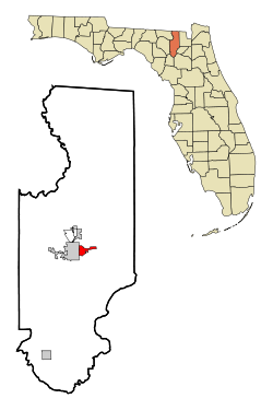
819:
818:
816:
815:
814:
795:
794:
793:
788:
782:
775:
766:
743:
736:
713:
695:
689:
684:
666:
661:
654:
647:
644:
639:
635:
605:
595:
593:
588:
587:
583:
573:
571:
562:
561:
557:
547:
545:
537:
536:
529:
522:
515:
505:
503:
498:
497:
493:
489:
465:married couples
438:Native American
345:
329:
314:
251:
166:
148:
146:
128:
126:
109:
107:
103:
100:
95:
92:
90:
88:
87:
81:
75:Columbia County
62:
46:
37:
30:
23:
22:
15:
12:
11:
5:
823:
821:
813:
812:
807:
797:
796:
790:
789:
787:
786:
779:
776:Florida portal
771:
768:
767:
765:
764:
759:
754:
748:
746:
742:Unincorporated
738:
737:
735:
734:
729:
723:
721:
715:
714:
712:
711:
705:
703:
697:
696:
687:
685:
683:
682:
676:
674:
668:
667:
652:
649:
648:
636:
634:
633:
626:
619:
611:
604:
603:
581:
555:
527:
513:
490:
488:
485:
419:
418:
414:
413:
410:
408:
405:
399:
398:
395:
393:
390:
384:
383:
380:
378:
375:
369:
368:
365:
363:
360:
354:
353:
348:
343:
338:
328:
325:
313:
310:
286:
285:
282:
275:
274:
271:
265:
264:
258:
248:
247:
237:
231:
230:
227:
223:
222:
219:
215:
214:
210:
209:
206:
202:
201:
198:
194:
193:
190:
186:
185:
182:
178:
177:
173:
172:
164:
158:
157:
144:
138:
137:
124:
118:
117:
83:
82:
72:
64:
63:
56:
48:
47:
42:
39:
38:
35:
28:
24:
14:
13:
10:
9:
6:
4:
3:
2:
822:
811:
808:
806:
803:
802:
800:
785:
780:
778:
773:
772:
769:
763:
760:
758:
755:
753:
750:
749:
747:
745:
739:
733:
730:
728:
725:
724:
722:
720:
716:
710:
707:
706:
704:
702:
698:
681:
678:
677:
675:
673:
669:
665:
664:
657:
650:
645:United States
642:
632:
627:
625:
620:
618:
613:
612:
609:
591:
585:
582:
569:
565:
559:
556:
544:
540:
534:
532:
528:
525:
520:
518:
514:
501:
495:
492:
486:
484:
482:
478:
473:
469:
466:
461:
460:of any race.
459:
455:
451:
448:, 0.21% from
447:
443:
439:
435:
431:
426:
415:
411:
409:
406:
404:
400:
396:
394:
391:
389:
385:
381:
379:
376:
374:
370:
366:
364:
361:
359:
355:
335:
326:
324:
322:
317:
311:
309:
307:
304:
300:
296:
292:
283:
280:
272:
270:
262:
259:
255:
245:
244:Eastern (EST)
241:
238:
236:
228:
220:
207:
199:
191:
183:
171:
165:
163:
156:
145:
143:
136:
135:United States
125:
123:
114:
86:Coordinates:
80:
76:
70:
60:
59:U.S. Route 90
54:
45:
40:
33:
27:
19:
18:Watertown, FL
731:
659:
594:. Retrieved
592:. Census.gov
584:
572:. Retrieved
558:
546:. Retrieved
504:. Retrieved
494:
481:poverty line
474:
470:
462:
422:
327:Demographics
318:
315:
290:
289:
73:Location in
26:
744:communities
727:Five Points
655:County seat
548:January 31,
506:December 2,
450:other races
108: /
799:Categories
762:Mikesville
752:Ellisville
709:Fort White
487:References
423:As of the
281:feature ID
213:Population
96:82°36′30″W
93:30°11′11″N
732:Watertown
680:Lake City
662:Lake City
574:April 23,
432:, 30.24%
312:Geography
297:(CDP) in
291:Watertown
269:FIPS code
235:Time zone
205:Elevation
454:Hispanic
444:, 0.04%
440:, 0.25%
436:, 0.56%
273:12-75300
170:Columbia
596:June 4,
284:0306564
155:Florida
122:Country
79:Florida
458:Latino
425:census
382:−15.1%
337:Census
167:
162:County
152:
132:
442:Asian
430:White
407:3,018
397:−0.3%
392:2,829
377:2,837
362:3,340
293:is a
263:(EDT)
261:UTC-4
240:UTC-5
221:3,018
142:State
757:Lulu
719:CDPs
701:Town
672:City
598:2016
576:2011
550:2008
508:2021
412:6.7%
403:2020
388:2010
373:2000
358:1990
346:Note
341:Pop.
279:GNIS
176:Area
456:or
254:DST
44:CDP
801::
658::
643:,
566:.
541:.
530:^
516:^
351:%±
308:.
630:e
623:t
616:v
600:.
578:.
552:.
510:.
367:—
256:)
246:)
242:(
20:)
Text is available under the Creative Commons Attribution-ShareAlike License. Additional terms may apply.