263:
29:
287:. The creek then turns south-southwest for several tenths of a mile, still flowing alongside Pennsylvania Route 42. It then turns south-southeast for a few tenths of a mile before turning south-southwest. The creek then reaches the end of its valley and reaches its confluence with Little Muncy Creek.
245:
in
Lycoming County. The watershed of the creek has an area of 4.33 square miles (11.2 km). The creek has one named tributary, which is known as West Creek. The surficial geology in the vicinity of West Branch Little Muncy Creek includes alluvium, bedrock, fill, Wisconsinan and Reworked Illinoian
350:
occurs in the surficial geology further upstream, and there are a few patches of it near the creek's lower reaches as well. In areas with shale bedrock, this till's matrix is clayey silt, while in areas with sandstone bedrock, it is clayey sand. There are
298:
West Branch Little Muncy Creek has one named tributary, which is known as West Creek. West Creek joins West Branch Little Muncy Creek 1.36 miles (2.19 km) upstream of its mouth, near
Biggerstown, and drains an area of 1.56 square miles (4.0 km).
451:
West Branch Little Muncy Creek is designated as a
Coldwater Fishery and a Migratory Fishery. Although the creek's designated use is Coldwater Fishery and Migratory Fishery, its existing use is Exceptional Value and Migratory Fishery, as of 2012.
246:
Till, Wisconsinan Till, Wisconsinan Flow-Till, Wisconsinan Till
Moraine, and Boulder Colluvium. The creek designated as a Coldwater Fishery and a Migratory Fishery and is being considered for addition to the wild
270:
West Branch Little Muncy Creek begins on
Huckleberry Mountain in Davidson Township, Sullivan County. It flows southwest for several tenths of a mile, entering Franklin Township, Lycoming County and crossing
448:. The stream was surveyed on July 2, 2013 and listed on the Pennsylvania Fish and Boat Commission website as being considered for wild trout designation on January 20, 2015.
715:
710:
238:
234:
242:
107:
279:
before turning southeast. After a few tenths of a mile, it turns south-southeast, entering Jordan
Township and receiving its only named tributary,
461:
275:
before turning south-southeast. The creek flows in this direction for several tenths of a mile along
Pennsylvania Route 42, passing through a
655:
566:
445:
251:
720:
592:
562:
429:
280:
202:
725:
500:
407:
473:
262:
467:
226:
222:
178:
28:
681:
406:
of West Branch Little Muncy Creek has an area of 4.33 square miles (11.2 km). The creek is entirely within the
290:
West Branch Little Muncy Creek joins Little Muncy Creek 19.35 miles (31.14 km) upstream of its mouth.
410:
391:
356:
633:
272:
346:
occurs on the sides of the creek's valley. However, a large area of
Wisconsinan and Reworked Illinoian
371:. In the creek's upper reaches, on Huckleberry Mountain, the surficial geology consists of Boulder
218:
628:
323:
601:
420:
pipeline would cross West Branch Little Muncy Creek and numerous other streams in the area.
360:
659:
531:
367:. Further upstream, there is Wisconsinan Till, Wisconsinan Flow-Till, and Wisconsinan Till
233:, in the United States. It is approximately 3.5 miles (5.6 km) long and flows through
432:
on August 2, 1979. Its identifier in the
Geographic Names Information System is 1190913.
403:
386:
The course of West Branch Little Muncy Creek passes through the furthest extent of the
182:
704:
95:
Little Muncy Creek in
Franklin Township, Lycoming County, Pennsylvania at Biggerstown
331:
316:
230:
326:
alongside West Branch Little Muncy Creek in its lower reaches mainly consists of
417:
308:
174:
80:
284:
122:
109:
380:
372:
339:
312:
214:
383:, or conglomerate boulders) and bedrock consisting of sandstone and shale.
504:
327:
61:
Huckleberry Mountain in Davidson Township, Sullivan County, Pennsylvania
387:
368:
364:
335:
376:
441:
352:
343:
261:
247:
311:
of West Branch Little Muncy Creek is 971 feet (296 m) above
347:
276:
440:
West Branch Little Muncy Creek is being considered for wild
568:
Feature Detail Report for: West Branch Little Muncy Creek
594:
SURFICIAL GEOLOGY OF THE SONESTOWN 7.5-MINUTE QUADRANGLE
464:, next tributary of Little Muncy Creek going downstream
683:
Statewide Existing Use Classifications Lycoming County
470:, next tributary of Little Muncy Creek going upstream
428:
West Branch Little Muncy Creek was entered into the
661:
Streams Being Considered for Wild Trout Designation
196:
188:
169:
164:
156:
148:
138:
99:
89:
79:
65:
55:
47:
38:
21:
629:"FEDERAL WATER POLLUTION CONTROL ACT, SECTION 401"
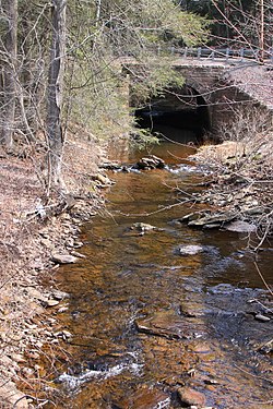
266:West Branch Little Muncy Creek looking downstream
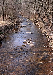
33:West Branch Little Muncy Creek looking upstream
495:
493:
491:
489:
8:
623:
621:
319:is 1,853 feet (565 m) above sea level.
716:Rivers of Lycoming County, Pennsylvania
711:Rivers of Sullivan County, Pennsylvania
586:
584:
485:
557:
555:
553:
462:Little Indian Run (Little Muncy Creek)
18:
656:Pennsylvania Fish and Boat Commission
526:
524:
522:
446:Pennsylvania Fish and Boat Commission
252:Pennsylvania Fish and Boat Commission
7:
539:, November 2, 2001, pp. 148–149
563:Geographic Names Information System
430:Geographic Names Information System
160:4.33 sq mi (11.2 km)
14:
533:Pennsylvania Gazetteer of Streams
27:
501:United States Geological Survey
408:United States Geological Survey
330:. However, there is a patch of
315:. The elevation of the creek's
474:List of rivers of Pennsylvania
211:West Branch Little Muncy Creek
101: • coordinates
22:West Branch Little Muncy Creek
1:
468:Buck Run (Little Muncy Creek)
179:West Branch Susquehanna River
39:Physical characteristics
686:, August 7, 2012, p. 20
600:, p. 20, archived from
375:(which is mostly covered in
140: • elevation
67: • elevation
91: • location
57: • location
742:
721:Tributaries of Muncy Creek
71:1,853 ft (565 m)
152:3.5 mi (5.6 km)
75:
43:
26:
144:971 ft (296 m)
591:Duane D. Braun (2004),
506:The National Map Viewer
307:The elevation near the
237:in Sullivan County and
198: • left
726:Rivers of Pennsylvania
392:Wisconsinan Glaciation
267:
634:Pennsylvania Bulletin
359:ranging in size from
303:Geography and geology
273:Pennsylvania Route 42
265:
173:Little Muncy Creek →
123:41.25132°N 76.53267°W
637:, September 19, 2015
444:designation by the
250:waters list of the
165:Basin features
128:41.25132; -76.53267
119: /
268:
219:Little Muncy Creek
355:of sandstone and
334:at the mouth and
324:surficial geology
239:Franklin Township
235:Davidson Township
208:
207:
733:
695:
694:
693:
691:
678:
672:
671:
670:
668:
652:
646:
645:
644:
642:
625:
616:
615:
614:
612:
607:on July 13, 2007
606:
599:
588:
579:
578:
577:
575:
559:
548:
547:
546:
544:
538:
528:
517:
516:
515:
513:
497:
199:
134:
133:
131:
130:
129:
124:
120:
117:
116:
115:
112:
68:
58:
31:
19:
741:
740:
736:
735:
734:
732:
731:
730:
701:
700:
699:
698:
689:
687:
680:
679:
675:
666:
664:
654:
653:
649:
640:
638:
627:
626:
619:
610:
608:
604:
597:
590:
589:
582:
573:
571:
561:
560:
551:
542:
540:
536:
530:
529:
520:
511:
509:
499:
498:
487:
482:
458:
438:
426:
400:
305:
296:
260:
243:Jordan Township
227:Lycoming County
223:Sullivan County
197:
141:
127:
125:
121:
118:
113:
110:
108:
106:
105:
102:
92:
66:
56:
34:
17:
12:
11:
5:
739:
737:
729:
728:
723:
718:
713:
703:
702:
697:
696:
673:
647:
617:
580:
549:
518:
484:
483:
481:
478:
477:
476:
471:
465:
457:
454:
437:
434:
425:
422:
413:of Sonestown.
399:
396:
338:consisting of
304:
301:
295:
292:
259:
256:
206:
205:
200:
194:
193:
190:
186:
185:
183:Chesapeake Bay
171:
167:
166:
162:
161:
158:
154:
153:
150:
146:
145:
142:
139:
136:
135:
103:
100:
97:
96:
93:
90:
87:
86:
83:
77:
76:
73:
72:
69:
63:
62:
59:
53:
52:
49:
45:
44:
41:
40:
36:
35:
32:
24:
23:
15:
13:
10:
9:
6:
4:
3:
2:
738:
727:
724:
722:
719:
717:
714:
712:
709:
708:
706:
685:
684:
677:
674:
663:
662:
657:
651:
648:
636:
635:
630:
624:
622:
618:
603:
596:
595:
587:
585:
581:
570:
569:
564:
558:
556:
554:
550:
535:
534:
527:
525:
523:
519:
508:
507:
502:
496:
494:
492:
490:
486:
479:
475:
472:
469:
466:
463:
460:
459:
455:
453:
449:
447:
443:
435:
433:
431:
423:
421:
419:
414:
412:
409:
405:
397:
395:
393:
389:
384:
382:
378:
374:
370:
366:
362:
358:
354:
349:
345:
341:
337:
333:
329:
325:
320:
318:
314:
310:
302:
300:
293:
291:
288:
286:
282:
278:
274:
264:
257:
255:
253:
249:
244:
240:
236:
232:
228:
224:
220:
216:
212:
204:
201:
195:
191:
187:
184:
180:
176:
172:
168:
163:
159:
155:
151:
147:
143:
137:
132:
104:
98:
94:
88:
84:
82:
78:
74:
70:
64:
60:
54:
50:
46:
42:
37:
30:
25:
20:
688:, retrieved
682:
676:
665:, retrieved
660:
650:
639:, retrieved
632:
609:, retrieved
602:the original
593:
572:, retrieved
567:
541:, retrieved
532:
510:, retrieved
505:
450:
439:
427:
415:
401:
385:
357:conglomerate
321:
306:
297:
289:
269:
231:Pennsylvania
210:
209:
418:natural gas
416:A proposed
390:during the
294:Tributaries
189:Tributaries
175:Muncy Creek
170:Progression
126: /
705:Categories
480:References
411:quadrangle
281:West Creek
203:West Creek
157:Basin size
114:76°31′58″W
111:41°15′05″N
404:watershed
398:Watershed
381:sandstone
373:Colluvium
340:sandstone
313:sea level
283:from the
215:tributary
690:March 1,
667:March 1,
641:March 1,
611:March 2,
574:March 1,
543:March 2,
512:March 1,
456:See also
388:glaciers
365:boulders
328:alluvium
436:Biology
424:History
369:Moraine
361:cobbles
336:bedrock
377:quartz
353:clasts
317:source
258:Course
192:
149:Length
85:
51:
48:Source
605:(PDF)
598:(PDF)
537:(PDF)
442:trout
344:shale
309:mouth
248:trout
229:, in
213:is a
81:Mouth
16:River
692:2016
669:2016
643:2016
613:2016
576:2016
545:2016
514:2016
402:The
348:Till
342:and
332:fill
322:The
285:left
277:pond
241:and
225:and
363:to
221:in
217:of
707::
658:,
631:,
620:^
583:^
565:,
552:^
521:^
503:,
488:^
394:.
379:,
254:.
181:→
177:→
Text is available under the Creative Commons Attribution-ShareAlike License. Additional terms may apply.