1064:
54:
74:
107:
42:
180:
198:
677:
114:
81:
666:
584:
is a former settlement within the township. It was settled as early as 1865 by John
Lennington. William Masters became the first postmaster of Wexford on February 17, 1865. The community was also referred to as Hanover, and a fire destroyed the community in 1906. It was partially rebuilt but later
731:
In the township the population was spread out, with 30.6% under the age of 18, 6.5% from 18 to 24, 28.7% from 25 to 44, 23.9% from 45 to 64, and 10.3% who were 65 years of age or older. The median age was 36 years. For every 100 females, there were 116.3 males. For every 100 females age 18 and
727:
living together, 6.0% had a female householder with no husband present, and 28.2% were non-families. 24.2% of all households were made up of individuals, and 8.7% had someone living alone who was 65 years of age or older. The average household size was 2.68 and the average family size was 3.10.
484:. A post office named Farnsworth opened on June 20, 1889 and was named after the Farnsworth & Chesbrough company, which operated a grist mill and sawmill in the area. The post office name was changed to Bagnall on December 29, 1902, but it is no longer in operation.
735:
The median income for a household in the township was $ 35,083, and the median income for a family was $ 37,727. Males had a median income of $ 25,833 versus $ 20,074 for females. The
539:, and the Wexford County portion was named Harlan and given a post office on March 31, 1890. The post office closed briefly in 1906 but remained in operation until July 15, 1935.
997:
635:
700:
was 21.9 per square mile (8.4/km). There were 379 housing units at an average density of 10.4 per square mile (4.0/km). The racial makeup of the township was 96.62%
1189:
631:
1465:
1139:
1470:
535:. The community began as a railway station along the Ann Arbor Railroad in 1888. For state purposes, the Manistee County portion was named Churchills within
142:
1159:
1174:
1164:
627:
1154:
1475:
392:
990:
106:
966:
1392:
73:
1407:
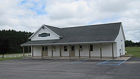
402:
481:
53:
1282:
983:
594:
550:
507:
452:
955:
Michigan Place Names: The
History of the Founding and the Naming of More Than Five Thousand Past and Present Michigan Communities
321:
1144:
639:
1460:
1194:
705:
975:
925:
709:
41:
1313:
1169:
1149:
958:
210:
760:
799:
652:
1129:
768:
1272:
1184:
1111:
752:
501:
430:
1323:
1179:
1007:
680:
536:
422:
380:
215:
59:
1352:
912:
889:
830:
819:
865:
1430:
1367:
1209:
1134:
1075:
772:
723:
There were 298 households, out of which 37.9% had children under the age of 18 living with them, 60.4% were
669:
371:
1362:
1308:
751:
Wexford
Township is served by three separate school districts. The majority of the township is served by
713:
1437:
1303:
1298:
717:
331:
1242:
1232:
1088:
701:
446:
739:
for the township was $ 14,331. About 8.3% of families and 11.3% of the population were below the
490:
is a former settlement founded in 1897 along the Ann Arbor
Railroad just west of the community of
1222:
1048:
1029:
697:
359:
696:
of 2000, there were 798 people, 298 households, and 213 families residing in the township. The
1318:
1277:
1257:
1083:
962:
764:
736:
623:
543:
491:
353:
1387:
1372:
1357:
1347:
1293:
1287:
1267:
1262:
1227:
1103:
1093:
1053:
756:
365:
494:. Claggettville, which was also referred to as West Sherman, was the site of a large mill.
1402:
1397:
1382:
1377:
244:
1329:
1252:
1217:
1121:
418:
32:
820:
U.S. Geological Survey
Geographic Names Information System: Wexford Township, Michigan
1454:
385:
913:
U.S. Geological Survey
Geographic Names Information System: Wexford Corner, Michigan
740:
591:
is an unincorporated community located in the northeast corner of the township at
547:
is an unincorporated community located in the southeast corner of the township at
655:, the township has a total area of 36.54 square miles (94.64 km), all land.
1022:
1339:
190:
890:
U.S. Geological Survey
Geographic Names Information System: Sherman, Michigan
831:
U.S. Geological Survey
Geographic Names Information System: Bagnall, Michigan
609:
596:
565:
552:
522:
509:
467:
454:
157:
144:
866:
U.S. Geological Survey
Geographic Names Information System: Harlan, Michigan
312:
743:, including 12.2% of those under age 18 and none of those age 65 or over.
1421:‡This populated place also has portions in an adjacent county or counties
724:
426:
346:
203:
1063:
480:. The community was settled in 1888 with a railway station along the
693:
767:. A very small northwestern portion of the township is served by
500:
is an unincorporated community located along the county line with
338:
317:
1040:
979:
683:
runs very briefly through the southwest corner of the township.
1062:
578:. The community extends into several neighboring township.
795:
759:. The northeastern portion of the township is served by
626:. The community is at a four-point intersection within
1416:
1338:
1241:
1208:
1120:
1102:
1074:
1039:
924:Michigan Geographic Framework (November 15, 2013).
672:
forms most of the eastern boundary of the township.
401:
391:
379:
345:
328:
311:
303:
295:
290:
282:
274:
266:
258:
253:
242:
234:
229:
221:
209:
189:
173:
23:
1067:Map of Michigan highlighting Wexford County.svg
630:on the southeast in Wexford County, as well as
991:
8:
998:
984:
976:
720:of any race were 0.63% of the population.
20:
18:Civil township in Michigan, United States
113:
80:
784:
771:, which is located to the northwest in
390:
344:
310:
289:
281:
252:
228:
220:
172:
137:
65:
50:
38:
1466:Townships in Wexford County, Michigan
900:
877:
853:
841:
790:
788:
400:
378:
327:
302:
294:
273:
270:36.54 sq mi (94.64 km)
265:
262:36.54 sq mi (94.64 km)
257:
241:
233:
208:
188:
93:Location within the state of Michigan
7:
1471:Populated places established in 1885
712:, and 2.01% from two or more races.
278:0.00 sq mi (0.00 km)
1006:Municipalities and communities of
953:Romig, Walter (October 1, 1986) .
429:. The population was 1,161 at the
14:
926:"Wexford County School Districts"
761:Buckley Community School District
622:just northwest of the village of
126:Location within the United States
957:(Paperback). Detroit, Michigan:
675:
664:
196:
178:
112:
105:
79:
72:
52:
40:
1476:1885 establishments in Michigan
961:. pp. 39, 117, 252, 596.
732:over, there were 109.1 males.
1:
769:Benzie County Central Schools
129:Show map of the United States
959:Wayne State University Press
800:United States Census Bureau
753:Mesick Consolidated Schools
1492:
286:1,086 ft (331 m)
25:Wexford Township, Michigan
1426:
1060:
1020:
138:
66:
51:
39:
30:
1009:Wexford County, Michigan
447:unincorporated community
449:within the township at
235: • Supervisor
1068:
1461:Townships in Michigan
1066:
796:"U.S. Census website"
640:Grand Traverse County
634:on the northwest and
610:44.51278°N 85.69611°W
566:44.42389°N 85.69667°W
523:44.45694°N 85.75278°W
468:44.42722°N 85.75861°W
425:in the U.S. state of
330: • Summer (
307:32/sq mi (12/km)
158:44.46139°N 85.74750°W
46:Wexford Township Hall
1439:United States portal
638:on the northeast in
304: • Density
96:Show map of Michigan
615:44.51278; -85.69611
606: /
571:44.42389; -85.69667
562: /
528:44.45694; -85.75278
519: /
473:44.42722; -85.75861
464: /
163:44.46139; -85.74750
154: /
1314:Missaukee Junction
1069:
698:population density
653:U.S. Census Bureau
482:Ann Arbor Railroad
296: • Total
275: • Water
259: • Total
1448:
1447:
968:978-0-8143-1838-6
737:per capita income
651:According to the
636:Mayfield Township
412:
411:
267: • Land
1483:
1440:
1433:
1104:Charter township
1065:
1032:
1025:
1015:
1010:
1000:
993:
986:
977:
972:
940:
939:
937:
935:
930:
921:
915:
910:
904:
898:
892:
887:
881:
875:
869:
863:
857:
851:
845:
839:
833:
828:
822:
817:
811:
810:
808:
806:
792:
706:African American
679:
678:
668:
667:
628:Hanover Township
621:
620:
618:
617:
616:
611:
607:
604:
603:
602:
599:
577:
576:
574:
573:
572:
567:
563:
560:
559:
558:
555:
534:
533:
531:
530:
529:
524:
520:
517:
516:
515:
512:
479:
478:
476:
475:
474:
469:
465:
462:
461:
460:
457:
415:Wexford Township
335:
202:
200:
199:
184:
182:
181:
169:
168:
166:
165:
164:
159:
155:
152:
151:
150:
147:
130:
120:Wexford Township
116:
115:
109:
97:
87:Wexford Township
83:
82:
76:
58:Location within
56:
44:
21:
1491:
1490:
1486:
1485:
1484:
1482:
1481:
1480:
1451:
1450:
1449:
1444:
1438:
1432:Michigan portal
1431:
1422:
1412:
1334:
1273:Garletts Corner
1244:
1237:
1204:
1122:Civil townships
1116:
1098:
1070:
1058:
1035:
1030:
1023:
1016:
1013:
1008:
1004:
969:
952:
949:
944:
943:
933:
931:
928:
923:
922:
918:
911:
907:
899:
895:
888:
884:
876:
872:
864:
860:
852:
848:
840:
836:
829:
825:
818:
814:
804:
802:
794:
793:
786:
781:
749:
725:married couples
710:Native American
690:
676:
665:
661:
649:
614:
612:
608:
605:
600:
597:
595:
593:
592:
570:
568:
564:
561:
556:
553:
551:
549:
548:
527:
525:
521:
518:
513:
510:
508:
506:
505:
502:Manistee County
472:
470:
466:
463:
458:
455:
453:
451:
450:
439:
375:
369:
363:
357:
329:
197:
195:
179:
177:
162:
160:
156:
153:
148:
145:
143:
141:
140:
134:
133:
132:
131:
128:
127:
124:
123:
122:
121:
117:
100:
99:
98:
95:
94:
91:
90:
89:
88:
84:
62:
47:
35:
26:
19:
12:
11:
5:
1489:
1487:
1479:
1478:
1473:
1468:
1463:
1453:
1452:
1446:
1445:
1443:
1442:
1435:
1427:
1424:
1423:
1420:
1418:
1414:
1413:
1411:
1410:
1405:
1400:
1395:
1390:
1385:
1380:
1375:
1370:
1365:
1360:
1355:
1350:
1344:
1342:
1336:
1335:
1333:
1332:
1327:
1324:Wexford Corner
1321:
1316:
1311:
1306:
1301:
1296:
1291:
1285:
1280:
1275:
1270:
1265:
1260:
1255:
1249:
1247:
1239:
1238:
1236:
1235:
1230:
1225:
1220:
1214:
1212:
1206:
1205:
1203:
1202:
1197:
1192:
1187:
1182:
1177:
1172:
1167:
1162:
1157:
1152:
1147:
1142:
1137:
1132:
1126:
1124:
1118:
1117:
1115:
1114:
1108:
1106:
1100:
1099:
1097:
1096:
1091:
1086:
1080:
1078:
1072:
1071:
1061:
1059:
1057:
1056:
1051:
1045:
1043:
1037:
1036:
1021:
1018:
1017:
1005:
1003:
1002:
995:
988:
980:
974:
973:
967:
948:
945:
942:
941:
916:
905:
903:, p. 596.
893:
882:
880:, p. 252.
870:
858:
856:, p. 117.
846:
834:
823:
812:
783:
782:
780:
777:
748:
745:
689:
686:
685:
684:
673:
660:
659:Major highways
657:
648:
645:
644:
643:
632:Grant Township
589:Wexford Corner
586:
579:
540:
537:Cleon Township
495:
485:
438:
435:
423:Wexford County
419:civil township
410:
409:
406:
399:
398:
395:
389:
388:
383:
377:
376:
351:
349:
343:
342:
336:
326:
325:
315:
309:
308:
305:
301:
300:
297:
293:
292:
288:
287:
284:
280:
279:
276:
272:
271:
268:
264:
263:
260:
256:
255:
251:
250:
249:Teresa Hankins
247:
240:
239:
238:David Williams
236:
232:
231:
227:
226:
223:
219:
218:
213:
207:
206:
193:
187:
186:
175:
171:
170:
136:
135:
125:
119:
118:
111:
110:
104:
103:
102:
101:
92:
86:
85:
78:
77:
71:
70:
69:
68:
67:
64:
63:
60:Wexford County
57:
49:
48:
45:
37:
36:
33:Civil township
31:
28:
27:
24:
17:
13:
10:
9:
6:
4:
3:
2:
1488:
1477:
1474:
1472:
1469:
1467:
1464:
1462:
1459:
1458:
1456:
1441:
1436:
1434:
1429:
1428:
1425:
1419:
1415:
1409:
1406:
1404:
1401:
1399:
1396:
1394:
1391:
1389:
1386:
1384:
1381:
1379:
1376:
1374:
1371:
1369:
1368:Claggettville
1366:
1364:
1361:
1359:
1356:
1354:
1351:
1349:
1346:
1345:
1343:
1341:
1337:
1331:
1328:
1325:
1322:
1320:
1317:
1315:
1312:
1310:
1307:
1305:
1302:
1300:
1297:
1295:
1292:
1289:
1286:
1284:
1281:
1279:
1276:
1274:
1271:
1269:
1266:
1264:
1261:
1259:
1256:
1254:
1251:
1250:
1248:
1246:
1240:
1234:
1231:
1229:
1226:
1224:
1221:
1219:
1216:
1215:
1213:
1211:
1207:
1201:
1198:
1196:
1193:
1191:
1188:
1186:
1183:
1181:
1178:
1176:
1173:
1171:
1168:
1166:
1163:
1161:
1158:
1156:
1153:
1151:
1148:
1146:
1143:
1141:
1138:
1136:
1133:
1131:
1128:
1127:
1125:
1123:
1119:
1113:
1110:
1109:
1107:
1105:
1101:
1095:
1092:
1090:
1087:
1085:
1082:
1081:
1079:
1077:
1073:
1055:
1052:
1050:
1047:
1046:
1044:
1042:
1038:
1034:
1033:
1026:
1019:
1014:United States
1011:
1001:
996:
994:
989:
987:
982:
981:
978:
970:
964:
960:
956:
951:
950:
946:
927:
920:
917:
914:
909:
906:
902:
897:
894:
891:
886:
883:
879:
874:
871:
867:
862:
859:
855:
850:
847:
844:, p. 39.
843:
838:
835:
832:
827:
824:
821:
816:
813:
801:
797:
791:
789:
785:
778:
776:
774:
773:Benzie County
770:
766:
762:
758:
754:
746:
744:
742:
738:
733:
729:
726:
721:
719:
715:
711:
707:
703:
699:
695:
687:
682:
674:
671:
663:
662:
658:
656:
654:
646:
641:
637:
633:
629:
625:
619:
590:
587:
583:
580:
575:
546:
545:
541:
538:
532:
503:
499:
496:
493:
489:
488:Claggettville
486:
483:
477:
448:
444:
441:
440:
436:
434:
432:
428:
424:
420:
416:
407:
404:
396:
394:
387:
384:
382:
373:
372:Thompsonville
367:
361:
355:
350:
348:
340:
337:
333:
323:
322:Eastern (EST)
319:
316:
314:
306:
298:
285:
277:
269:
261:
248:
246:
243: •
237:
224:
217:
214:
212:
205:
194:
192:
185:United States
176:
167:
139:Coordinates:
108:
75:
61:
55:
43:
34:
29:
22:
16:
1363:Cherry Grove
1309:Millersville
1199:
1190:South Branch
1145:Cherry Grove
1028:
954:
932:. Retrieved
919:
908:
896:
885:
873:
861:
849:
837:
826:
815:
803:. Retrieved
750:
741:poverty line
734:
730:
722:
691:
688:Demographics
650:
588:
581:
542:
497:
487:
442:
414:
413:
15:
1353:Bond's Mill
1340:Ghost towns
1245:communities
1195:Springville
1140:Cedar Creek
1024:County seat
805:January 31,
613: /
569: /
526: /
471: /
437:Communities
431:2020 census
347:ZIP code(s)
222:Established
161: /
1455:Categories
1393:Round Lake
1304:Meauwataka
1299:Hoxeyville
901:Romig 1986
878:Romig 1986
854:Romig 1986
842:Romig 1986
779:References
692:As of the
601:85°41′46″W
598:44°30′46″N
585:abandoned.
557:85°41′48″W
554:44°25′26″N
514:85°45′10″W
511:44°27′25″N
459:85°45′31″W
456:44°25′38″N
405:feature ID
291:Population
230:Government
149:85°44′51″W
146:44°27′41″N
1417:Footnotes
1233:Wedgewood
1170:Henderson
1160:Greenwood
1150:Clam Lake
1089:Harrietta
934:August 8,
747:Education
647:Geography
393:FIPS code
381:Area code
313:Time zone
283:Elevation
1283:Glengary
1223:Caberfae
1076:Villages
1049:Cadillac
1031:Cadillac
714:Hispanic
708:, 1.25%
704:, 0.13%
427:Michigan
397:26-86500
360:Copemish
204:Michigan
1408:Wexford
1319:Sherman
1278:Gilbert
1258:Bagnall
1200:Wexford
1175:Liberty
1165:Hanover
1130:Antioch
1084:Buckley
947:Sources
765:Buckley
624:Buckley
582:Wexford
544:Sherman
492:Sherman
443:Bagnall
408:1627253
370:49683 (
364:49668 (
358:49625 (
354:Buckley
352:49620 (
216:Wexford
174:Country
1388:Mystic
1373:Coline
1358:Bunyea
1348:Angola
1294:Hobart
1288:Harlan
1268:Benson
1263:Baxter
1228:Haring
1185:Slagle
1155:Colfax
1112:Haring
1094:Mesick
1054:Manton
1041:Cities
965:
757:Mesick
718:Latino
694:census
498:Harlan
445:is an
366:Mesick
211:County
201:
183:
1403:Thorp
1398:Soper
1383:Haire
1378:Elton
1243:Other
1180:Selma
929:(PDF)
702:White
681:M-115
417:is a
341:(EDT)
339:UTC-4
318:UTC-5
299:1,161
245:Clerk
191:State
1330:Yuma
1253:Axin
1218:Boon
1210:CDPs
1135:Boon
963:ISBN
936:2023
807:2008
670:M-37
403:GNIS
254:Area
225:1885
763:in
755:in
716:or
504:at
421:of
386:231
332:DST
1457::
1027::
1012:,
798:.
787:^
775:.
433:.
1326:‡
1290:‡
999:e
992:t
985:v
971:.
938:.
868:.
809:.
642:.
374:)
368:)
362:)
356:)
334:)
324:)
320:(
Text is available under the Creative Commons Attribution-ShareAlike License. Additional terms may apply.