861:
78:
58:
111:
46:
390:. Copper mines in Michigan had historically helped provide housing for workers so that miners could have nearby places to live and attract families which were believed to allow more stable workforces with employees staying with the company longer. The site developed as a typical post war suburb. Many homes were single-story ranch homes although a trailer park and apartment complex were also built. The community never developed fully as the
118:
85:
394:
envisioned. The automobile transformed how workers commuted where previous mine sites had workers walking from nearby housing to the mine, many workers by the 1950s preferred driving 90 miles a day and remain in their current homes rather than move.
1137:
1152:
799:
146:
1147:
1018:
890:
442:
380:
217:
1142:
915:
792:
1028:
110:
785:
340:
77:
633:
608:
549:
57:
45:
404:
777:
1094:
920:
910:
895:
200:
930:
925:
905:
880:
697:
662:
575:
435:
885:
809:
364:
205:
63:
900:
772:
769:. U.S. Environmental Protection Agency, Office of Solid Waste, observations from EPA site visit May 5 and 6, 1992
692:
657:
498:
423:
376:
953:
412:
328:
178:
537:
1107:
940:
842:
419:
360:
32:
968:
1053:
1043:
766:
1114:
1023:
1013:
450:
391:
301:
1076:
1033:
1008:
993:
973:
963:
850:
831:
446:
356:
36:
1086:
1058:
1038:
978:
948:
426:, meaning it now has officially defined boundaries and population statistics for the first time.
1048:
629:
604:
291:
1003:
454:
387:
685:"Michigan: 2010 Population and Housing Unit Counts 2010 Census of Population and Housing"
650:"Michigan: 2010 Population and Housing Unit Counts 2010 Census of Population and Housing"
601:
Hollowed Ground : copper mining and community building on Lake
Superior, 1840s-1990s
958:
872:
212:
415:
to mine it. The settlement was given a post office as "White Pine Mine" in June 1915.
1131:
408:
333:
386:
Much of White Pine was developed in the 1950s a housing community for miners at the
684:
649:
18:
Census-designated place & unincorporated community in
Michigan, United States
824:
741:
538:
U.S. Geological Survey
Geographic Names Information System: White Pine, Michigan
1068:
438:, White Pine has a total area of 5.00 square miles (12.95 km), all land.
368:
188:
161:
148:
282:
860:
720:
461:
372:
316:
193:
603:. Detroit, Mich.: Wayne State University Press. pp. 251–303.
464:, which is the highest numeric ZIP Code in the state of Michigan.
308:
287:
407:. Thomas H. Wilcox, a mining engineer, found mass copper in the
781:
859:
418:
The community of White Pine was listed as a newly-organized
571:
1138:
Unincorporated communities in
Ontonagon County, Michigan
1153:
Census-designated places in
Ontonagon County, Michigan
767:
Mine Site Visit: Copper Range
Company White Pine Mine
1085:
1067:
992:
939:
871:
841:
628:. Detroit, Michigan: Wayne State University Press.
339:
327:
315:
298:
281:
273:
265:
260:
252:
244:
236:
228:
223:
211:
199:
187:
177:
23:
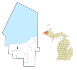
864:Map of Michigan highlighting Ontonagon County.svg
594:
592:
793:
8:
800:
786:
778:
471:
375:. The CDP had a population of 474 at the
20:
447:Porcupine Mountains Wilderness State Park
405:Chicago, Minneapolis and St. Paul Railway
525:
338:
314:
280:
259:
251:
222:
176:
141:
69:
54:
42:
1148:Unincorporated communities in Michigan
533:
531:
529:
491:
721:"Zip Codes for the State of Michigan"
700:. September 2012. p. 28 Michigan
326:
297:
272:
264:
243:
235:
227:
210:
198:
186:
97:Location within the state of Michigan
7:
1143:Census-designated places in Michigan
240:5.00 sq mi (12.96 km)
232:5.00 sq mi (12.96 km)
248:0.00 sq mi (0.00 km)
50:Entry sign to White Pine, Michigan.
808:Municipalities and communities of
742:"Census of Population and Housing"
481:
460:White Pine is served by the 49971
117:
84:
14:
457:in White Pine from 1955 to 1995.
379:. White Pine is located within
116:
109:
83:
76:
56:
44:
665:. September 2012. p. III-7
130:White Pine (the United States)
1:
552:. United States Census Bureau
441:White Pine is located within
133:Show map of the United States
1095:Ontonagon Indian Reservation
698:United States Census Bureau
663:United States Census Bureau
576:United States Census Bureau
550:"2020 U.S. Gazetteer Files"
436:United States Census Bureau
277:67.77/sq mi (26.17/km)
1169:
811:Ontonagon County, Michigan
599:Lankton, Larry D. (2010).
1103:
857:
822:
773:Copper mining in Michigan
719:ZIPCodesToGo.com (2018).
693:2010 United States Census
658:2010 United States Census
512:
497:
490:
485:
480:
477:
413:White Pine Copper Company
142:
70:
55:
43:
30:
403:It was a station on the
357:unincorporated community
256:899 ft (274 m)
37:unincorporated community
624:Romig, Walter (1986) .
420:census-designated place
361:census-designated place
33:Census-designated place
865:
863:
572:"U.S. Census website"
513:U.S. Decennial Census
473:Historical population
300: • Summer (
162:46.75389°N 89.58417°W
1116:United States portal
626:Michigan Place Names
451:Copper Range Company
392:Copper Range Company
274: • Density
100:Show map of Michigan
25:White Pine, Michigan
474:
167:46.75389; -89.58417
158: /
1087:Indian reservation
866:
472:
443:Carp Lake Township
381:Carp Lake Township
266: • Total
245: • Water
229: • Total
1125:
1124:
517:
516:
434:According to the
350:
349:
237: • Land
1160:
1117:
1110:
862:
834:
827:
817:
812:
802:
795:
788:
779:
754:
753:
751:
749:
738:
732:
731:
729:
727:
716:
710:
709:
707:
705:
689:
681:
675:
674:
672:
670:
654:
646:
640:
639:
621:
615:
614:
596:
587:
586:
584:
582:
568:
562:
561:
559:
557:
546:
540:
535:
493:
488:
483:
475:
365:Ontonagon County
305:
173:
172:
170:
169:
168:
163:
159:
156:
155:
154:
151:
134:
120:
119:
113:
101:
87:
86:
80:
64:Ontonagon County
62:Location within
60:
48:
21:
1168:
1167:
1163:
1162:
1161:
1159:
1158:
1157:
1128:
1127:
1126:
1121:
1115:
1109:Michigan portal
1108:
1099:
1081:
1063:
995:
988:
935:
873:Civil townships
867:
855:
837:
832:
825:
818:
815:
810:
806:
763:
758:
757:
747:
745:
740:
739:
735:
725:
723:
718:
717:
713:
703:
701:
687:
683:
682:
678:
668:
666:
652:
648:
647:
643:
636:
623:
622:
618:
611:
598:
597:
590:
580:
578:
570:
569:
565:
555:
553:
548:
547:
543:
536:
527:
522:
486:
470:
455:White Pine mine
432:
411:and formed the
401:
388:White Pine mine
323:
299:
166:
164:
160:
157:
152:
149:
147:
145:
144:
138:
137:
136:
135:
132:
131:
128:
127:
126:
125:
121:
104:
103:
102:
99:
98:
95:
94:
93:
92:
88:
66:
51:
39:
26:
19:
12:
11:
5:
1166:
1164:
1156:
1155:
1150:
1145:
1140:
1130:
1129:
1123:
1122:
1120:
1119:
1112:
1104:
1101:
1100:
1098:
1097:
1091:
1089:
1083:
1082:
1080:
1079:
1073:
1071:
1065:
1064:
1062:
1061:
1056:
1051:
1046:
1041:
1036:
1031:
1026:
1021:
1016:
1011:
1006:
1000:
998:
990:
989:
987:
986:
981:
976:
971:
966:
961:
956:
954:Bruce Crossing
951:
945:
943:
937:
936:
934:
933:
928:
923:
918:
913:
908:
903:
898:
893:
888:
883:
877:
875:
869:
868:
858:
856:
854:
853:
847:
845:
839:
838:
823:
820:
819:
807:
805:
804:
797:
790:
782:
776:
775:
770:
762:
761:External links
759:
756:
755:
733:
711:
676:
641:
634:
616:
609:
588:
563:
541:
524:
523:
521:
518:
515:
514:
510:
509:
506:
504:
501:
495:
494:
489:
484:
479:
469:
466:
431:
428:
400:
397:
348:
347:
344:
337:
336:
331:
325:
324:
321:
319:
313:
312:
306:
296:
295:
285:
279:
278:
275:
271:
270:
267:
263:
262:
258:
257:
254:
250:
249:
246:
242:
241:
238:
234:
233:
230:
226:
225:
221:
220:
215:
209:
208:
203:
197:
196:
191:
185:
184:
181:
175:
174:
140:
139:
129:
123:
122:
115:
114:
108:
107:
106:
105:
96:
90:
89:
82:
81:
75:
74:
73:
72:
71:
68:
67:
61:
53:
52:
49:
41:
40:
31:
28:
27:
24:
17:
13:
10:
9:
6:
4:
3:
2:
1165:
1154:
1151:
1149:
1146:
1144:
1141:
1139:
1136:
1135:
1133:
1118:
1113:
1111:
1106:
1105:
1102:
1096:
1093:
1092:
1090:
1088:
1084:
1078:
1075:
1074:
1072:
1070:
1066:
1060:
1057:
1055:
1052:
1050:
1047:
1045:
1042:
1040:
1037:
1035:
1032:
1030:
1027:
1025:
1022:
1020:
1017:
1015:
1012:
1010:
1007:
1005:
1002:
1001:
999:
997:
991:
985:
982:
980:
977:
975:
972:
970:
967:
965:
962:
960:
957:
955:
952:
950:
947:
946:
944:
942:
938:
932:
929:
927:
924:
922:
919:
917:
914:
912:
909:
907:
904:
902:
899:
897:
894:
892:
889:
887:
884:
882:
879:
878:
876:
874:
870:
852:
849:
848:
846:
844:
840:
836:
835:
828:
821:
816:United States
813:
803:
798:
796:
791:
789:
784:
783:
780:
774:
771:
768:
765:
764:
760:
743:
737:
734:
722:
715:
712:
699:
695:
694:
686:
680:
677:
664:
660:
659:
651:
645:
642:
637:
635:0-8143-1838-X
631:
627:
620:
617:
612:
610:9780814334904
606:
602:
595:
593:
589:
577:
573:
567:
564:
551:
545:
542:
539:
534:
532:
530:
526:
519:
511:
507:
505:
502:
500:
496:
476:
467:
465:
463:
458:
456:
453:operated the
452:
448:
444:
439:
437:
429:
427:
425:
421:
416:
414:
410:
409:Mineral River
406:
398:
396:
393:
389:
384:
382:
378:
374:
370:
366:
362:
358:
354:
345:
342:
335:
332:
330:
320:
318:
310:
307:
303:
293:
292:Eastern (EST)
289:
286:
284:
276:
268:
255:
247:
239:
231:
219:
216:
214:
207:
204:
202:
195:
192:
190:
183:United States
182:
180:
171:
143:Coordinates:
112:
79:
65:
59:
47:
38:
34:
29:
22:
16:
983:
969:Lake Gogebic
830:
746:. Retrieved
744:. Census.gov
736:
724:. Retrieved
714:
702:. Retrieved
691:
679:
667:. Retrieved
656:
644:
625:
619:
600:
579:. Retrieved
566:
554:. Retrieved
544:
468:Demographics
459:
445:east of the
440:
433:
417:
402:
385:
352:
351:
35:(CDP) &
15:
1054:Trout Creek
1044:Paynesville
1029:Maple Grove
996:communities
826:County seat
424:2010 census
377:2010 census
317:ZIP code(s)
165: /
1132:Categories
1069:Ghost town
1024:Craigsmere
1014:Calderwood
984:White Pine
520:References
369:U.S. state
353:White Pine
343:feature ID
261:Population
153:89°35′03″W
150:46°45′14″N
124:White Pine
91:White Pine
1077:Adventure
1034:Matchwood
1019:Carp Lake
1009:Algonquin
974:Mass City
964:Greenland
921:Ontonagon
911:Matchwood
896:Greenland
891:Carp Lake
851:Ontonagon
833:Ontonagon
430:Geography
363:(CDP) in
329:Area code
283:Time zone
253:Elevation
218:Carp Lake
206:Ontonagon
1059:Victoria
1039:Paulding
979:Rockland
949:Bergland
931:Stannard
926:Rockland
916:McMillan
906:Interior
881:Bergland
726:April 4,
704:April 3,
669:April 8,
462:ZIP Code
422:for the
373:Michigan
213:Township
194:Michigan
1049:Robbins
886:Bohemia
843:Village
748:June 4,
581:May 14,
556:May 21,
399:History
367:in the
346:1622143
179:Country
901:Haight
632:
607:
478:Census
449:. The
355:is an
201:County
1004:Agate
994:Other
688:(PDF)
653:(PDF)
322:49971
311:(EDT)
309:UTC-4
288:UTC-5
189:State
959:Ewen
941:CDPs
750:2016
728:2020
706:2020
671:2020
630:ISBN
605:ISBN
583:2011
558:2022
499:2020
487:Note
482:Pop.
359:and
341:GNIS
224:Area
503:339
371:of
334:906
302:DST
269:339
1134::
829::
814:,
696:.
690:.
661:.
655:.
591:^
574:.
528:^
492:%±
383:.
801:e
794:t
787:v
752:.
730:.
708:.
673:.
638:.
613:.
585:.
560:.
508:—
304:)
294:)
290:(
Text is available under the Creative Commons Attribution-ShareAlike License. Additional terms may apply.