70:
154:
96:
344:
84:, the "Loneliest Road in America", crosses the range near its northern end at Little Antelope Summit (7,433 ft; 2,266 m). At the southern edge of the range
295:
349:
36:. The range runs for approximately 51 miles (82 km) from Beck Pass in the north to Currant Pass in the south. To the west of the range are the Duckwater (
339:
189:
60:
17:
180:
334:
261:
209:
56:
185:
286:
271:
147:
63:
136:
128:
88:
crosses at
Currant Summit (6,999 ft; 2,133 m). The southern edge of the range extends into northeastern
29:
150:. Young and old trees alike exist at elevations above 10,000 feet, right up to the summit of Currant Mountain.
175:
108:
81:
85:
276:
287:"Scientists Voice Their Overwhelming Support for Wilderness Designations in White Pine County, Nevada"
132:
124:
45:
120:
89:
116:
104:
74:
16:
41:
328:
266:
127:(10,182 ft; 3,103 m). This high section of the range is protected as the
111:(10,745 ft; 3,275 m). The southern portion of the range rises to a thin
69:
143:
49:
281:
153:
310:
297:
112:
95:
37:
119:(11,513 ft; 3,509 m), the high point of the range. Nearby are
146:, the range might better be known for its large and vigorous stand of
33:
94:
68:
15:
44:. To the east are Jakes Valley and the northern part of the long
256:
231:
157:
The southern White Pine Range, looking west at sunrise.
139:
borders the
Currant Mountain Wilderness on the south.
131:, and its eastern slopes serve as headwaters to the
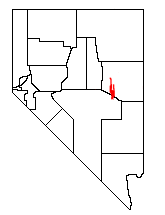
20:Location of the White Pine Range within Nevada
55:The White Pine Range is a unit of the larger
40:) tribal lands and the northern arm of large
8:
345:Mountain ranges of White Pine County, Nevada
107:lies just south of Highway 50 and includes
99:The summit crest at Currant Mountain (NFS)
212:. US Bureau of Land Management. June 2012
190:United States Department of the Interior
152:
167:
257:USFS Humboldt-Toiyabe National Forest
7:
28:is a group of mountains in southern
181:Geographic Names Information System
123:(11,188 ft; 3,410 m) and
340:Mountain ranges of the Great Basin
232:"Humboldt-Toiyabe National Forest"
210:"Ely District Wilderness Area Map"
135:. The 40,013-acre (161.9 km)
14:
48:. To the south are the Horse and
350:Humboldt–Toiyabe National Forest
262:Ely District Wilderness Area Map
137:White Pine Range Wilderness Area
129:Currant Mountain Wilderness Area
57:Humboldt-Toiyabe National Forest
186:United States Geological Survey
267:History and photos of Hamilton
61:US Department of Agriculture's
1:
148:Great Basin Bristlecone Pines
103:The historic mining area of
272:Historic photos of Hamilton
366:
311:38.9124362°N 115.3930832°W
335:Mountain ranges of Nevada
289:by the Wilderness Society
142:Although named after the
316:38.9124362; -115.3930832
158:
100:
78:
77:below Currant Mountain
21:
156:
98:
72:
19:
59:administered by the
307: /
234:. US Forest Service
176:"White Pine Range"
159:
101:
79:
46:White River Valley
22:
115:ridge, including
75:Bristlecone Pines
30:White Pine County
357:
322:
321:
319:
318:
317:
312:
308:
305:
304:
303:
300:
244:
243:
241:
239:
228:
222:
221:
219:
217:
206:
200:
199:
197:
196:
172:
117:Currant Mountain
26:White Pine Range
365:
364:
360:
359:
358:
356:
355:
354:
325:
324:
315:
313:
309:
306:
301:
298:
296:
294:
293:
253:
248:
247:
237:
235:
230:
229:
225:
215:
213:
208:
207:
203:
194:
192:
174:
173:
169:
164:
125:White Pine Peak
42:Railroad Valley
12:
11:
5:
363:
361:
353:
352:
347:
342:
337:
327:
326:
291:
290:
284:
282:Peakbagger.com
279:
277:Summitpost.org
274:
269:
264:
259:
252:
251:External links
249:
246:
245:
223:
201:
166:
165:
163:
160:
121:Duckwater Peak
64:Forest Service
13:
10:
9:
6:
4:
3:
2:
362:
351:
348:
346:
343:
341:
338:
336:
333:
332:
330:
323:
320:
288:
285:
283:
280:
278:
275:
273:
270:
268:
265:
263:
260:
258:
255:
254:
250:
233:
227:
224:
211:
205:
202:
191:
187:
183:
182:
177:
171:
168:
161:
155:
151:
149:
145:
140:
138:
134:
130:
126:
122:
118:
114:
110:
106:
97:
93:
91:
87:
83:
82:U.S. Route 50
76:
71:
67:
65:
62:
58:
53:
51:
47:
43:
39:
35:
32:, in eastern
31:
27:
18:
292:
238:November 11,
236:. Retrieved
226:
216:November 11,
214:. Retrieved
204:
193:. Retrieved
179:
170:
141:
109:Mt. Hamilton
102:
86:U.S. Route 6
80:
54:
25:
23:
314: /
302:115°23′35″W
144:Limber Pine
133:White River
329:Categories
299:38°54′45″N
195:2008-12-11
162:References
90:Nye County
113:limestone
105:Hamilton
73:Ancient
52:Ranges.
38:Shoshone
34:Nevada
50:Grant
240:2012
218:2012
24:The
331::
188:,
184:.
178:.
92:.
66:.
242:.
220:.
198:.
Text is available under the Creative Commons Attribution-ShareAlike License. Additional terms may apply.