596:
59:
92:
42:
99:
66:
381:
In the township the population was spread out, with 29.0% under the age of 18, 4.7% from 18 to 24, 24.6% from 25 to 44, 27.8% from 45 to 64, and 14.0% who were 65 years of age or older. The median age was 41 years. For every 100 females, there were 108.8 males. For every 100 females age 18 and over,
377:
living together, 2.4% had a female householder with no husband present, and 18.3% were non-families. 15.4% of all households were made up of individuals, and 6.5% had someone living alone who was 65 years of age or older. The average household size was 2.79 and the average family size was 3.10.
385:
The median income for a household in the township was $ 38,214, and the median income for a family was $ 43,750. Males had a median income of $ 27,813 versus $ 16,625 for females. The
127:
503:
665:
630:
675:
615:
354:
was 13.1 people per square mile (5.1/km). There were 179 housing units at an average density of 5.0/sq mi (1.9/km). The racial makeup of the township was 99.58%
870:
660:
650:
620:
690:
645:
625:
655:
91:
695:
670:
640:
58:
680:
635:
496:
285:
295:
489:
260:
875:
442:
481:
359:
181:
816:
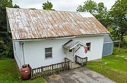
786:
417:
335:
766:
513:
311:
186:
840:
159:
32:
771:
720:
585:
373:
There were 169 households, out of which 37.3% had children under the age of 18 living with them, 77.5% were
781:
735:
579:
554:
363:
791:
745:
41:
847:
730:
559:
535:
367:
270:
761:
740:
725:
705:
355:
471:
806:
796:
776:
751:
574:
389:
for the township was $ 20,072. About 2.2% of families and 3.5% of the population were below the
351:
350:
of 2000, there were 472 people, 169 households, and 138 families residing in the township. The
564:
386:
569:
756:
465:
715:
607:
864:
338:, the township has a total area of 36.0 square miles (93.2 km), all land.
390:
528:
169:
142:
129:
315:
251:
174:
831:‡This populated place also has portions in an adjacent county or counties
393:, including 2.6% of those under age 18 and 5.8% of those age 65 or over.
374:
347:
595:
467:
Minnesota
Geographic Names: Their Origin and Historic Significance
277:
256:
546:
485:
594:
438:
318:, United States. The population was 472 at the 2000 census.
413:
98:
65:
826:
805:
704:
606:
545:
294:
284:
267:
250:
242:
234:
229:
221:
213:
205:
197:
192:
180:
168:
158:
23:
111:Wilmington Township, Minnesota (the United States)
497:
8:
599:Map of Minnesota highlighting Houston County
326:Wilmington township was organized in 1858.
504:
490:
482:
370:of any race were 0.42% of the population.
20:
470:. Minnesota Historical Society. p.
402:
283:
249:
228:
220:
191:
157:
122:
50:
38:
871:Townships in Houston County, Minnesota
78:Location within the state of Minnesota
408:
406:
293:
266:
241:
233:
212:
204:
196:
179:
167:
7:
18:Township in Minnesota, United States
209:36.0 sq mi (93.2 km)
201:36.0 sq mi (93.2 km)
512:Municipalities and communities of
14:
217:0.0 sq mi (0.0 km)
97:
90:
64:
57:
40:
443:United States Geological Survey
439:"US Board on Geographic Names"
105:Wilmington Township, Minnesota
72:Wilmington Township, Minnesota
25:Wilmington Township, Minnesota
1:
114:Show map of the United States
817:Ho-Chunk Indian Reservation
418:United States Census Bureau
336:United States Census Bureau
892:
225:1,125 ft (343 m)
836:
592:
526:
515:Houston County, Minnesota
123:
51:
39:
30:
382:there were 105.5 males.
246:13.1/sq mi (5.1/km)
876:Townships in Minnesota
600:
464:Upham, Warren (1920).
598:
414:"U.S. Census website"
269: • Summer (
143:43.55028°N 91.53500°W
81:Show map of Minnesota
849:United States portal
243: • Density
308:Wilmington Township
148:43.55028; -91.53500
139: /
601:
445:. October 25, 2007
352:population density
235: • Total
214: • Water
198: • Total
858:
857:
387:per capita income
334:According to the
310:is a township in
305:
304:
206: • Land
883:
850:
843:
842:Minnesota portal
787:Willington Grove
597:
538:
531:
521:
516:
506:
499:
492:
483:
476:
475:
461:
455:
454:
452:
450:
435:
429:
428:
426:
424:
410:
360:African American
274:
154:
153:
151:
150:
149:
144:
140:
137:
136:
135:
132:
115:
101:
100:
94:
82:
68:
67:
61:
44:
21:
891:
890:
886:
885:
884:
882:
881:
880:
861:
860:
859:
854:
848:
841:
832:
822:
808:
801:
707:
700:
602:
590:
541:
536:
529:
522:
519:
514:
510:
480:
479:
463:
462:
458:
448:
446:
437:
436:
432:
422:
420:
412:
411:
404:
399:
375:married couples
344:
332:
324:
268:
147:
145:
141:
138:
133:
130:
128:
126:
125:
119:
118:
117:
116:
113:
112:
109:
108:
107:
106:
102:
85:
84:
83:
80:
79:
76:
75:
74:
73:
69:
47:
35:
26:
19:
12:
11:
5:
889:
887:
879:
878:
873:
863:
862:
856:
855:
853:
852:
845:
837:
834:
833:
830:
828:
824:
823:
821:
820:
813:
811:
803:
802:
800:
799:
794:
789:
784:
779:
774:
769:
767:River Junction
764:
759:
754:
749:
743:
738:
733:
728:
723:
718:
712:
710:
706:Unincorporated
702:
701:
699:
698:
693:
688:
683:
678:
673:
668:
663:
658:
653:
648:
643:
638:
633:
628:
623:
618:
612:
610:
604:
603:
593:
591:
589:
588:
583:
577:
572:
567:
562:
557:
551:
549:
543:
542:
527:
524:
523:
511:
509:
508:
501:
494:
486:
478:
477:
456:
430:
401:
400:
398:
395:
343:
340:
331:
328:
323:
320:
312:Houston County
303:
302:
299:
292:
291:
288:
282:
281:
275:
265:
264:
254:
248:
247:
244:
240:
239:
236:
232:
231:
227:
226:
223:
219:
218:
215:
211:
210:
207:
203:
202:
199:
195:
194:
190:
189:
184:
178:
177:
172:
166:
165:
162:
156:
155:
121:
120:
110:
104:
103:
96:
95:
89:
88:
87:
86:
77:
71:
70:
63:
62:
56:
55:
54:
53:
52:
49:
48:
45:
37:
36:
31:
28:
27:
24:
17:
13:
10:
9:
6:
4:
3:
2:
888:
877:
874:
872:
869:
868:
866:
851:
846:
844:
839:
838:
835:
829:
825:
818:
815:
814:
812:
810:
804:
798:
795:
793:
790:
788:
785:
783:
780:
778:
775:
773:
770:
768:
765:
763:
760:
758:
755:
753:
750:
747:
744:
742:
739:
737:
734:
732:
729:
727:
724:
722:
719:
717:
714:
713:
711:
709:
703:
697:
694:
692:
689:
687:
684:
682:
679:
677:
674:
672:
669:
667:
666:Mound Prairie
664:
662:
659:
657:
654:
652:
649:
647:
644:
642:
639:
637:
634:
632:
631:Crooked Creek
629:
627:
624:
622:
619:
617:
614:
613:
611:
609:
605:
587:
584:
581:
578:
576:
573:
571:
568:
566:
563:
561:
558:
556:
553:
552:
550:
548:
544:
540:
539:
532:
525:
520:United States
517:
507:
502:
500:
495:
493:
488:
487:
484:
473:
469:
468:
460:
457:
444:
440:
434:
431:
419:
415:
409:
407:
403:
396:
394:
392:
388:
383:
379:
376:
371:
369:
365:
361:
357:
353:
349:
341:
339:
337:
329:
327:
321:
319:
317:
313:
309:
300:
297:
289:
287:
279:
276:
272:
262:
261:Central (CST)
258:
255:
253:
245:
237:
224:
216:
208:
200:
188:
185:
183:
176:
173:
171:
164:United States
163:
161:
152:
124:Coordinates:
93:
60:
43:
34:
29:
22:
16:
772:Schechs Mill
721:Black Hammer
685:
676:Spring Grove
616:Black Hammer
586:Spring Grove
534:
466:
459:
447:. Retrieved
433:
421:. Retrieved
391:poverty line
384:
380:
372:
345:
342:Demographics
333:
325:
307:
306:
15:
809:reservation
782:South Ridge
736:Money Creek
708:communities
661:Money Creek
651:La Crescent
621:Brownsville
580:La Crescent
555:Brownsville
530:County seat
449:January 31,
423:January 31,
146: /
865:Categories
792:Wilmington
746:Pine Creek
686:Wilmington
397:References
358:and 0.42%
346:As of the
298:feature ID
230:Population
827:Footnotes
731:Jefferson
691:Winnebago
646:Jefferson
626:Caledonia
608:Townships
560:Caledonia
537:Caledonia
330:Geography
316:Minnesota
286:FIPS code
252:Time zone
222:Elevation
175:Minnesota
134:91°32′6″W
131:43°33′1″N
46:Town hall
762:Riceford
741:Newhouse
726:Freeburg
656:Mayville
364:Hispanic
290:27-70564
33:Township
797:Yucatan
777:Sheldon
752:Perkins
696:Yucatan
671:Sheldon
641:Houston
575:Houston
322:History
301:0666005
187:Houston
160:Country
807:Indian
565:Eitzen
547:Cities
368:Latino
348:census
182:County
681:Union
636:Hokah
570:Hokah
356:White
280:(CDT)
278:UTC-5
257:UTC-6
170:State
757:Reno
451:2008
425:2008
296:GNIS
193:Area
716:Bee
472:240
366:or
271:DST
238:472
867::
533::
518:,
441:.
416:.
405:^
362:.
314:,
819:‡
748:‡
582:‡
505:e
498:t
491:v
474:.
453:.
427:.
273:)
263:)
259:(
Text is available under the Creative Commons Attribution-ShareAlike License. Additional terms may apply.