314:
302:
497:
28:
418:
389:
831:
240:
225:
460:
424:
395:
383:
111:
88:
83:
329:
Initially, in 1923, WIS 160 was established to bypass WIS 16 from Mill Center to
Angelica through downtown Pulaski. In 1930, four years after WIS 16 was renumbered WIS 29, both WIS 29 and WIS 160 switched places. However, WIS 160 ended up traveling from WIS 29
856:
861:
295:
Starting at WIS 29/WIS 55 junction in
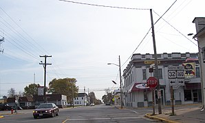
Angelica, WIS 160 travels eastward. After under 3.5 miles (5.6 km), WIS 160 ends at WIS 32 in Pulaski.
820:
198:
188:
769:
734:
58:
851:
180:
193:
835:
203:
330:
in
Angelica to WIS 32 in Pulaski. In 1996, the route was slightly truncated in favor of the WIS 29 expressway.
313:
370:
365:
157:
442:
208:
161:
301:
522:
243:
228:
467:
463:
428:
411:
403:
399:
114:
95:
91:
280:
99:
471:
447:
432:
407:
284:
272:
118:
811:
743:
620:
585:
501:
706:
678:
650:
611:
576:
548:
742:(Map) (1995–1996 ed.). 1:823,680. Madison: Wisconsin Department of Transportation.
777:(Map) (1997–1998 ed.). 1:823,680. Madison: Wisconsin Department of Transportation
845:
137:
747:
589:
276:
147:
830:
624:
628:
652:
Official
Highway Map of Wisconsin, 'The Playground of the Middle West'
578:
Official
Highway Map of Wisconsin: 'The Playground of the Middle West'
768:
Wisconsin
Department of Transportation Division of Highways (1997).
733:
Wisconsin
Department of Transportation Division of Highways (1995).
27:
819:
556:(Map). Scale not given. Madison: Wisconsin Highway Commission
584:(Map). c. 1:950,400. Madison: Wisconsin Highway Commission.
481:
1.000 mi = 1.609 km; 1.000 km = 0.621 mi
550:
Official Map of the State Trunk
Highway System of Wisconsin
619:(Map). 1:950,400. Madison: Wisconsin Highway Commission.
807:
802:
714:(Map). 1:887,040. Madison: Wisconsin Highway Commission
686:(Map). 1:506,880. Madison: Wisconsin Highway Commission
658:(Map). 1:950,400. Madison: Wisconsin Highway Commission
279:. It runs in east–west in east-central Wisconsin from
171:
153:
143:
133:
128:
105:
77:
72:
64:
51:
23:
8:
857:Transportation in Shawano County, Wisconsin
821:Template:Attached KML/Wisconsin Highway 160
337:
217:
862:Transportation in Brown County, Wisconsin
824:
680:Official Highway Service Map of Wisconsin
16:State highway in Wisconsin, United States
513:
297:
476:Roadway continues as southbound WIS 32
20:
705:Wisconsin Highway Commission (1931).
677:Wisconsin Highway Commission (1930).
649:Wisconsin Highway Commission (1927).
610:Wisconsin Highway Commission (1926).
575:Wisconsin Highway Commission (1924).
547:Wisconsin Highway Commission (1923).
457:
451:
380:
374:
7:
181:Wisconsin State Trunk Highway System
352:
14:
708:Official Highway Map of Wisconsin
613:Official Highway Map of Wisconsin
829:
495:
458:
422:
416:
393:
387:
381:
312:
300:
238:
223:
109:
86:
81:
68:3.44 mi (5.54 km)
40:Polish Veterans Memorial Highway
26:
722:– via Wikimedia Commons.
694:– via Wikimedia Commons.
666:– via Wikimedia Commons.
638:– via Wikimedia Commons.
599:– via Wikimedia Commons.
564:– via Wikimedia Commons.
1:
347:
852:State highways in Wisconsin
437:Roadway continues as WIS 55
878:
46:WIS 160 highlighted in red
480:
475:
454:
446:
441:
436:
377:
369:
364:
359:
356:
351:
346:
343:
340:
319:West terminus from WIS 29
216:
176:
167:
124:
56:
44:
39:
825:KML is not from Wikidata
257:State Trunk Highway 160
33:State Trunk Highway 160
836:Wisconsin Highway 160
771:Wisconsin Highway Map
736:Wisconsin Highway Map
502:U.S. Roads portal
371:Community of Angelica
838:at Wikimedia Commons
334:Major intersections
275:in the US state of
527:Wisconsin Highways
523:"Highways 160–169"
834:Media related to
486:
485:
291:Route description
254:
253:
250:
249:
52:Route information
869:
833:
815:
787:
786:
784:
782:
776:
765:
759:
758:
756:
754:
741:
730:
724:
723:
721:
719:
713:
702:
696:
695:
693:
691:
685:
674:
668:
667:
665:
663:
657:
646:
640:
639:
637:
635:
618:
607:
601:
600:
598:
596:
583:
572:
566:
565:
563:
561:
555:
544:
538:
537:
535:
533:
521:Bessert, Chris.
518:
500:
499:
498:
462:
461:
427:
426:
425:
420:
419:
398:
397:
396:
391:
390:
385:
384:
354:
349:
338:
316:
307:Eastern terminus
304:
246:
242:
241:
231:
227:
226:
218:
113:
112:
90:
89:
85:
84:
30:
21:
877:
876:
872:
871:
870:
868:
867:
866:
842:
841:
826:
823:
818:
817:
816:
800:
796:
791:
790:
780:
778:
774:
767:
766:
762:
752:
750:
739:
732:
731:
727:
717:
715:
711:
704:
703:
699:
689:
687:
683:
676:
675:
671:
661:
659:
655:
648:
647:
643:
633:
631:
616:
609:
608:
604:
594:
592:
581:
574:
573:
569:
559:
557:
553:
546:
545:
541:
531:
529:
520:
519:
515:
510:
496:
494:
491:
482:
459:
423:
421:
417:
415:
414:
394:
392:
388:
386:
382:
336:
327:
320:
317:
308:
305:
293:
239:
237:
224:
222:
110:
87:
82:
73:Major junctions
47:
35:
34:
31:
17:
12:
11:
5:
875:
873:
865:
864:
859:
854:
844:
843:
840:
839:
799:
798:
797:
795:
794:External links
792:
789:
788:
760:
725:
697:
669:
641:
602:
567:
539:
512:
511:
509:
506:
505:
504:
490:
487:
484:
483:
478:
477:
474:
456:
453:
450:
445:
439:
438:
435:
379:
376:
373:
368:
362:
361:
358:
355:
350:
345:
342:
335:
332:
326:
323:
322:
321:
318:
311:
309:
306:
299:
292:
289:
259:(often called
252:
251:
248:
247:
234:
232:
214:
213:
212:
211:
206:
201:
196:
191:
185:
184:
174:
173:
172:Highway system
169:
168:
165:
164:
155:
151:
150:
145:
141:
140:
135:
131:
130:
126:
125:
122:
121:
107:
103:
102:
79:
75:
74:
70:
69:
66:
62:
61:
57:Maintained by
54:
53:
49:
48:
45:
42:
41:
37:
36:
32:
25:
24:
15:
13:
10:
9:
6:
4:
3:
2:
874:
863:
860:
858:
855:
853:
850:
849:
847:
837:
832:
828:
827:
822:
813:
809:
805:
804:
793:
773:
772:
764:
761:
749:
745:
738:
737:
729:
726:
710:
709:
701:
698:
682:
681:
673:
670:
654:
653:
645:
642:
630:
626:
622:
615:
614:
606:
603:
591:
587:
580:
579:
571:
568:
552:
551:
543:
540:
528:
524:
517:
514:
507:
503:
493:
492:
488:
479:
473:
469:
465:
449:
444:
440:
434:
431:south –
430:
413:
409:
406:north –
405:
401:
372:
367:
363:
339:
333:
331:
324:
315:
310:
303:
298:
296:
290:
288:
286:
282:
278:
274:
273:state highway
270:
266:
262:
258:
245:
235:
233:
230:
220:
219:
215:
210:
207:
205:
202:
200:
197:
195:
192:
190:
187:
186:
183:
182:
178:
177:
175:
170:
166:
163:
159:
156:
152:
149:
146:
142:
139:
138:United States
136:
132:
127:
123:
120:
116:
108:
106:East end
104:
101:
97:
93:
80:
78:West end
76:
71:
67:
63:
60:
55:
50:
43:
38:
29:
22:
19:
801:
781:February 21,
779:. Retrieved
770:
763:
753:February 21,
751:. Retrieved
735:
728:
718:February 21,
716:. Retrieved
707:
700:
690:February 21,
688:. Retrieved
679:
672:
662:February 21,
660:. Retrieved
651:
644:
634:February 21,
632:. Retrieved
612:
605:
595:February 21,
593:. Retrieved
577:
570:
560:February 21,
558:. Retrieved
549:
542:
530:. Retrieved
526:
516:
357:Destinations
328:
294:
269:WIS 160
268:
264:
260:
256:
255:
244:WIS 161
229:WIS 159
179:
18:
464:WIS 32
429:WIS 55
404:WIS 55
400:WIS 29
261:Highway 160
115:WIS 32
96:WIS 55
92:WIS 29
846:Categories
508:References
189:Interstate
748:300018174
625:237003454
590:560719947
532:March 20,
468:Green Bay
412:Green Bay
277:Wisconsin
148:Wisconsin
803:KML file
629:71251169
489:See also
466: –
402: /
344:Location
281:Angelica
154:Counties
129:Location
100:Angelica
94: /
472:Gillett
448:Pulaski
433:Seymour
408:Shawano
366:Shawano
325:History
285:Pulaski
271:) is a
265:STH-160
158:Shawano
134:Country
119:Pulaski
746:
623:
588:
341:County
209:Rustic
204:Scenic
65:Length
59:WisDOT
775:(PDF)
740:(PDF)
712:(PDF)
684:(PDF)
656:(PDF)
617:(PDF)
582:(PDF)
554:(PDF)
443:Brown
360:Notes
199:State
162:Brown
144:State
812:help
808:edit
783:2021
755:2021
744:OCLC
720:2021
692:2021
664:2021
636:2021
621:OCLC
597:2021
586:OCLC
562:2021
534:2007
455:5.54
452:3.44
378:0.00
375:0.00
283:to
267:or
117:in
98:in
848::
810:•
627:,
525:.
470:,
410:,
353:km
348:mi
287:.
263:,
236:→
221:←
194:US
160:,
814:)
806:(
785:.
757:.
536:.
Text is available under the Creative Commons Attribution-ShareAlike License. Additional terms may apply.