288:
300:
423:
566:
539:
493:
100:
26:
452:
417:
1029:
458:
388:
229:
214:
76:
518:
95:
330:
Initially, in 1919, WIS 86 was formed to travel along present-day WIS 73 from WIS 18 (now US 10) in
Neillsville to WIS 16 (later WIS 29, now CTH-X) in Withee. This routing was eventually relocated in 1924 after WIS 73 extended northwestward, superseding the old
334:
In 1956, WIS 86 extended northwest along former CTH-A (now CTH-O) to US 8 east of
Catawba. In the fall of 1983, WIS 86 extended eastward towards the newly built US 51 Tomahawk bypass. By 1993, most of the 1956 northwestern extension was reverted to its county maintenance,
318:. After the crossing, it then turns north towards downtown Tomahawk. In downtown, it first intersects CTH-S (former WIS 107) and then turns east once again. Further east, it then meets
1059:
314:
in Ogema, WIS 86 then turns north and then east again. Continuing east, WIS 86 intersects WIS 102. Continuing further east, WIS 86 then crosses above the
1054:
287:
615:
1018:
187:
177:
960:
917:
878:
843:
51:
299:
1049:
331:
route in the process. On the new route, WIS 56 traveled from WIS 13 (now CTH-G) in Ogema to WIS 10 (now CTH-S) in
Tomahawk.
169:
310:
The roadway transitions from County Trunk
Highway O (CTH-O) to WIS 86 at the WIS 13 intersection west of Ogema. After crossing the
182:
335:
replacing with CTH-O in the process. As a result, WIS 86 was truncated back to WIS 13, this time at the Ogema bypass.
192:
1033:
322:(US 51) at a diamond interchange. At this point, WIS 86 ends there, and the roadway continues east as CTH-D.
521:
319:
103:
475:
150:
370:
197:
146:
503:
462:
591:
391:
232:
217:
79:
529:
480:
466:
428:
395:
273:
107:
525:
497:
399:
261:
1009:
969:
926:
887:
852:
789:
754:
691:
652:
570:
533:
438:
375:
269:
83:
815:
780:
745:
717:
682:
643:
315:
311:
968:(Map) (1993–1994 ed.). 1:823,680. Madison: Wisconsin Department of Transportation.
925:(Map) (1991–1992 ed.). 1:823,680. Madison: Wisconsin Department of Transportation.
886:(Map) (1983–1984 ed.). 1:823,680. Madison: Wisconsin Department of Transportation.
1043:
126:
620:
973:
856:
793:
758:
265:
136:
695:
1028:
934:
895:
891:
660:
656:
938:
930:
747:
Official
Highway Map of Wisconsin: 'The Playground of the Middle West'
959:
Wisconsin
Department of Transportation Division of Highways (1993).
916:
Wisconsin
Department of Transportation Division of Highways (1991).
877:
Wisconsin
Department of Transportation Division of Highways (1983).
842:
Wisconsin
Department of Transportation Division of Highways (1982).
851:(Map). 1:823,680. Madison: Wisconsin Department of Transportation.
788:(Map). 1:887,040. Madison: State Highway Commission of Wisconsin.
25:
1017:
823:(Map). 1:887,040. Madison: State Highway Commission of Wisconsin
690:(Map). Scale not given. Madison: Wisconsin Highway Commission.
725:(Map). Scale not given. Madison: Wisconsin Highway Commission
753:(Map). c. 1:950,400. Madison: Wisconsin Highway Commission.
550:
1.000 mi = 1.609 km; 1.000 km = 0.621 mi
719:
Official Map of the State Trunk
Highway System of Wisconsin
684:
Official Map of the State Trunk Highway System of Wisconsin
645:
Official Map of the State Trunk Highway System of Wisconsin
1005:
1000:
268:. It runs east–west in north central Wisconsin from
160:
142:
132:
122:
117:
89:
70:
65:
57:
44:
21:
592:"Wisconsin Highways: Highways 80-89 (Highway 86)"
651:(Map). . Madison: Wisconsin Highway Commission.
814:State Highway Commission of Wisconsin (1957).
779:State Highway Commission of Wisconsin (1956).
8:
1060:Transportation in Lincoln County, Wisconsin
1019:Template:Attached KML/Wisconsin Highway 86
342:
206:
1055:Transportation in Price County, Wisconsin
1022:
16:State highway in Wisconsin, United States
582:
433:Rustic Road; to Timm's Hill County Park
283:
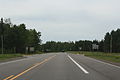
293:Looking west from the eastern terminus
18:
744:Wisconsin Highway Commission (1924).
716:Wisconsin Highway Commission (1923).
681:Wisconsin Highway Commission (1920).
642:Wisconsin Highway Commission (1919).
515:
509:
490:
484:
448:
442:
413:
407:
385:
379:
7:
170:Wisconsin State Trunk Highway System
357:
61:32.32 mi (52.01 km)
14:
782:Official Highway Map of Wisconsin
1027:
564:
537:
516:
491:
456:
450:
421:
415:
386:
298:
286:
227:
212:
98:
93:
74:
24:
831:– via Wikimedia Commons.
803:– via Wikimedia Commons.
768:– via Wikimedia Commons.
733:– via Wikimedia Commons.
705:– via Wikimedia Commons.
670:– via Wikimedia Commons.
1:
352:
1050:State highways in Wisconsin
1076:
545:Roadway continues as CTH-D
549:
544:
512:
501:
487:
479:
474:
470:
445:
437:
432:
410:
403:
382:
374:
369:
364:
361:
356:
351:
348:
345:
205:
165:
156:
113:
49:
39:WIS 86 highlighted in red
37:
1023:KML is not from Wikidata
616:"Overview map of WIS 86"
246:State Trunk Highway 86
31:State Trunk Highway 86
962:Wisconsin Highway Map
919:Wisconsin Highway Map
880:Wisconsin Highway Map
845:Wisconsin Highway Map
817:Wisconsin Highway Map
571:U.S. Roads portal
264:in the U.S. state of
1036:at Wikimedia Commons
1034:Wisconsin Highway 86
427:CTH-RR south –
339:Major intersections
596:Wisconsin Highways
320:US Highway 51
1032:Media related to
555:
554:
280:Route description
243:
242:
239:
238:
106: / CTH-D in
45:Route information
1067:
1031:
1013:
985:
984:
982:
980:
967:
956:
950:
949:
947:
945:
924:
913:
907:
906:
904:
902:
885:
874:
868:
867:
865:
863:
850:
839:
833:
832:
830:
828:
822:
811:
805:
804:
802:
800:
787:
776:
770:
769:
767:
765:
752:
741:
735:
734:
732:
730:
724:
713:
707:
706:
704:
702:
689:
678:
672:
671:
669:
667:
650:
639:
633:
632:
630:
628:
612:
606:
605:
603:
602:
590:Bessert, Chris.
587:
569:
568:
567:
541:
540:
520:
519:
495:
494:
461:
460:
459:
454:
453:
426:
425:
424:
419:
418:
390:
389:
359:
354:
343:
302:
290:
235:
231:
230:
220:
216:
215:
207:
102:
101:
97:
96:
78:
77:
28:
19:
1075:
1074:
1070:
1069:
1068:
1066:
1065:
1064:
1040:
1039:
1024:
1021:
1016:
1015:
1014:
998:
994:
989:
988:
978:
976:
965:
958:
957:
953:
943:
941:
922:
915:
914:
910:
900:
898:
883:
876:
875:
871:
861:
859:
848:
841:
840:
836:
826:
824:
820:
813:
812:
808:
798:
796:
785:
778:
777:
773:
763:
761:
750:
743:
742:
738:
728:
726:
722:
715:
714:
710:
700:
698:
687:
680:
679:
675:
665:
663:
648:
641:
640:
636:
626:
624:
614:
613:
609:
600:
598:
589:
588:
584:
579:
565:
563:
560:
551:
538:
536:
517:
492:
457:
455:
451:
449:
422:
420:
416:
414:
387:
341:
328:
316:Wisconsin River
312:Pine Line Trail
306:
303:
294:
291:
282:
228:
226:
213:
211:
99:
94:
75:
66:Major junctions
40:
33:
32:
29:
17:
12:
11:
5:
1073:
1071:
1063:
1062:
1057:
1052:
1042:
1041:
1038:
1037:
997:
996:
995:
993:
992:External links
990:
987:
986:
951:
908:
869:
834:
806:
771:
736:
708:
673:
634:
607:
581:
580:
578:
575:
574:
573:
559:
556:
553:
552:
547:
546:
543:
514:
511:
507:
506:
500:
489:
486:
483:
478:
472:
471:
469:
447:
444:
441:
435:
434:
431:
412:
409:
405:
404:
402:
384:
381:
378:
373:
367:
366:
363:
360:
355:
350:
347:
340:
337:
327:
324:
308:
307:
304:
297:
295:
292:
285:
281:
278:
248:(often called
241:
240:
237:
236:
223:
221:
203:
202:
201:
200:
195:
190:
185:
180:
174:
173:
163:
162:
161:Highway system
158:
157:
154:
153:
144:
140:
139:
134:
130:
129:
124:
120:
119:
115:
114:
111:
110:
91:
87:
86:
72:
68:
67:
63:
62:
59:
55:
54:
50:Maintained by
47:
46:
42:
41:
38:
35:
34:
30:
23:
22:
15:
13:
10:
9:
6:
4:
3:
2:
1072:
1061:
1058:
1056:
1053:
1051:
1048:
1047:
1045:
1035:
1030:
1026:
1025:
1020:
1011:
1007:
1003:
1002:
991:
975:
971:
964:
963:
955:
952:
940:
936:
932:
928:
921:
920:
912:
909:
897:
893:
889:
882:
881:
873:
870:
858:
854:
847:
846:
838:
835:
819:
818:
810:
807:
795:
791:
784:
783:
775:
772:
760:
756:
749:
748:
740:
737:
721:
720:
712:
709:
697:
693:
686:
685:
677:
674:
662:
658:
654:
647:
646:
638:
635:
623:
622:
617:
611:
608:
597:
593:
586:
583:
576:
572:
562:
561:
557:
548:
535:
531:
527:
523:
508:
505:
499:
496:CTH-S –
482:
477:
473:
468:
465:south –
464:
440:
436:
430:
406:
401:
397:
393:
377:
372:
368:
344:
338:
336:
332:
325:
323:
321:
317:
313:
305:West terminus
301:
296:
289:
284:
279:
277:
275:
271:
267:
263:
262:state highway
259:
255:
251:
247:
234:
224:
222:
219:
209:
208:
204:
199:
196:
194:
191:
189:
186:
184:
181:
179:
176:
175:
172:
171:
167:
166:
164:
159:
155:
152:
148:
145:
141:
138:
135:
131:
128:
127:United States
125:
121:
116:
112:
109:
105:
92:
90:East end
88:
85:
81:
73:
71:West end
69:
64:
60:
56:
53:
48:
43:
36:
27:
20:
999:
977:. Retrieved
961:
954:
942:. Retrieved
918:
911:
899:. Retrieved
879:
872:
860:. Retrieved
844:
837:
825:. Retrieved
816:
809:
797:. Retrieved
781:
774:
762:. Retrieved
746:
739:
727:. Retrieved
718:
711:
699:. Retrieved
683:
676:
664:. Retrieved
644:
637:
625:. Retrieved
619:
610:
599:. Retrieved
595:
585:
463:WIS 102
362:Destinations
333:
329:
309:
257:
253:
249:
245:
244:
168:
979:January 30,
944:January 30,
901:January 30,
862:January 30,
827:January 30,
799:January 30,
764:January 30,
729:January 30,
701:January 30,
666:January 30,
627:January 29,
621:Google Maps
392:WIS 13
233:WIS 87
218:WIS 85
80:WIS 13
1044:Categories
601:2007-03-20
577:References
522:US 51
250:Highway 86
178:Interstate
104:US 51
974:316818757
935:781234246
896:381172055
892:713016540
857:761318152
794:233933988
759:560719947
661:911138596
657:829862961
502:Formerly
266:Wisconsin
137:Wisconsin
1001:KML file
939:27016238
931:25418391
558:See also
530:Minocqua
524: –
481:Tomahawk
467:Rib Lake
429:Rib Lake
396:Prentice
394: –
349:Location
274:Tomahawk
143:Counties
118:Location
108:Tomahawk
696:5673515
618:(Map).
526:Merrill
504:WIS 107
498:Merrill
476:Lincoln
400:Medford
326:History
260:) is a
151:Lincoln
123:Country
972:
929:
890:
855:
792:
757:
694:
655:
534:Wausau
439:Spirit
346:County
258:WIS 86
254:STH-86
198:Rustic
193:Scenic
58:Length
52:WisDOT
966:(PDF)
923:(PDF)
884:(PDF)
849:(PDF)
821:(PDF)
786:(PDF)
751:(PDF)
723:(PDF)
688:(PDF)
649:(PDF)
542:CTH-D
513:52.01
510:32.32
488:47.28
485:29.38
446:16.09
443:10.00
411:11.15
376:Ogema
371:Price
365:Notes
270:Ogema
188:State
147:Price
133:State
84:Ogema
1010:help
1006:edit
981:2021
970:OCLC
946:2021
927:OCLC
903:2021
888:OCLC
864:2021
853:OCLC
829:2021
801:2021
790:OCLC
766:2021
755:OCLC
731:2021
703:2021
692:OCLC
668:2021
653:OCLC
629:2021
408:6.93
383:0.00
380:0.00
272:to
256:or
82:in
1046::
1008:•
937:,
933:,
894:,
659:,
594:.
532:,
528:,
398:,
358:km
353:mi
276:.
252:,
225:→
210:←
183:US
149:,
1012:)
1004:(
983:.
948:.
905:.
866:.
631:.
604:.
Text is available under the Creative Commons Attribution-ShareAlike License. Additional terms may apply.