42:
54:
1041:
899:
916:
891:
877:
459:
532:
The township's age distribution consisted of 21.1% under the age of 18, 5.6% from 18 to 24, 16.7% from 25 to 44, 41.1% from 45 to 64, and 15.6% who were 65 years of age or older. The median age was 51.1 years. For every 100 females, there were 66.7 males. For every 100 females age 18 and over, there
528:
There were 44 households, out of which 25.00% had children under the age of 18 living with them, 52.27% were married couples living together, 25.00% had a female householder with no spouse present, and 22.73% were non-families. 22.70% of all households were made up of individuals, and 11.40% had
492:
there were 212 people, 44 households, and 34 families residing in the township. The population density was 4.39 inhabitants per square mile (1.69/km). There were 108 housing units at an average density of 2.23 per square mile (0.86/km). The racial makeup of the township was 95.75%
285:
According to the 2021 census gazetteer files, Woodville
Township has a total area of 48.34 square miles (125.20 km), of which 47.51 square miles (123.05 km) (or 98.28%) is land and 0.83 square miles (2.15 km) (or 1.72%) is water.
536:
The median income for a household in the township was $ 67,857, and the median income for a family was $ 69,643. Males had a median income of $ 40,625 versus $ 31,406 for females. The
67:
41:
964:
53:
839:
1236:
1143:
1098:
1148:
1128:
1108:
866:
1133:
1123:
1103:
861:
927:
1158:
1138:
409:
373:
337:
301:
1118:
676:
643:
247:
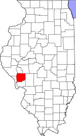
1113:
905:
448:
The township contains these eleven cemeteries: Borlin, Busch, Clark, Cumming, Dayton, Fry, Maberry, Mills, Mount Gilead, Reynolds and Varble.
957:
1080:
667:
832:
950:
529:
someone living alone who was 65 years of age or older. The average household size was 2.05 and the average family size was 2.24.
229:
208:
672:
1241:
510:
498:
942:
825:
738:
502:
121:
514:
817:
603:
588:
573:
489:
99:
662:
1206:
974:
266:
126:
331:
812:
518:
1213:
1075:
1030:
1020:
1015:
996:
522:
403:
295:
218:
367:
1168:
1025:
506:
494:
690:
540:
for the township was $ 40,092. About 32.4% of families and 36.7% of the population were below the
1183:
1065:
1052:
783:
712:
1193:
757:
537:
462:
807:
1178:
1060:
1188:
1007:
769:
1090:
1070:
477:
262:
32:
1230:
277:. As of the 2020 census, its population was 212 and it contained 108 housing units.
274:
541:
989:
109:
424:
411:
388:
375:
352:
339:
316:
303:
82:
69:
199:
544:, including 100.0% of those under age 18 and none of those age 65 or over.
270:
114:
458:
440:(This list is based on USGS data and may include former settlements.)
1040:
225:
204:
695:
946:
821:
848:
Places adjacent to
Woodville Township, Greene County, Illinois
1039:
691:
United States Census Bureau 2007 TIGER/Line
Shapefiles
1167:
1089:
1051:
1006:
246:
236:
215:
198:
190:
182:
177:
169:
161:
153:
145:
140:
132:
120:
108:
98:
23:
165:0.83 sq mi (2.1 km) 1.72%
958:
833:
663:"Woodville Township, Greene County, Illinois"
8:
633:Carrollton Community Unit School District 1
1044:Map of Illinois highlighting Greene County
965:
951:
943:
840:
826:
818:
546:
525:of any race were 1.42% of the population.
20:
630:Calhoun Community Unit School District 40
677:United States Department of the Interior
701:
245:
235:
197:
176:
168:
139:
131:
97:
62:
38:
765:
755:
566:
644:Illinois' 17th congressional district
214:
189:
181:
160:
157:47.81 sq mi (123.8 km)
152:
149:48.34 sq mi (125.2 km)
144:
119:
107:
50:
7:
1237:Townships in Greene County, Illinois
855:
707:
705:
517:, and 2.83% from two or more races.
58:Greene County's location in Illinois
668:Geographic Names Information System
18:Township in Illinois, United States
973:Municipalities and communities of
784:"Census of Population and Housing"
556:
14:
928:Richwood Township, Jersey County
914:
897:
889:
875:
457:
52:
40:
673:United States Geological Survey
1:
915:
876:
898:
890:
696:United States National Atlas
1258:
1202:
1037:
987:
853:
617:
602:
587:
572:
565:
560:
555:
552:
63:
51:
46:Location in Greene County
39:
30:
651:State Senate District 49
173:459 ft (140 m)
976:Greene County, Illinois
813:Illinois State Archives
648:State House District 97
425:39.193381°N 90.578732°W
389:39.230881°N 90.579010°W
353:39.160048°N 90.609010°W
194:4.4/sq mi (1.7/km)
1045:
317:39.25977°N 90.577899°W
1242:Townships in Illinois
1043:
713:"Explore Census Data"
618:U.S. Decennial Census
548:Historical population
430:39.193381; -90.578732
394:39.230881; -90.579010
358:39.160048; -90.609010
217: • Summer (
83:39.20722°N 90.52833°W
1215:United States portal
322:39.25977; -90.577899
290:Unincorporated towns
191: • Density
867:Carrollton Township
737:Bureau, US Census.
638:Political districts
549:
421: /
385: /
349: /
313: /
261:is one of thirteen
88:39.20722; -90.52833
79: /
1046:
895:Woodville Township
862:Bluffdale Township
768:has generic name (
547:
259:Woodville Township
183: • Total
162: • Water
146: • Total
25:Woodville Township
1224:
1223:
940:
939:
935:
934:
739:"Gazetteer Files"
622:
621:
538:per capita income
533:were 73.2 males.
463:Illinois Route 16
256:
255:
154: • Land
1249:
1216:
1209:
1042:
999:
992:
982:
977:
967:
960:
953:
944:
918:
917:
901:
900:
893:
892:
879:
878:
856:
842:
835:
828:
819:
796:
795:
793:
791:
780:
774:
773:
767:
763:
761:
753:
751:
749:
734:
728:
727:
725:
723:
709:
687:
685:
683:
625:School districts
568:
563:
558:
550:
511:Pacific Islander
499:African American
461:
436:
435:
433:
432:
431:
426:
422:
419:
418:
417:
414:
400:
399:
397:
396:
395:
390:
386:
383:
382:
381:
378:
364:
363:
361:
360:
359:
354:
350:
347:
346:
345:
342:
328:
327:
325:
324:
323:
318:
314:
311:
310:
309:
306:
222:
136:November 4, 1884
94:
93:
91:
90:
89:
84:
80:
77:
76:
75:
72:
56:
44:
21:
1257:
1256:
1252:
1251:
1250:
1248:
1247:
1246:
1227:
1226:
1225:
1220:
1214:
1208:Illinois portal
1207:
1198:
1170:
1163:
1085:
1047:
1035:
1002:
997:
990:
983:
980:
975:
971:
941:
936:
902:
849:
846:
804:
799:
789:
787:
782:
781:
777:
764:
754:
747:
745:
736:
735:
731:
721:
719:
717:data.census.gov
711:
710:
703:
681:
679:
661:
658:
640:
627:
561:
503:Native American
486:
474:
454:
446:
429:
427:
423:
420:
415:
412:
410:
408:
407:
393:
391:
387:
384:
379:
376:
374:
372:
371:
357:
355:
351:
348:
343:
340:
338:
336:
335:
321:
319:
315:
312:
307:
304:
302:
300:
299:
292:
283:
242:
216:
87:
85:
81:
78:
73:
70:
68:
66:
65:
59:
47:
35:
26:
19:
12:
11:
5:
1255:
1253:
1245:
1244:
1239:
1229:
1228:
1222:
1221:
1219:
1218:
1211:
1203:
1200:
1199:
1197:
1196:
1191:
1186:
1181:
1175:
1173:
1169:Unincorporated
1165:
1164:
1162:
1161:
1156:
1151:
1146:
1141:
1136:
1131:
1126:
1121:
1116:
1111:
1106:
1101:
1095:
1093:
1087:
1086:
1084:
1083:
1078:
1073:
1068:
1063:
1057:
1055:
1049:
1048:
1038:
1036:
1034:
1033:
1028:
1023:
1018:
1012:
1010:
1004:
1003:
988:
985:
984:
972:
970:
969:
962:
955:
947:
938:
937:
933:
932:
930:
925:
922:
921:
919:
912:
909:
908:
903:
888:
886:
883:
882:
880:
873:
870:
869:
864:
859:
854:
851:
850:
847:
845:
844:
837:
830:
822:
816:
815:
810:
803:
802:External links
800:
798:
797:
775:
729:
700:
699:
698:
693:
688:
657:
654:
653:
652:
649:
646:
639:
636:
635:
634:
631:
626:
623:
620:
619:
615:
614:
611:
609:
606:
600:
599:
596:
594:
591:
585:
584:
581:
579:
576:
570:
569:
564:
559:
554:
485:
482:
481:
480:
478:Illinois River
473:
470:
469:
468:
465:
453:
452:Major highways
450:
445:
442:
438:
437:
401:
365:
329:
291:
288:
282:
279:
254:
253:
250:
244:
243:
240:
238:
234:
233:
223:
213:
212:
202:
196:
195:
192:
188:
187:
184:
180:
179:
175:
174:
171:
167:
166:
163:
159:
158:
155:
151:
150:
147:
143:
142:
138:
137:
134:
130:
129:
124:
118:
117:
112:
106:
105:
102:
96:
95:
61:
60:
57:
49:
48:
45:
37:
36:
31:
28:
27:
24:
17:
13:
10:
9:
6:
4:
3:
2:
1254:
1243:
1240:
1238:
1235:
1234:
1232:
1217:
1212:
1210:
1205:
1204:
1201:
1195:
1192:
1190:
1187:
1185:
1182:
1180:
1177:
1176:
1174:
1172:
1166:
1160:
1157:
1155:
1152:
1150:
1147:
1145:
1142:
1140:
1137:
1135:
1132:
1130:
1127:
1125:
1122:
1120:
1117:
1115:
1112:
1110:
1107:
1105:
1102:
1100:
1097:
1096:
1094:
1092:
1088:
1082:
1079:
1077:
1074:
1072:
1069:
1067:
1064:
1062:
1059:
1058:
1056:
1054:
1050:
1032:
1029:
1027:
1024:
1022:
1019:
1017:
1014:
1013:
1011:
1009:
1005:
1001:
1000:
993:
986:
981:United States
978:
968:
963:
961:
956:
954:
949:
948:
945:
931:
929:
926:
924:
923:
920:
913:
911:
910:
907:
906:Kane Township
904:
896:
887:
885:
884:
881:
874:
872:
871:
868:
865:
863:
860:
858:
857:
852:
843:
838:
836:
831:
829:
824:
823:
820:
814:
811:
809:
808:City-Data.com
806:
805:
801:
785:
779:
776:
771:
759:
744:
740:
733:
730:
718:
714:
708:
706:
702:
697:
694:
692:
689:
678:
674:
670:
669:
664:
660:
659:
655:
650:
647:
645:
642:
641:
637:
632:
629:
628:
624:
616:
612:
610:
607:
605:
601:
597:
595:
592:
590:
586:
582:
580:
577:
575:
571:
551:
545:
543:
539:
534:
530:
526:
524:
520:
516:
513:, 1.42% from
512:
508:
504:
500:
496:
491:
483:
479:
476:
475:
471:
466:
464:
460:
456:
455:
451:
449:
443:
441:
434:
405:
402:
398:
369:
366:
362:
333:
330:
326:
297:
294:
293:
289:
287:
280:
278:
276:
272:
268:
267:Greene County
264:
260:
251:
249:
239:
231:
227:
224:
220:
210:
206:
203:
201:
193:
185:
172:
164:
156:
148:
135:
128:
125:
123:
116:
113:
111:
104:United States
103:
101:
92:
64:Coordinates:
55:
43:
34:
29:
22:
16:
1153:
995:
894:
788:. Retrieved
786:. Census.gov
778:
746:. Retrieved
742:
732:
720:. Retrieved
716:
680:. Retrieved
666:
542:poverty line
535:
531:
527:
487:
484:Demographics
447:
439:
284:
258:
257:
252:17-061-83401
241:62016, 62027
15:
1171:communities
1144:Walkerville
1099:Athensville
991:County seat
766:|last=
748:January 22,
722:January 22,
682:January 17,
515:other races
490:2020 census
428: /
392: /
356: /
332:East Hardin
320: /
133:Established
86: /
1231:Categories
1149:White Hall
1129:Rockbridge
1109:Carrollton
1081:Wilmington
1076:Rockbridge
1031:White Hall
1021:Greenfield
1016:Carrollton
998:Carrollton
743:Census.gov
656:References
488:As of the
467:Woody Road
444:Cemeteries
416:90°34′43″W
413:39°11′36″N
380:90°34′44″W
377:39°13′51″N
344:90°36′32″W
341:39°09′36″N
308:90°34′40″W
305:39°15′35″N
178:Population
74:90°31′42″W
71:39°12′26″N
1154:Woodville
1134:Roodhouse
1124:Patterson
1104:Bluffdale
1091:Townships
1026:Roodhouse
281:Geography
263:townships
248:FIPS code
237:ZIP codes
200:Time zone
170:Elevation
1184:Belltown
1066:Hillview
1053:Villages
758:cite web
519:Hispanic
509:, 0.00%
505:, 0.00%
501:, 0.00%
497:, 0.00%
271:Illinois
115:Illinois
33:Township
1194:Wrights
1159:Wrights
1139:Rubicon
790:June 4,
100:Country
1179:Barrow
1119:Linder
1061:Eldred
1008:Cities
613:−11.3%
598:−20.6%
553:Census
523:Latino
472:Rivers
127:Greene
122:County
1189:Drake
507:Asian
495:White
404:Titus
296:Clark
226:UTC-5
205:UTC-6
110:State
1114:Kane
1071:Kane
792:2016
770:help
750:2023
724:2023
684:2010
604:2020
589:2010
574:2000
562:Note
557:Pop.
368:King
141:Area
608:212
593:239
578:301
521:or
406:at
370:at
334:at
298:at
275:USA
265:in
230:CDT
219:DST
209:CST
186:212
1233::
994::
979:,
762::
760:}}
756:{{
741:.
715:.
704:^
675:,
671:.
665:.
567:%±
273:,
269:,
966:e
959:t
952:v
841:e
834:t
827:v
794:.
772:)
752:.
726:.
686:.
583:—
232:)
228:(
221:)
211:)
207:(
Text is available under the Creative Commons Attribution-ShareAlike License. Additional terms may apply.