54:
831:
42:
468:
In the CDP, the population was spread out, with 25.5% under the age of 18, 8.1% from 18 to 24, 25.7% from 25 to 44, 23.7% from 45 to 64, and 17.0% who were 65 years of age or older. The median age was 40 years. For every 100 females, there were 96.1 males. For every 100 females age 18 and over, there
464:
living together, 11.2% had a female householder with no husband present, and 39.0% were non-families. 35.4% of all households were made up of individuals, and 17.5% had someone living alone who was 65 years of age or older. The average household size was 2.27 and the average family size was 2.97.
428:
of 2000, there were 506 people, 223 households, and 136 families residing in the CDP. The population density was 254.1 inhabitants per square mile (98.1/km). There were 239 housing units at an average density of 120.0 per square mile (46.3/km). The racial makeup of the CDP was 96.25%
1051:
317:
Worden is home to a number of restaurants, bars, stores, churches, and other services. It is also the home of the
Huntley Project School System, consisting of an elementary, junior high, and high school.
53:
472:
The median income for a household in the CDP was $ 22,625, and the median income for a family was $ 38,393. Males had a median income of $ 22,434 versus $ 20,156 for females. The
764:
349:. Irrigation transformed the area into an agricultural district and attracted immigrants. The town had a German Congregational church and a Methodist church. A newspaper,
1056:
757:
712:
249:
692:
750:
67:
1061:
311:
259:
539:
670:
742:
434:
893:
438:
774:
649:
508:
446:
362:
319:
279:
126:
121:
903:
299:
520:
403:
335:
287:
237:
99:
563:
956:
860:
460:
There were 223 households, out of which 27.8% had children under the age of 18 living with them, 46.6% were
331:
275:
32:
1018:
450:
338:
was surveyed and built in the early 1880s, a station called "Clermont" was supposedly built 21 miles from
41:
1025:
454:
210:
923:
873:
442:
430:
307:
291:
500:
Worden is located along
Shepherd Road, formerly Montana Highway 312. It is accessed via exit 6 on
948:
850:
699:
200:
980:
933:
908:
888:
815:
796:
473:
366:
339:
990:
975:
883:
295:
476:
for the CDP was $ 14,319. About 3.8% of families and 8.5% of the population were below the
985:
938:
878:
820:
346:
303:
898:
868:
1045:
995:
501:
242:
477:
726:
789:
623:
736:
967:
109:
82:
69:
365:, the CDP has a total area of 2.0 square miles (5.2 km), all land. The
191:
564:
U.S. Geological Survey
Geographic Names Information System: Worden, Montana
480:, including 8.9% of those under age 18 and 16.5% of those age 65 or over.
1009:‡This populated place also has portions in an adjacent county or counties
461:
225:
731:
283:
114:
693:"2020 CENSUS - SCHOOL DISTRICT REFERENCE MAP: Yellowstone County, MT"
575:
425:
217:
196:
842:
807:
489:
746:
492:
is licensed in Worden. It plays an adult contemporary format.
829:
330:
Worden is located on land designated in 1868 as part of the
737:
Yellowstone County Towns, Train
Stations & Post Offices
597:
286:, United States. The population was 582 at the 506 at the
645:
345:
The town of Worden was mapped out in 1907 as part of the
1052:
Census-designated places in
Yellowstone County, Montana
1004:
966:
947:
922:
859:
841:
806:
258:
248:
236:
224:
207:
190:
182:
174:
169:
161:
153:
145:
137:
132:
120:
108:
98:
23:
342:, just across the tracks from present-day Worden.
732:Huntley Project Museum of Irrigated Agriculture
830:
758:
8:
765:
751:
743:
457:of any race were 3.56% of the population.
376:
20:
727:Bureau of Reclamation - Huntley Project
531:
247:
223:
189:
168:
160:
131:
97:
62:
50:
38:
559:
557:
396:
257:
235:
206:
181:
173:
152:
144:
136:
119:
107:
7:
449:, and 1.58% from two or more races.
1057:Census-designated places in Montana
312:United States Bureau of Reclamation
157:0.00 sq mi (0.00 km)
149:1.98 sq mi (5.12 km)
141:1.98 sq mi (5.12 km)
773:Municipalities and communities of
624:"Census of Population and Housing"
523:, a K-12 unified school district.
386:
322:'s team name is the "Red Devils."
14:
578:. Montana High School Association
540:"ArcGIS REST Services Directory"
52:
40:
1:
602:Montana Place Names Companion
542:. United States Census Bureau
186:294.53/sq mi (113.70/km)
18:CDP in Montana, United States
604:. Montana Historical Society
521:Huntley Project K-12 Schools
776:Yellowstone County, Montana
650:United States Census Bureau
509:Logan International Airport
363:United States Census Bureau
351:The Yellowstone County News
320:Huntley Project High School
58:Location of Worden, Montana
1078:
1062:Billings metropolitan area
165:2,963 ft (903 m)
1014:
827:
787:
417:
402:
395:
390:
385:
382:
336:Northern Pacific Railroad
63:
51:
39:
30:
957:Crow Indian Reservation
519:The school district is
507:The nearest airport is
332:Crow Indian Reservation
276:census-designated place
835:
834:Yellowstone County map
369:is just to the north.
83:45.96083°N 108.16361°W
833:
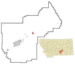
646:"U.S. Census website"
488:The FM radio station
418:U.S. Decennial Census
378:Historical population
290:. Worden, along with
209: • Summer (
1027:United States portal
894:Mountain View Colony
183: • Density
88:45.96083; -108.16361
46:Streetside in Worden
379:
310:established by the
308:irrigation district
79: /
949:Indian reservation
836:
700:U.S. Census Bureau
377:
353:, was based here.
280:Yellowstone County
175: • Total
154: • Water
138: • Total
1036:
1035:
474:per capita income
469:were 89.4 males.
422:
421:
367:Yellowstone River
361:According to the
302:, is part of the
269:
268:
146: • Land
1069:
1028:
1021:
832:
799:
792:
782:
777:
767:
760:
753:
744:
715:
710:
708:
706:
697:
689:
683:
682:
680:
678:
667:
661:
660:
658:
656:
642:
636:
635:
633:
631:
620:
614:
613:
611:
609:
594:
588:
587:
585:
583:
576:"Member Schools"
572:
566:
561:
552:
551:
549:
547:
536:
435:African American
398:
393:
388:
380:
214:
94:
93:
91:
90:
89:
84:
80:
77:
76:
75:
72:
56:
44:
21:
1077:
1076:
1072:
1071:
1070:
1068:
1067:
1066:
1042:
1041:
1039:
1037:
1032:
1026:
1019:
1010:
1000:
962:
943:
925:
918:
855:
837:
825:
802:
797:
790:
783:
780:
775:
771:
723:
718:
704:
702:
695:
691:
690:
686:
676:
674:
669:
668:
664:
654:
652:
644:
643:
639:
629:
627:
622:
621:
617:
607:
605:
596:
595:
591:
581:
579:
574:
573:
569:
562:
555:
545:
543:
538:
537:
533:
529:
517:
498:
486:
462:married couples
439:Native American
391:
375:
359:
347:Huntley Project
328:
304:Huntley Project
300:Pompey's Pillar
232:
208:
87:
85:
81:
78:
73:
70:
68:
66:
65:
59:
47:
35:
26:
25:Worden, Montana
19:
12:
11:
5:
1075:
1073:
1065:
1064:
1059:
1054:
1044:
1043:
1034:
1033:
1031:
1030:
1023:
1020:Montana portal
1015:
1012:
1011:
1008:
1006:
1002:
1001:
999:
998:
993:
988:
983:
978:
972:
970:
964:
963:
961:
960:
953:
951:
945:
944:
942:
941:
936:
930:
928:
920:
919:
917:
916:
911:
906:
904:Pompeys Pillar
901:
896:
891:
886:
881:
876:
871:
865:
863:
857:
856:
854:
853:
847:
845:
839:
838:
828:
826:
824:
823:
818:
812:
810:
804:
803:
788:
785:
784:
772:
770:
769:
762:
755:
747:
741:
740:
739:, rootsweb.com
734:
729:
722:
721:External links
719:
717:
716:
684:
662:
637:
615:
589:
567:
553:
530:
528:
525:
516:
513:
497:
496:Infrastructure
494:
485:
482:
420:
419:
415:
414:
411:
409:
406:
400:
399:
394:
389:
384:
374:
371:
358:
355:
327:
324:
267:
266:
263:
256:
255:
252:
246:
245:
240:
234:
233:
230:
228:
222:
221:
215:
205:
204:
201:Mountain (MST)
194:
188:
187:
184:
180:
179:
176:
172:
171:
167:
166:
163:
159:
158:
155:
151:
150:
147:
143:
142:
139:
135:
134:
130:
129:
124:
118:
117:
112:
106:
105:
102:
96:
95:
61:
60:
57:
49:
48:
45:
37:
36:
31:
28:
27:
24:
17:
13:
10:
9:
6:
4:
3:
2:
1074:
1063:
1060:
1058:
1055:
1053:
1050:
1049:
1047:
1040:
1029:
1024:
1022:
1017:
1016:
1013:
1007:
1003:
997:
994:
992:
989:
987:
984:
982:
979:
977:
974:
973:
971:
969:
965:
958:
955:
954:
952:
950:
946:
940:
937:
935:
932:
931:
929:
927:
921:
915:
912:
910:
907:
905:
902:
900:
897:
895:
892:
890:
887:
885:
882:
880:
877:
875:
872:
870:
867:
866:
864:
862:
858:
852:
849:
848:
846:
844:
840:
822:
819:
817:
814:
813:
811:
809:
805:
801:
800:
793:
786:
781:United States
778:
768:
763:
761:
756:
754:
749:
748:
745:
738:
735:
733:
730:
728:
725:
724:
720:
714:
701:
694:
688:
685:
672:
666:
663:
651:
647:
641:
638:
625:
619:
616:
603:
599:
593:
590:
577:
571:
568:
565:
560:
558:
554:
541:
535:
532:
526:
524:
522:
514:
512:
511:in Billings.
510:
505:
503:
502:Interstate 94
495:
493:
491:
483:
481:
479:
475:
470:
466:
463:
458:
456:
452:
448:
445:, 0.40% from
444:
440:
436:
432:
427:
416:
412:
410:
407:
405:
401:
381:
372:
370:
368:
364:
356:
354:
352:
348:
343:
341:
337:
333:
325:
323:
321:
315:
313:
309:
305:
301:
297:
293:
289:
285:
281:
277:
273:
264:
261:
253:
251:
244:
241:
239:
229:
227:
219:
216:
212:
202:
198:
195:
193:
185:
177:
164:
156:
148:
140:
128:
125:
123:
116:
113:
111:
104:United States
103:
101:
92:
64:Coordinates:
55:
43:
34:
29:
22:
16:
1038:
913:
795:
703:. Retrieved
687:
677:December 24,
675:. Retrieved
665:
653:. Retrieved
640:
628:. Retrieved
626:. Census.gov
618:
606:. Retrieved
601:
592:
580:. Retrieved
570:
546:September 5,
544:. Retrieved
534:
518:
506:
499:
487:
478:poverty line
471:
467:
459:
423:
373:Demographics
360:
350:
344:
329:
316:
271:
270:
15:
968:Ghost towns
926:communities
791:County seat
655:January 31,
447:other races
334:. When the
288:2020 census
127:Yellowstone
86: /
1046:Categories
874:Ballantine
527:References
424:As of the
292:Ballantine
262:feature ID
170:Population
74:108°9′49″W
71:45°57′39″N
1005:Footnotes
851:Broadview
713:Text list
705:March 15,
608:April 11,
582:April 19,
515:Education
357:Geography
314:in 1907.
278:(CDP) in
250:FIPS code
238:Area code
192:Time zone
162:Elevation
981:Mossmain
934:Comanche
909:Shepherd
889:Lockwood
816:Billings
798:Billings
598:"Worden"
451:Hispanic
441:, 0.20%
437:, 0.99%
433:, 0.59%
340:Billings
254:30-81925
226:ZIP code
991:Rimrock
976:Coulson
884:Huntley
630:June 4,
326:History
296:Huntley
284:Montana
265:0778696
115:Montana
100:Country
986:Osborn
939:Hesper
914:Worden
879:Custer
821:Laurel
808:Cities
671:"KCHH"
455:Latino
426:census
383:Census
298:, and
272:Worden
122:County
924:Other
899:Nibbe
869:Acton
696:(PDF)
673:. FCC
484:Media
443:Asian
431:White
306:, an
274:is a
231:59088
220:(MDT)
218:UTC-6
197:UTC-7
110:State
996:Waco
861:CDPs
843:Town
707:2024
679:2023
657:2008
632:2016
610:2021
584:2021
548:2022
490:KCHH
404:2020
392:Note
387:Pop.
260:GNIS
133:Area
453:or
408:582
243:406
211:DST
178:582
33:CDP
1048::
794::
779:,
711:-
698:.
648:.
600:.
556:^
504:.
397:%±
294:,
282:,
959:‡
766:e
759:t
752:v
709:.
681:.
659:.
634:.
612:.
586:.
550:.
413:—
213:)
203:)
199:(
Text is available under the Creative Commons Attribution-ShareAlike License. Additional terms may apply.