42:
656:
66:
73:
397:
In the CDP, the population was spread out, with 32.2% under the age of 18, 7.4% from 18 to 24, 33.1% from 25 to 44, 21.5% from 45 to 64, and 5.8% who were 65 years of age or older. The median age was 30 years. For every 100 females, there were 96.7 males. For every 100 females age 18 and over, there
393:
living together, 7.2% had a female householder with no husband present, and 19.3% were non-families. 14.5% of all households were made up of individuals, and 3.6% had someone living alone who was 65 years of age or older. The average household size was 2.92 and the average family size was 3.22.
41:
800:
401:
The median income for a household in the CDP was $ 32,273, and the median income for a family was $ 30,795. Males had a median income of $ 23,750 versus $ 18,542 for females. The
574:
370:
was 99.3 people per square mile (38.3/km). There were 86 housing units at an average density of 35.3/sq mi (13.6/km). The racial makeup of the CDP was 96.69%
805:
97:
267:
319:
65:
531:
418:
567:
277:
560:
483:
552:
505:
509:
458:
375:
351:
151:
437:
305:
694:
255:
129:
734:
684:
666:
293:
32:
389:
There were 83 households, out of which 42.2% had children under the age of 18 living with them, 68.7% were
770:
584:
379:
297:
156:
47:
777:
383:
240:
714:
535:
371:
679:
674:
645:
640:
625:
606:
367:
230:
724:
635:
402:
405:
for the CDP was $ 12,188. About 13.6% of families and 19.3% of the population were below the
757:
704:
689:
630:
366:
of 2000, there were 242 people, 83 households, and 66 families residing in the CDP. The
729:
617:
794:
260:
739:
409:, including 25.5% of those under the age of eighteen and none of those 65 or over.
406:
599:
749:
139:
354:, the CDP has a total area of 2.4 square miles (6.2 km), all land.
334:
321:
112:
99:
221:
390:
301:
144:
51:
363:
247:
226:
556:
417:
Public education in the community of Y-O Ranch is provided by
654:
479:
454:
748:
713:
665:
616:
438:"Y-O Ranch Population and Housing Occupancy Status"
276:
266:
254:
237:
220:
212:
204:
199:
191:
183:
175:
167:
162:
150:
138:
128:
23:
801:Census-designated places in Platte County, Wyoming
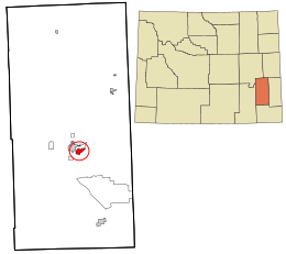
304:, United States. The population was 195 at the
568:
8:
575:
561:
553:
506:"US Gazetteer files: 2010, 2000, and 1990"
386:of any race were 5.79% of the population.
72:
20:
429:
265:
253:
219:
198:
190:
161:
127:
92:
58:
38:
449:
447:
275:
236:
211:
203:
182:
174:
166:
149:
137:
7:
534:. U.S. Census Bureau. Archived from
806:Census-designated places in Wyoming
583:Municipalities and communities of
14:
187:0.0 sq mi (0.0 km)
179:2.4 sq mi (6.3 km)
171:2.4 sq mi (6.3 km)
419:Platte County School District #1
71:
64:
40:
484:United States Geological Survey
480:"US Board on Geographic Names"
1:
85:Location in the United States
18:CDP in Wyoming, United States
195:4,885 ft (1,489 m)
510:United States Census Bureau
459:United States Census Bureau
352:United States Census Bureau
822:
532:"2010 Wyoming Place Names"
347:(42.035835, -104.939874).
766:
652:
597:
93:
59:
39:
30:
335:42.035835°N 104.939874°W
316:Y-O Ranch is located at
294:census-designated place
659:
586:Platte County, Wyoming
340:42.035835; -104.939874
113:42.03583°N 104.94000°W
658:
455:"U.S. Census website"
239: • Summer (
216:81/sq mi (31/km)
779:United States portal
213: • Density
118:42.03583; -104.94000
512:. February 12, 2011
331: /
109: /
660:
486:. October 25, 2007
398:were 102.5 males.
368:population density
205: • Total
184: • Water
168: • Total
79:Y-O Ranch, Wyoming
25:Y-O Ranch, Wyoming
788:
787:
538:on April 11, 2011
403:per capita income
350:According to the
287:
286:
176: • Land
50:and the state of
813:
780:
773:
657:
609:
602:
592:
587:
577:
570:
563:
554:
548:
547:
545:
543:
528:
522:
521:
519:
517:
502:
496:
495:
493:
491:
476:
470:
469:
467:
465:
451:
442:
441:
434:
346:
345:
343:
342:
341:
336:
332:
329:
328:
327:
324:
244:
124:
123:
121:
120:
119:
114:
110:
107:
106:
105:
102:
75:
74:
68:
44:
21:
821:
820:
816:
815:
814:
812:
811:
810:
791:
790:
789:
784:
778:
771:
762:
744:
716:
709:
695:Westview Circle
661:
655:
650:
612:
607:
600:
593:
590:
585:
581:
551:
541:
539:
530:
529:
525:
515:
513:
504:
503:
499:
489:
487:
478:
477:
473:
463:
461:
453:
452:
445:
436:
435:
431:
427:
415:
391:married couples
360:
339:
337:
333:
330:
325:
322:
320:
318:
317:
314:
238:
117:
115:
111:
108:
103:
100:
98:
96:
95:
89:
88:
87:
86:
83:
82:
81:
80:
76:
55:
35:
26:
19:
12:
11:
5:
819:
817:
809:
808:
803:
793:
792:
786:
785:
783:
782:
775:
772:Wyoming portal
767:
764:
763:
761:
760:
754:
752:
746:
745:
743:
742:
737:
735:Dwyer Junction
732:
727:
721:
719:
711:
710:
708:
707:
702:
697:
692:
687:
685:Lakeview North
682:
677:
671:
669:
663:
662:
653:
651:
649:
648:
643:
638:
633:
628:
622:
620:
614:
613:
598:
595:
594:
582:
580:
579:
572:
565:
557:
550:
549:
523:
497:
471:
443:
428:
426:
423:
414:
411:
359:
356:
313:
310:
285:
284:
281:
274:
273:
270:
264:
263:
258:
252:
251:
245:
235:
234:
231:Mountain (MST)
224:
218:
217:
214:
210:
209:
206:
202:
201:
197:
196:
193:
189:
188:
185:
181:
180:
177:
173:
172:
169:
165:
164:
160:
159:
154:
148:
147:
142:
136:
135:
132:
126:
125:
91:
90:
84:
78:
77:
70:
69:
63:
62:
61:
60:
57:
56:
45:
37:
36:
31:
28:
27:
24:
17:
13:
10:
9:
6:
4:
3:
2:
818:
807:
804:
802:
799:
798:
796:
781:
776:
774:
769:
768:
765:
759:
756:
755:
753:
751:
747:
741:
738:
736:
733:
731:
728:
726:
723:
722:
720:
718:
712:
706:
703:
701:
698:
696:
693:
691:
688:
686:
683:
681:
678:
676:
673:
672:
670:
668:
664:
647:
644:
642:
639:
637:
634:
632:
629:
627:
624:
623:
621:
619:
615:
611:
610:
603:
596:
591:United States
588:
578:
573:
571:
566:
564:
559:
558:
555:
537:
533:
527:
524:
511:
507:
501:
498:
485:
481:
475:
472:
460:
456:
450:
448:
444:
439:
433:
430:
424:
422:
420:
412:
410:
408:
404:
399:
395:
392:
387:
385:
381:
377:
374:, 3.31% from
373:
369:
365:
357:
355:
353:
348:
344:
311:
309:
307:
303:
299:
298:Platte County
295:
291:
282:
279:
271:
269:
262:
259:
257:
249:
246:
242:
232:
228:
225:
223:
215:
207:
194:
186:
178:
170:
158:
155:
153:
146:
143:
141:
134:United States
133:
131:
122:
94:Coordinates:
67:
53:
49:
48:Platte County
43:
34:
29:
22:
16:
699:
605:
540:. Retrieved
536:the original
526:
514:. Retrieved
500:
488:. Retrieved
474:
462:. Retrieved
432:
416:
407:poverty line
400:
396:
388:
361:
358:Demographics
349:
315:
289:
288:
46:Location in
15:
717:communities
601:County seat
490:January 31,
464:January 31,
376:other races
338: /
326:104°56′24″W
306:2010 census
116: /
104:104°56′24″W
795:Categories
750:Ghost town
425:References
362:As of the
323:42°02′09″N
280:feature ID
200:Population
700:Y-O Ranch
680:El Rancho
675:Chugcreek
646:Wheatland
641:Hartville
626:Chugwater
608:Wheatland
516:April 23,
413:Education
312:Geography
296:(CDP) in
290:Y-O Ranch
268:FIPS code
256:Area code
222:Time zone
192:Elevation
725:Bordeaux
636:Guernsey
542:July 13,
380:Hispanic
272:56-86737
101:42°2′9″N
758:Sunrise
705:Whiting
302:Wyoming
283:1853220
145:Wyoming
130:Country
52:Wyoming
690:Slater
631:Glendo
384:Latino
364:census
157:Platte
152:County
730:Dwyer
715:Other
618:Towns
372:White
292:is a
250:(MDT)
248:UTC-6
227:UTC-7
140:State
667:CDPs
544:2012
518:2011
492:2008
466:2008
278:GNIS
163:Area
740:Uva
382:or
261:307
241:DST
208:195
33:CDP
797::
604::
589:,
508:.
482:.
457:.
446:^
421:.
378:.
308:.
300:,
576:e
569:t
562:v
546:.
520:.
494:.
468:.
440:.
243:)
233:)
229:(
54:.
Text is available under the Creative Commons Attribution-ShareAlike License. Additional terms may apply.