76:
48:
83:
55:
31:
281:
side. The shell midden contained shells from mostly freshwater shellfish, but also had oyster shells, despite its distance from the ocean. The settlement extended for approximately 490 meters east-west by 120 meters north-south. A number of horizontal cave tombs were also found. The top of the hill was terraced, and post holes for a 5 meter diameter
280:
The site is located on an isolated hill with an elevation of 15-20 meters over the surrounding Ōsaki plains. Per excavations conducted in 1965, 1974 and 1975, the remains of an early to middle Jōmon period settlement were found on the southern side of the hill, with the shell midden on the eastern
295:
have been found in the vicinity, including the 66-meter long
Kyozenizuka keyhole-shaped tomb, but are outside the limits of the designated Historic Site area. The settlement vanished sometime during then
75:
285:
was found near the summit. The base of the hill has moat, with a width of 5-6 meters, which indicates that the settlement was later fortified during the
327:
417:
422:
47:
132:
427:
268:, indicating continuous occupation over several thousand years. It is protected by the central government as a
407:
241:
402:
269:
412:
304:
233:
384:
198:
245:
289:. From within the moat, wooden spurs, bamboo spears and other weapons were found. number of
315:
249:
120:
376:
261:
172:
308:
237:
106:
396:
297:
286:
282:
265:
176:
347:
147:
134:
30:
312:
307:
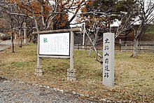
and has been opened to the public. It is about a 20-minute walk from
257:
256:. The site is the ruins of a settlement with associated tombs and
291:
253:
110:
208:
Archaeological site with long-term occupation in Japan.
187:
182:
168:
163:
126:
116:
102:
223:
217:
8:
16:
354:(in Japanese). Agency for Cultural Affairs
29:
15:
328:List of Historic Sites of Japan (Miyagi)
339:
7:
82:
54:
236:located in what is now the town of
377:Miyagi Prefecture official website
260:containing remains from the early
14:
303:The site is now maintained as an
81:
74:
53:
46:
199:National Historic Site of Japan
1:
418:Archaeological sites in Japan
65:Show map of Miyagi Prefecture
423:History of Miyagi Prefecture
385:Misato Town official website
224:
444:
218:
195:
40:
28:
21:
352:Cultural Heritage Online
428:Historic Sites of Japan
270:National Historic Site
148:38.53861°N 141.04861°E
90:Yamamae Site (Japan)
305:archaeological park
234:archaeological site
153:38.53861; 141.04861
144: /
18:
188:Public access
246:Miyagi Prefecture
206:
205:
93:Show map of Japan
435:
389:
381:
364:
363:
361:
359:
344:
316:Tohoku Main Line
231:
230:
227:
221:
220:
159:
158:
156:
155:
154:
149:
145:
142:
141:
140:
137:
94:
85:
84:
78:
66:
57:
56:
50:
33:
19:
443:
442:
438:
437:
436:
434:
433:
432:
393:
392:
387:
379:
373:
368:
367:
357:
355:
346:
345:
341:
336:
324:
278:
228:
215:
209:
202:
201:
152:
150:
146:
143:
138:
135:
133:
131:
130:
98:
97:
96:
95:
92:
91:
88:
87:
86:
69:
68:
67:
64:
63:
60:
59:
58:
36:
24:
12:
11:
5:
441:
439:
431:
430:
425:
420:
415:
410:
405:
403:Misato, Miyagi
395:
394:
391:
390:
382:
372:
371:External links
369:
366:
365:
338:
337:
335:
332:
331:
330:
323:
320:
309:Kogota Station
277:
274:
207:
204:
203:
197:
196:
193:
192:
189:
185:
184:
180:
179:
170:
166:
165:
161:
160:
128:
124:
123:
118:
114:
113:
107:Misato, Miyagi
104:
100:
99:
89:
80:
79:
73:
72:
71:
70:
61:
52:
51:
45:
44:
43:
42:
41:
38:
37:
34:
26:
25:
22:
13:
10:
9:
6:
4:
3:
2:
440:
429:
426:
424:
421:
419:
416:
414:
411:
409:
406:
404:
401:
400:
398:
388:(in Japanese)
386:
383:
380:(in Japanese)
378:
375:
374:
370:
353:
349:
343:
340:
333:
329:
326:
325:
321:
319:
317:
314:
310:
306:
301:
299:
294:
293:
288:
284:
275:
273:
271:
267:
263:
259:
255:
251:
250:Tōhoku region
247:
243:
242:Tōda District
239:
235:
226:
225:Yamamae iseki
214:
213:Yamamae ruins
200:
194:
190:
186:
181:
178:
174:
171:
167:
162:
157:
129:
125:
122:
121:Tōhoku region
119:
115:
112:
108:
105:
101:
77:
62:Yamamae ruins
49:
39:
35:Yamamae ruins
32:
27:
20:
17:Yamamae ruins
413:Kofun period
408:Jōmon period
356:. Retrieved
351:
342:
302:
298:Heian period
290:
287:Kofun period
283:pit dwelling
279:
266:Kofun period
264:through the
262:Jōmon period
258:shell midden
252:of northern
212:
210:
177:Kofun period
358:25 December
151: /
139:141°02′55″E
127:Coordinates
397:Categories
334:References
191:Yes (park)
183:Site notes
136:38°32′19″N
322:See also
276:Overview
103:Location
313:JR East
311:on the
248:in the
169:Periods
164:History
348:"山前遺跡"
238:Misato
232:is an
117:Region
292:kofun
254:Japan
173:Jōmon
111:Japan
360:2016
219:山前遺跡
211:The
23:山前遺跡
175:to
399::
350:.
318:.
300:.
272:.
244:,
240:,
222:,
109:,
362:.
229:)
216:(
Text is available under the Creative Commons Attribution-ShareAlike License. Additional terms may apply.