72:
96:
947:
126:
156:
792:, August 2012. Accessed November 20, 2012. "Mercer County—Name Changes: Robbinsville township name changed from Washington; New CDPs: Groveville (formed from part of deleted Yardville-Groveville CDP and additional area), Hamilton Square (formed from part of deleted Mercerville-Hamilton Square CDP and additional area), Mercerville (formed from part of deleted Mercerville-Hamilton Square CDP), Robbinsville, and Yardville (formed from part of deleted Yardville-Groveville CDP and additional area)"
228:
56:
248:
163:
133:
103:
622:
Of the 2,757 households, 28.4% had children under the age of 18; 61.2% were married couples living together; 9.0% had a female householder with no husband present and 25.7% were non-families. Of all households, 21.5% were made up of individuals and 9.3% had someone living alone who was 65 years of
626:
20.0% of the population were under the age of 18, 7.8% from 18 to 24, 23.5% from 25 to 44, 32.5% from 45 to 64, and 16.2% who were 65 years of age or older. The median age was 44.3 years. For every 100 females, the population had 96.5 males. For every 100 females ages 18 and older there were 91.6
71:
1370:
1380:
885:
824:
508:, the CDP has a total area of 4.10 square miles (10.62 km), including 4.07 square miles (10.54 km) of land and 0.03 square miles (0.08 km) of water (0.76%).
95:
591:
was 1,773.9 per square mile (684.9/km). There were 2,841 housing units at an average density of 701.3 per square mile (270.8/km). The racial makeup was 92.93% (6,678)
1375:
612:
1192:
1019:
1014:
1009:
438:
277:
61:
1162:
1077:
1257:
1277:
402:
1142:
878:
188:
125:
155:
1157:
1147:
1172:
1282:
672:
414:
1197:
871:
1152:
1024:
647:
450:
1302:
1092:
1072:
757:
1227:
1112:
1067:
863:
851:
DP-1 - Profile of
General Population and Housing Characteristics: 2010 Demographic Profile Data for Yardville CDP, New Jersey
608:
430:
260:
685:
1307:
600:
478:
1137:
1317:
1272:
1217:
1052:
854:
789:
729:
713:
482:
55:
1004:
850:
709:
1340:
1292:
1267:
1242:
1187:
1057:
895:
584:
557:
542:
446:
442:
265:
77:
1312:
1207:
1177:
1132:
1127:
1029:
999:
393:
220:
668:
1262:
1167:
1122:
1097:
1087:
1062:
1039:
462:
434:
46:
1297:
1252:
1247:
1237:
1232:
1212:
1202:
1082:
1047:
976:
966:
616:
494:
490:
466:
1322:
1287:
1222:
991:
981:
786:
New Jersey: 2010 - Population and
Housing Unit Counts - 2010 Census of Population and Housing (CPH-2-32)
372:
272:
1347:
1182:
971:
958:
361:
1327:
936:
917:
604:
596:
592:
498:
387:
588:
505:
928:
351:
669:
U.S. Geological Survey
Geographic Names Information System: Yardville Census Designated Place
17:
741:
470:
407:
785:
623:
age or older. The average household size was 2.60 and the average family size was 3.03.
486:
474:
368:
347:
1364:
233:
489:
runs through the center of the community, leading southwest 3 miles (5 km) to
449:, the CDP's population was 6,965. Before the 2010 census, the area was part of the
769:
910:
802:
686:"P1. Race – Yardville CDP, New Jersey: 2020 DEC Redistricting Data (PL 94-171)"
773:
253:
240:
81:
203:
190:
342:
587:
counted 7,186 people, 2,757 households, and 2,048 families in the CDP. The
380:
501:, the state capital, is 6 miles (10 km) northwest of Yardville.
461:
Yardville is in southern Mercer County, bordered to the northwest by
946:
867:
945:
753:
725:
1371:
Census-designated places in Mercer County, New Jersey
744:, Missouri Census Data Center. Accessed June 9, 2023.
642:
640:
485:
forms part of the northern border of the CDP, while
32:
Census-designated place in New Jersey, United States
1111:
1038:
990:
957:
927:
413:
401:
379:
358:
341:
333:
325:
320:
312:
304:
296:
288:
283:
271:
259:
239:
219:
37:
619:of any race were 4.31% (310) of the population.
27:Populated place in Camden County, New Jersey, US
308:0.03 sq mi (0.08 km) 0.56%
879:
846:
844:
842:
8:
1381:Hamilton Township, Mercer County, New Jersey
950:Map of New Jersey highlighting Mercer County
705:
703:
886:
872:
864:
515:
34:
615:, and 0.86% (62) from two or more races.
648:"2023 U.S. Gazetteer Files: New Jersey"
636:
400:
378:
340:
319:
311:
282:
218:
183:
87:
68:
52:
1376:Census-designated places in New Jersey
742:Geographic Codes Lookup for New Jersey
535:
493:and northeast 9 miles (14 km) to
469:. It is bordered to the southwest by
412:
357:
332:
324:
303:
295:
287:
270:
258:
238:
115:Show map of Mercer County, New Jersey
7:
300:4.07 sq mi (10.55 km)
292:4.10 sq mi (10.63 km)
673:Geographic Names Information System
894:Municipalities and communities of
803:"Census of Population and Housing"
525:
25:
162:
132:
102:
246:
226:
161:
154:
131:
124:
101:
94:
70:
54:
758:United States Geological Survey
337:1,710.04/sq mi (660.31/km)
710:Gazetteer of New Jersey Places
1:
857:. Accessed November 20, 2012.
827:. United States Census Bureau
760:. Accessed September 4, 2014.
732:. Accessed September 4, 2014.
675:. Accessed November 20, 2012.
650:. United States Census Bureau
175:Show map of the United States
18:Yardville Heights, New Jersey
754:US Board on Geographic Names
855:United States Census Bureau
790:United States Census Bureau
730:United States Census Bureau
714:United States Census Bureau
445:, United States. As of the
1397:
776:. Accessed April 19, 2015.
60:Along South Broad Street (
1336:
1078:The College of New Jersey
943:
908:
897:Mercer County, New Jersey
716:. Accessed July 21, 2016.
597:Black or African American
585:2010 United States census
571:
556:
541:
534:
529:
524:
521:
447:2020 United States census
443:Mercer County, New Jersey
184:
88:
69:
53:
44:
465:and to the southeast by
431:unincorporated community
825:"Census Population API"
435:census-designated place
47:Census-designated place
1163:Coalport/North Clinton
951:
316:59 ft (18 m)
204:40.186645°N 74.66308°W
145:Show map of New Jersey
949:
572:U.S. Decennial Census
517:Historical population
473:, a tributary of the
360: • Summer (
39:Yardville, New Jersey
1349:United States portal
688:. U.S. Census Bureau
451:Yardville-Groveville
334: • Density
209:40.186645; -74.66308
1093:Washington Crossing
1073:Robbinsville Center
726:U.S. Census website
518:
200: /
1143:Cadwalader Heights
1068:Princeton Junction
952:
617:Hispanic or Latino
611:, 1.00% (72) from
589:population density
516:
506:U.S. Census Bureau
481:across the creek.
326: • Total
305: • Water
289: • Total
1358:
1357:
1342:New Jersey portal
576:
575:
504:According to the
479:Burlington County
439:Hamilton Township
424:
423:
297: • Land
80:and the state of
16:(Redirected from
1388:
1350:
1343:
1138:Braeburn Heights
948:
920:
913:
903:
898:
888:
881:
874:
865:
858:
848:
837:
836:
834:
832:
821:
815:
814:
812:
810:
799:
793:
783:
777:
767:
761:
751:
745:
739:
733:
723:
717:
707:
698:
697:
695:
693:
682:
676:
666:
660:
659:
657:
655:
644:
609:Pacific Islander
537:
532:
527:
519:
471:Crosswicks Creek
365:
252:
250:
249:
232:
230:
229:
215:
214:
212:
211:
210:
205:
201:
198:
197:
196:
193:
176:
165:
164:
158:
146:
135:
134:
128:
116:
105:
104:
98:
74:
58:
35:
21:
1396:
1395:
1391:
1390:
1389:
1387:
1386:
1385:
1361:
1360:
1359:
1354:
1348:
1341:
1332:
1273:Princeton North
1258:Pleasant Valley
1218:Hopewell Valley
1128:Berkeley Square
1114:
1107:
1053:Hamilton Square
1034:
986:
953:
941:
923:
918:
911:
904:
901:
896:
892:
862:
861:
849:
840:
830:
828:
823:
822:
818:
808:
806:
801:
800:
796:
784:
780:
770:Locality Search
768:
764:
752:
748:
740:
736:
724:
720:
708:
701:
691:
689:
684:
683:
679:
667:
663:
653:
651:
646:
645:
638:
633:
601:Native American
581:
530:
514:
459:
397:
391:
359:
247:
245:
227:
225:
208:
206:
202:
199:
194:
191:
189:
187:
186:
180:
179:
178:
177:
174:
173:
172:
171:
170:
166:
149:
148:
147:
144:
143:
142:
141:
140:
136:
119:
118:
117:
114:
113:
112:
111:
110:
106:
84:
65:
49:
40:
33:
28:
23:
22:
15:
12:
11:
5:
1394:
1392:
1384:
1383:
1378:
1373:
1363:
1362:
1356:
1355:
1353:
1352:
1345:
1337:
1334:
1333:
1331:
1330:
1325:
1320:
1315:
1310:
1305:
1300:
1295:
1290:
1285:
1280:
1275:
1270:
1265:
1260:
1255:
1250:
1245:
1240:
1235:
1230:
1225:
1220:
1215:
1210:
1205:
1200:
1195:
1190:
1185:
1180:
1175:
1170:
1165:
1160:
1155:
1150:
1145:
1140:
1135:
1130:
1125:
1119:
1117:
1109:
1108:
1106:
1105:
1100:
1095:
1090:
1085:
1080:
1075:
1070:
1065:
1060:
1055:
1050:
1044:
1042:
1036:
1035:
1033:
1032:
1027:
1022:
1017:
1012:
1007:
1002:
996:
994:
988:
987:
985:
984:
979:
974:
969:
963:
961:
955:
954:
944:
942:
940:
939:
933:
931:
925:
924:
909:
906:
905:
893:
891:
890:
883:
876:
868:
860:
859:
838:
816:
794:
778:
762:
746:
734:
718:
699:
677:
661:
635:
634:
632:
629:
603:, 2.34% (168)
595:, 2.80% (201)
580:
577:
574:
573:
569:
568:
565:
563:
560:
554:
553:
550:
548:
545:
539:
538:
533:
528:
523:
513:
510:
487:U.S. Route 130
483:Interstate 195
475:Delaware River
458:
455:
422:
421:
418:
411:
410:
405:
399:
398:
385:
383:
377:
376:
366:
356:
355:
345:
339:
338:
335:
331:
330:
327:
323:
322:
318:
317:
314:
310:
309:
306:
302:
301:
298:
294:
293:
290:
286:
285:
281:
280:
275:
269:
268:
263:
257:
256:
243:
237:
236:
223:
217:
216:
182:
181:
168:
167:
160:
159:
153:
152:
151:
150:
138:
137:
130:
129:
123:
122:
121:
120:
108:
107:
100:
99:
93:
92:
91:
90:
89:
86:
85:
75:
67:
66:
59:
51:
50:
45:
42:
41:
38:
31:
26:
24:
14:
13:
10:
9:
6:
4:
3:
2:
1393:
1382:
1379:
1377:
1374:
1372:
1369:
1368:
1366:
1351:
1346:
1344:
1339:
1338:
1335:
1329:
1326:
1324:
1321:
1319:
1316:
1314:
1311:
1309:
1306:
1304:
1301:
1299:
1296:
1294:
1293:South Trenton
1291:
1289:
1286:
1284:
1281:
1279:
1278:Quaker Bridge
1276:
1274:
1271:
1269:
1268:Princessville
1266:
1264:
1261:
1259:
1256:
1254:
1251:
1249:
1246:
1244:
1243:North Trenton
1241:
1239:
1236:
1234:
1231:
1229:
1226:
1224:
1221:
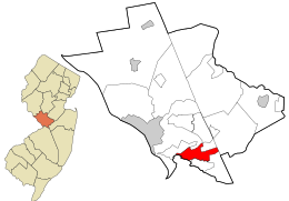
1219:
1216:
1214:
1211:
1209:
1206:
1204:
1201:
1199:
1198:Ewing/Carroll
1196:
1194:
1191:
1189:
1188:Eldridge Park
1186:
1184:
1181:
1179:
1176:
1174:
1171:
1169:
1166:
1164:
1161:
1159:
1156:
1154:
1151:
1149:
1146:
1144:
1141:
1139:
1136:
1134:
1131:
1129:
1126:
1124:
1121:
1120:
1118:
1116:
1110:
1104:
1101:
1099:
1096:
1094:
1091:
1089:
1086:
1084:
1081:
1079:
1076:
1074:
1071:
1069:
1066:
1064:
1061:
1059:
1058:Lawrenceville
1056:
1054:
1051:
1049:
1046:
1045:
1043:
1041:
1037:
1031:
1028:
1026:
1023:
1021:
1018:
1016:
1013:
1011:
1008:
1006:
1003:
1001:
998:
997:
995:
993:
989:
983:
980:
978:
975:
973:
970:
968:
965:
964:
962:
960:
956:
938:
935:
934:
932:
930:
926:
922:
921:
914:
907:
902:United States
899:
889:
884:
882:
877:
875:
870:
869:
866:
856:
852:
847:
845:
843:
839:
826:
820:
817:
804:
798:
795:
791:
787:
782:
779:
775:
771:
766:
763:
759:
755:
750:
747:
743:
738:
735:
731:
727:
722:
719:
715:
711:
706:
704:
700:
687:
681:
678:
674:
670:
665:
662:
649:
643:
641:
637:
630:
628:
624:
620:
618:
614:
610:
606:
602:
598:
594:
590:
586:
578:
570:
566:
564:
561:
559:
555:
551:
549:
546:
544:
540:
520:
511:
509:
507:
502:
500:
496:
492:
488:
484:
480:
476:
472:
468:
464:
456:
454:
452:
448:
444:
440:
436:
432:
428:
419:
416:
409:
406:
404:
395:
389:
384:
382:
374:
373:Eastern (EDT)
370:
367:
363:
353:
352:Eastern (EST)
349:
346:
344:
336:
328:
315:
307:
299:
291:
279:
276:
274:
267:
264:
262:
255:
244:
242:
235:
234:United States
224:
222:
213:
185:Coordinates:
157:
127:
97:
83:
79:
78:Mercer County
73:
63:
57:
48:
43:
36:
30:
19:
1313:West Trenton
1208:Grovers Mill
1178:East Trenton
1153:Chambersburg
1133:Berrien City
1102:
1030:West Windsor
1025:Robbinsville
1000:East Windsor
916:
829:. Retrieved
819:
807:. Retrieved
805:. Census.gov
797:
788:, P. III-4.
781:
765:
749:
737:
721:
690:. Retrieved
680:
664:
652:. Retrieved
625:
621:
607:, 0.00% (0)
599:, 0.07% (5)
582:
512:Demographics
503:
460:
426:
425:
394:Robbinsville
76:Location in
29:
1263:Port Mercer
1168:Duck Island
1158:Clarksville
1148:Cedar Grove
1123:Bear Tavern
1115:communities
1098:White Horse
1088:Twin Rivers
1063:Mercerville
912:County seat
831:October 11,
772:, State of
613:other races
579:2010 Census
463:White Horse
207: /
1365:Categories
1303:The Island
1298:Stoutsburg
1253:Penns Neck
1248:Nottingham
1238:New Canton
1233:Mount Rose
1213:Harbourton
1203:Ewingville
1173:Dutch Neck
1083:Titusville
1048:Groveville
977:Pennington
967:Hightstown
774:New Jersey
631:References
495:Hightstown
491:Bordentown
467:Groveville
417:feature ID
321:Population
254:New Jersey
195:74°39′47″W
192:40°11′12″N
82:New Jersey
1323:Wilburtha
1288:Slackwood
1228:Mill Hill
1223:Lamberton
1103:Yardville
992:Townships
982:Princeton
477:, and by
457:Geography
437:(CDP) in
427:Yardville
403:FIPS code
381:ZIP Codes
369:UTC−04:00
348:UTC−05:00
343:Time zone
313:Elevation
169:Yardville
139:Yardville
109:Yardville
1308:Top Road
1283:Rosedale
1183:Edinburg
1020:Lawrence
1015:Hopewell
1010:Hamilton
972:Hopewell
959:Boroughs
692:July 10,
654:July 10,
420:02633183
408:34-83170
278:Hamilton
273:Township
1328:Windsor
937:Trenton
919:Trenton
809:June 4,
627:males.
499:Trenton
392:08691 (
388:Trenton
386:08610 (
221:Country
1318:Wilbur
522:Census
429:is an
266:Mercer
261:County
251:
231:
62:CR 672
1193:Ewing
1113:Other
1005:Ewing
605:Asian
593:White
567:−3.1%
562:6,965
547:7,186
453:CDP.
329:6,965
241:State
1040:CDPs
929:City
833:2022
811:2016
694:2024
656:2024
583:The
558:2020
543:2010
531:Note
526:Pop.
433:and
415:GNIS
284:Area
362:DST
1367::
915::
900:,
853:,
841:^
756:,
728:,
712:,
702:^
671:,
639:^
536:%±
497:.
441:,
887:e
880:t
873:v
835:.
813:.
696:.
658:.
552:—
396:)
390:)
375:)
371:(
364:)
354:)
350:(
64:)
20:)
Text is available under the Creative Commons Attribution-ShareAlike License. Additional terms may apply.