565:
514:
452:
464:
301:
476:
500:
488:
54:
436:(2.6%), being the most commonly spoken non-English languages. Top ancestries were Lebanese (13.3%), Australian (10.9%), Vietnamese (9.2%), English (8.1%) and Chinese (7.9%). Common religions were Islam (26.1%), Catholic (20.3%), Not stated (15.6%), No Religion (10.4%) and Buddhism (8.8%). Christianity was the largest group religious group reported overall (42.7%).
745:
439:
The median age of people in
Yennora was 43 years. With regards to employment, 42.4% of people were employed full-time, 27.4% were employed part-time, 18.7% were employed but away from work and 12.2% were unemployed. Furthermore, Yennora is known to be the poorest suburb of Sydney, where the median
340:
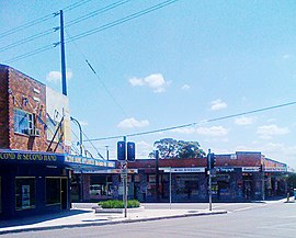
Although the suburb's commercial area is vastly industrial, Yennora does feature some small shops and restaurants that are mostly found in
Fairfield Street. Yennora Oasis Hotel is a restaurant that features a dine-in and delivery service.
308:
A portion of
Yennora is dominated by an industrial zone, which includes the 300,000m Yennora Distribution Centre. It was opened in June 1971 as the Yennora Wool Centre. The Yennora Distribution Centre has a connection to the
693:
142:
130:
984:
776:
1195:
109:
977:
769:
1125:
612:
285:. Aboriginal people from the Cabrogal tribe, a sub-group of the Gandangara tribe, have lived in the Fairfield area for over 30,000 years.
962:
289:
258:
121:
353:
such as
Springfield Park, Knight Park and Yennora Park, where they feature children's playgrounds, a sportsground and walking tracks.
970:
870:
754:
749:
762:
596:
584:
1083:
880:
373:
246:
1140:
1053:
937:
875:
835:
543:
205:
135:
922:
210:
193:
292:
in 1927 and given the name
Yennora. The public school was opened in 1955 and the Wool Stores were established in June 1971.
463:
416:(2.3%) being other common responses. A high percentage (74.8%) of people spoke a language other than English at home, with
1103:
1023:
885:
855:
250:
1088:
905:
840:
326:
1135:
1113:
1078:
1043:
910:
850:
825:
805:
475:
310:
168:
513:
451:
1190:
1185:
1073:
1048:
1038:
1033:
1028:
927:
860:
810:
369:
365:
200:
185:
178:
173:
1150:
1145:
1108:
1098:
1093:
890:
845:
708:
1058:
932:
1018:
1013:
994:
505:
361:
653:
499:
1166:
998:
953:
786:
547:
393:
274:
262:
159:
80:
72:
679:
790:
627:
288:
European settlement began in
Fairfield in the early 19th century. A siding platform was built by the
1130:
421:
147:
487:
815:
668:
580:
433:
254:
116:
579:, Compiled by Frances Pollon, Angus & Robertson Publishers, 1990, Published in Australia
429:
1118:
915:
895:
830:
334:
238:
44:
564:
17:
865:
1179:
1063:
900:
314:
304:
Yennora industrial zone, showing Pine Road and the Hume
Building Products warehouses.
300:
820:
682:
381:
697:
377:
318:
665:
350:
322:
102:
723:
710:
599:
425:
242:
53:
744:
1068:
413:
405:
397:
1002:
794:
417:
330:
234:
230:
40:
409:
299:
694:
The stark difference between Sydney’s richest and poorest suburbs
401:
396:, 37.6% of people stated that they were born in Australia, with
966:
758:
249:. The residential part of the suburb is primarily in the
321:
and the suburb. Other key operators in the area include
380:. Yennora is also serviced by bus services operated by
349:
Despite its small size, Yennora features a number of
257:, although the industrial area in west is a part of
680:
Parramatta, Bankstown and
Liverpool bus network map
141:
129:
108:
97:
89:
79:
67:
34:
154:
978:
770:
8:
29:Suburb of Sydney, New South Wales, Australia
985:
971:
963:
777:
763:
755:
656:; theurbandeveloper.com; 21 September 2015
563:
52:
31:
625:Containerisation at Yennora Wool Village
654:Yennora Industrial Site Set For Carve Up
538:
536:
534:
368:. Trains run frequently from Yennora to
530:
447:
642:Freight & Container Transportation
613:Freight & Container Transportation
610:Wool selling centre to be established
317:for freight services running between
198:
183:
166:
156:
7:
1196:Cumberland Council, New South Wales
481:Yennora Railway Station Cycle Path
290:New South Wales Government Railways
440:personal income is just $ 19,000.
25:
469:Rosary Village Retirement Centre
743:
512:
498:
486:
474:
462:
450:
247:Sydney central business district
101:29 km (18 mi) west of
544:Australian Bureau of Statistics
993:Suburbs and localities within
785:Suburbs and localities within
337:, and Hume Building Products.
1:
245:, 29 kilometres west of the
597:Yennora Distribution Centre
311:Old Main South railway line
1212:
644:September 1976 pages 24/25
577:The Book of Sydney Suburbs
1164:
1009:
951:
801:
216:
157:
153:
63:
51:
750:Yennora, New South Wales
548:"Yennora (State Suburb)"
18:Yennora, New South Wales
995:Cumberland City Council
506:Yennora railway station
362:Yennora railway station
1167:List of Sydney suburbs
999:Greater Western Sydney
954:List of Sydney suburbs
787:Fairfield City Council
724:33.86278°S 150.96611°E
552:2021 Census QuickStats
519:Railway Parade Yennora
457:Yennora Public School
305:
263:Greater Western Sydney
93:21 m (69 ft)
752:at Wikimedia Commons
640:Yennora Wool Village
303:
251:local government area
1126:South Wentworthville
791:South Western Sydney
729:-33.86278; 150.96611
631:February 1974 page 3
616:January 1969 page 11
261:. It is part of the
1131:Sydney Olympic Park
720: /
143:Federal division(s)
131:State electorate(s)
306:
259:Cumberland Council
122:Cumberland Council
1191:City of Fairfield
1186:Suburbs of Sydney
1173:
1172:
960:
959:
871:Fairfield Heights
816:Bonnyrigg Heights
748:Media related to
669:Transport for NSW
392:According to the
313:, and is used by
255:City of Fairfield
224:
223:
220:
219:
117:City of Fairfield
16:(Redirected from
1203:
987:
980:
973:
964:
779:
772:
765:
756:
747:
735:
734:
732:
731:
730:
725:
721:
718:
717:
716:
713:
700:
691:
685:
677:
671:
663:
657:
651:
645:
638:
632:
623:
617:
608:
602:
594:
588:
574:
568:
567:
562:
560:
558:
546:(28 June 2022).
540:
516:
502:
490:
478:
466:
454:
237:in the state of
155:
56:
47:
37:
32:
21:
1211:
1210:
1206:
1205:
1204:
1202:
1201:
1200:
1176:
1175:
1174:
1169:
1160:
1119:Smithfield West
1084:Merrylands West
1005:
991:
961:
956:
947:
916:Smithfield West
896:Mount Pritchard
881:Greenfield Park
831:Cabramatta West
797:
783:
741:
728:
726:
722:
719:
714:
711:
709:
707:
706:
704:
703:
692:
688:
678:
674:
666:Yennora Station
664:
660:
652:
648:
639:
635:
624:
620:
609:
605:
595:
591:
575:
571:
556:
554:
542:
541:
532:
527:
520:
517:
508:
503:
494:
491:
482:
479:
470:
467:
458:
455:
446:
390:
359:
347:
335:Queensland Rail
298:
296:Commercial area
271:
239:New South Wales
162:around Yennora:
59:
45:New South Wales
39:
38:
35:
30:
23:
22:
15:
12:
11:
5:
1209:
1207:
1199:
1198:
1193:
1188:
1178:
1177:
1171:
1170:
1165:
1162:
1161:
1159:
1158:
1153:
1148:
1143:
1141:Wentworthville
1138:
1133:
1128:
1123:
1122:
1121:
1111:
1106:
1101:
1096:
1091:
1086:
1081:
1076:
1071:
1066:
1061:
1056:
1054:Guildford West
1051:
1046:
1041:
1036:
1031:
1026:
1021:
1016:
1010:
1007:
1006:
992:
990:
989:
982:
975:
967:
958:
957:
952:
949:
948:
946:
945:
940:
938:Wetherill Park
935:
930:
925:
920:
919:
918:
908:
903:
898:
893:
888:
883:
878:
876:Fairfield West
873:
868:
866:Fairfield East
863:
858:
853:
848:
843:
838:
836:Canley Heights
833:
828:
823:
818:
813:
808:
802:
799:
798:
784:
782:
781:
774:
767:
759:
740:
739:External links
737:
702:
701:
686:
672:
658:
646:
633:
618:
603:
589:
569:
529:
528:
526:
523:
522:
521:
518:
511:
509:
504:
497:
495:
492:
485:
483:
480:
473:
471:
468:
461:
459:
456:
449:
445:
442:
389:
386:
366:Old Main South
358:
355:
346:
343:
297:
294:
273:Yennora is an
270:
267:
222:
221:
218:
217:
214:
213:
208:
206:Fairfield East
203:
197:
196:
191:
188:
182:
181:
176:
171:
165:
164:
151:
150:
145:
139:
138:
133:
127:
126:
125:
124:
119:
112:
106:
105:
99:
95:
94:
91:
87:
86:
83:
77:
76:
69:
65:
64:
61:
60:
57:
49:
48:
28:
24:
14:
13:
10:
9:
6:
4:
3:
2:
1208:
1197:
1194:
1192:
1189:
1187:
1184:
1183:
1181:
1168:
1163:
1157:
1154:
1152:
1149:
1147:
1144:
1142:
1139:
1137:
1134:
1132:
1129:
1127:
1124:
1120:
1117:
1116:
1115:
1112:
1110:
1107:
1105:
1102:
1100:
1097:
1095:
1092:
1090:
1087:
1085:
1082:
1080:
1077:
1075:
1072:
1070:
1067:
1065:
1064:Homebush West
1062:
1060:
1057:
1055:
1052:
1050:
1047:
1045:
1042:
1040:
1037:
1035:
1032:
1030:
1027:
1025:
1022:
1020:
1017:
1015:
1012:
1011:
1008:
1004:
1000:
996:
988:
983:
981:
976:
974:
969:
968:
965:
955:
950:
944:
941:
939:
936:
934:
931:
929:
926:
924:
923:St Johns Park
921:
917:
914:
913:
912:
909:
907:
904:
902:
901:Old Guildford
899:
897:
894:
892:
889:
887:
884:
882:
879:
877:
874:
872:
869:
867:
864:
862:
859:
857:
854:
852:
849:
847:
844:
842:
839:
837:
834:
832:
829:
827:
824:
822:
819:
817:
814:
812:
809:
807:
804:
803:
800:
796:
792:
788:
780:
775:
773:
768:
766:
761:
760:
757:
753:
751:
746:
738:
736:
733:
699:
695:
690:
687:
684:
681:
676:
673:
670:
667:
662:
659:
655:
650:
647:
643:
637:
634:
630:
629:
622:
619:
615:
614:
607:
604:
601:
598:
593:
590:
586:
585:0-207-14495-8
582:
578:
573:
570:
566:
553:
549:
545:
539:
537:
535:
531:
524:
515:
510:
507:
501:
496:
489:
484:
477:
472:
465:
460:
453:
448:
443:
441:
437:
435:
431:
427:
423:
419:
415:
411:
407:
403:
399:
395:
387:
385:
383:
379:
375:
371:
367:
363:
356:
354:
352:
344:
342:
338:
336:
332:
328:
324:
320:
316:
312:
302:
295:
293:
291:
286:
284:
280:
277:word meaning
276:
268:
266:
264:
260:
256:
252:
248:
244:
240:
236:
232:
228:
215:
212:
211:Old Guildford
209:
207:
204:
202:
199:
195:
194:Old Guildford
192:
189:
187:
184:
180:
177:
175:
172:
170:
167:
163:
161:
152:
149:
146:
144:
140:
137:
134:
132:
128:
123:
120:
118:
115:
114:
113:
111:
107:
104:
100:
96:
92:
88:
84:
82:
78:
74:
70:
66:
62:
58:Yennora Shops
55:
50:
46:
42:
33:
27:
19:
1155:
1104:Regents Park
1024:Chester Hill
942:
886:Horsley Park
856:Edensor Park
821:Bossley Park
742:
705:
689:
683:Transdev NSW
675:
661:
649:
641:
636:
626:
621:
611:
606:
592:
576:
572:
555:. Retrieved
551:
438:
391:
388:Demographics
382:Transdev NSW
360:
348:
345:Recreational
339:
307:
287:
282:
278:
272:
226:
225:
158:
71:1,675 (
26:
1089:Pendle Hill
906:Prairiewood
841:Canley Vale
727: /
715:150°57′58″E
698:News.com.au
432:(2.6%) and
412:(2.9%) and
394:2021 census
378:City Circle
351:urban parks
319:Port Botany
81:Postcode(s)
73:2021 census
1180:Categories
1136:Toongabbie
1114:Smithfield
1079:Merrylands
1044:Greystanes
911:Smithfield
851:Cecil Park
826:Cabramatta
806:Abbotsbury
712:33°51′46″S
587:, page 277
557:1 December
525:References
493:Tara Close
422:Vietnamese
370:Leppington
364:is on the
327:Woolworths
323:Toll Group
275:Aboriginal
169:Smithfield
103:Sydney CBD
68:Population
1074:Mays Hill
1049:Guildford
1039:Granville
1034:Girraween
1029:Fairfield
928:Villawood
861:Fairfield
811:Bonnyrigg
600:Stockland
426:Cantonese
420:(26.9%),
357:Transport
283:to stroll
265:region.
243:Australia
201:Fairfield
186:Fairfield
179:Guildford
174:Guildford
136:Fairfield
90:Elevation
1151:Woodpark
1146:Westmead
1109:Rookwood
1099:Prospect
1094:Pemulwuy
1069:Lidcombe
891:Lansvale
846:Carramar
428:(3.0%),
424:(9.5%),
408:(5.4%),
404:(7.3%),
400:(8.7%),
376:and the
374:Richmond
98:Location
1156:Yennora
1059:Holroyd
943:Yennora
933:Wakeley
628:Network
444:Gallery
430:Spanish
414:Myanmar
406:Lebanon
398:Vietnam
279:walking
269:History
253:of the
227:Yennora
190:Yennora
160:Suburbs
148:McMahon
43:,
36:Yennora
1019:Berala
1014:Auburn
1003:Sydney
795:Sydney
583:
418:Arabic
331:Linfox
235:Sydney
231:suburb
110:LGA(s)
41:Sydney
434:Karen
410:China
229:is a
581:ISBN
559:2021
402:Iraq
315:Quve
85:2161
696:by
281:or
233:of
1182::
1001:,
997:,
793:,
789:,
550:.
533:^
384:.
372:,
333:,
329:,
325:,
241:,
986:e
979:t
972:v
778:e
771:t
764:v
561:.
75:)
20:)
Text is available under the Creative Commons Attribution-ShareAlike License. Additional terms may apply.