724:
71:
56:
46:
597:
87:
510:
285:
As of 2019 the total population of the county is 43,719, out of which the population of Złotoryja is 15,564, that of
Wojcieszów is 3,668, that of Świerzawa is 2,286, and the rural population is 22,201.
921:
670:
723:
553:
663:
464:
877:
596:
55:
70:
656:
45:
853:
546:
267:
326:(two urban, one urban-rural and three rural). These are listed in the following table, in descending order of population.
270:
passed in 1998. The county covers an area of 575.45 square kilometres (222.2 sq mi). Its administrative seat is
793:
307:
916:
539:
818:
683:
259:
104:
511:"Population. Size and structure and vital statistics in Poland by territorial division in 2019. As of 30th June"
222:
743:
763:
303:
99:
738:
311:
838:
748:
843:
828:
808:
637:
611:
407:
386:
159:
149:
848:
773:
768:
627:
450:
144:
858:
833:
813:
823:
247:
803:
783:
703:
648:
778:
753:
632:
429:
295:
154:
910:
798:
586:
471:
275:
134:
788:
758:
299:
713:
580:
421:
400:
367:
279:
271:
139:
114:
697:
204:
892:
879:
531:
443:
708:
328:
679:
263:
255:
92:
33:
562:
323:
121:
235:
254:) is a unit of territorial administration and local government (
652:
535:
266:. It came into being on January 1, 1999, as a result of the
731:
690:
620:
604:
573:
231:
221:
213:
202:
194:
186:
181:
173:
168:
120:
110:
98:
80:
21:
664:
547:
8:
16:County in Lower Silesian Voivodeship, Poland
922:Land counties of Lower Silesian Voivodeship
671:
657:
649:
554:
540:
532:
18:
502:
230:
220:
180:
177:575.45 km (222.18 sq mi)
167:
132:
109:
79:
67:
39:
212:
201:
193:
185:
172:
119:
97:
7:
274:, and it also contains the towns of
322:The county is subdivided into six
14:
722:
595:
294:Złotoryja County is bordered by
85:
69:
54:
44:
517:. Statistics Poland. 2019-10-15
268:Polish local government reforms
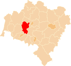
75:Location within the voivodeship
330:
236:http://www.powiat-zlotoryja.pl
1:
490:* seat not part of the gmina
938:
684:Lower Silesian Voivodeship
260:Lower Silesian Voivodeship
720:
593:
489:
68:
40:
31:
318:Administrative division
129:Total 6 (incl. 2 urban)
251:
198:76/km (200/sq mi)
290:Neighbouring counties
308:Lwówek Śląski County
195: • Density
889: /
304:Jelenia Góra County
298:to the north-east,
312:Bolesławiec County
306:to the south, and
252:powiat złotoryjski
214: • Rural
187: • Total
174: • Total
26:Powiat złotoryjski
893:51.133°N 15.917°E
872:
871:
854:Ząbkowice Śląskie
646:
645:
628:Gmina Pielgrzymka
605:Urban-rural gmina
494:
493:
451:Gmina Pielgrzymka
356:
347:
241:
240:
145:Gmina Pielgrzymka
929:
917:Złotoryja County
904:
903:
901:
900:
899:
894:
890:
887:
886:
885:
882:
726:
673:
666:
659:
650:
599:
567:Złotoryja County
556:
549:
542:
533:
526:
525:
523:
522:
507:
354:
345:
329:
262:, south-western
244:Złotoryja County
91:
89:
88:
73:
58:
48:
23:Złotoryja County
19:
937:
936:
932:
931:
930:
928:
927:
926:
907:
906:
897:
895:
891:
888:
883:
880:
878:
876:
875:
873:
868:
727:
718:
686:
677:
647:
642:
638:Gmina Złotoryja
616:
612:Gmina Świerzawa
600:
591:
569:
560:
530:
529:
520:
518:
509:
508:
504:
499:
408:Gmina Złotoryja
387:Gmina Świerzawa
353:
344:
320:
292:
164:
160:Gmina Złotoryja
150:Gmina Świerzawa
131:
130:
86:
84:
76:
64:
63:
62:
61:
52:
51:
36:
27:
24:
17:
12:
11:
5:
935:
933:
925:
924:
919:
909:
908:
898:51.133; 15.917
870:
869:
867:
866:
861:
856:
851:
846:
841:
836:
831:
826:
821:
816:
811:
806:
801:
796:
791:
786:
781:
776:
771:
766:
761:
756:
751:
746:
741:
735:
733:
729:
728:
721:
719:
717:
716:
711:
706:
701:
694:
692:
688:
687:
678:
676:
675:
668:
661:
653:
644:
643:
641:
640:
635:
633:Gmina Zagrodno
630:
624:
622:
618:
617:
615:
614:
608:
606:
602:
601:
594:
592:
590:
589:
584:
577:
575:
571:
570:
561:
559:
558:
551:
544:
536:
528:
527:
501:
500:
498:
495:
492:
491:
487:
486:
483:
480:
477:
474:
468:
467:
462:
459:
456:
453:
447:
446:
441:
438:
435:
432:
430:Gmina Zagrodno
426:
425:
419:
416:
413:
410:
404:
403:
398:
395:
392:
389:
383:
382:
379:
376:
373:
370:
364:
363:
358:
349:
340:
335:
319:
316:
296:Legnica County
291:
288:
239:
238:
233:
229:
228:
225:
219:
218:
215:
211:
210:
207:
200:
199:
196:
192:
191:
188:
184:
183:
179:
178:
175:
171:
170:
166:
165:
163:
162:
157:
155:Gmina Zagrodno
152:
147:
142:
137:
128:
127:
126:
124:
118:
117:
112:
108:
107:
105:Lower Silesian
102:
96:
95:
82:
78:
77:
74:
66:
65:
59:
53:
49:
43:
42:
41:
38:
37:
32:
29:
28:
25:
22:
15:
13:
10:
9:
6:
4:
3:
2:
934:
923:
920:
918:
915:
914:
912:
905:
902:
865:
862:
860:
857:
855:
852:
850:
847:
845:
842:
840:
837:
835:
832:
830:
827:
825:
822:
820:
817:
815:
812:
810:
807:
805:
802:
800:
797:
795:
794:Lwówek Śląski
792:
790:
787:
785:
782:
780:
777:
775:
772:
770:
767:
765:
764:Kamienna Góra
762:
760:
757:
755:
752:
750:
747:
745:
742:
740:
737:
736:
734:
732:Land counties
730:
725:
715:
712:
710:
707:
705:
702:
699:
696:
695:
693:
691:City counties
689:
685:
681:
674:
669:
667:
662:
660:
655:
654:
651:
639:
636:
634:
631:
629:
626:
625:
623:
619:
613:
610:
609:
607:
603:
598:
588:
585:
582:
579:
578:
576:
572:
568:
564:
557:
552:
550:
545:
543:
538:
537:
534:
516:
512:
506:
503:
496:
488:
484:
481:
478:
475:
473:
470:
469:
466:
463:
460:
457:
454:
452:
449:
448:
445:
442:
439:
436:
433:
431:
428:
427:
423:
420:
417:
414:
411:
409:
406:
405:
402:
399:
396:
393:
390:
388:
385:
384:
380:
377:
374:
371:
369:
366:
365:
362:
359:
357:
350:
348:
341:
339:
336:
334:
331:
327:
325:
317:
315:
314:to the west.
313:
309:
305:
302:to the east,
301:
297:
289:
287:
283:
281:
277:
273:
269:
265:
261:
257:
253:
249:
245:
237:
234:
226:
224:
216:
208:
206:
203: •
197:
189:
176:
161:
158:
156:
153:
151:
148:
146:
143:
141:
138:
136:
133:
125:
123:
116:
113:
106:
103:
101:
94:
83:
72:
57:
47:
35:
30:
20:
874:
863:
819:Środa Śląska
704:Jelenia Góra
621:Rural gminas
574:Urban gminas
566:
519:. Retrieved
514:
505:
391:urban-rural
360:
351:
342:
337:
332:
321:
300:Jawor County
293:
284:
243:
242:
60:Coat of arms
896: /
744:Dzierżoniów
739:Bolesławiec
515:stat.gov.pl
465:Pielgrzymka
100:Voivodeship
911:Categories
769:Karkonosze
587:Wojcieszów
521:2020-02-14
497:References
472:Wojcieszów
352:Population
276:Wojcieszów
223:Car plates
182:Population
135:Wojcieszów
864:Złotoryja
859:Zgorzelec
839:Wałbrzych
834:Trzebnica
814:Polkowice
714:Wałbrzych
700:(capital)
581:Złotoryja
422:Złotoryja
401:Świerzawa
368:Złotoryja
280:Świerzawa
272:Złotoryja
140:Złotoryja
115:Złotoryja
829:Świdnica
824:Strzelin
809:Oleśnica
680:Counties
444:Zagrodno
884:15°55′E
881:51°08′N
849:Wrocław
779:Legnica
774:Kłodzko
709:Legnica
698:Wrocław
485:
381:
378:15,564
232:Website
81:Country
799:Milicz
749:Głogów
583:(seat)
563:Gminas
482:3,668
476:urban
461:4,570
458:105.2
455:rural
440:5,294
437:122.1
434:rural
418:7,071
415:145.1
412:rural
397:7,552
394:157.7
372:urban
355:(2019)
324:gminas
264:Poland
256:powiat
248:Polish
217:22,201
209:21,518
190:43,719
122:Gminas
93:Poland
90:
34:County
844:Wołów
804:Oława
789:Lubin
784:Lubań
759:Jawor
479:32.2
375:11.5
333:Gmina
258:) in
205:Urban
754:Góra
361:Seat
346:(km)
343:Area
338:Type
310:and
278:and
169:Area
111:Seat
50:Flag
682:of
565:of
227:DZL
913::
513:.
424:*
282:.
250::
672:e
665:t
658:v
555:e
548:t
541:v
524:.
246:(
Text is available under the Creative Commons Attribution-ShareAlike License. Additional terms may apply.