42:
392:
112:
49:
328:
The original port of Adulis is now 4 km (2.5 mi) inland, debris washed down from the mountains having accumulated along the coastline, extending it further out to sea. Napier built limited port facilities at Zula to enable his expedition; the remains of the railway tracks, laid by Napier's
259:. Agew Niguse was defeated by Emperor Tewodros, and the commander of a French cruiser sent to Annesley Bay in 1859 found the country in a state of anarchy. No further steps were taken by France to assert its sovereignty, and Zula with the neighbouring coast passed, nominally, to
221:
was a powerful trading empire centered in northern
Ethiopia and Eritrea. It existed from approximately 100–940 AD, growing from the proto-Aksumite D'mt, of the Iron Age period c. 4th century BC to achieve prominence by the 1st century AD.
412:
264:
523:
493:
441:
374:
607:
271:
against
Tewodros disembarked, Annesley Bay affording safe and ample anchorage for the largest ocean-going vessels. A road was built by the
548:
466:
407:
41:
563:
73:
329:
Expedition to haul his heavy equipment ashore, can still be seen. However, modern port services are handled at
Massawa.
268:
206:, along the Red Sea littoral. The tools are believed to have been used by early humans to harvest marine resources like
325:. The coast here is lined with mangroves, and there is an aircraft landing strip 5 km (3 mi) to the north.
346:
202:
scientists discovered a
Paleolithic site with stone and obsidian tools dated to over 125,000 years old south of
602:
321:, on a narrow coastal plain on the west side of the Gulf of Zula, some 80 km (50 mi) to the east of
252:
127:
105:
17:
163:
318:
249:
483:
280:
122:
544:
519:
513:
489:
462:
437:
370:
364:
302:
397:
One or more of the preceding sentences incorporates text from a publication now in the
218:
298:
245:
317:
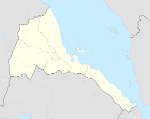
Zula is a village on the Red Sea in central
Eritrea. It stands on the right bank of the
272:
596:
403:
398:
234:
199:
290:
195:
151:
293:
was proclaimed in 1888, and in 1890 the town was incorporated into the colony of
306:
226:
111:
578:
565:
88:
75:
241:
191:
187:
183:
416:. Vol. 28 (11th ed.). Cambridge University Press. p. 1049.
350:
294:
211:
203:
155:
147:
115:
541:
All the
Countries We've Ever Invaded: And the Few We Never Got Round T
322:
276:
256:
159:
229:
led from Adulis, then on the coast, to the capital of the kingdom,
287:
260:
207:
150:. It is situated near the head of Annesley Bay (also known as the
230:
171:
167:
434:
The Saho of
Eritrea: Ethnic Identity and National Consciousness
369:. International Business Publications. 2004. p. 27.
158:
coast. Four kilometers away is the archeological site of
286:The authority of Egypt having lapsed over Zula, an
121:
104:
28:
305:, it remains an important trade center for the
182:The Eritrean Research Project Team composed of
240:In 1857, an agreement was entered into by the
8:
366:Eritrea Foreign Policy And Government Guide
427:
425:
423:
25:
507:
505:
338:
103:
68:
34:
512:Edward Denison; Edward Paice (2007).
120:
7:
518:. Bradt Travel Guides. p. 176.
461:. Reed International. p. 108.
432:Mohammed, Abdulkader Saleh (2010).
263:in 1866. Zula was the place where
23:Place in Northern Red Sea, Eritrea
14:
269:British expedition of 1867 – 1868
485:Western Arabia & The Red Sea
390:
110:
47:
40:
515:Eritrea: The Bradt Travel Guide
1:
48:
608:Populated places in Eritrea
436:. Lit Verlag. p. 107.
146:is a small town in central
624:
15:
488:. Routledge. p. 78.
69:
35:
539:Laycock, Stuart (2012).
413:Encyclopædia Britannica
253:Tewodros II of Ethiopia
255:, to cede Zula to the
543:. The History Press.
18:Zula (disambiguation)
248:, in revolt against
16:For other uses, see
575: /
85: /
61:Location in Eritrea
459:Atlas of the World
281:Eritrean Highlands
579:15.250°N 39.667°E
525:978-1-84162-171-5
495:978-1-136-21002-0
457:Philip's (1994).
443:978-3-643-90332-7
376:978-0-7397-9641-2
233:, located in the
133:
132:
89:15.250°N 39.667°E
615:
590:
589:
587:
586:
585:
580:
576:
573:
572:
571:
568:
555:
554:
536:
530:
529:
509:
500:
499:
479:
473:
472:
454:
448:
447:
429:
418:
417:
396:
394:
393:
387:
381:
380:
361:
355:
354:
349:. Archived from
343:
219:Kingdom of Aksum
128:Northern Red Sea
114:
100:
99:
97:
96:
95:
90:
86:
83:
82:
81:
78:
51:
50:
44:
26:
623:
622:
618:
617:
616:
614:
613:
612:
603:Aksumite cities
593:
592:
583:
581:
577:
574:
569:
566:
564:
562:
561:
559:
558:
551:
538:
537:
533:
526:
511:
510:
503:
496:
481:
480:
476:
469:
456:
455:
451:
444:
431:
430:
421:
406:, ed. (1911). "
402:
391:
389:
388:
384:
377:
363:
362:
358:
347:"Out of Africa"
345:
344:
340:
335:
315:
180:
162:, which was an
93:
91:
87:
84:
79:
76:
74:
72:
71:
65:
64:
63:
62:
59:
58:
57:
56:
52:
31:
24:
21:
12:
11:
5:
621:
619:
611:
610:
605:
595:
594:
584:15.250; 39.667
557:
556:
550:978-0752479699
549:
531:
524:
501:
494:
482:Naval (2013).
474:
467:
449:
442:
419:
404:Chisholm, Hugh
382:
375:
356:
353:on 2008-03-24.
337:
336:
334:
331:
314:
311:
179:
176:
131:
130:
125:
119:
118:
108:
102:
101:
94:15.250; 39.667
67:
66:
60:
54:
53:
46:
45:
39:
38:
37:
36:
33:
32:
29:
22:
13:
10:
9:
6:
4:
3:
2:
620:
609:
606:
604:
601:
600:
598:
591:
588:
552:
546:
542:
535:
532:
527:
521:
517:
516:
508:
506:
502:
497:
491:
487:
486:
478:
475:
470:
468:0-540-05831-9
464:
460:
453:
450:
445:
439:
435:
428:
426:
424:
420:
415:
414:
409:
405:
400:
399:public domain
386:
383:
378:
372:
368:
367:
360:
357:
352:
348:
342:
339:
332:
330:
326:
324:
320:
319:Aligede River
312:
310:
308:
304:
300:
297:. Along with
296:
292:
289:
284:
282:
278:
275:from Zula to
274:
270:
266:
265:Robert Napier
262:
258:
254:
251:
247:
243:
238:
237:of Ethiopia.
236:
235:Tigray Region
232:
228:
225:An important
223:
220:
215:
213:
209:
205:
201:
197:
193:
189:
185:
177:
175:
173:
169:
165:
161:
157:
153:
149:
145:
141:
137:
129:
126:
124:
117:
113:
109:
107:
98:
70:Coordinates:
43:
27:
19:
560:
540:
534:
514:
484:
477:
458:
452:
433:
411:
385:
365:
359:
351:the original
341:
327:
316:
291:protectorate
285:
239:
224:
216:
181:
152:Gulf of Zula
143:
139:
135:
134:
582: /
307:Saho people
227:trade route
92: /
597:Categories
333:References
154:), on the
313:Geography
242:Dejazmach
142:saba ሰብኣ
192:American
188:Canadian
184:Eritrean
166:and the
164:emporium
570:39°40′E
567:15°15′N
401::
303:Irafalo
295:Eritrea
288:Italian
279:in the
273:British
250:Emperor
212:oysters
204:Massawa
178:History
156:Red Sea
148:Eritrea
116:Eritrea
106:Country
80:39°40′E
77:15°15′N
547:
522:
492:
465:
440:
395:
373:
323:Asmara
277:Senafe
257:French
246:Tigray
200:French
160:Adulis
123:Region
261:Egypt
231:Aksum
208:clams
196:Dutch
545:ISBN
520:ISBN
490:ISBN
463:ISBN
438:ISBN
408:Zula
371:ISBN
301:and
299:Afta
217:The
210:and
198:and
172:Axum
168:port
144:𐩸𐩡
138:ግእዝ
136:Zula
55:Zula
30:Zula
410:".
267:'s
244:of
170:of
599::
504:^
422:^
309:.
283:.
214:.
194:,
190:,
186:,
174:.
140:ዙላ
553:.
528:.
498:.
471:.
446:.
379:.
20:.
Text is available under the Creative Commons Attribution-ShareAlike License. Additional terms may apply.