24:
59:, however the 1897 flood was different in terms of the human response to it. Although the river gauge was not installed on the Red River until 1901, other sources indicate that the crest of the 1897 flood at a site 1.5 miles (2.4 km) downstream from the present Fargo gauge would have been 40.10 ft (with a discharge rate of 25,000
86:
In the spring of 1897 R.M. Probesfield took a measurement of 5 feet (1.5 m) of snow on the ground in an area which was free from drifting; a value 2 feet (0.61 m) higher than one taken prior to the
282:
262:
272:
217:
174:
213:
277:
149:
292:
247:
287:
141:
78:
area and has since served as the benchmark for which many other floods of the Red River were measured against.
113:
88:
48:
267:
60:
71:
56:
126:
52:
75:
242:
209:
64:
55:. The conditions which led to the flood of 1897 were similar to the conditions behind the
256:
23:
91:. Due to the level of measured snowfall a flood in the spring was expected.
98:
243:
Photographs of
Flooding in the Fargo–Moorhead Region: 1897–1996
28:
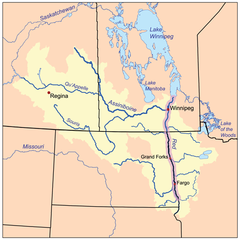
The Red River drainage basin, with the Red River highlighted
74:, the 1897 flood was the highest water recorded in the
33:
51:resulting in significant damage to the city of
8:
16:
283:1897 natural disasters in the United States
22:
15:
263:19th-century floods in the United States
210:"Red River of the North Flooding - 1897"
166:
204:
202:
200:
198:
196:
194:
192:
7:
248:Red River’s last record crest – 1897
175:"Red River Flood Comparable To 1897"
47:took place in April 1897, along the
220:from the original on 31 March 2009
14:
273:Natural disasters in North Dakota
177:. Vance Publishing. 2009-03-23
1:
131:40.10 ft (present datum)
136:1897-04-07 - Early Morning
63:) according to the present
309:
142:Grand Forks, North Dakota
133:34.2 ft (1952 datum)
118:2' 8" above the 1893 high
21:
148:Covering Demers Ave in
114:Wahpeton, North Dakota
146:Line along 3rd Street
278:1897 in North Dakota
45:1897 Red River flood
17:1897 Red River flood
127:Fargo, North Dakota
53:Fargo, North Dakota
18:
154:1897-04-10 - Noon
37:April 1 - April 24
293:April 1897 events
158:
157:
41:
40:
300:
288:Red River floods
230:
229:
227:
225:
206:
187:
186:
184:
182:
171:
150:East Grand Forks
99:
26:
19:
308:
307:
303:
302:
301:
299:
298:
297:
253:
252:
239:
234:
233:
223:
221:
208:
207:
190:
180:
178:
173:
172:
168:
163:
147:
132:
97:
84:
29:
12:
11:
5:
306:
304:
296:
295:
290:
285:
280:
275:
270:
265:
255:
254:
251:
250:
245:
238:
237:External links
235:
232:
231:
216:. 2008-03-14.
188:
165:
164:
162:
159:
156:
155:
152:
144:
138:
137:
134:
129:
123:
122:
119:
116:
110:
109:
106:
103:
96:
93:
83:
80:
76:Fargo-Moorhead
39:
38:
35:
31:
30:
27:
13:
10:
9:
6:
4:
3:
2:
305:
294:
291:
289:
286:
284:
281:
279:
276:
274:
271:
269:
266:
264:
261:
260:
258:
249:
246:
244:
241:
240:
236:
219:
215:
211:
205:
203:
201:
199:
197:
195:
193:
189:
176:
170:
167:
160:
153:
151:
145:
143:
140:
139:
135:
130:
128:
125:
124:
120:
117:
115:
112:
111:
107:
104:
101:
100:
94:
92:
90:
81:
79:
77:
73:
68:
66:
62:
58:
54:
50:
46:
36:
32:
25:
20:
268:1890s floods
222:. Retrieved
179:. Retrieved
169:
95:River crests
85:
69:
44:
42:
121:1897-03-31
257:Categories
161:References
89:1861 flood
72:2009 flood
70:Until the
57:2009 flood
49:Red River
218:Archived
224:1 April
181:1 April
82:Causes
108:Date
105:Crest
65:datum
226:2009
214:USGS
183:2009
102:City
61:ft/s
43:The
34:Date
259::
212:.
191:^
67:.
228:.
185:.
Text is available under the Creative Commons Attribution-ShareAlike License. Additional terms may apply.