42:
49:
175:
367:
From 1926 to the present day, there was a haulage company called "Richard Bell & Sons". This company transported cattle and other animals around
Scotland, with its base being in Boghead. It was a family business through the years, until its sale in 2000 to one of its employees. The business is
354:
Bent
Primary is a primary school situated 1 mile (1.6 km) east of Boghead on the A726. The school is mainly attended by children from Boghead and other close villages and is a Mixed school of Non Denominational religion. It is for pupils aged 5 years old through 11, and its
371:
Owen
Pilling Graphics Ltd, one of the UK's leading manufacturers in vehicle graphics and design, was set up and based adjoining the owner's house in Boghead. OPG have recently moved out from Boghead, and their business is now located in Lesmahagow.
223:
233:
215:
199:
241:
88:
41:
161:
451:
342:. It is composed of houses built along Strathaven Road (the B7086) and Lesmahagow Road. It originated in the early 19th century around the old
187:
400:
259:
192:
368:
still running under the title "Richard Bell & Sons", however its current owner resides outside the village in
Brocketsbrae.
149:
115:
274:
81:
264:
204:
356:
129:
97:
330:. Boghead is a residential area, with working residents commuting to nearby villages and large towns of
16:
This article is about the village in
Lanarkshire. For the former football ground of Dumbarton F.C., see
343:
416:
396:
311:
105:
62:
154:
180:
445:
323:
17:
335:
331:
327:
289:
276:
139:
315:
121:
319:
339:
232:
214:
198:
186:
174:
160:
148:
138:
128:
114:
96:
80:
72:
30:
346:, as the original inhabitants used to work there.
318:. It is about 23 miles (37 km) southeast of
8:
417:"Ordnance Survey: 1:50,000 Scale Gazetteer"
27:
390:Ordnance Survey: Landranger map sheet 71
224:East Kilbride, Strathaven and Lesmahagow
381:
213:
169:
137:
113:
79:
231:
197:
185:
173:
159:
147:
127:
95:
7:
14:
426:. Ordnance Survey. 1 January 2016
47:
40:
48:
395:(Map). Ordnance Survey. 2014.
1:
452:Villages in South Lanarkshire
392:Lanark & Upper Nithsdale
25:Human settlement in Scotland
82:OS grid reference
468:
15:
357:Local Education Authority
250:
210:
170:
35:
424:www.ordnancesurvey.co.uk
234:Scottish Parliament
322:and sits nearby to the
359:is South Lanarkshire.
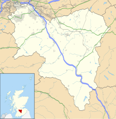
310:is a small village in
150:Postcode district
363:Businesses in Boghead
130:Sovereign state
286: /
216:UK Parliament
162:Dialling code
312:South Lanarkshire
305:
304:
106:South Lanarkshire
98:Council area
76:Approximately 200
63:South Lanarkshire
459:
436:
435:
433:
431:
421:
420:(csv (download))
413:
407:
406:
386:
344:Blackwood Estate
301:
300:
298:
297:
296:
291:
290:55.656°N 3.942°W
287:
284:
283:
282:
279:
256:
124:
92:
91:
61:Location within
51:
50:
44:
28:
467:
466:
462:
461:
460:
458:
457:
456:
442:
441:
440:
439:
429:
427:
419:
415:
414:
410:
403:
388:
387:
383:
378:
365:
352:
314:, west central
294:
292:
288:
285:
280:
277:
275:
273:
272:
271:
254:
246:
228:
120:
110:
87:
86:
68:
67:
66:
65:
59:
58:
57:
56:
52:
26:
21:
12:
11:
5:
465:
463:
455:
454:
444:
443:
438:
437:
408:
401:
380:
379:
377:
374:
364:
361:
351:
348:
303:
302:
295:55.656; -3.942
270:
269:
267:
262:
257:
255:List of places
251:
248:
247:
245:
244:
238:
236:
230:
229:
227:
226:
220:
218:
212:
211:
208:
207:
202:
196:
195:
190:
184:
183:
178:
172:
171:
168:
167:
164:
158:
157:
152:
146:
145:
142:
136:
135:
134:United Kingdom
132:
126:
125:
118:
112:
111:
109:
108:
102:
100:
94:
93:
84:
78:
77:
74:
70:
69:
60:
54:
53:
46:
45:
39:
38:
37:
36:
33:
32:
24:
13:
10:
9:
6:
4:
3:
2:
464:
453:
450:
449:
447:
425:
418:
412:
409:
404:
402:9780319229712
398:
394:
391:
385:
382:
375:
373:
369:
362:
360:
358:
349:
347:
345:
341:
337:
333:
329:
325:
321:
317:
313:
309:
299:
268:
266:
263:
261:
258:
253:
252:
249:
243:
240:
239:
237:
235:
225:
222:
221:
219:
217:
209:
206:
203:
201:
194:
191:
189:
182:
179:
177:
165:
163:
156:
153:
151:
143:
141:
133:
131:
123:
119:
117:
107:
104:
103:
101:
99:
90:
85:
83:
75:
71:
64:
43:
34:
29:
23:
19:
428:. Retrieved
423:
411:
393:
389:
384:
370:
366:
353:
350:Bent Primary
324:River Nethan
307:
306:
22:
18:Boghead Park
293: /
430:30 January
376:References
336:Strathaven
332:Lesmahagow
328:Avon Water
278:55°39′22″N
242:Clydesdale
73:Population
281:3°56′31″W
200:Ambulance
140:Post town
446:Category
316:Scotland
265:Scotland
205:Scottish
193:Scottish
181:Scotland
122:Scotland
89:NS779419
320:Glasgow
308:Boghead
116:Country
55:Boghead
31:Boghead
399:
340:Lanark
176:Police
144:LANARK
166:01555
432:2016
397:ISBN
338:and
326:and
188:Fire
155:ML11
448::
422:.
334:,
260:UK
434:.
405:.
20:.
Text is available under the Creative Commons Attribution-ShareAlike License. Additional terms may apply.