49:
255:
118:
56:
191:
Famous teak timbers are still found in the locality. The local zigzag roads within the deep jungle will definitely baffle anyone taking the roads. There is also some tribal people in the village
Taltala, Kalikapur and Chaiterbaid known as Mandai. People from Deopara-Taltala have been able to contribute to the Country in various aspects.
190:
Deopara is a hill locked Union
Parishad under Ghatail Upa-Zilla of Tangail District under Dhaka Division. Deopara is surrounded by nearby villages like Taltala, Kalikapur, Sholakipara, Sharashak and Goariya. Deopara-Taltala-Kalikapur is renowned primarily for its natural resources especially woods.
315:
296:
320:
236:
48:
289:
80:
214:. Bangladesh Bureau of Statistics, Planning Division, Ministry of Planning, Govt. of the People's Republic of Bangladesh
282:
163:
142:
130:
266:
262:
176:
147:
17:
254:
180:
135:
309:
209:
184:
123:
95:
82:
154:
232:
159:
270:
20:
of
Rajshahi district, an important archeological site
153:
141:
129:
111:
28:
290:
8:
211:Bangladesh Population Census, 2001: Barisal
16:Not to be confused with Deopara village in
297:
283:
25:
237:National Geospatial-Intelligence Agency
200:
152:
110:
75:
41:
140:
128:
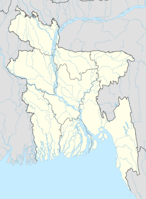
23:Village in Dhaka Division, Bangladesh
7:
316:Populated places in Barisal District
251:
249:
269:. You can help Knowledge (XXG) by
14:
321:Barisal Division geography stubs
253:
116:
54:
47:
55:
1:
208:Parisaṃkhyāna Byuro (2005).
337:
248:
239:, accessed 18 January 2011
15:
76:
42:
35:
265:location article is a
68:Location in Bangladesh
183:of southern-central
92: /
278:
277:
170:
169:
96:22.917°N 90.250°E
328:
299:
292:
285:
263:Barisal Division
257:
250:
240:
233:Geographic Names
230:
224:
223:
221:
219:
205:
177:Tangail District
175:is a village in
148:Tangail District
122:
120:
119:
107:
106:
104:
103:
102:
97:
93:
90:
89:
88:
85:
58:
57:
51:
26:
18:Godagari Upazila
336:
335:
331:
330:
329:
327:
326:
325:
306:
305:
304:
303:
246:
244:
243:
231:
227:
217:
215:
207:
206:
202:
197:
164:Bangladesh Time
117:
115:
100:
98:
94:
91:
86:
83:
81:
79:
78:
72:
71:
70:
69:
66:
65:
64:
63:
59:
38:
31:
24:
21:
12:
11:
5:
334:
332:
324:
323:
318:
308:
307:
302:
301:
294:
287:
279:
276:
275:
258:
242:
241:
225:
199:
198:
196:
193:
181:Dhaka Division
168:
167:
157:
151:
150:
145:
139:
138:
136:Dhaka Division
133:
127:
126:
113:
109:
108:
101:22.917; 90.250
74:
73:
67:
61:
60:
53:
52:
46:
45:
44:
43:
40:
39:
36:
33:
32:
29:
22:
13:
10:
9:
6:
4:
3:
2:
333:
322:
319:
317:
314:
313:
311:
300:
295:
293:
288:
286:
281:
280:
274:
272:
268:
264:
259:
256:
252:
247:
238:
234:
229:
226:
213:
212:
204:
201:
194:
192:
188:
186:
182:
178:
174:
165:
161:
158:
156:
149:
146:
144:
137:
134:
132:
125:
114:
105:
77:Coordinates:
50:
34:
27:
19:
271:expanding it
260:
245:
228:
216:. Retrieved
210:
203:
189:
172:
171:
99: /
310:Categories
218:18 January
195:References
185:Bangladesh
124:Bangladesh
155:Time zone
143:District
131:Division
179:in the
173:Deopara
112:Country
87:90°15′E
84:22°55′N
62:Deopara
37:Village
30:Deopara
121:
261:This
160:UTC+6
267:stub
220:2011
312::
235:,
187:.
298:e
291:t
284:v
273:.
222:.
166:)
162:(
Text is available under the Creative Commons Attribution-ShareAlike License. Additional terms may apply.