134:
331:
841:
1054:
121:
306:
810:
800:
99:
1279:
1100:
89:
828:
67:
755:
790:
141:
314:
461:) characterized by warm summers and cool winters with light snowfall. The average annual temperature in Kan'onji is 15.5 °C. The average annual rainfall is 1439 mm with September as the wettest month. The temperatures are highest on average in August, at around 26.6 °C, and lowest in January, at around 4.9 °C.
739:
Kan'onji has ten public elementary schools and five public middle schools operated by the city government, and one private middle school. The city has two public high schools operated by the Kagawa
Prefectural Board of Education.The prefecture also operates one special education school for the
318:
321:
320:
316:
315:
322:
319:
1252:
675:
with the creation of the modern municipalities system on
December 16,1878. It was elevated to town status on February 15, 1890. In 1899, Toyota district was merged with Mino District to form
707:
city council of 22 members. Kan'onji contributes three members to the Kagawa
Prefectural Assembly. In terms of national politics, the town is part of Kagawa 3rd district of the
133:
317:
944:
1340:
1316:
165:
1053:
1335:
1263:
66:
120:
708:
672:
1043:
98:
1350:
1099:
1309:
330:
1345:
1021:
88:
1224:
1201:
1071:
723:
The economy of Kan'onji is primarily food-related, with the city being the largest producer of lettuce in Japan.
644:
454:
1302:
890:
813:
407:
205:
904:
633:
305:
1177:
1160:
881:
803:
758:
688:
676:
640:
977:
1189:
1114:
875:
648:
378:
of 490 persons per km². The total area of the city is 117.84 square kilometres (45.50 sq mi).
1229:
898:
1081:
1036:
793:
469:
Per
Japanese census data, the population of Kan'onji has been gradually declining in recent decades.
391:
217:
894:
1144:
1000:
832:
768:
288:
870:
724:
664:
442:
375:
1278:
1234:
917:
680:
1066:
1057:
866:
679:. Kan'onji was elevated to city status on January 1, 1955. On October 11, 2005, the towns of
668:
422:
363:
222:
1212:
1207:
1182:
1124:
772:
684:
395:
1217:
1165:
1134:
1029:
776:
660:
621:
387:
359:
52:
1286:
1139:
1129:
923:
432:
1329:
988:
886:
845:
827:
712:
700:
637:
76:
1194:
629:
399:
754:
762:
704:
656:
371:
284:
731:, and food-processing, notably the frozen food industry, is also prominent.
180:
167:
1089:
279:
386:
Kan'onji is located at the western end of Kagawa
Prefecture. It faces the
853:
728:
652:
849:
210:
17:
964:
936:
403:
1170:
840:
625:
367:
329:
304:
486:
1025:
406:. Some coastal parts of the city are within the borders of the
624:
and has been inhabited since prehistoric times. A number of
481:
370:. As of 1 October 2022, the city had an estimated
651:(from which the city derives its name) was founded by the
1290:
703:
form of government with a directly elected mayor and a
299:
Sakamoto-cho 1-1-1, Kan-onji-shi, Kagawa-ken 768-8601
1245:
1153:
1107:
1080:
295:
278:
270:
262:
257:
249:
244:
233:
228:
216:
204:
196:
32:
671:, the village of Kan'onji was established within
349:
343:
39:
1310:
1285:This Kagawa Prefecture location article is a
1037:
8:
856:, China, friendship city since July 27, 2000
659:, the city area was part of the holdings of
472:
893:, includes a coin-shaped sand drawing, the
402:in the Seto Inland Sea between Shikoku and
1317:
1303:
1044:
1030:
1022:
471:
29:
636:. Historical documents indicate that the
620:The area of Kan'onji was part of ancient
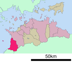
113:Location of Kan'onji in Kagawa Prefecture
926:, politician, former Minister of Defense
312:
956:
878:, 69th temple on the Shikoku Pilgrimage
835:, United States, since January 27, 1988
294:
277:
256:
243:
227:
195:
160:
126:
110:
82:
63:
58:
253:117.84 km (45.50 sq mi)
269:
261:
248:
232:
215:
203:
117:
7:
1275:
1273:
1264:List of mergers in Kagawa Prefecture
632:have been identified, including the
374:of 57,921 in 25510 households and a
140:
965:"Kan'onji city official statistics"
334:Aerial view of Kan'onji city center
25:
1341:Populated coastal places in Japan
1277:
1098:
1052:
839:
826:
808:
798:
788:
753:
643:was founded in 703 and that the
398:to the south. The city includes
139:
132:
119:
97:
87:
65:
989:Kan'onji population statistics
945:A tourist's report of Kan'onji
937:Kan'onji City official website
1:
1289:. You can help Knowledge by
1336:Cities in Kagawa Prefecture
414:Neighbouring municipalities
350:
1367:
1272:
912:Noted people from Kan'onji
1261:
1096:
1064:
920:, Prime Minister of Japan
499:—
455:humid subtropical climate
344:
274:490/km (1,300/sq mi)
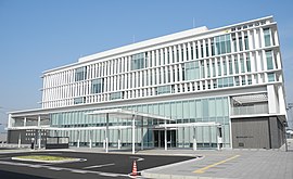
239:(since November 20, 2021)
161:
127:
118:
111:
83:
64:
59:
50:
40:
907:, National Historic Site
891:Setonaikai National Park
691:) merged with Kan'onji.
408:Setonaikai National Park
390:to the west and borders
36:
889:, which is part of the
814:National Route 377
759:Shikoku Railway Company
677:Mitoyo District, Kagawa
1351:Kagawa geography stubs
804:National Route 11
335:
327:
326:View of Kan'onji, 2021
310:
181:34.12722°N 133.66139°E
27:City in Shikoku, Japan
978:Kan'onji climate data
967:(in Japanese). Japan.
905:Ōnohara Kofun cluster
869:, 68th temple on the
634:Ōnohara Kofun cluster
473:Historical population
438:Tokushima Prefecture
333:
325:
308:
882:Kotohiki Hachiman-gū
794:Takamatsu Expressway
641:Kotohiki Hachiman-gū
392:Tokushima Prefecture
271: • Density
897:, which models the
833:Appleton, Wisconsin
655:in 803. During the
474:
186:34.12722; 133.66139
177: /
911:
871:Shikoku Pilgrimage
725:Commercial fishing
665:Tokugawa shogunate
428:Kagawa Prefecture
376:population density
336:
328:
311:
309:Kan'onji City Hall
263: • Total
250: • Total
234: • Mayor
71:Sand Coin Effigy (
1298:
1297:
1270:
1269:
1253:ja:ネット・ゲーム依存症対策条例
1202:Nakatado District
1075:
1058:Kagawa Prefecture
861:Local attractions
727:, especially for
669:Meiji restoration
613:
612:
418:Ehime Prefecture
364:Kagawa Prefecture
323:
303:
302:
296:City hall address
240:
153:Location in Japan
16:(Redirected from
1358:
1346:Kan'onji, Kagawa
1319:
1312:
1305:
1281:
1274:
1102:
1069:
1056:
1046:
1039:
1032:
1023:
1016:
1015:
1013:
1011:
997:
991:
986:
980:
975:
969:
968:
961:
941:
844:
843:
831:
830:
812:
811:
802:
801:
792:
791:
757:
667:. Following the
488:
483:
475:
396:Sanuki Mountains
357:
356:
353:
347:
346:
324:
238:
192:
191:
189:
188:
187:
182:
178:
175:
174:
173:
170:
143:
142:
136:
123:
101:
91:
69:
45:
44:
43:
42:
30:
21:
1366:
1365:
1361:
1360:
1359:
1357:
1356:
1355:
1326:
1325:
1324:
1323:
1271:
1266:
1257:
1241:
1178:Kagawa District
1161:Ayauta District
1149:
1103:
1094:
1076:
1060:
1050:
1020:
1019:
1009:
1007:
1001:"Sister Cities"
999:
998:
994:
987:
983:
976:
972:
963:
962:
958:
953:
939:
933:
918:Masayoshi Ōhira
914:
863:
838:
825:
822:
809:
799:
789:
785:
751:
746:
737:
721:
699:Kan'onji has a
697:
689:Mitoyo District
673:Toyota District
661:Marugame Domain
645:Buddhist temple
622:Sanuki Province
618:
467:
453:Kan'onji has a
451:
416:
388:Seto Inland Sea
384:
354:
341:
313:
185:
183:
179:
176:
171:
168:
166:
164:
163:
157:
156:
155:
154:
151:
150:
149:
148:
144:
114:
107:
106:
105:
104:
95:
94:
79:
73:Zenigata suna-e
55:
46:
38:
37:
35:
28:
23:
22:
15:
12:
11:
5:
1364:
1362:
1354:
1353:
1348:
1343:
1338:
1328:
1327:
1322:
1321:
1314:
1307:
1299:
1296:
1295:
1282:
1268:
1267:
1262:
1259:
1258:
1256:
1255:
1249:
1247:
1243:
1242:
1240:
1239:
1238:
1237:
1232:
1225:Shōzu District
1222:
1221:
1220:
1215:
1210:
1199:
1198:
1197:
1187:
1186:
1185:
1175:
1174:
1173:
1168:
1157:
1155:
1151:
1150:
1148:
1147:
1142:
1137:
1132:
1127:
1122:
1117:
1111:
1109:
1105:
1104:
1097:
1095:
1093:
1092:
1086:
1084:
1078:
1077:
1065:
1062:
1061:
1051:
1049:
1048:
1041:
1034:
1026:
1018:
1017:
992:
981:
970:
955:
954:
952:
949:
948:
947:
942:
932:
931:External links
929:
928:
927:
924:Yoshinori Ohno
921:
913:
910:
909:
908:
902:
895:Zenigata Sunae
884:
879:
873:
862:
859:
858:
857:
836:
821:
820:Sister citiess
818:
817:
816:
806:
796:
784:
781:
780:
779:
750:
747:
745:
744:Transportation
742:
736:
733:
720:
717:
696:
693:
617:
614:
611:
610:
607:
604:
600:
599:
596:
593:
589:
588:
585:
582:
578:
577:
574:
571:
567:
566:
563:
560:
556:
555:
552:
549:
545:
544:
541:
538:
534:
533:
530:
527:
523:
522:
519:
516:
512:
511:
508:
505:
501:
500:
497:
494:
490:
489:
484:
479:
466:
463:
450:
447:
446:
445:
436:
435:
426:
425:
415:
412:
383:
380:
301:
300:
297:
293:
292:
282:
276:
275:
272:
268:
267:
264:
260:
259:
255:
254:
251:
247:
246:
242:
241:
237:Akihiro Saeki
235:
231:
230:
226:
225:
220:
214:
213:
208:
202:
201:
198:
194:
193:
159:
158:
152:
146:
145:
138:
137:
131:
130:
129:
128:
125:
124:
116:
115:
112:
109:
108:
102:
96:
92:
86:
85:
84:
81:
80:
70:
62:
61:
57:
56:
51:
48:
47:
33:
26:
24:
14:
13:
10:
9:
6:
4:
3:
2:
1363:
1352:
1349:
1347:
1344:
1342:
1339:
1337:
1334:
1333:
1331:
1320:
1315:
1313:
1308:
1306:
1301:
1300:
1294:
1292:
1288:
1283:
1280:
1276:
1265:
1260:
1254:
1251:
1250:
1248:
1244:
1236:
1233:
1231:
1228:
1227:
1226:
1223:
1219:
1216:
1214:
1211:
1209:
1206:
1205:
1203:
1200:
1196:
1193:
1192:
1191:
1190:Kita District
1188:
1184:
1181:
1180:
1179:
1176:
1172:
1169:
1167:
1164:
1163:
1162:
1159:
1158:
1156:
1152:
1146:
1143:
1141:
1138:
1136:
1133:
1131:
1128:
1126:
1123:
1121:
1118:
1116:
1115:Higashikagawa
1113:
1112:
1110:
1106:
1101:
1091:
1088:
1087:
1085:
1083:
1079:
1073:
1068:
1063:
1059:
1055:
1047:
1042:
1040:
1035:
1033:
1028:
1027:
1024:
1006:
1002:
996:
993:
990:
985:
982:
979:
974:
971:
966:
960:
957:
950:
946:
943:
940:(in Japanese)
938:
935:
934:
930:
925:
922:
919:
916:
915:
906:
903:
900:
896:
892:
888:
887:Kotohiki Park
885:
883:
880:
877:
874:
872:
868:
865:
864:
860:
855:
851:
847:
846:Jimo District
842:
837:
834:
829:
824:
823:
819:
815:
807:
805:
797:
795:
787:
786:
782:
778:
774:
770:
767:
766:
765:
764:
760:
756:
748:
743:
741:
740:handicapped.
734:
732:
730:
726:
718:
716:
714:
713:Diet of Japan
710:
706:
702:
701:mayor-council
694:
692:
690:
686:
682:
678:
674:
670:
666:
662:
658:
654:
650:
646:
642:
639:
638:Shinto shrine
635:
631:
627:
626:burial mounds
623:
615:
608:
605:
602:
601:
597:
594:
591:
590:
586:
583:
580:
579:
575:
572:
569:
568:
564:
561:
558:
557:
553:
550:
547:
546:
542:
539:
536:
535:
531:
528:
525:
524:
520:
517:
514:
513:
509:
506:
503:
502:
498:
495:
492:
491:
485:
480:
477:
476:
470:
464:
462:
460:
456:
448:
444:
441:
440:
439:
434:
431:
430:
429:
424:
421:
420:
419:
413:
411:
409:
405:
401:
397:
393:
389:
381:
379:
377:
373:
369:
365:
361:
352:
340:
332:
307:
298:
290:
286:
283:
281:
273:
265:
252:
236:
224:
221:
219:
212:
209:
207:
199:
190:
162:Coordinates:
135:
122:
100:
90:
78:
77:Kotohiki Park
74:
68:
60:Kan'onji City
54:
49:
31:
19:
1291:expanding it
1284:
1119:
1008:. Retrieved
1005:appleton.org
1004:
995:
984:
973:
959:
899:Kan'ei Tsūhō
752:
738:
722:
698:
630:Kofun period
619:
468:
465:Demographics
458:
452:
437:
427:
417:
400:Ibuki island
385:
351:Kan'onji-shi
338:
337:
72:
709:lower house
687:(both from
423:Shikokuchūō
394:across the
362:located in
184: /
172:133°39′41″E
1330:Categories
1230:Shōdoshima
1010:August 30,
951:References
763:Yosan Line
705:unicameral
695:Government
663:under the
657:Edo Period
372:population
258:Population
229:Government
218:Prefecture
1154:Districts
1090:Takamatsu
1082:Core city
1067:Takamatsu
876:Kannon-ji
735:Education
649:Kannon-ji
628:from the
382:Geography
285:UTC+09:00
280:Time zone
169:34°7′38″N
1208:Kotohira
1183:Naoshima
1145:Zentsūji
1125:Marugame
1120:Kan'onji
867:Jinne-in
854:Shandong
783:Highways
773:Toyohama
769:Kan'onji
749:Railways
729:sardines
685:Toyohama
457:(Köppen
339:Kan'onji
147:Kan'onji
34:Kan'onji
1235:Tonoshō
1218:Tadotsu
1166:Ayagawa
1135:Sakaide
1072:capital
850:Qingdao
777:Minoura
719:Economy
711:of the
681:Ōnohara
616:History
449:Climate
443:Miyoshi
211:Shikoku
197:Country
18:Kanonji
1246:Others
1140:Sanuki
1130:Mitoyo
1108:Cities
606:57,438
595:62,690
584:66,555
573:68,436
562:68,435
551:66,653
540:73,186
532:+33.5%
529:78,356
518:58,708
507:58,228
496:54,251
433:Mitoyo
404:Honshu
266:57,921
223:Kagawa
206:Region
103:Emblem
1213:Mannō
1171:Utazu
653:Kūkai
609:−8.4%
603:2020
598:−5.8%
592:2010
587:−2.7%
581:2000
576:+0.0%
570:1990
565:+2.7%
559:1980
554:−8.9%
548:1970
543:−6.6%
537:1960
526:1950
521:+0.8%
515:1940
510:+7.3%
504:1930
493:1920
368:Japan
358:is a
200:Japan
75:) in
1287:stub
1195:Miki
1012:2020
683:and
482:Pop.
478:Year
360:city
345:観音寺市
245:Area
93:Flag
53:City
41:観音寺市
647:of
459:Cfa
289:JST
1332::
1204::
1003:.
852:,
848:,
775:-
771:-
761:-
715:.
487:±%
410:.
366:,
348:,
1318:e
1311:t
1304:v
1293:.
1074:)
1070:(
1045:e
1038:t
1031:v
1014:.
901:.
355:)
342:(
291:)
287:(
20:)
Text is available under the Creative Commons Attribution-ShareAlike License. Additional terms may apply.