188:
45:
29:
383:
52:
242:
cycling, and cross-country ski trails run near the south side of the lake and connect to the large system of trails in the forests that surround Oslo. They can be reached by a short walk from the Kjelsås trolley, bus, or train stations. Trails run alongside
Akerselva from the Marridalsvannet dam almost all the way to Oslofjord. The
241:
The shores of the lake and substantial areas of woods and fields around it are owned by the city of Oslo to protect the water supply. Some farms are still operated under city supervision, but others were closed down in the mid 20th century; their remains are marked by historical signs. Hiking,
91:
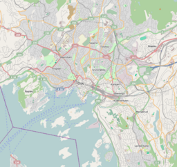
210:, Norway. It is the largest lake in the municipality of Oslo, and serves as the main drinking water supply for the city. The lake drains via the river
424:
231:
44:
187:
453:
417:
448:
410:
297:
141:
223:
130:
443:
219:
123:
367:
Most of the information in this paragraph comes from signs posted on the trails around the lake.
227:
134:
394:
235:
353:
329:
243:
155:
437:
28:
344:
320:
106:
93:
348:
324:
215:
211:
203:
148:
73:
124:
382:
142:
292:
390:
207:
77:
398:
278:
Lee, Phil, Jules Brown, & Anette
Slettbakk. 2003.
177:
169:
165:
154:
140:
122:
83:
69:
21:
84:
418:
357:(in Norwegian) (2 ed.). Oslo: Aschehoug.
333:(in Norwegian) (2 ed.). Oslo: Aschehoug.
8:
425:
411:
18:
186:
301:(in Norwegian). Oslo: Kunnskapsforlaget
258:
51:
7:
379:
377:
232:Hammeren Hydroelectric Power Station
173:3.83 km (1.48 sq mi)
397:. You can help Knowledge (XXG) by
327:, eds. (1966) . "Maridalsvannet".
14:
381:
50:
43:
27:
282:. London: Rough Guides, p. 112.
176:
168:
269:. Berkeley, CA: Avalon Travel.
1:
351:, eds. (1966) . "Akerselva".
68:
191:Maridalsvannet and Maridalen
246:runs along the same shore.
470:
376:
199:
38:
26:
181:149 m (489 ft)
267:Rick Steves Scandinavia
234:exploits the fall from
393:location article is a
192:
298:Store norske leksikon
190:
454:Oslo geography stubs
265:Steves, Rick. 2015.
16:Lake in Oslo, Norway
238:to Maridalsvannet.
103: /
193:
406:
405:
185:
184:
178:Surface elevation
107:59.983°N 10.783°E
461:
427:
420:
413:
385:
378:
368:
365:
359:
358:
341:
335:
334:
317:
311:
310:
308:
306:
293:"Maridalsvannet"
289:
283:
276:
270:
263:
201:
144:
143:Primary outflows
126:
118:
117:
115:
114:
113:
108:
104:
101:
100:
99:
96:
86:
54:
53:
47:
31:
19:
469:
468:
464:
463:
462:
460:
459:
458:
434:
433:
432:
431:
374:
372:
371:
366:
362:
354:Oslo byleksikon
343:
342:
338:
330:Oslo byleksikon
319:
318:
314:
304:
302:
291:
290:
286:
277:
273:
264:
260:
255:
249:
202:) is a lake in
158: countries
125:Primary inflows
111:
109:
105:
102:
97:
94:
92:
90:
89:
65:
64:
63:
62:
61:
60:
59:
55:
34:
17:
12:
11:
5:
467:
465:
457:
456:
451:
446:
436:
435:
430:
429:
422:
415:
407:
404:
403:
386:
370:
369:
360:
336:
312:
284:
271:
257:
256:
254:
251:
218:. The primary
196:Maridalsvannet
183:
182:
179:
175:
174:
171:
167:
166:
163:
162:
159:
152:
151:
146:
138:
137:
128:
120:
119:
112:59.983; 10.783
87:
81:
80:
71:
67:
66:
58:Maridalsvannet
57:
56:
49:
48:
42:
41:
40:
39:
36:
35:
33:Maridalsvannet
32:
24:
23:
22:Maridalsvannet
15:
13:
10:
9:
6:
4:
3:
2:
466:
455:
452:
450:
449:Lakes of Oslo
447:
445:
442:
441:
439:
428:
423:
421:
416:
414:
409:
408:
402:
400:
396:
392:
387:
384:
380:
375:
364:
361:
356:
355:
350:
346:
345:Arstal, Aksel
340:
337:
332:
331:
326:
322:
321:Arstal, Aksel
316:
313:
300:
299:
294:
288:
285:
281:
275:
272:
268:
262:
259:
252:
250:
247:
245:
239:
237:
233:
229:
225:
221:
217:
213:
209:
205:
197:
189:
180:
172:
164:
160:
157:
153:
150:
147:
145:
139:
136:
132:
129:
127:
121:
116:
88:
82:
79:
75:
72:
46:
37:
30:
25:
20:
399:expanding it
388:
373:
363:
352:
339:
328:
315:
303:. Retrieved
296:
287:
279:
274:
266:
261:
248:
240:
224:Skjærsjøelva
200:Lake Maridal
195:
194:
170:Surface area
131:Skjærsjøelva
244:Gjøvik Line
110: /
85:Coordinates
438:Categories
349:Just, Carl
325:Just, Carl
253:References
236:Skjærsjøen
228:Dausjøelva
198:(English:
135:Dausjøelva
444:Maridalen
216:Oslofjord
212:Akerselva
204:Maridalen
149:Akerselva
74:Maridalen
305:14 April
70:Location
220:inflows
214:to the
98:10°47′E
95:59°59′N
280:Norway
230:. The
161:Norway
389:This
156:Basin
395:stub
391:Oslo
307:2011
226:and
222:are
208:Oslo
133:and
78:Oslo
440::
347:;
323:;
295:.
206:,
76:,
426:e
419:t
412:v
401:.
309:.
Text is available under the Creative Commons Attribution-ShareAlike License. Additional terms may apply.