1702:
110:
127:
3479:
163:
63:
199:
671:
2844:. Accessed May 20, 2024. "Sussex County is governed by five (5) Commissioners who are elected by the voters of Sussex County. Each serves on the county’s Board of County Commissioners for a term of three (3) years, after which time they can seek re‐election or retire.... The Commissioners are elected at‐large to serve three‐year staggered terms. The five Commissioners elect a director from among themselves to run their meetings and to serve as a spokesperson for the board."
745:. This dam, 10 miles (16 km) south of Walpack, would have created a lake roughly 40 miles (64 km) long and 1 mile (1.6 km) wide. Approximately 72,000 acres (29,000 ha) of the surrounding land, including Walpack, were claimed under eminent domain by the government for this project and thousands of area residents were forced to move out. Although the dam was never actually constructed, the township's population has been on the decline ever since.
90:
3158:, Sandyston-Walpack Consolidated School District. Accessed June 22, 2020. "The Sandyston-Walpack Consolidated School is a K-6 district with an enrollment of about 120 students. The school is located in a beautiful portion of northwest New Jersey. The elementary students who live in the townships of Sandyston and Walpack attend here. The students of middle and high school age attend Kittatinny Regional High School located in Hampton Township."
274:
294:
2221:. Accessed March 11, 2020. "Congress responded quickly, commissioning the Army Corps of Engineers to dust off a 1930s river basin study and determine the viability of constructing dams and reservoirs along the Delaware, with one dam on the main stem of the river at the southern tip of Tocks Island. The proposed Tocks Island Dam would have created a lake-sized reservoir roughly 40 miles long and a mile wide."
3191:, September 2017. Accessed January 30, 2020. "Based on data from the state Department of Education from the last school year and the Census Bureau, NJ Advance Media made a list of the smallest of the small school districts in the state, excluding charter schools and specialty institutions.... 26. Sandyston-Walpack Township (tie;) Enrollment: 149; Grades: K-6; County: Sussex; Town population: 2,014"
3893:
3223:. Accessed June 22, 2020. "Located in beautiful, rural Sussex County in northwest New Jersey, Kittatinny Regional School District serves the five municipalities of Fredon Township, Hampton Township, Sandyston Township, Stillwater Township and the Township of Walpack. The District is comprised of 125 square miles and has a school population of approximately 1020 students."
3207:. Accessed June 22, 2020. "Located in beautiful, rural Sussex County in northwest New Jersey, Kittatinny Regional School District serves the five municipalities of Fredon Township, Hampton Township, Sandyston Township, Stillwater Township and the Township of Walpack. The District is comprised of 125 square miles and has a school population of approximately 1020 students."
3910:
3885:
3871:
2233:, Scenes From the Trail, September 10, 2016. Accessed March 11, 2020. "Although the dam was never built, 72,000 acres of land were acquired by condemnation and eminent domain. The Corps and the National Park Service would end up spending $ 100 million to buy homes, stores and churches on either side of the river. About 8,000 people were evicted from their homes."
206:
170:
134:
2251:, April 29, 1973. Accessed January 24, 2018. "In the summer of 1970, Judge Stamler issued a permanent injunction that prevented a group of promoters from holding a rock festival in rural Sussex County. 'The question of health, safety and welfare of the young, and the potential harm to the public, far outweighs any good which might be derived,' he ruled."
313:
2679:, April 30, 2019. Accessed November 7, 2019. "New Jersey’s average property tax bill may have hit $ 8,767 last year — a new record — but taxpayers in some parts of the state pay just a fraction of that.... The average property tax bill in Walpack Township was $ 450 in 2018, the lowest in Sussex County."
1254:
12.5% of the population were under the age of 18, 12.5% from 18 to 24, 18.8% from 25 to 44, 31.3% from 45 to 64, and 25.0% who were 65 years of age or older. The median age was 56.5 years. For every 100 females, the population had 100.0 males. For every 100 females ages 18 and older there were 100.0
1341:
in partisan elections to serve three-year terms of office on a staggered basis, with one seat coming up for election each year as part of the
November general election in a three-year cycle. At an annual reorganization meeting, the Township Committee selects one of its members to serve as Mayor and
1307:
In the township the population was spread out, with 19.5% under the age of 18, 2.4% from 18 to 24, 19.5% from 25 to 44, 31.7% from 45 to 64, and 26.8% who were 65 years of age or older. The median age was 49 years. For every 100 females, there were 95.2 males. For every 100 females age 18 and over,
1250:
Of the 8 households, 12.5% had children under the age of 18; 37.5% were married couples living together; 0.0% had a female householder with no husband present and 50.0% were non-families. Of all households, 50.0% were made up of individuals and 25.0% had someone living alone who was 65 years of age
1481:
in partisan elections on a staggered basis, with either one or two seats coming up for election each year. At an annual reorganization meeting held in the beginning of
January, the board selects a Commissioner Director and Deputy Director from among its members, with day-to-day supervision of the
1303:
living together, 10.0% had a female householder with no husband present, and 40.0% were non-families. 40.0% of all households were made up of individuals, and 10.0% had someone living alone who was 65 years of age or older. The average household size was 2.05 and the average family size was 2.75.
756:
rejected a proposal for a six-day rock festival to be held in the summer of 1970 on a 400-acre (160 ha) site in the township, leading to the passage of standards for similar events that requires planning for traffic and safety between the organizers and local authorities, and sets limits on
2269:, July 14, 1970. Accessed January 24, 2018. "Walpack Township officials Monday won the first round in a court proceeding initiated at 9:30 ... Stamler said that there is a 'probability' the festival would jeopardize the public health and welfare of Walpack Township and Sussex County residents."
1336:
form of New Jersey municipal government, one of 141 municipalities (of the 564) statewide that use this form, the second-most commonly used form of government in the state. The governing body is comprised of the three-member
Township Committee, whose members are elected directly by the voters
1569:
received 14 votes (70.0% vs. 59.2% countywide), ahead of
Democrat Barack Obama with 3 votes (15.0% vs. 38.7%) and other candidates with 2 votes (10.0% vs. 1.5%), among the 20 ballots cast by the township's 28 registered voters, for a turnout of 71.4% (vs. 76.9% in Sussex County). In the
2368:, p. 271, J. E. Potter and company, 1877. Accessed February 26, 2013. "Wallpack is on the western part of the county and forms the boundary between New Jersey and Pennsylvania. Population in 1850, 783; in 1860, 851; and in 1870, 647. This is the smallest township in the county."
1291:
there were 41 people, 20 households, and 12 families residing in the township. The population density was 1.7 inhabitants per square mile (0.66/km). There were 34 housing units at an average density of 1.4 per square mile (0.54/km). The racial makeup of the township was 100.00%
1701:
1218:
counted 16 people, 8 households, and 4 families in the township. The population density was 0.7 inhabitants per square mile (0.27/km). There were 15 housing units at an average density of 0.6 per square mile (0.23/km). The racial makeup was 93.75% (15)
690:
upon that county's creation in 1739, and became part of the newly formed Sussex County in 1753. As of April 15, 1754, Walpack's boundaries were defined as a "precinct". Walpack was formally incorporated as a township by an act of the
3293:, June 25, 2016. Accessed June 26, 2016. "The son of Frank Joseph Chapot and the former Dorothy Davis, Frank Davis Chapot was born on Feb. 24, 1932, in Camden, N.J. He was reared on his parents' horse farm in Walpack, N.J."
769:, the township had a total area of 24.88 square miles (64.45 km), including 24.24 square miles (62.77 km) of land and 0.65 square miles (1.68 km) of water (2.60%). The township is located in the
1560:
with 2 votes (16.7% vs. 38.2%) and other candidates with no votes (0.0% vs. 2.1%), among the 12 ballots cast by the township's 18 registered voters, for a turnout of 66.7% (vs. 68.3% in Sussex County). In the
662:, a compound of two Native American words, "woa-lac" (a hole), and "tuppeck" (a pool), though other sources attribute the name to mean "very deep water" or "sudden bend of a stream around the base of a rock".
1582:
with 6 votes (21.4% vs. 34.4%) and other candidates with no votes (0.0% vs. 1.3%), among the 28 ballots cast by the township's 35 registered voters, for a turnout of 80.0% (vs. 77.7% in the whole county).
1270:
was $ 108,333 (with a margin of error of +/− $ 155,555) and the median family income was $ 127,500 (+/− $ 88,897). Males had a median income of $ (+/− $ ) versus $ 57,813 (+/− $ 26,023) for females. The
1610:
with no votes (0.0% vs. 9.1%) and other candidates with no votes (0.0% vs. 1.3%), among the 12 ballots cast by the township's 23 registered voters, yielding a 52.2% turnout (vs. 52.3% in the county).
3030:
3969:
2084:
2068:
1935:
1897:
1858:
62:
3924:
1571:
1562:
1549:
109:
757:
duration. Stamler stated that any positive benefits from such an event must be weighed against the "health, safety and welfare of the young, and the potential harm to the public".
1311:
The median income for a household in the township was $ 22,250, and the median income for a family was $ 22,250. Males had a median income of $ 46,250 versus $ 0 for females. The
126:
3964:
1545:. Among the township's 2010 Census population, 137.5% (vs. 65.8% in Sussex County) were registered to vote, including 157.1% of those ages 18 and over (vs. 86.5% countywide).
3382:
2561:
89:
2579:
1638:
section of
Sandyston Township. As of the 2022–23 school year, the district, comprised of one school, had an enrollment of 120 students and 14.8 classroom teachers (on an
1360:
In 2018, the township had an average property tax bill of $ 450, the lowest in the county, compared to an average bill of $ 7,626 in Sussex County and $ 8,767 statewide.
787:, localities and place names located partially or completely within the township include Dry Pond, Flat Brook, Flatbrookville, Haneys Mill, Harding Lake, Long Pond and
3989:
3979:
3830:
3007:
1728:
1627:
1240:
3974:
3284:
2516:
DP-1: Profile of
General Demographic Characteristics: 2000 - Census 2000 Summary File 1 (SF 1) 100-Percent Data for Walpack township, Sussex County, New Jersey
1598:
with 22.2% (2 votes), and other candidates receiving no votes, among the 9 ballots cast by the township's 19 registered voters, for a turnout of 47.4%. In the
3855:
2607:
3167:
2218:
3135:
2541:
2034:
3959:
3850:
3027:
2672:
2659:
2518:
1836:
1474:
162:
1893:
1377:
198:
2060:
1424:
234:
2761:, press release dated October 23, 2019. Accessed January 19, 2022. "My name, Tom Malinowski. My address, 86 Washington Street, Rocky Hill, NJ 08553."
2539:
DP03: Selected
Economic Characteristics from the 2006-2010 American Community Survey 5-Year Estimates for Walpack township, Sussex County, New Jersey
3338:
3252:
3171:
2150:
1963:
548:
1947:
3375:
3268:
2314:
1599:
1587:
1646:
of 8.1:1. In the 2016–17 school year, Sandyston-Walpack had the 26th smallest enrollment of any school district in the state, with 149 students.
1509:
Constitutional officers elected on a countywide basis are Clerk
Jeffrey M. Parrott (R, Wantage Township, 2026), Sheriff Michael F. Strada (R,
3954:
3740:
3248:
3236:
2754:
1525:
As of March 2011, there were a total of 22 registered voters in
Walpack Township, of which 1 (4.5% vs. 16.5% countywide) was registered as a
734:
648:
1712:
As of May 2010, the township had a total of 20.01 miles (32.20 km) of roadways, all of which were maintained by the municipality.
3725:
2720:
1912:
1682:
723:
622:
3050:
3083:
2692:
1874:
558:
3823:
3368:
3329:
3204:
2623:
1538:
727:
3108:
1780:
3984:
3634:
2491:
Census 2000 Profiles of
Demographic / Social / Economic / Housing Characteristics for Walpack township, Sussex County, New Jersey
2114:
History of Sussex and Warren Counties, New Jersey, With Illustrations and Biographical Sketches of its Prominent Men and Pioneers
1530:
1526:
1483:
1482:
operation of the county delegated to a County Administrator. As of 2024, Sussex County's Commissioners are Director Jill Space (
1440:
1398:
1386:
1350:
371:
2080:
1685:
in 1997–98. As of the 2022–23 school year, the high school had an enrollment of 781 students and 79.5 classroom teachers (on an
3931:
3571:
3220:
3066:
2704:
2469:
2242:
2010:
1716:
1705:
1670:
1658:
799:
712:
704:
72:
3860:
3655:
3561:
3551:
3546:
3526:
3360:
3143:
3070:
3054:
3004:
2992:
2708:
2332:
1631:
1491:
1236:
795:
784:
700:
306:
2988:
1931:
1368:
Walpack Township is located in the 7th Congressional District and is part of New Jersey's 24th state legislative district.
3919:
3816:
3556:
2688:
1799:
1228:
803:
696:
2655:
3899:
3586:
3541:
3516:
1951:
1662:
1510:
1487:
1464:
1444:
1420:
1372:
742:
683:
3334:
3760:
3576:
3566:
3531:
3015:
2549:
2526:
2494:
2457:
2439:
2421:
2402:
2230:
2100:
2042:
2032:
DP-1 - Profile of General Population and Housing Characteristics: 2010 for Walpack township, Sussex County, New Jersey
1982:
1916:
1803:
1784:
1673:. The high school is located on a 96-acre (39 ha) campus in Hampton Township, about seven minutes outside of the
1666:
1542:
1448:
766:
68:
2770:
2538:
2031:
2795:
2782:
2515:
3690:
3614:
3536:
3521:
3353:
1413:
788:
1913:
Annual Estimates of the Resident Population for Minor Civil Divisions in New Jersey: April 1, 2020 to July 1, 2023
1690:
1643:
3788:
3645:
3640:
3609:
3392:
3315:
3038:
2937:
2921:
2905:
2889:
2873:
2857:
2841:
2643:
2639:
2627:
2611:
2298:
2215:
1534:
1470:
1288:
1259:
1215:
1161:
1146:
1131:
1116:
1101:
1086:
1071:
1056:
1040:
1025:
1010:
995:
980:
965:
950:
935:
920:
905:
890:
874:
859:
844:
807:
753:
708:
687:
634:
618:
614:
610:
598:
316:
147:
95:
31:
2435:
Thirteenth Census of the United States, 1910: Population by Counties and Minor Civil Divisions, 1910, 1900, 1890
3730:
3604:
3132:
536:
312:
266:
2595:
1275:
for the borough was $ 36,663 (+/− $ 14,435). About none of families and none of the population were below the
1870:
3755:
3735:
3720:
3710:
3675:
3629:
3619:
3596:
3438:
3109:"Number of Registered Voters and Ballots Cast - November 5, 2013 - General Election Results - Sussex County"
1499:
1267:
630:
2057:
1299:
There were 20 households, out of which 20.0% had children under the age of 18 living with them, 50.0% were
3750:
3458:
3264:
3184:
3005:
GCT-P7: Selected Age Groups: 2010 - State -- County Subdivision; 2010 Census Summary File 1 for New Jersey
2825:
2773:, PhillyVoice. Accessed April 30, 2021. "He now owns a home and lives in Newark's Central Ward community."
2742:
2726:
1428:
1244:
692:
3765:
3745:
3705:
3508:
3453:
2294:
2202:
2184:
2097:
New Jersey: 2010 - Population and Housing Unit Counts - 2010 Census of Population and Housing (CPH-2-32)
1390:
1333:
778:
655:
626:
594:
516:
349:
331:
53:
3311:
1357:
Kelly Happe (R, term on committee ends and term as deputy mayor ends 2024) and James Heigis (R, 2025).
1733:
People who were born in, residents of, or otherwise closely associated with Walpack Township include:
3795:
3700:
3685:
3665:
3463:
3443:
3425:
1686:
1639:
1456:
1394:
1263:
505:
2126:
3695:
3670:
3448:
3433:
2326:
1750:
1293:
1232:
1224:
1220:
719:
670:
3808:
3715:
3680:
3624:
3498:
3468:
3414:
3289:
2800:
2738:
2583:
2567:
2310:
2247:
1855:
1678:
1635:
1503:
1495:
1405:
774:
3325:
2821:
625:
as of the 2020 Census; it had the state's third-smallest population in the 2010 census, behind
3490:
2451:
2433:
2396:
2381:
2363:
2348:
2199:"National Register of Historic Places Inventory/Nomination: Wallpack Center Historic District"
1602:, Republican Chris Christie received 11 votes (91.7% vs. 63.3% countywide), ahead of Democrat
1432:
1315:
for the township was $ 17,624. None of the population and none of the families were below the
1312:
1272:
495:
2415:
2198:
2180:
2171:, Bureau of Geology and Topography; Trenton, New Jersey; 1969. p. 232. Accessed May 30, 2024.
2144:
2624:
Sussex County, New Jersey General Election November 8, 2022, Official Results Summary Report
1994:
1514:
3139:
3034:
2377:
2166:
2081:
Table 7. Population for the Counties and Municipalities in New Jersey: 1990, 2000 and 2010
2064:
1460:
1382:
641:
380:
2837:
617:
count of 16, which in turn reflected a decline of 34 (−82.9%) from the 41 counted in the
2417:
Preliminary Results as Contained in the Eleventh Census Bulletins: Volume III - 51 to 75
2758:
2490:
1591:
1575:
770:
749:
738:
2181:
National Register of Historic Places Inventory Nomination Form for Andrew Snable House
512:
491:
3948:
3232:
3011:
2961:
2545:
2522:
2472:, Workforce New Jersey Public Information Network, August 2001. Accessed May 1, 2023.
2365:
The History of New Jersey: From Its Earliest Settlement to the Present Time, Volume 1
2344:
2265:
2140:
2038:
1654:
1650:
1607:
1595:
1452:
541:
279:
2933:
1251:
or older. The average household size was 2.00 and the average family size was 3.00.
621:. Walpack Township was the smallest municipality by population and one of only four
3280:
3200:
2917:
2901:
2853:
2096:
1737:
1619:
1557:
1436:
1409:
1354:
1316:
1276:
651:
2885:
2869:
2673:"These are the towns with the lowest property taxes in each of N.J.’s 21 counties"
1832:
3233:
Blue Ribbon Schools Program: Schools Recognized 1982-1983 through 1999-2002 (PDF)
2783:
https://www.nytimes.com/2024/08/23/nyregion/george-helmy-bob-menendez-murphy.html
2278:
3407:
2771:
U.S. Sen. Cory Booker cruises past Republican challenger Rik Mehta in New Jersey
2260:
1674:
1623:
1603:
1566:
1553:
1401:
678:
Walpack Township dates back to October 26, 1731, when it was first mentioned as
1871:
U.S. Geological Survey Geographic Names Information System: Township of Walpack
2282:
1820:
1579:
606:
602:
299:
286:
183:
99:
2328:
Compendium of censuses 1726-1905: together with the tabulated returns of 1905
249:
236:
2949:
2131:, New Jersey Public Library Commission, May 1945. Accessed October 20, 2015.
659:
486:
3779:‡This populated place also has portions in an adjacent county or counties
3285:"Frank Chapot, Olympic Show Jumper and Mainstay of the Sport, Dies at 84"
3155:
2640:
Summary Results Report November 2, 2021 General Election Official Results
2058:
Profile of General Demographic Characteristics: 2010 for Walpack township
1478:
1338:
1300:
1279:, including none of those under age 18 and none of those age 65 or over.
524:
2973:
2608:
Summary Results Report Official Results November 7 2023 General Election
1932:
Population Density by County and Municipality: New Jersey, 2020 and 2021
3168:
District information for Sandyston-Walpack Consolidated School District
2453:
Fifteenth Census of the United States : 1930 - Population Volume I
17:
1353:, term on committee ends December 31, 2026; term as mayor ends 2024),
3350:
3188:
3146:
Division of Elections, December 31, 2009. Accessed February 26, 2013.
3073:
Division of Elections, December 13, 2004. Accessed February 26, 2013.
3057:
Division of Elections, December 23, 2008. Accessed February 26, 2013.
2796:"Menendez's Senate Replacement Has Been a Democrat for Just 5 Months"
2676:
2350:
American Almanac and Repository of Useful Knowledge for the Year 1843
1894:
Total Population: Census 2010 - Census 2020 New Jersey Municipalities
645:
613:, the township's population was 7, a decrease of 9 (−56.3%) from the
3478:
3320:
2470:
Table 6: New Jersey Resident Population by Municipality: 1940 - 2000
2116:. (Centennial ed., Harmony, NJ: Harmony Press, 1981), pgs. 314, 326.
3326:
School Performance Report for Sandyston-Walpack Consolidated School
2570:
Center for Government Studies, July 1, 2011. Accessed June 1, 2023.
2995:
Division of Elections, March 23, 2011. Accessed February 26, 2013.
2755:"Congressman Malinowski Fights For The Corporate Transparency Act"
1700:
1578:
received 22 votes (78.6% vs. 63.9% countywide), ahead of Democrat
1556:
received 10 votes (83.3% vs. 59.4% countywide), ahead of Democrat
1346:
695:
on February 21, 1798. Portions of the township were taken to form
669:
365:
3028:
General Election November 6, 2012: District Report - Group Detail
3306:
573:
3812:
3364:
3216:
3041:
Clerk, run date November 30, 2012. Accessed February 26, 2013.
2353:, p. 231, David H. Williams, 1842. Accessed February 26, 2013.
1657:
from Sandyston and Walpack Townships for public school attend
686:. The area covered by the present-day township was set off to
3201:
Kittatiny Regional School District 2016 Report Card Narrative
3185:"These 43 N.J. school districts have fewer than 200 students"
3477:
2006:
30:"Walpack" and "Wallpack" redirect here. For other uses, see
1345:
As of 2024, members of the Walpack Township Committee are
3051:
2008 Presidential General Election Results: Sussex County
2386:, p. 141. R. Armstrong, 1853. Accessed February 26, 2013.
1978:
3343:
2964:, Sussex County Sheriff's Office. Accessed May 20, 2024.
2563:
Inventory of Municipal Forms of Government in New Jersey
2085:
New Jersey Department of Labor and Workforce Development
2069:
New Jersey Department of Labor and Workforce Development
1936:
New Jersey Department of Labor and Workforce Development
1898:
New Jersey Department of Labor and Workforce Development
1859:
Edward J. Bloustein School of Planning and Public Policy
623:
municipalities in New Jersey with a population under 100
2705:
Municipalities Sorted by 2011-2020 Legislative District
1594:
received 77.8% of the vote (7 cast), ahead of Democrat
3265:
Sussex County Mileage by Municipality and Jurisdiction
3114:. New Jersey Department of Elections. January 29, 2014
3089:. New Jersey Department of Elections. January 29, 2014
2662:, updated January 16, 2019. Accessed November 7, 2019.
2646:, updated November 22, 2021. Accessed January 1, 2022.
2146:
The Origin of Certain Place Names in the United States
1997:, Missouri Census Data Center. Accessed April 1, 2022.
1681:. Kittatinny Regional High School was recognized as a
2586:
Center for Government Studies. Accessed June 1, 2023.
2168:
The Story of New Jersey's Civil Boundaries: 1606-1968
2984:
2982:
2630:, dated November 21, 2022. Accessed January 1, 2023.
3774:
3654:
3595:
3507:
3489:
3424:
568:
557:
547:
535:
523:
502:
485:
475:
467:
457:
449:
441:
436:
428:
418:
410:
402:
394:
389:
378:
363:
355:
345:
340:
330:
322:
305:
285:
265:
44:
794:The township is bordered by the municipalities of
3970:New Jersey populated places on the Delaware River
2976:, Sussex County Surrogate. Accessed May 20, 2024.
114:Census Bureau map of Walpack Township, New Jersey
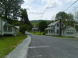
2511:
2509:
2507:
2505:
2503:
1927:
1925:
1839:, updated April 1, 2024. Accessed April 1, 2024.
733:In 1955 a proposal was made by Congress for the
3839:Places adjacent to Walpack Township, New Jersey
3249:School data for Kittatinny Regional High School
2614:, November 22, 2023. Accessed February 1, 2024.
1740:(1932–2016), Olympic silver medalist equestrian
711:(December 27, 1824). Territory was gained from
414:0.65 sq mi (1.68 km) 2.60%
3335:Data for Sandyston-Walpack Consolidated School
1852:2012 New Jersey Legislative District Data Book
1781:2019 Census Gazetteer Files: New Jersey Places
1729:Category:People from Sussex County, New Jersey
1628:Sandyston-Walpack Consolidated School District
1247:of any race were 0.00% (0) of the population.
3824:
3376:
2952:, Sussex County Clerk. Accessed May 20, 2024.
2722:2019 New Jersey Citizen's Guide to Government
2580:"Forms of Municipal Government in New Jersey"
2486:
2484:
2482:
2480:
2478:
2383:The Seventh Census of the United States: 1850
2027:
2025:
2023:
2021:
2019:
8:
3482:Map of New Jersey highlighting Sussex County
2231:"Walpack Township – Abandoned in New Jersey"
1966:, Area-Codes.com. Accessed October 29, 2014.
1776:
1774:
1772:
1770:
1768:
1766:
1606:with one vote (8.3% vs. 25.7%), Independent
3965:Delaware Water Gap National Recreation Area
2598:, Walpack Township. Accessed April 1, 2024.
2219:Delaware Water Gap National Recreation Area
1919:, released May 2024. Accessed May 16, 2024.
1823:, Walpack Township. Accessed April 1, 2024.
1816:
1814:
1812:
1665:, which also serves students who reside in
1490:, 2025), Deputy Director Chris Carney (R,
654:"wahlpeck," which means "turn-hole," or an
3831:
3817:
3809:
3383:
3369:
3361:
2660:New Jersey Department of Community Affairs
2103:, August 2012. Accessed February 26, 2013.
2053:
2051:
1964:Area Code Lookup - NPA NXX for Walpack, NJ
1847:
1845:
1837:New Jersey Department of Community Affairs
1533:and 2 (9.1% vs. 44.1%) were registered as
1529:, 17 (77.3% vs. 39.3%) were registered as
1202:* = Territorial change in previous decade.
817:
41:
3349:Sussex County Historic Marker Committee.
3067:2004 Presidential Election: Sussex County
1948:Look Up a ZIP Code for Walpack Center, NJ
1889:
1887:
1885:
1883:
1683:National Blue Ribbon School of Excellence
1364:Federal, state, and county representation
27:Township in Sussex County, New Jersey, US
3339:National Center for Education Statistics
3253:National Center for Education Statistics
3172:National Center for Education Statistics
2161:
2159:
2151:United States Government Printing Office
1908:
1906:
1800:US Gazetteer files: 2010, 2000, and 1990
1243:, and 6.25% (1) from two or more races.
730:was added to the NRHP on July 17, 1980.
703:(February 26, 1762) and the now-defunct
205:
169:
133:
3269:New Jersey Department of Transportation
2315:New Jersey Department of Transportation
1762:
1378:New Jersey's 7th congressional district
1332:Walpack Township is governed under the
722:was built in 1801 and was added to the
567:
546:
522:
484:
435:
427:
388:
339:
321:
264:
229:
118:
86:
78:
59:
3990:Townships in Sussex County, New Jersey
3980:Township form of New Jersey government
2398:A compendium of the ninth census, 1870
2087:, February 2011. Accessed May 1, 2023.
1995:Geographic Codes Lookup for New Jersey
1974:
1972:
1715:Signed routes in the township include
837:
3321:Sandyston-Walpack Consolidated School
3237:United States Department of Education
2460:, p. 719. Accessed February 26, 2013.
2442:, p. 339. Accessed February 26, 2013.
1795:
1793:
741:by constructing a dam at the site of
556:
534:
501:
474:
466:
456:
448:
440:
417:
409:
406:24.24 sq mi (62.77 km)
401:
398:24.88 sq mi (64.45 km)
393:
377:
362:
354:
344:
329:
304:
284:
152:Show map of Sussex County, New Jersey
106:
39:Township in New Jersey, United States
7:
3975:Populated places established in 1798
3846:
2261:"Proposed rock fete hits stone wall"
2128:The Origin of New Jersey Place Names
1537:. There were 2 voters registered as
1393:). New Jersey is represented in the
724:National Register of Historic Places
82:Oldest Municipality in Sussex County
3271:, May 2010. Accessed July 18, 2014.
2989:Voter Registration Summary - Sussex
2693:New Jersey Redistricting Commission
2424:, 1890. Accessed February 26, 2013.
2405:, 1872. Accessed February 26, 2013.
1875:Geographic Names Information System
674:Information sign in Wallpack Center
629:(population 5) and the now-defunct
3391:Municipalities and communities of
3330:New Jersey Department of Education
3205:New Jersey Department of Education
2822:Legislative Roster for District 24
2153:, 1905. Accessed October 20, 2015.
827:
25:
3960:1798 establishments in New Jersey
2794:Tully, Tracey (August 23, 2024).
2739:Districts by Number for 2011-2020
728:Wallpack Center Historic District
3908:
3891:
3883:
3869:
1833:2023 New Jersey Mayors Directory
311:
292:
272:
204:
197:
168:
161:
146:Location of Walpack Township in
132:
125:
108:
88:
61:
3344:Kittatinny Regional High School
3221:Kittatinny Regional High School
2335:, 1906. Accessed July 21, 2013.
2311:New Jersey Municipal Boundaries
2011:United States Geological Survey
1717:National Park Service Route 615
1706:National Park Service Route 615
1659:Kittatinny Regional High School
1634:. The school is located in the
1517:(R, Frankford Township, 2028).
1477:whose five members are elected
73:National Park Service Route 615
3925:Middle Smithfield Township, PA
3144:New Jersey Department of State
3071:New Jersey Department of State
3055:New Jersey Department of State
2993:New Jersey Department of State
2709:New Jersey Department of State
2378:Debow, James Dunwoody Brownson
2333:New Jersey Department of State
2197:Bodle, Wayne K. (April 1977).
1630:, together with students from
1258:The Census Bureau's 2006–2010
374:, term ends December 31, 2024)
1:
3909:
3870:
3312:Web page for Walpack Township
3018:. Accessed February 26, 2013.
2934:Board of County Commissioners
2656:2018 Property Tax Information
2552:. Accessed February 26, 2013.
2529:. Accessed February 26, 2013.
2497:. Accessed February 26, 2013.
2317:. Accessed November 15, 2019.
2071:. Accessed February 26, 2013.
2045:. Accessed February 26, 2013.
2013:. Accessed September 4, 2014.
1985:. Accessed September 4, 2014.
1954:. Accessed February 26, 2013.
1806:. Accessed September 4, 2014.
1502:, 2025) and Earl Schick (R,
1498:, 2026), William Hayden (R,
1475:Board of County Commissioners
737:to alleviate flooding on the
640:The township is named from a
221:Show map of the United States
218:Location in the United States
3955:Walpack Township, New Jersey
3892:
3884:
3255:. Accessed February 1, 2024.
3174:. Accessed February 1, 2024.
3133:2009 Governor: Sussex County
2828:. Accessed January 18, 2024.
2729:. Accessed October 30, 2019.
2711:. Accessed February 1, 2020.
2216:Tocks Island Dam Controversy
2187:. Accessed October 20, 2015.
2007:US Board on Geographic Names
1952:United States Postal Service
1900:. Accessed December 1, 2022.
1373:118th United States Congress
735:U.S. Army Corps of Engineers
46:Walpack Township, New Jersey
3016:United States Census Bureau
2745:. Accessed January 6, 2013.
2550:United States Census Bureau
2527:United States Census Bureau
2495:United States Census Bureau
2458:United States Census Bureau
2440:United States Census Bureau
2422:United States Census Bureau
2403:United States Census Bureau
2101:United States Census Bureau
2043:United States Census Bureau
1983:United States Census Bureau
1917:United States Census Bureau
1804:United States Census Bureau
1785:United States Census Bureau
1600:2009 gubernatorial election
1588:2013 gubernatorial election
1494:, 2024), Jack DeGroot (R,
767:United States Census Bureau
450: • Estimate
69:Wallpack Center, New Jersey
4006:
3354:Historical Marker Database
3084:"Governor - Sussex County"
2301:. Accessed March 10, 2020.
2285:. Accessed April 16, 2015.
1877:. Accessed March 14, 2013.
1726:
1626:attend the schools of the
1572:2004 presidential election
1563:2008 presidential election
1550:2012 presidential election
785:Unincorporated communities
29:
3844:
3784:
3475:
3405:
3394:Sussex County, New Jersey
3316:Sussex County, New Jersey
3239:. Accessed June 22, 2020.
3217:Kittatinny has a New Look
3039:Sussex County, New Jersey
2938:Sussex County, New Jersey
2922:Sussex County, New Jersey
2906:Sussex County, New Jersey
2890:Sussex County, New Jersey
2874:Sussex County, New Jersey
2858:Sussex County, New Jersey
2842:Sussex County, New Jersey
2644:Sussex County, New Jersey
2628:Sussex County, New Jersey
2612:Sussex County, New Jersey
2596:2022 Municipal Data Sheet
2414:Porter, Robert Percival.
2299:Sussex County, New Jersey
1938:. Accessed March 1, 2023.
1708:North in Walpack Township
1425:24th legislative district
1342:another as Deputy Mayor.
1289:2000 United States census
1260:American Community Survey
1225:Black or African American
1216:2010 United States census
1188:
1175:
1160:
1145:
1130:
1115:
1100:
1085:
1070:
1055:
1039:
1024:
1009:
994:
979:
964:
949:
934:
919:
904:
889:
873:
858:
843:
836:
831:
826:
823:
802:in Sussex County; and by
754:New Jersey Superior Court
633:(population 12), both in
611:2020 United States census
230:
119:
107:
96:Sussex County, New Jersey
87:
79:
60:
51:
32:Wallpack (disambiguation)
2940:. Accessed May 20, 2024.
2924:. Accessed May 20, 2024.
2908:. Accessed May 20, 2024.
2892:. Accessed May 20, 2024.
2876:. Accessed May 20, 2024.
2860:. Accessed May 20, 2024.
2243:"Stamler Sums Up Career"
1787:. Accessed July 1, 2020.
1308:there were 106.3 males.
1192:1810–1920 1840 1850–1870
432:436 ft (133 m)
98:and of Sussex County in
3985:Townships in New Jersey
3187:, NJ Advance Media for
2838:About County Government
2689:2022 Redistricting Plan
2675:, NJ Advance Media for
2112:Snell, James P. (1881)
1513:, 2025) and Surrogate
1268:median household income
476: • Rank
471:0.3/sq mi (0.1/km)
3483:
3010:February 12, 2020, at
2826:New Jersey Legislature
2743:New Jersey Legislature
2727:League of Women Voters
2544:February 12, 2020, at
2521:February 12, 2020, at
2063:March 4, 2016, at the
2037:February 12, 2020, at
1709:
1431:is represented in the
1429:New Jersey Legislature
1408:, term ends 2027) and
773:that extends from the
726:on July 23, 1979. The
693:New Jersey Legislature
675:
530:07881 – Walpack Center
385:Christine M. Von Oesen
188:Show map of New Jersey
3856:Delaware Township, PA
3481:
3138:June 6, 2013, at the
3033:June 6, 2013, at the
2203:National Park Service
2185:National Park Service
2125:Hutchinson, Viola L.
1861:, March 2013, p. 110.
1704:
1691:student–teacher ratio
1644:student–teacher ratio
1262:showed that (in 2010
819:Historical population
779:Port Jervis, New York
673:
504: • Summer (
479:565th of 565 in state
461:565th of 565 in state
422:109th of 565 in state
3797:United States portal
3635:Upper Greenwood Lake
1395:United States Senate
481:24th of 24 in county
468: • Density
463:24th of 24 in county
424:10th of 24 in county
3932:Stillwater Township
3851:Lehman Township, PA
2695:, December 8, 2022.
1979:U.S. Census website
1671:Stillwater Township
1416:, term ends 2024).
1196:1890–1910 1910–1930
1194:1850 1870 1880–1890
1189:Population sources:
820:
800:Stillwater Township
720:Andrew Snable House
713:Stillwater Township
705:Pahaquarry Township
246: /
3861:Sandyston Township
3484:
3290:The New York Times
2801:The New York Times
2671:Marcus, Samantha.
2584:Rutgers University
2568:Rutgers University
2248:The New York Times
1856:Rutgers University
1710:
1632:Sandyston Township
1492:Frankford Township
1381:is represented by
1349:Victor J. Maglio (
1264:inflation-adjusted
1245:Hispanic or Latino
818:
796:Sandyston Township
775:Delaware Water Gap
701:Sandyston Township
699:(March 26, 1759),
676:
442: • Total
411: • Water
395: • Total
370:Victor J. Maglio (
359:Township Committee
3942:
3941:
3937:
3936:
3920:Hardwick Township
3806:
3805:
3790:New Jersey portal
2295:Sussex County Map
1473:is governed by a
1421:2024-2025 session
1313:per capita income
1273:per capita income
1239:, 0.00% (0) from
1207:
1206:
1203:
804:Hardwick Township
765:According to the
697:Montague Township
588:
587:
458: • Rank
419: • Rank
403: • Land
356: • Body
346: • Type
336:February 21, 1798
250:41.121°N 74.890°W
16:(Redirected from
3997:
3912:
3911:
3900:Hampton Township
3895:
3894:
3889:Walpack Township
3887:
3886:
3873:
3872:
3847:
3833:
3826:
3819:
3810:
3798:
3791:
3480:
3417:
3410:
3400:
3395:
3385:
3378:
3371:
3362:
3357:
3351:"Wallpack, N.J."
3307:Township website
3294:
3278:
3272:
3262:
3256:
3246:
3240:
3230:
3224:
3214:
3208:
3198:
3192:
3181:
3175:
3165:
3159:
3153:
3147:
3130:
3124:
3123:
3121:
3119:
3113:
3105:
3099:
3098:
3096:
3094:
3088:
3080:
3074:
3064:
3058:
3048:
3042:
3025:
3019:
3002:
2996:
2986:
2977:
2971:
2965:
2959:
2953:
2947:
2941:
2931:
2925:
2915:
2909:
2899:
2893:
2883:
2877:
2867:
2861:
2851:
2845:
2835:
2829:
2819:
2813:
2812:
2810:
2808:
2791:
2785:
2780:
2774:
2768:
2762:
2752:
2746:
2736:
2730:
2718:
2712:
2702:
2696:
2686:
2680:
2669:
2663:
2653:
2647:
2637:
2631:
2621:
2615:
2605:
2599:
2593:
2587:
2577:
2571:
2559:
2553:
2536:
2530:
2513:
2498:
2488:
2473:
2467:
2461:
2449:
2443:
2431:
2425:
2412:
2406:
2393:
2387:
2375:
2369:
2360:
2354:
2342:
2336:
2324:
2318:
2308:
2302:
2292:
2286:
2276:
2270:
2258:
2252:
2240:
2234:
2228:
2222:
2213:
2207:
2206:
2194:
2188:
2178:
2172:
2165:Snyder, John P.
2163:
2154:
2138:
2132:
2123:
2117:
2110:
2104:
2094:
2088:
2078:
2072:
2055:
2046:
2029:
2014:
2004:
1998:
1992:
1986:
1976:
1967:
1961:
1955:
1945:
1939:
1929:
1920:
1910:
1901:
1891:
1878:
1868:
1862:
1849:
1840:
1830:
1824:
1818:
1807:
1797:
1788:
1778:
1751:Van Campen's Inn
1663:Hampton Township
1515:Gary R. Chiusano
1511:Hampton Township
1488:Wantage Township
1465:Chester Township
1449:General Assembly
1445:Wantage Township
1380:
1328:Local government
1237:Pacific Islander
1190:
839:
834:
829:
821:
684:Hunterdon County
591:Walpack Township
584:
581:
579:
577:
575:
509:
326:October 26, 1731
323:Earliest mention
315:
298:
296:
295:
278:
276:
275:
261:
260:
258:
257:
256:
251:
247:
244:
243:
242:
239:
222:
212:Walpack Township
208:
207:
201:
189:
176:Walpack Township
172:
171:
165:
153:
140:Walpack Township
136:
135:
129:
112:
92:
67:The downtown of
65:
42:
21:
4005:
4004:
4000:
3999:
3998:
3996:
3995:
3994:
3945:
3944:
3943:
3938:
3923:
3896:
3840:
3837:
3807:
3802:
3796:
3789:
3780:
3770:
3761:Wallpack Center
3657:
3650:
3591:
3503:
3485:
3473:
3420:
3415:
3408:
3401:
3398:
3393:
3389:
3348:
3303:
3298:
3297:
3279:
3275:
3263:
3259:
3247:
3243:
3231:
3227:
3215:
3211:
3199:
3195:
3183:Guion, Payton.
3182:
3178:
3166:
3162:
3154:
3150:
3140:Wayback Machine
3131:
3127:
3117:
3115:
3111:
3107:
3106:
3102:
3092:
3090:
3086:
3082:
3081:
3077:
3065:
3061:
3049:
3045:
3035:Wayback Machine
3026:
3022:
3003:
2999:
2987:
2980:
2972:
2968:
2960:
2956:
2948:
2944:
2932:
2928:
2916:
2912:
2900:
2896:
2884:
2880:
2868:
2864:
2852:
2848:
2836:
2832:
2820:
2816:
2806:
2804:
2793:
2792:
2788:
2781:
2777:
2769:
2765:
2753:
2749:
2737:
2733:
2719:
2715:
2703:
2699:
2687:
2683:
2670:
2666:
2654:
2650:
2638:
2634:
2622:
2618:
2606:
2602:
2594:
2590:
2578:
2574:
2560:
2556:
2537:
2533:
2514:
2501:
2489:
2476:
2468:
2464:
2450:
2446:
2432:
2428:
2413:
2409:
2394:
2390:
2376:
2372:
2361:
2357:
2343:
2339:
2325:
2321:
2309:
2305:
2293:
2289:
2279:Locality Search
2277:
2273:
2259:
2255:
2241:
2237:
2229:
2225:
2214:
2210:
2196:
2195:
2191:
2179:
2175:
2164:
2157:
2139:
2135:
2124:
2120:
2111:
2107:
2095:
2091:
2079:
2075:
2065:Wayback Machine
2056:
2049:
2030:
2017:
2005:
2001:
1993:
1989:
1977:
1970:
1962:
1958:
1946:
1942:
1930:
1923:
1911:
1904:
1892:
1881:
1869:
1865:
1850:
1843:
1831:
1827:
1819:
1810:
1798:
1791:
1779:
1764:
1759:
1747:
1731:
1725:
1699:
1667:Fredon Township
1616:
1523:
1461:Mike Inganamort
1383:Thomas Kean Jr.
1376:
1366:
1330:
1325:
1301:married couples
1285:
1229:Native American
1212:
1201:
1199:
1197:
1195:
1193:
1191:
832:
816:
771:Minisink Valley
763:
668:
649:Native American
572:
531:
503:
480:
462:
423:
381:Municipal clerk
293:
291:
273:
271:
255:41.121; -74.890
254:
252:
248:
245:
240:
237:
235:
233:
232:
226:
225:
224:
223:
220:
219:
216:
215:
214:
213:
209:
192:
191:
190:
187:
186:
180:
179:
178:
177:
173:
156:
155:
154:
151:
150:
144:
143:
142:
141:
137:
115:
103:
83:
75:
56:
47:
40:
35:
28:
23:
22:
15:
12:
11:
5:
4003:
4001:
3993:
3992:
3987:
3982:
3977:
3972:
3967:
3962:
3957:
3947:
3946:
3940:
3939:
3935:
3934:
3929:
3927:
3916:
3915:
3913:
3906:
3903:
3902:
3897:
3882:
3880:
3877:
3876:
3874:
3867:
3864:
3863:
3858:
3853:
3845:
3842:
3841:
3838:
3836:
3835:
3828:
3821:
3813:
3804:
3803:
3801:
3800:
3793:
3785:
3782:
3781:
3778:
3776:
3772:
3771:
3769:
3768:
3763:
3758:
3753:
3748:
3743:
3738:
3733:
3728:
3723:
3718:
3713:
3708:
3703:
3698:
3693:
3691:Flatbrookville
3688:
3683:
3678:
3673:
3668:
3662:
3660:
3652:
3651:
3649:
3648:
3643:
3638:
3632:
3627:
3622:
3617:
3615:Highland Lakes
3612:
3607:
3601:
3599:
3593:
3592:
3590:
3589:
3584:
3579:
3574:
3569:
3564:
3559:
3554:
3549:
3544:
3539:
3534:
3529:
3524:
3519:
3513:
3511:
3505:
3504:
3502:
3501:
3495:
3493:
3487:
3486:
3476:
3474:
3472:
3471:
3466:
3461:
3456:
3451:
3446:
3441:
3436:
3430:
3428:
3422:
3421:
3406:
3403:
3402:
3390:
3388:
3387:
3380:
3373:
3365:
3359:
3358:
3346:
3341:
3332:
3323:
3318:
3309:
3302:
3301:External links
3299:
3296:
3295:
3273:
3257:
3241:
3225:
3209:
3193:
3176:
3160:
3148:
3125:
3100:
3075:
3059:
3043:
3020:
2997:
2978:
2966:
2962:Administration
2954:
2942:
2926:
2910:
2902:William Hayden
2894:
2878:
2862:
2846:
2830:
2814:
2786:
2775:
2763:
2759:Tom Malinowski
2747:
2731:
2713:
2697:
2681:
2664:
2648:
2632:
2616:
2600:
2588:
2572:
2554:
2531:
2499:
2474:
2462:
2444:
2426:
2407:
2388:
2370:
2362:Raum, John O.
2355:
2345:Bowen, Francis
2337:
2319:
2303:
2287:
2271:
2253:
2235:
2223:
2208:
2189:
2173:
2155:
2141:Gannett, Henry
2133:
2118:
2105:
2089:
2073:
2047:
2015:
1999:
1987:
1968:
1956:
1940:
1921:
1902:
1879:
1863:
1841:
1825:
1808:
1789:
1761:
1760:
1758:
1755:
1754:
1753:
1746:
1743:
1742:
1741:
1724:
1723:Notable people
1721:
1698:
1697:Transportation
1695:
1689:basis), for a
1642:basis), for a
1615:
1612:
1592:Chris Christie
1576:George W. Bush
1522:
1519:
1414:Mountain Lakes
1365:
1362:
1329:
1326:
1324:
1321:
1284:
1281:
1211:
1208:
1205:
1204:
1198:1940–2000 2000
1186:
1185:
1182:
1180:
1177:
1173:
1172:
1169:
1167:
1164:
1158:
1157:
1154:
1152:
1149:
1143:
1142:
1139:
1137:
1134:
1128:
1127:
1124:
1122:
1119:
1113:
1112:
1109:
1107:
1104:
1098:
1097:
1094:
1092:
1089:
1083:
1082:
1079:
1077:
1074:
1068:
1067:
1064:
1062:
1059:
1053:
1052:
1049:
1046:
1043:
1037:
1036:
1033:
1031:
1028:
1022:
1021:
1018:
1016:
1013:
1007:
1006:
1003:
1001:
998:
992:
991:
988:
986:
983:
977:
976:
973:
971:
968:
962:
961:
958:
956:
953:
947:
946:
943:
941:
938:
932:
931:
928:
926:
923:
917:
916:
913:
911:
908:
902:
901:
898:
896:
893:
887:
886:
883:
880:
877:
871:
870:
867:
865:
862:
856:
855:
852:
850:
847:
841:
840:
835:
830:
825:
815:
812:
789:Walpack Center
762:
759:
750:Joseph Stamler
739:Delaware River
667:
664:
586:
585:
570:
566:
565:
562:
555:
554:
551:
545:
544:
539:
533:
532:
529:
527:
521:
520:
510:
500:
499:
489:
483:
482:
477:
473:
472:
469:
465:
464:
459:
455:
454:
451:
447:
446:
443:
439:
438:
434:
433:
430:
426:
425:
420:
416:
415:
412:
408:
407:
404:
400:
399:
396:
392:
391:
387:
386:
383:
376:
375:
368:
361:
360:
357:
353:
352:
347:
343:
342:
338:
337:
334:
328:
327:
324:
320:
319:
309:
303:
302:
289:
283:
282:
269:
263:
262:
228:
227:
217:
211:
210:
203:
202:
196:
195:
194:
193:
181:
175:
174:
167:
166:
160:
159:
158:
157:
145:
139:
138:
131:
130:
124:
123:
122:
121:
120:
117:
116:
113:
105:
104:
93:
85:
84:
81:
77:
76:
66:
58:
57:
52:
49:
48:
45:
38:
26:
24:
14:
13:
10:
9:
6:
4:
3:
2:
4002:
3991:
3988:
3986:
3983:
3981:
3978:
3976:
3973:
3971:
3968:
3966:
3963:
3961:
3958:
3956:
3953:
3952:
3950:
3933:
3930:
3928:
3926:
3921:
3918:
3917:
3914:
3907:
3905:
3904:
3901:
3898:
3890:
3881:
3879:
3878:
3875:
3868:
3866:
3865:
3862:
3859:
3857:
3854:
3852:
3849:
3848:
3843:
3834:
3829:
3827:
3822:
3820:
3815:
3814:
3811:
3799:
3794:
3792:
3787:
3786:
3783:
3777:
3773:
3767:
3764:
3762:
3759:
3757:
3754:
3752:
3749:
3747:
3744:
3742:
3739:
3737:
3734:
3732:
3729:
3727:
3724:
3722:
3719:
3717:
3714:
3712:
3709:
3707:
3704:
3702:
3699:
3697:
3694:
3692:
3689:
3687:
3684:
3682:
3679:
3677:
3674:
3672:
3669:
3667:
3664:
3663:
3661:
3659:
3653:
3647:
3646:Vernon Valley
3644:
3642:
3641:Vernon Center
3639:
3636:
3633:
3631:
3628:
3626:
3623:
3621:
3618:
3616:
3613:
3611:
3610:Crandon Lakes
3608:
3606:
3603:
3602:
3600:
3598:
3594:
3588:
3585:
3583:
3580:
3578:
3575:
3573:
3570:
3568:
3565:
3563:
3560:
3558:
3555:
3553:
3550:
3548:
3545:
3543:
3540:
3538:
3535:
3533:
3530:
3528:
3525:
3523:
3520:
3518:
3515:
3514:
3512:
3510:
3506:
3500:
3497:
3496:
3494:
3492:
3488:
3470:
3467:
3465:
3462:
3460:
3457:
3455:
3452:
3450:
3447:
3445:
3442:
3440:
3437:
3435:
3432:
3431:
3429:
3427:
3423:
3419:
3418:
3411:
3404:
3399:United States
3396:
3386:
3381:
3379:
3374:
3372:
3367:
3366:
3363:
3355:
3352:
3347:
3345:
3342:
3340:
3336:
3333:
3331:
3327:
3324:
3322:
3319:
3317:
3313:
3310:
3308:
3305:
3304:
3300:
3292:
3291:
3286:
3282:
3281:Fox, Margalit
3277:
3274:
3270:
3266:
3261:
3258:
3254:
3250:
3245:
3242:
3238:
3234:
3229:
3226:
3222:
3218:
3213:
3210:
3206:
3202:
3197:
3194:
3190:
3186:
3180:
3177:
3173:
3169:
3164:
3161:
3157:
3152:
3149:
3145:
3141:
3137:
3134:
3129:
3126:
3110:
3104:
3101:
3085:
3079:
3076:
3072:
3068:
3063:
3060:
3056:
3052:
3047:
3044:
3040:
3036:
3032:
3029:
3024:
3021:
3017:
3013:
3012:archive.today
3009:
3006:
3001:
2998:
2994:
2990:
2985:
2983:
2979:
2975:
2970:
2967:
2963:
2958:
2955:
2951:
2946:
2943:
2939:
2935:
2930:
2927:
2923:
2919:
2914:
2911:
2907:
2903:
2898:
2895:
2891:
2887:
2882:
2879:
2875:
2871:
2866:
2863:
2859:
2855:
2850:
2847:
2843:
2839:
2834:
2831:
2827:
2823:
2818:
2815:
2803:
2802:
2797:
2790:
2787:
2784:
2779:
2776:
2772:
2767:
2764:
2760:
2756:
2751:
2748:
2744:
2740:
2735:
2732:
2728:
2725:, New Jersey
2724:
2723:
2717:
2714:
2710:
2706:
2701:
2698:
2694:
2690:
2685:
2682:
2678:
2674:
2668:
2665:
2661:
2657:
2652:
2649:
2645:
2641:
2636:
2633:
2629:
2625:
2620:
2617:
2613:
2609:
2604:
2601:
2597:
2592:
2589:
2585:
2581:
2576:
2573:
2569:
2565:
2564:
2558:
2555:
2551:
2547:
2546:archive.today
2543:
2540:
2535:
2532:
2528:
2524:
2523:archive.today
2520:
2517:
2512:
2510:
2508:
2506:
2504:
2500:
2496:
2492:
2487:
2485:
2483:
2481:
2479:
2475:
2471:
2466:
2463:
2459:
2455:
2454:
2448:
2445:
2441:
2437:
2436:
2430:
2427:
2423:
2419:
2418:
2411:
2408:
2404:
2400:
2399:
2392:
2389:
2385:
2384:
2379:
2374:
2371:
2367:
2366:
2359:
2356:
2352:
2351:
2346:
2341:
2338:
2334:
2330:
2329:
2323:
2320:
2316:
2312:
2307:
2304:
2300:
2296:
2291:
2288:
2284:
2280:
2275:
2272:
2268:
2267:
2266:Pocono Record
2262:
2257:
2254:
2250:
2249:
2244:
2239:
2236:
2232:
2227:
2224:
2220:
2217:
2212:
2209:
2204:
2200:
2193:
2190:
2186:
2182:
2177:
2174:
2170:
2169:
2162:
2160:
2156:
2152:
2148:
2147:
2142:
2137:
2134:
2130:
2129:
2122:
2119:
2115:
2109:
2106:
2102:
2098:
2093:
2090:
2086:
2082:
2077:
2074:
2070:
2066:
2062:
2059:
2054:
2052:
2048:
2044:
2040:
2039:archive.today
2036:
2033:
2028:
2026:
2024:
2022:
2020:
2016:
2012:
2008:
2003:
2000:
1996:
1991:
1988:
1984:
1980:
1975:
1973:
1969:
1965:
1960:
1957:
1953:
1949:
1944:
1941:
1937:
1933:
1928:
1926:
1922:
1918:
1914:
1909:
1907:
1903:
1899:
1895:
1890:
1888:
1886:
1884:
1880:
1876:
1872:
1867:
1864:
1860:
1857:
1853:
1848:
1846:
1842:
1838:
1834:
1829:
1826:
1822:
1817:
1815:
1813:
1809:
1805:
1801:
1796:
1794:
1790:
1786:
1782:
1777:
1775:
1773:
1771:
1769:
1767:
1763:
1756:
1752:
1749:
1748:
1744:
1739:
1736:
1735:
1734:
1730:
1722:
1720:
1718:
1713:
1707:
1703:
1696:
1694:
1692:
1688:
1684:
1680:
1676:
1672:
1668:
1664:
1660:
1656:
1655:twelfth grade
1652:
1647:
1645:
1641:
1637:
1633:
1629:
1625:
1621:
1613:
1611:
1609:
1608:Chris Daggett
1605:
1601:
1597:
1596:Barbara Buono
1593:
1590:, Republican
1589:
1584:
1581:
1577:
1574:, Republican
1573:
1568:
1565:, Republican
1564:
1559:
1555:
1552:, Republican
1551:
1546:
1544:
1540:
1536:
1532:
1528:
1520:
1518:
1516:
1512:
1507:
1505:
1501:
1497:
1493:
1489:
1485:
1480:
1476:
1472:
1471:Sussex County
1468:
1466:
1462:
1458:
1454:
1453:Dawn Fantasia
1450:
1447:) and in the
1446:
1442:
1438:
1434:
1430:
1426:
1422:
1417:
1415:
1411:
1407:
1403:
1400:
1396:
1392:
1388:
1384:
1379:
1374:
1369:
1363:
1361:
1358:
1356:
1352:
1348:
1343:
1340:
1335:
1327:
1322:
1320:
1318:
1314:
1309:
1305:
1302:
1297:
1295:
1290:
1282:
1280:
1278:
1274:
1269:
1265:
1261:
1256:
1252:
1248:
1246:
1242:
1238:
1234:
1230:
1226:
1222:
1217:
1209:
1187:
1183:
1181:
1178:
1174:
1170:
1168:
1165:
1163:
1159:
1155:
1153:
1150:
1148:
1144:
1140:
1138:
1135:
1133:
1129:
1125:
1123:
1120:
1118:
1114:
1110:
1108:
1105:
1103:
1099:
1095:
1093:
1090:
1088:
1084:
1080:
1078:
1075:
1073:
1069:
1065:
1063:
1060:
1058:
1054:
1050:
1047:
1044:
1042:
1038:
1034:
1032:
1029:
1027:
1023:
1019:
1017:
1014:
1012:
1008:
1004:
1002:
999:
997:
993:
989:
987:
984:
982:
978:
974:
972:
969:
967:
963:
959:
957:
954:
952:
948:
944:
942:
939:
937:
933:
929:
927:
924:
922:
918:
914:
912:
909:
907:
903:
899:
897:
894:
892:
888:
884:
881:
878:
876:
872:
868:
866:
863:
861:
857:
853:
851:
848:
846:
842:
822:
813:
811:
809:
808:Warren County
805:
801:
797:
792:
790:
786:
782:
780:
776:
772:
768:
760:
758:
755:
751:
746:
744:
740:
736:
731:
729:
725:
721:
716:
714:
710:
709:Warren County
706:
702:
698:
694:
689:
688:Morris County
685:
681:
672:
665:
663:
661:
657:
653:
650:
647:
643:
638:
636:
635:Camden County
632:
628:
624:
620:
616:
612:
608:
604:
600:
599:Sussex County
596:
592:
583:
571:
563:
560:
552:
550:
543:
540:
538:
528:
526:
518:
517:Eastern (EDT)
514:
511:
507:
497:
496:Eastern (EST)
493:
490:
488:
478:
470:
460:
452:
444:
431:
421:
413:
405:
397:
384:
382:
379: •
373:
369:
367:
364: •
358:
351:
348:
335:
333:
325:
318:
314:
310:
308:
301:
290:
288:
281:
280:United States
270:
268:
259:
231:Coordinates:
200:
185:
164:
149:
148:Sussex County
128:
111:
102:(upper right)
101:
97:
91:
74:
70:
64:
55:
50:
43:
37:
33:
19:
3888:
3731:Pinkneyville
3605:Byram Center
3581:
3413:
3288:
3276:
3260:
3244:
3228:
3212:
3196:
3179:
3163:
3151:
3128:
3118:December 24,
3116:. Retrieved
3103:
3093:December 24,
3091:. Retrieved
3078:
3062:
3046:
3023:
3000:
2969:
2957:
2945:
2929:
2913:
2897:
2886:Jack DeGroot
2881:
2870:Chris Carney
2865:
2849:
2833:
2817:
2805:. Retrieved
2799:
2789:
2778:
2766:
2750:
2734:
2721:
2716:
2700:
2684:
2667:
2651:
2635:
2619:
2603:
2591:
2575:
2562:
2557:
2534:
2465:
2452:
2447:
2434:
2429:
2416:
2410:
2397:
2391:
2382:
2373:
2364:
2358:
2349:
2340:
2327:
2322:
2306:
2290:
2274:
2264:
2256:
2246:
2238:
2226:
2211:
2192:
2176:
2167:
2145:
2136:
2127:
2121:
2113:
2108:
2092:
2076:
2002:
1990:
1959:
1943:
1866:
1851:
1828:
1738:Frank Chapot
1732:
1714:
1711:
1649:Students in
1648:
1620:kindergarten
1618:Students in
1617:
1585:
1558:Barack Obama
1547:
1539:Libertarians
1535:Unaffiliated
1524:
1508:
1469:
1437:Parker Space
1433:State Senate
1418:
1410:George Helmy
1370:
1367:
1359:
1355:Deputy Mayor
1344:
1331:
1317:poverty line
1310:
1306:
1298:
1286:
1277:poverty line
1257:
1253:
1249:
1235:, 0.00% (0)
1231:, 0.00% (0)
1227:, 0.00% (0)
1223:, 0.00% (0)
1213:
814:Demographics
793:
783:
764:
747:
743:Tocks Island
732:
717:
679:
677:
652:content word
639:
609:. As of the
590:
589:
332:Incorporated
182:Location in
94:Location in
80:Motto:
36:
3756:Tranquility
3736:Quarryville
3721:Middleville
3711:Hainesville
3676:Beemerville
3658:communities
3630:Ross Corner
3620:Lake Mohawk
3439:Branchville
3409:County seat
2918:Earl Schick
2281:, State of
1675:county seat
1661:located in
1624:sixth grade
1604:Jon Corzine
1567:John McCain
1554:Mitt Romney
1531:Republicans
1500:Branchville
1402:Cory Booker
1283:2000 census
1241:other races
1210:2010 census
1176:2023 (est.)
631:Pine Valley
619:2000 census
615:2010 census
253: /
3949:Categories
3751:Swartswood
3741:Springdale
3572:Stillwater
3459:Ogdensburg
2950:Contact Us
2854:Jill Space
2807:August 23,
2401:, p. 260.
2283:New Jersey
1757:References
1727:See also:
1693:of 9.8:1.
1580:John Kerry
1323:Government
1287:As of the
642:corruption
607:New Jersey
603:U.S. state
561:feature ID
553:3403776640
437:Population
341:Government
300:New Jersey
241:74°53′24″W
238:41°07′16″N
184:New Jersey
100:New Jersey
3775:Footnotes
3766:Whitehall
3746:Stockholm
3726:Millville
3706:Greendell
3562:Sandyston
3552:Lafayette
3547:Hardyston
3527:Frankford
3509:Townships
3454:Hopatcong
2974:Home Page
2420:, p. 99.
2149:, p. 31.
1821:Directory
1614:Education
1506:, 2024).
1399:Democrats
1391:Westfield
1266:dollars)
1200:2010 2020
777:north to
761:Geography
715:in 1935.
660:whirlpool
627:Tavistock
601:, in the
549:FIPS code
537:Area code
513:UTC−04:00
492:UTC−05:00
487:Time zone
429:Elevation
3701:Glenwood
3686:Brighton
3666:Abertown
3557:Montague
3464:Stanhope
3444:Franklin
3426:Boroughs
3136:Archived
3031:Archived
3008:Archived
2582:, p. 7.
2542:Archived
2519:Archived
2061:Archived
2035:Archived
1745:See also
1653:through
1622:through
1527:Democrat
1521:Politics
1479:at-large
1457:Franklin
1419:For the
1371:For the
1339:at-large
1334:Township
595:township
578:.walpack
525:ZIP Code
350:Township
54:Township
3696:Glasser
3671:Augusta
3587:Wantage
3582:Walpack
3542:Hampton
3517:Andover
3449:Hamburg
3434:Andover
2395:Staff.
1651:seventh
1586:In the
1548:In the
1427:of the
1255:males.
680:Walpake
666:History
644:of the
569:Website
564:0882259
267:Country
71:facing
18:Walpack
3716:McAfee
3681:Bevans
3625:Layton
3577:Vernon
3567:Sparta
3532:Fredon
3499:Newton
3469:Sussex
3416:Newton
3189:NJ.com
2677:NJ.com
1679:Newton
1636:Layton
1543:Greens
1504:Newton
1496:Sussex
1459:) and
1423:, the
1406:Newark
1184:−14.3%
1171:−56.2%
1156:−61.0%
1141:−38.8%
1126:−55.3%
1111:−60.9%
1035:−31.0%
1005:−22.9%
990:−14.9%
975:−24.2%
960:−11.1%
945:−24.0%
885:−19.7%
824:Census
748:Judge
646:Lenape
317:Sussex
307:County
297:
277:
3656:Other
3537:Green
3522:Byram
3156:About
3112:(PDF)
3087:(PDF)
1347:Mayor
1294:White
1233:Asian
1221:White
1096:54.8%
1081:21.6%
1066:−1.4%
1051:16.3%
1020:−9.8%
900:10.3%
869:39.1%
593:is a
366:Mayor
287:State
3597:CDPs
3491:Town
3120:2014
3095:2014
2809:2024
1669:and
1463:(R,
1455:(R,
1214:The
1162:2020
1147:2010
1132:2000
1117:1990
1102:1980
1087:1970
1072:1960
1057:1950
1041:1940
1026:1930
1011:1920
996:1910
981:1900
966:1890
951:1880
936:1870
930:8.7%
921:1860
915:7.6%
906:1850
891:1840
875:1830
860:1820
845:1810
833:Note
828:Pop.
798:and
718:The
656:eddy
576:.twp
559:GNIS
390:Area
3922:and
1687:FTE
1677:of
1640:FTE
1541:or
1467:).
1451:by
1435:by
1397:by
1106:150
1091:384
1076:248
1061:204
1045:207
1030:178
1015:258
1000:286
985:371
970:436
955:575
940:647
925:851
910:783
895:728
879:660
864:822
849:591
806:in
752:of
707:in
682:in
658:or
605:of
597:in
582:.us
580:.nj
574:www
542:908
506:DST
3951::
3412::
3397:,
3337:,
3328:,
3314:,
3287:,
3283:.
3267:,
3251:,
3235:,
3219:,
3203:,
3170:,
3142:,
3069:,
3053:,
3037:,
3014:,
2991:,
2981:^
2936:,
2920:,
2904:,
2888:,
2872:,
2856:,
2840:,
2824:,
2798:.
2757:,
2741:,
2707:,
2691:,
2658:,
2642:,
2626:,
2610:,
2566:,
2548:,
2525:,
2502:^
2493:,
2477:^
2456:,
2438:,
2380:.
2347:.
2331:,
2313:,
2297:,
2263:,
2245:,
2201:.
2183:,
2158:^
2143:.
2099:,
2083:,
2067:,
2050:^
2041:,
2018:^
2009:,
1981:,
1971:^
1950:,
1934:,
1924:^
1915:,
1905:^
1896:,
1882:^
1873:,
1854:,
1844:^
1835:,
1811:^
1802:,
1792:^
1783:,
1765:^
1719:.
1486:,
1443:,
1389:,
1375:,
1319:.
1296:.
1151:16
1136:41
1121:67
838:%±
810:.
791:.
781:.
637:.
3832:e
3825:t
3818:v
3637:‡
3384:e
3377:t
3370:v
3356:.
3122:.
3097:.
2811:.
2205:.
1484:R
1441:R
1439:(
1412:(
1404:(
1387:R
1385:(
1351:R
1179:6
1166:7
1048:*
882:*
854:—
519:)
515:(
508:)
498:)
494:(
453:6
445:7
372:R
34:.
20:)
Text is available under the Creative Commons Attribution-ShareAlike License. Additional terms may apply.