238:
43:
36:
270:
285:, to perform a general geological study of the North Sea. In this study, geologists concluded that they found an extinct volcano. This was published in the news on 9 May 2020.
237:
351:
occur frequently. This causes a deviation of the Earth's magnetic field at the location of
Mulciber, comparable with that of the Zuidwal Volcano.
494:
509:
35:
472:
433:
452:
74:
261:
performed a test drill and found several metres of volcanic ash and basalt. At the time, it was thought those were remains of the
221:, the area around the North Sea calmed down seismically. The volcano was covered by 3300 m of sediment layers, but due to
67:
514:
504:
148:
417:
266:
278:
360:
340:
The volcano is about 3300 m below the sea floor. of the North Sea, which at that location is about 40 m deep.
226:
225:, ash and basalt remains have transferred upwards to layers at a depth of about 1660 m, which were shown by
390:
136:
413:
205:
was active. In this time period, the area around the North Sea was seismically active because of the
394:
322:
499:
306:
274:
456:
337:-shipping lane. The closest point of orientation is the FR-A buoy, about 6.3 km south.
302:
262:
242:
198:
141:
468:
218:
214:
122:
488:
476:
348:
326:
318:
178:
265:, which is unlikely due to that volcano being 100 km to the south east. The
330:
282:
222:
170:
246:
202:
194:
89:
76:
344:
174:
437:
210:
190:
154:
416:
van 9 May 2020, interview with
Michiel van der Meulen, geologist of the
166:
317:
The core samples are from a location about 100 km north west of
258:
236:
453:
Miljoenen jaren oude vulkaan ontdekt in
Nederlands deel Noordzee
206:
241:
Deviation of the earth magnetic field on the North Sea. The
197:, about 150 million years ago, the same period in which the
441:
147:
135:
130:
110:
105:
66:
61:
23:
213:. When rifts occurred on other locations, in the
391:Nieuwe vulkaan ontdekt in Nederlandse ondergrond
273:, has reinterpreted existing data, among which
257:In the summer of 1985, oil exploration company
386:
384:
382:
380:
378:
376:
8:
253:is the closest other blob to the northwest.
114:
20:
428:
426:
372:
409:
407:
405:
403:
7:
329:and 100 km south west of the
301:, the god of fire and volcanos in
14:
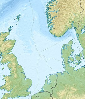
177:, about 100 km Northwest of
343:In magmatic rock, minerals like
189:Mulciber was active in the late
42:
41:
34:
16:Extinct volcano in the North Sea
455:, Heleen Ekker, 9 May 2020 on
1:
471:of the core samples found on
495:Volcanoes of the Netherlands
418:Geologische Dienst Nederland
295:Geologische Dienst Nederland
277:of oil and gas exploration,
267:Geologische Dienst Nederland
510:Extinct volcanoes of Europe
209:of the then-supercontinent
531:
321:, 20 km north of the
325:, 60 km east of the
227:oil exploration drillings
28:
420:, starting from 08:08:54
361:Geology of the North Sea
333:. A few km south is the
297:named the volcano after
245:is the red blob in the
293:The geologists of the
279:Earth's magnetic field
254:
115:
240:
436:, data found at the
90:54.06056°N 4.28194°E
438:Keuzelijst Boringen
393:, Geert-Jan Vis on
335:Off Friesland North
86: /
515:Magnetic anomalies
505:Jurassic volcanoes
255:
62:Highest point
160:
159:
95:54.06056; 4.28194
522:
479:
467:Drafting of the
465:
459:
450:
444:
430:
421:
414:Radio 1 Journaal
411:
398:
388:
126:
118:
101:
100:
98:
97:
96:
91:
87:
84:
83:
82:
79:
45:
44:
38:
21:
530:
529:
525:
524:
523:
521:
520:
519:
485:
484:
483:
482:
466:
462:
451:
447:
431:
424:
412:
401:
389:
374:
369:
357:
315:
303:Roman mythology
291:
263:Zuidwal volcano
243:Zuidwal volcano
235:
201:in the current
199:Zuidwal volcano
187:
120:
94:
92:
88:
85:
80:
77:
75:
73:
72:
57:
56:
55:
54:
53:
52:
51:
50:
46:
17:
12:
11:
5:
528:
526:
518:
517:
512:
507:
502:
497:
487:
486:
481:
480:
460:
445:
422:
399:
371:
370:
368:
365:
364:
363:
356:
353:
314:
311:
305:, also called
290:
287:
234:
231:
219:Atlantic Ocean
215:Gulf of Biscay
186:
183:
165:is an extinct
158:
157:
151:
145:
144:
139:
133:
132:
128:
127:
112:
108:
107:
103:
102:
70:
64:
63:
59:
58:
48:
47:
40:
39:
33:
32:
31:
30:
29:
26:
25:
15:
13:
10:
9:
6:
4:
3:
2:
527:
516:
513:
511:
508:
506:
503:
501:
498:
496:
493:
492:
490:
478:
477:OpenStreetMap
474:
470:
464:
461:
458:
454:
449:
446:
443:
439:
435:
429:
427:
423:
419:
415:
410:
408:
406:
404:
400:
396:
395:Wetenschap.nu
392:
387:
385:
383:
381:
379:
377:
373:
366:
362:
359:
358:
354:
352:
350:
349:ferrous oxide
346:
341:
338:
336:
332:
328:
324:
323:Frisian Front
320:
312:
310:
308:
304:
300:
296:
288:
286:
284:
280:
276:
272:
268:
264:
260:
252:
248:
244:
239:
232:
230:
228:
224:
220:
216:
212:
208:
204:
200:
196:
192:
184:
182:
180:
176:
172:
168:
164:
156:
152:
150:
149:Last eruption
146:
143:
140:
138:
137:Mountain type
134:
129:
124:
117:
113:
109:
104:
99:
71:
69:
65:
60:
37:
27:
22:
19:
463:
448:
397:, 9 May 2020
342:
339:
334:
327:Cleaver Bank
319:Terschelling
316:
298:
294:
292:
283:core samples
275:seismic data
256:
250:
188:
179:Terschelling
173:part of the
162:
161:
18:
331:Dogger Bank
223:halokinesis
111:Native name
93: /
68:Coordinates
489:Categories
367:References
269:, part of
247:Wadden Sea
207:separation
203:Wadden Sea
195:Cretaceous
193:and early
500:North Sea
345:magnetite
281:data and
233:Discovery
175:North Sea
81:4°16′55″E
78:54°3′38″N
469:location
355:See also
313:Location
299:Mulciber
251:Mulciber
217:and the
211:Laurasia
191:Jurassic
163:Mulciber
155:Jurassic
116:Mulciber
49:Mulciber
24:Mulciber
440:of the
432:Boring
185:History
169:on the
167:volcano
142:Extinct
131:Geology
457:NOS.nl
434:F16-02
307:Vulcan
119:
106:Naming
259:Amoco
171:Dutch
153:Late
123:Dutch
473:NLOG
442:NLOG
347:and
289:Name
475:on
271:TNO
491::
425:^
402:^
375:^
309:.
249:,
229:.
181:.
125:)
121:(
Text is available under the Creative Commons Attribution-ShareAlike License. Additional terms may apply.