968:
person to $ 5.00 for a family. The building was later able to get an expansion to 810 square feet. The Mary Esther
Community Library was then renamed in October 1976 to the current name of the Mary Esther Public Library. In 1988 when the space for the library was deemed too small, the Friends of the Library group created a petition for the citizens calling on the City Council to build a newer, bigger library. On February 6, 1989, the City Council approved the new site and size of the library. While the new library was being built the state of Florida also elected to give $ 175,000 in matching funds to help with construction. Ground was broken on February 28, 1991, and the new Mary Esther Public Library opened to the public on March 9, 1992. Throughout the history of the Mary Esther Public Library there was talk of an Okaloosa County Library System, but it was repeatedly denied. The Okaloosa County Public Library Cooperative eventually formed in 1997 with Mary Esther as one of the member libraries. The library received its most recent renovation in 2004 after receiving a $ 350,000 grant, adding an additional 2,000 square feet.
67:
1441:
47:
127:
147:
946:
Of the 1,623 households in 2000, 29.0% had children under the age of 18 living with them, 57.0% were married couples living together, 9.9% had a female householder with no husband present, and 29.3% were non-families. 21.7% of households were one person and 7.0% were one person aged 65 or older. The
967:
The idea of a public library was first proposed on
February 4, 1974, to the then Mayor Tom Pryor. The library was first named the Mary Esther Community Library. It was run by volunteers and not tax supported. The original building was only 585 square feet, with annual fees ranging from $ 1.00 per
950:
In 2000, the age distribution was 23.4% under the age of 18, 7.8% from 18 to 24, 30.5% from 25 to 44, 25.1% from 45 to 64, and 13.3% 65 or older. The median age was 39 years. For every 100 females, there were 102.3 males. For every 100 females age 18 and over, there were 100.1 males.
954:
In 2000, the median household income was $ 42,647 and the median family income was $ 47,917. Males had a median income of $ 31,030 versus $ 20,319 for females. The per capita income for the city was $ 22,488. About 4.1% of families and 5.7% of the population were below the
937:
there were 4,055 people in 1,623 households, including 1,147 families, in the city. The population density was 2,635.0 inhabitants per square mile (1,017.4/km). There were 1,732 housing units at an average density of 1,125.5 per square mile (434.6/km). The
66:
437:
516:
Climate is characterized by relatively high temperatures and evenly distributed precipitation throughout the year. This climate type is found on the eastern sides of the continents between 20° and 35° N and S latitude. The
942:
of the city was 83.65% White, 6.46% African
American, 0.96% Native American, 3.77% Asian, 0.17% Pacific Islander, 1.21% from other races, and 3.77% from two or more races. Hispanic or Latino of any race were 4.09%.
1633:
1349:
1112:
1648:
939:
1638:
1628:
87:
744:
459:
374:
1342:
764:
1061:
1557:
1482:
384:
46:
1335:
1180:"P2 HISPANIC OR LATINO, AND NOT HISPANIC OR LATINO BY RACE - 2020: DEC Redistricting Data (PL 94-171) - Mary Esther city, Florida"
1160:"P2 HISPANIC OR LATINO, AND NOT HISPANIC OR LATINO BY RACE - 2010: DEC Redistricting Data (PL 94-171) - Mary Esther city, Florida"
985:
518:
325:
1039:
192:
1327:
1487:
1086:
872:
724:
1179:
1159:
1219:
1199:
1224:
1204:
1184:
1164:
1090:
1014:
505:
159:
1643:
1410:
808:
494:
430:
1567:
934:
922:
915:
832:
664:
649:
634:
619:
604:
589:
574:
559:
522:
1359:
490:
418:
362:
167:
119:
72:
1537:
1474:
1598:
1492:
448:
Mary Esther gets its name from its first postmaster, John Newton, who named it for both of his daughters.
852:
521:
subtype for this climate is "Cfa" (C = mild temperate, f = fully humid, and a = hot summer), which is a
174:
1605:
1459:
1415:
335:
1512:
1497:
1430:
1425:
1400:
1381:
498:
426:
1137:
1585:
1552:
1532:
1464:
1542:
1502:
1405:
812:
788:
434:
1522:
32:
925:, there were 3,851 people, 1,770 households, and 1,071 families residing in the city.
918:, there were 3,982 people, 1,573 households, and 1,149 families residing in the city.
1622:
1562:
1547:
1527:
768:
367:
211:
132:
440:. The population was 3,982 at the 2020 US census, up from 3,851 at the 2010 census.
956:
237:
222:
1577:
1374:
1289:
1239:
1264:
248:
139:
474:
461:
102:
89:
316:
493:
is the main route through the city, leading east 4 mi (6 km) to
959:, including 8.8% of those under age 18 and 1.0% of those age 65 or over.
508:, the city has a total area of 1.5 square miles (3.9 km), all land.
350:
422:
152:
76:
947:
average household size was 2.50 and the average family size was 2.93.
1317:
1113:"Mary Esther, Florida Köppen Climate Classification (Weatherbase)"
342:
321:
200:
1220:"S1101 HOUSEHOLDS AND FAMILIES - 2010: Mary Esther city, Florida"
1200:"S1101 HOUSEHOLDS AND FAMILIES - 2020: Mary Esther city, Florida"
1451:
1392:
1331:
1322:
399:
1439:
1035:
1010:
1634:
1576:
1511:
1473:
1450:
1391:
394:
383:
373:
361:
349:
332:
315:
307:
299:
294:
286:
278:
270:
262:
257:
246:
235:
220:
209:
198:
188:
183:
173:
158:
138:
118:
23:
1343:
8:
1265:"Document Center • Destin, FL • CivicEngage"
695:(Hispanics excluded from racial categories)
1350:
1336:
1328:
1087:"US Gazetteer files: 2010, 2000, and 1990"
532:
20:
1062:"City of Mary Esther, Florida - About Us"
1649:1838 establishments in Florida Territory
689:
977:
393:
372:
348:
314:
293:
285:
256:
182:
117:
82:
63:
55:
43:
38:
552:
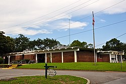
51:Mary Esther City Hall, September 2014.
1005:
1003:
382:
360:
331:
306:
298:
277:
269:
261:
245:
234:
219:
208:
197:
187:
172:
157:
137:
7:
1639:Populated places established in 1838
497:and west 37 mi (60 km) to
425:, United States. It is part of the
282:0.01 sq mi (0.02 km)
274:1.46 sq mi (3.77 km)
266:1.46 sq mi (3.79 km)
1629:Cities in Okaloosa County, Florida
1358:Municipalities and communities of
1138:"Census of Population and Housing"
542:
14:
311:2,736.77/sq mi (1,056.63/km)
145:
125:
65:
45:
1040:United States Geological Survey
1036:"US Board on Geographic Names"
692:Mary Esther racial composition
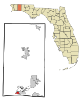
18:City in Florida, United States
1:
988:. United States Census Bureau
853:Two or more races/Multiracial
519:Köppen Climate Classification
438:Metropolitan Statistical Area
1323:Northwest Florida Daily News
1290:"About Us | Mary Esther, FL"
1240:"Mary Esther Public Library"
40:City of Mary Esther, Florida
1225:United States Census Bureau
1205:United States Census Bureau
1185:United States Census Bureau
1165:United States Census Bureau
1091:United States Census Bureau
1015:United States Census Bureau
986:"2020 U.S. Gazetteer Files"
506:United States Census Bureau
1665:
456:Mary Esther is located at
227:Larry Carter, Bernie Oder,
1594:
1437:
1372:
923:2010 United States census
916:2020 United States census
745:Black or African American
678:
663:
648:
633:
618:
603:
588:
573:
558:
551:
546:
541:
538:
523:humid subtropical climate
408:
205:Christopher "Chris" Stein
83:
64:
56:
44:
39:
30:
1361:Okaloosa County, Florida
1294:www.cityofmaryesther.com
1066:www.cityofmaryesther.com
475:30.412266°N 86.659044°W
1444:
59:"A Growing Community "
1443:
1011:"U.S. Census website"
679:U.S. Decennial Census
534:Historical population
480:30.412266; -86.659044
334: • Summer (
290:23 ft (7 m)
103:30.41222°N 86.65917°W
1607:United States portal
1269:www.cityofdestin.com
686:2010 and 2020 census
308: • Density
25:Mary Esther, Florida
1318:City of Mary Esther
1244:digital.lib.usf.edu
1093:. February 12, 2011
703:
535:
471: /
108:30.41222; -86.65917
99: /
1445:
1042:. October 25, 2007
873:Hispanic or Latino
690:
533:
300: • Total
279: • Water
263: • Total
1644:Cities in Florida
1616:
1615:
1586:Fort Walton Mound
1411:Fort Walton Beach
912:
911:
699:NH = Non-Hispanic
683:
682:
504:According to the
495:Fort Walton Beach
431:Fort Walton Beach
412:
411:
271: • Land
189: • Type
75:and the state of
1656:
1608:
1601:
1568:Wynnehaven Beach
1442:
1384:
1377:
1367:
1362:
1352:
1345:
1338:
1329:
1305:
1304:
1302:
1300:
1286:
1280:
1279:
1277:
1275:
1261:
1255:
1254:
1252:
1250:
1236:
1230:
1229:
1216:
1210:
1209:
1196:
1190:
1189:
1176:
1170:
1169:
1156:
1150:
1149:
1147:
1145:
1134:
1128:
1127:
1125:
1123:
1109:
1103:
1102:
1100:
1098:
1083:
1077:
1076:
1074:
1072:
1058:
1052:
1051:
1049:
1047:
1032:
1026:
1025:
1023:
1021:
1007:
998:
997:
995:
993:
982:
809:Pacific Islander
704:
554:
549:
544:
536:
486:
485:
483:
482:
481:
476:
472:
469:
468:
467:
464:
404:
401:
400:cityofmaryesther
339:
166:
151:
149:
148:
131:
129:
128:
114:
113:
111:
110:
109:
104:
100:
97:
96:
95:
92:
69:
49:
21:
1664:
1663:
1659:
1658:
1657:
1655:
1654:
1653:
1619:
1618:
1617:
1612:
1606:
1599:
1590:
1572:
1514:
1507:
1469:
1446:
1440:
1435:
1387:
1382:
1375:
1368:
1365:
1360:
1356:
1314:
1309:
1308:
1298:
1296:
1288:
1287:
1283:
1273:
1271:
1263:
1262:
1258:
1248:
1246:
1238:
1237:
1233:
1218:
1217:
1213:
1198:
1197:
1193:
1178:
1177:
1173:
1158:
1157:
1153:
1143:
1141:
1136:
1135:
1131:
1121:
1119:
1111:
1110:
1106:
1096:
1094:
1085:
1084:
1080:
1070:
1068:
1060:
1059:
1055:
1045:
1043:
1034:
1033:
1029:
1019:
1017:
1009:
1008:
1001:
991:
989:
984:
983:
979:
974:
965:
931:
833:Some other race
813:Native Hawaiian
765:Native American
702:
696:
694:
688:
547:
531:
514:
479:
477:
473:
470:
465:
462:
460:
458:
457:
454:
446:
435:Destin, Florida
419:Okaloosa County
398:
357:
333:
230:
228:
193:Council-Manager
164:
146:
144:
126:
124:
107:
105:
101:
98:
93:
90:
88:
86:
85:
79:
73:Okaloosa County
60:
52:
35:
26:
19:
12:
11:
5:
1662:
1660:
1652:
1651:
1646:
1641:
1636:
1631:
1621:
1620:
1614:
1613:
1611:
1610:
1603:
1600:Florida portal
1595:
1592:
1591:
1589:
1588:
1582:
1580:
1574:
1573:
1571:
1570:
1565:
1560:
1555:
1550:
1545:
1540:
1538:Escambia Farms
1535:
1530:
1525:
1519:
1517:
1513:Unincorporated
1509:
1508:
1506:
1505:
1500:
1495:
1490:
1488:Hurlburt Field
1485:
1479:
1477:
1471:
1470:
1468:
1467:
1462:
1456:
1454:
1448:
1447:
1438:
1436:
1434:
1433:
1428:
1423:
1418:
1413:
1408:
1403:
1397:
1395:
1389:
1388:
1373:
1370:
1369:
1357:
1355:
1354:
1347:
1340:
1332:
1326:
1325:
1320:
1313:
1312:External links
1310:
1307:
1306:
1281:
1256:
1231:
1211:
1191:
1171:
1151:
1129:
1104:
1078:
1053:
1027:
999:
976:
975:
973:
970:
964:
961:
930:
927:
910:
909:
907:
905:
900:
895:
889:
888:
885:
882:
879:
876:
869:
868:
865:
862:
859:
856:
849:
848:
845:
842:
839:
836:
829:
828:
825:
822:
819:
816:
805:
804:
801:
798:
795:
792:
785:
784:
781:
778:
775:
772:
761:
760:
757:
754:
751:
748:
741:
740:
737:
734:
731:
728:
721:
720:
717:
714:
711:
708:
687:
684:
681:
680:
676:
675:
672:
670:
667:
661:
660:
657:
655:
652:
646:
645:
642:
640:
637:
631:
630:
627:
625:
622:
616:
615:
612:
610:
607:
601:
600:
597:
595:
592:
586:
585:
582:
580:
577:
571:
570:
567:
565:
562:
556:
555:
550:
545:
540:
530:
527:
513:
510:
453:
450:
445:
442:
410:
409:
406:
405:
396:
392:
391:
388:
381:
380:
377:
371:
370:
365:
359:
358:
355:
353:
347:
346:
340:
330:
329:
319:
313:
312:
309:
305:
304:
301:
297:
296:
292:
291:
288:
284:
283:
280:
276:
275:
272:
268:
267:
264:
260:
259:
255:
254:
251:
244:
243:
240:
233:
232:
231:Richard Lawson
225:
223:Councilmembers
218:
217:
214:
207:
206:
203:
196:
195:
190:
186:
185:
181:
180:
177:
171:
170:
162:
156:
155:
142:
136:
135:
122:
116:
115:
81:
80:
70:
62:
61:
58:
54:
53:
50:
42:
41:
37:
36:
31:
28:
27:
24:
17:
13:
10:
9:
6:
4:
3:
2:
1661:
1650:
1647:
1645:
1642:
1640:
1637:
1635:
1632:
1630:
1627:
1626:
1624:
1609:
1604:
1602:
1597:
1596:
1593:
1587:
1584:
1583:
1581:
1579:
1575:
1569:
1566:
1564:
1561:
1559:
1556:
1554:
1551:
1549:
1546:
1544:
1541:
1539:
1536:
1534:
1531:
1529:
1528:Bluewater Bay
1526:
1524:
1521:
1520:
1518:
1516:
1510:
1504:
1501:
1499:
1496:
1494:
1493:Lake Lorraine
1491:
1489:
1486:
1484:
1481:
1480:
1478:
1476:
1472:
1466:
1463:
1461:
1458:
1457:
1455:
1453:
1449:
1432:
1429:
1427:
1424:
1422:
1419:
1417:
1414:
1412:
1409:
1407:
1404:
1402:
1399:
1398:
1396:
1394:
1390:
1386:
1385:
1378:
1371:
1366:United States
1363:
1353:
1348:
1346:
1341:
1339:
1334:
1333:
1330:
1324:
1321:
1319:
1316:
1315:
1311:
1295:
1291:
1285:
1282:
1270:
1266:
1260:
1257:
1245:
1241:
1235:
1232:
1227:
1226:
1221:
1215:
1212:
1207:
1206:
1201:
1195:
1192:
1187:
1186:
1181:
1175:
1172:
1167:
1166:
1161:
1155:
1152:
1139:
1133:
1130:
1118:
1114:
1108:
1105:
1092:
1088:
1082:
1079:
1067:
1063:
1057:
1054:
1041:
1037:
1031:
1028:
1016:
1012:
1006:
1004:
1000:
987:
981:
978:
971:
969:
962:
960:
958:
952:
948:
944:
941:
940:racial makeup
936:
928:
926:
924:
919:
917:
908:
906:
904:
901:
899:
896:
894:
891:
890:
886:
883:
880:
877:
874:
871:
870:
866:
863:
860:
857:
854:
851:
850:
846:
843:
840:
837:
834:
831:
830:
826:
823:
820:
817:
814:
810:
807:
806:
802:
799:
796:
793:
790:
787:
786:
782:
779:
776:
773:
770:
769:Alaska Native
766:
763:
762:
758:
755:
752:
749:
746:
743:
742:
738:
735:
732:
729:
726:
723:
722:
718:
715:
712:
709:
706:
705:
700:
693:
685:
677:
673:
671:
668:
666:
662:
658:
656:
653:
651:
647:
643:
641:
638:
636:
632:
628:
626:
623:
621:
617:
613:
611:
608:
606:
602:
598:
596:
593:
591:
587:
583:
581:
578:
576:
572:
568:
566:
563:
561:
557:
537:
528:
526:
524:
520:
511:
509:
507:
502:
500:
496:
492:
491:U.S. Route 98
488:
484:
451:
449:
443:
441:
439:
436:
432:
428:
424:
420:
417:is a city in
416:
407:
403:
397:
389:
386:
378:
376:
369:
366:
364:
354:
352:
344:
341:
337:
327:
326:Central (CST)
323:
320:
318:
310:
302:
289:
281:
273:
265:
253:Dillon Morris
252:
250:
247: •
241:
239:
236: •
229:KC Woods, and
226:
224:
221: •
215:
213:
212:Mayor Pro Tem
210: •
204:
202:
199: •
194:
191:
178:
176:
169:
163:
161:
154:
143:
141:
134:
133:United States
123:
121:
112:
84:Coordinates:
78:
74:
68:
48:
34:
29:
22:
16:
1420:
1380:
1299:November 26,
1297:. Retrieved
1293:
1284:
1274:November 20,
1272:. Retrieved
1268:
1259:
1249:November 20,
1247:. Retrieved
1243:
1234:
1223:
1214:
1203:
1194:
1183:
1174:
1163:
1154:
1142:. Retrieved
1140:. Census.gov
1132:
1120:. Retrieved
1116:
1107:
1095:. Retrieved
1081:
1069:. Retrieved
1065:
1056:
1044:. Retrieved
1030:
1018:. Retrieved
990:. Retrieved
980:
966:
957:poverty line
953:
949:
945:
932:
920:
913:
902:
897:
892:
698:
691:
529:Demographics
515:
503:
489:
455:
447:
414:
413:
238:City Manager
216:April Sutton
175:Incorporated
71:Location in
57:Motto:
15:
1578:Ghost towns
1515:communities
1460:Cinco Bayou
1421:Mary Esther
1416:Laurel Hill
1376:County seat
1117:Weatherbase
1046:January 31,
1020:January 31,
992:October 31,
935:2000 census
929:2000 census
875:(any race)
478: /
415:Mary Esther
106: /
1623:Categories
1498:Ocean City
1431:Valparaiso
972:References
921:As of the
914:As of the
466:86°39′33″W
463:30°24′44″N
387:feature ID
295:Population
249:City Clerk
242:Jared Cobb
184:Government
94:86°39′33″W
91:30°24′44″N
1558:Oak Grove
1483:Eglin AFB
1426:Niceville
1401:Crestview
1383:Crestview
1097:April 23,
963:Libraries
713:Pop 2020
710:Pop 2010
499:Pensacola
452:Geography
444:Etymology
427:Crestview
375:FIPS code
363:Area code
317:Time zone
287:Elevation
1553:Milligan
1533:Deerland
1465:Shalimar
379:12-43375
351:ZIP code
168:Okaloosa
1543:Florosa
1144:June 4,
933:At the
887:11.20%
739:69.19%
736:76.16%
719:% 2020
716:% 2010
512:Climate
433:–
429:–
423:Florida
395:Website
390:0286480
153:Florida
120:Country
77:Florida
1503:Wright
1406:Destin
1393:Cities
1122:May 1,
1071:May 1,
884:7.48%
867:7.66%
864:3.61%
847:0.23%
844:0.08%
827:0.20%
824:0.10%
803:4.65%
800:5.12%
783:0.30%
780:0.62%
759:6.58%
756:6.83%
733:2,755
730:2,933
599:309.2%
584:134.9%
539:Census
525:zone.
165:
160:County
150:
130:
1523:Baker
1452:Towns
903:3,982
898:3,851
893:Total
855:(NH)
835:(NH)
815:(NH)
791:(NH)
789:Asian
771:(NH)
747:(NH)
727:(NH)
725:White
707:Race
669:3,982
659:−5.0%
654:3,851
644:−2.0%
639:4,055
629:17.3%
624:4,139
614:10.6%
609:3,530
594:3,192
356:32569
345:(CDT)
343:UTC-5
322:UTC-6
303:3,982
201:Mayor
140:State
1563:Svea
1548:Holt
1475:CDPs
1301:2021
1276:2021
1251:2021
1146:2015
1124:2018
1099:2011
1073:2018
1048:2008
1022:2008
994:2021
881:446
878:288
861:305
858:139
797:185
794:197
753:262
750:263
674:3.4%
665:2020
650:2010
635:2000
620:1990
605:1980
590:1970
575:1960
560:1950
548:Note
543:Pop.
402:.com
385:GNIS
258:Area
179:1946
33:City
811:or
777:12
774:24
767:or
579:780
564:332
368:850
336:DST
1625::
1379::
1364:,
1292:.
1267:.
1242:.
1222:.
1202:.
1182:.
1162:.
1115:.
1089:.
1064:.
1038:.
1013:.
1002:^
841:9
838:3
821:8
818:4
553:%±
501:.
487:.
421:,
1351:e
1344:t
1337:v
1303:.
1278:.
1253:.
1228:.
1208:.
1188:.
1168:.
1148:.
1126:.
1101:.
1075:.
1050:.
1024:.
996:.
701:)
697:(
569:—
338:)
328:)
324:(
Text is available under the Creative Commons Attribution-ShareAlike License. Additional terms may apply.