59:
31:
229:
be created next to the canal, on the old access roads. The plan also called for the redevelopment of
Central Park (which the canal ran through). This included constructing winding paths, replace lighting, and expanding the canal to a lake. The bridge across the canal was replaced with the covered “Mill Creek” bridge. The park reopened in 2009. The rest of the linear park opened in 2010.
66:
38:
225:
first foot bridge was constructed over the canal. In 1956, part of the land was used for the
Cunningham Memorial Art Gallery (later the Bakersfield Museum of Art). A camellia garden was added in 1956 in memory of Aram Adams (who was a local automobile dealer). In 1964, another section of the park was used for the establishment of the Community House.
228:
In 2001, city planners started to consider how to redevelop the area. After years of planning, and raising funds, the Mill Creek project was born. The plan was to create a linear park which would run along the Kern Island Canal. The canal would be altered to look like a natural stream. A path would
224:
Central Park was created August 21, 1921. The same day, a bid was accepted from MacRori and McLaren
Company for its construction. Originally called Stark Park (for about one month), the name was changed to Central Park since the park was located between Bakersfield and East Bakersfield. In 1938 the
241:
There is a gap in the park, between 19th Street and the BNSF railroad yard. Access across the yard is provided by the Q Street underpass. The section between the yard and
Truxtun Avenue was not changed since it was already improved when the Beale Memorial Library was built in 1988. The section
237:
The length of the park is approximately 1.5 miles (including the gap segments). The path runs along both sides of the canal, except between Golden State Avenue and 21st Street, where it only runs on the west side. That segment is also lined with an iron fence (with pedestrian gates), since it
254:
The construction of Mill Creek is only the beginning of the changes in the area. In the near future, a four-story office building and a waterfront condominium complex will be constructed next to the new “river.” There will also be a senior center and an apartment complex built near the new
255:
development. The east side of
Central Park will be the location of a new federal courthouse. In addition, located near the railroad yard is a possible location for a California High Speed Rail train station.
238:
primarily runs next to a residential neighborhood. Central Park has public restrooms, as well as a playground. It is also equipped with Wi-Fi service (for a fee).
373:
166:
30:
113:
58:
504:
304:
346:
326:
366:
209:, the only park in downtown. The park contains a lake with spray fountains and the “Mill Creek” bridge. It is also home to the
359:
242:
between
Truxtun Avenue and 19th Street could not be improved because the parking lots and buildings of the Hill House (a
437:
106:
478:
301:
210:
404:
399:
292:
Mayer, Steven. High hope grows where the water flows. The
Bakersfield Californian. March 14, 2010. A1, A6-A7.
271:
383:
190:
99:
483:
460:
202:
205:, although there is a gap between 19th Street and the BNSF railroad yard. The center of the park is
246:
Plus hotel) were constructed too close to the canal to allow for improvements at the present time.
455:
414:
198:
323:
330:
308:
498:
272:
U.S. Geological Survey
Geographic Names Information System: Mill Creek (Bakersfield)
351:
243:
409:
186:
89:
194:
128:
115:
347:
Bakersfield
Department of Recreation & Parks: Central Park at Mill Creek
216:
The park is named after a flour mill which was located on 17th Street.
311:. Bakersfield Historic Preservation Commission. Accessed: 03-28-2011.
333:. City of Bakersfield Recreation & Parks. Accessed: 04-03-2010.
355:
319:
317:
288:
286:
284:
282:
280:
201:
between Golden State Avenue and
California Avenue in
469:
446:
428:
390:
172:
162:
152:
144:
105:
95:
85:
18:
65:
37:
167:Bakersfield Department of Recreation and Parks
367:
8:
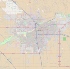
45:Location of Central Park within Bakersfield
374:
360:
352:
15:
264:
213:and the Bakersfield Community House.
73:Mill Creek (Bakersfield) (California)
7:
171:
84:
48:Show map of Bakersfield, California
14:
505:Parks in Bakersfield, California
94:
64:
57:
36:
29:
161:
143:
302:Rehabilitate Bakersfield Right
1:
521:
324:Central Park at Mill Creek
211:Bakersfield Museum of Art
23:
19:Central Park / Mill Creek
384:Bakersfield, California
274:. Accessed: 12-16-2011.
148:1.5 miles (2.4 km)
100:Bakersfield, California
484:The Park at River Walk
461:Kern River County Park
129:35.37667°N 119.00778°W
76:Show map of California
197:. It runs along the
156:1921 (Central Park),
134:35.37667; -119.00778
125: /
415:Kern River Parkway
329:2011-05-05 at the
307:2012-02-01 at the
492:
491:
199:Kern Island Canal
180:
179:
158:2009 (Mill Creek)
512:
376:
369:
362:
353:
334:
321:
312:
299:
293:
290:
275:
269:
233:Park description
163:Operated by
140:
139:
137:
136:
135:
130:
126:
123:
122:
121:
118:
77:
68:
67:
61:
49:
40:
39:
33:
16:
520:
519:
515:
514:
513:
511:
510:
509:
495:
494:
493:
488:
465:
442:
424:
386:
380:
343:
338:
337:
331:Wayback Machine
322:
315:
309:Wayback Machine
300:
296:
291:
278:
270:
266:
261:
252:
235:
222:
157:
133:
131:
127:
124:
119:
116:
114:
112:
111:
81:
80:
79:
78:
75:
74:
71:
70:
69:
52:
51:
50:
47:
46:
43:
42:
41:
12:
11:
5:
518:
516:
508:
507:
497:
496:
490:
489:
487:
486:
481:
475:
473:
467:
466:
464:
463:
458:
452:
450:
444:
443:
441:
440:
438:Jefferson Park
434:
432:
426:
425:
423:
422:
417:
412:
407:
402:
396:
394:
388:
387:
381:
379:
378:
371:
364:
356:
350:
349:
342:
341:External links
339:
336:
335:
313:
294:
276:
263:
262:
260:
257:
251:
248:
234:
231:
221:
218:
178:
177:
174:
170:
169:
164:
160:
159:
154:
150:
149:
146:
142:
141:
109:
103:
102:
97:
93:
92:
87:
83:
82:
72:
63:
62:
56:
55:
54:
53:
44:
35:
34:
28:
27:
26:
25:
24:
21:
20:
13:
10:
9:
6:
4:
3:
2:
517:
506:
503:
502:
500:
485:
482:
480:
479:Patriots Park
477:
476:
474:
472:
468:
462:
459:
457:
454:
453:
451:
449:
445:
439:
436:
435:
433:
431:
427:
421:
418:
416:
413:
411:
408:
406:
403:
401:
398:
397:
395:
393:
389:
385:
377:
372:
370:
365:
363:
358:
357:
354:
348:
345:
344:
340:
332:
328:
325:
320:
318:
314:
310:
306:
303:
298:
295:
289:
287:
285:
283:
281:
277:
273:
268:
265:
258:
256:
249:
247:
245:
239:
232:
230:
226:
219:
217:
214:
212:
208:
204:
200:
196:
192:
188:
184:
175:
168:
165:
155:
151:
147:
138:
110:
108:
104:
101:
98:
91:
88:
60:
32:
22:
17:
470:
447:
429:
419:
391:
297:
267:
253:
244:Best Western
240:
236:
227:
223:
215:
207:Central Park
206:
182:
181:
410:Jastro Park
191:Bakersfield
189:located in
187:linear park
132: /
120:119°00′28″W
107:Coordinates
90:Linear Park
420:Mill Creek
405:Beale Park
400:Beach Park
259:References
195:California
183:Mill Creek
117:35°22′36″N
471:Southwest
456:Hart Park
448:Northeast
382:Parks in
499:Category
327:Archived
305:Archived
203:downtown
176:All year
96:Location
392:Central
220:History
153:Created
250:Future
173:Status
185:is a
430:East
145:Area
86:Type
501::
316:^
279:^
193:,
375:e
368:t
361:v
Text is available under the Creative Commons Attribution-ShareAlike License. Additional terms may apply.