64:
36:
71:
43:
296:
in the east. The boundary was defined physically by having a series of large earth mounds erected as boundary markers. In 1688, an additional series of smaller mounds was built to further delineate the boundary. In the 11 kilometer stretch currently designated as a
National Historic Site, 17 large
287:
In the year 1642, the
Tokugawa shogunate re-confirmed the Nanbu clan and the Date clan in their holdings, and drew a 130 kilometres (81 mi) boundary between the two feudal domains from Mount Komagatake in the
63:
263:
which ruled from 1602 to 1865; however, the number of markers and their excellent state of preservation led the grouping in the modern municipalities of
316:
124:
411:
300:
The protected area is currently maintained as part of the “Michinoku Folk
Village” open-air museum and is a thirty minute walk from
35:
416:
401:
396:
421:
276:
406:
260:
202:
268:
98:
365:
304:
272:
112:
264:
94:
289:
256:
240:
390:
293:
248:
373:
336:
381:
244:
236:
232:
180:
139:
126:
252:
301:
102:
259:
of northern Japan. Such boundary markers were common under the
231:
are a series of earth mounds constructed in the early
191:
186:
176:
168:
163:
155:
118:
108:
90:
70:
42:
224:
218:
8:
16:
297:mounds and 198 small mounds are preserved.
343:(in Japanese). Agency for Cultural Affairs
15:
382:Glossary of Iwate's Cultural information
328:
317:List of Historic Sites of Japan (Iwate)
7:
14:
374:Kitakami tourist information site
78:Nanbu-Date border mounds (Japan)
69:
62:
41:
34:
235:to mark the border between the
203:National Historic Site of Japan
1:
53:Show map of Iwate Prefecture
412:History of Iwate Prefecture
337:"南部領伊達領境塚 なんぶりょうだてりょうさかいづか"
225:
438:
226:Nanburyō-Dateryō Sakaizuka
219:
199:
28:
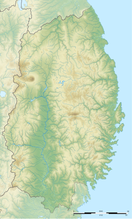
21:
341:Cultural Heritage Online
214:Nanbu-Date Border Mounds
50:Nanbu-Date Border Mounds
17:Nanbu-Date Border Mounds
417:Historic Sites of Japan
279:. on January 31, 2000.
366:Iwate prefectural site
277:National Historic Site
245:i.e. “Nanbu territory”
140:39.26472°N 141.05083°E
253:i.e. “Date territory”
195:Yes (open-air museum)
292:in the west to the
275:to be designated a
145:39.26472; 141.05083
136: /
18:
261:Tokugawa shogunate
192:Public access
402:Kanegasaki, Iwate
210:
209:
99:Kanegasaki, Iwate
81:Show map of Japan
429:
378:
370:
353:
352:
350:
348:
333:
305:Kitakami Station
273:Iwate Prefecture
230:
228:
222:
221:
159:boundary markers
151:
150:
148:
147:
146:
141:
137:
134:
133:
132:
129:
82:
73:
72:
66:
54:
45:
44:
38:
19:
437:
436:
432:
431:
430:
428:
427:
426:
397:Kitakami, Iwate
387:
386:
376:
368:
362:
357:
356:
346:
344:
335:
334:
330:
325:
313:
285:
216:
206:
205:
144:
142:
138:
135:
130:
127:
125:
123:
122:
86:
85:
84:
83:
80:
79:
76:
75:
74:
57:
56:
55:
52:
51:
48:
47:
46:
24:
12:
11:
5:
435:
433:
425:
424:
422:Mutsu Province
419:
414:
409:
404:
399:
389:
388:
385:
384:
379:
371:
361:
360:External links
358:
355:
354:
327:
326:
324:
321:
320:
319:
312:
309:
284:
281:
257:Mutsu Province
241:Morioka Domain
237:feudal domains
208:
207:
201:
200:
197:
196:
193:
189:
188:
184:
183:
178:
174:
173:
170:
166:
165:
161:
160:
157:
153:
152:
120:
116:
115:
110:
106:
105:
92:
88:
87:
77:
68:
67:
61:
60:
59:
58:
49:
40:
39:
33:
32:
31:
30:
29:
26:
25:
22:
13:
10:
9:
6:
4:
3:
2:
434:
423:
420:
418:
415:
413:
410:
408:
405:
403:
400:
398:
395:
394:
392:
383:
380:
377:(in Japanese)
375:
372:
369:(in Japanese)
367:
364:
363:
359:
342:
338:
332:
329:
322:
318:
315:
314:
310:
308:
306:
303:
298:
295:
294:Pacific Ocean
291:
282:
280:
278:
274:
270:
266:
262:
258:
254:
250:
249:Sendai Domain
246:
242:
238:
234:
227:
215:
204:
198:
194:
190:
185:
182:
179:
175:
171:
167:
162:
158:
154:
149:
121:
117:
114:
113:Tōhoku region
111:
107:
104:
100:
96:
93:
89:
65:
37:
27:
20:
345:. Retrieved
340:
331:
299:
290:Ōu Mountains
286:
213:
211:
347:25 December
143: /
131:141°03′03″E
119:Coordinates
407:Edo period
391:Categories
323:References
283:Background
269:Kanegasaki
233:Edo period
187:Site notes
181:Edo period
172:1642, 1688
128:39°15′53″N
311:See also
265:Kitakami
220:南部領伊達領境塚
95:Kitakami
91:Location
23:南部領伊達領境塚
302:JR East
177:Periods
169:Founded
164:History
251:(i.e.
247:) and
109:Region
255:) in
103:Japan
349:2016
267:and
212:The
156:Type
97:and
271:in
239:of
393::
339:.
307:.
223:,
101:,
351:.
243:(
229:)
217:(
Text is available under the Creative Commons Attribution-ShareAlike License. Additional terms may apply.