50:
57:
288:, a landslide formed a 70 m tall dam; in 1942, another landslide caused the dam to grow to 170 m tall. On 18 May 1951, the dam abruptly failed, killing hundreds of people downstream, including 74 soldiers constructing a road up to the lake. On 15 August 1979, a landslide caused by
280:
is mountainous and prone to landslides. Historically, there have been four instances of barrier lakes forming in this area. The first recorded instance was during the
352:
304:
on
September 21, 1999, a landslide west of Caoling formed a 50 m tall barrier that once again dammed up the Qingshui River. After the earthquake, the
319:
Though the lake covered over some of
Caoling's scenic attractions, the new lake was still popular among tourists. However, the lake was short-lived, as
331:(known as the Seven-Two Flood) raised the lake's surface above the dam, washing away the barrier and returning the river to its original state.
96:
470:
49:
571:
566:
540:
The name "Caoling Lake" typically refers to all four instances of this lake, while "New
Caoling Lake" only refers to the 1999-2004 lake.
556:
501:
211:
289:
357:
509:
561:
362:
328:
285:
281:
265:
446:
305:
301:
261:
419:
324:
308:
announced that the lake's dam was stable, and the newly formed lake could potentially be used as a
478:
441:
323:
gradually raised the lake's floor. Also, water channels formed on the dam, which decreased the
35:
241:
82:
257:
233:
78:
550:
320:
245:
237:
229:
133:
128:
316:, which was damaged in the earthquake. However, this plan was never carried out.
474:
313:
411:
111:
98:
309:
385:
277:
249:
264:
on
September 21, 1999. The lake disappeared during a flood caused by
253:
219:
292:
caused a lake to form, which failed on 24 August the same year.
256:. Located on the Qingshui River, a tributary of the
198:
194:
182:
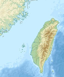
174:
166:
162:
147:
139:
127:
88:
74:
21:
260:, the lake formed due to a landslide during the
89:
327:of the water. In July 2004, a flood caused by
27:
8:
18:
56:
533:
340:
405:
403:
361:(in Chinese (Taiwan)). Archived from
346:
344:
7:
284:, and lasted until 1898. During the
14:
55:
48:
388:(in Chinese (Taiwan)). Now News
181:
173:
165:
384:蘇榮泉; 郭春輝 (20 September 2019).
312:and serve as a substitute for
224:
215:
1:
73:
151:September 21, 1999
28:
588:
572:Landforms of Chiayi County
567:Landforms of Yunlin County
386:"九二一走過20年 夢幻草嶺潭、大飛山成為永遠印記"
358:National Taiwan University
510:Public Television Service
500:王晴玲 (30 September 2004).
469:劉在武 (24 September 1999).
43:
26:
508:(in Chinese (Taiwan)).
473:(in Chinese (Taiwan)).
418:(in Chinese (Taiwan)).
286:1941 Chungpu earthquake
178:58 m (190 ft)
170:5 km (3.1 mi)
557:Landslide-dammed lakes
447:Water Resources Agency
440:張炎銘 (3 October 2014).
416:Encyclopedia of Taiwan
306:Water Resources Agency
282:1862 Tainan earthquake
248:, near the village of
186:46,000,000 m (1.6
450:(in Chinese (Taiwan))
16:Former lake in Taiwan
353:"變遷中的地景 「新草嶺潭」的地景變遷"
302:1999 Jiji earthquake
262:1999 Jiji earthquake
228:) was a short-lived
112:23.5759°N 120.6934°E
420:Ministry of Culture
190:10 cu ft)
108: /
442:"1951年5月18日-草嶺潭崩潰"
232:on the border of
205:
204:
117:23.5759; 120.6934
579:
541:
538:
521:
520:
518:
516:
497:
491:
490:
488:
486:
481:on 9 August 2014
477:. Archived from
471:"新草嶺潭 蓄水量相當石門水庫"
466:
460:
459:
457:
455:
437:
431:
430:
428:
426:
407:
398:
397:
395:
393:
381:
375:
374:
372:
370:
365:on 17 March 2016
348:
329:Typhoon Mindulle
276:The area around
266:Typhoon Mindulle
226:
217:
208:New Caoling Lake
189:
158:
156:
123:
122:
120:
119:
118:
113:
109:
106:
105:
104:
101:
91:
63:New Caoling Lake
59:
58:
52:
39:
31:
30:
22:New Caoling Lake
19:
587:
586:
582:
581:
580:
578:
577:
576:
562:Lakes of Taiwan
547:
546:
545:
544:
539:
535:
530:
525:
524:
514:
512:
499:
498:
494:
484:
482:
468:
467:
463:
453:
451:
439:
438:
434:
424:
422:
409:
408:
401:
391:
389:
383:
382:
378:
368:
366:
350:
349:
342:
337:
298:
274:
225:Xīn Cǎolǐng Tán
187:
154:
152:
116:
114:
110:
107:
102:
99:
97:
95:
94:
83:Meishan, Chiayi
70:
69:
68:
67:
66:
65:
64:
60:
33:
17:
12:
11:
5:
585:
583:
575:
574:
569:
564:
559:
549:
548:
543:
542:
532:
531:
529:
526:
523:
522:
492:
461:
432:
399:
376:
339:
338:
336:
333:
325:retention time
297:
294:
273:
270:
268:in July 2004.
258:Zhuoshui River
203:
202:
200:
196:
195:
192:
191:
184:
180:
179:
176:
172:
171:
168:
164:
163:
160:
159:
149:
145:
144:
143:Qingshui River
141:
137:
136:
131:
125:
124:
92:
86:
85:
79:Gukeng, Yunlin
76:
72:
71:
62:
61:
54:
53:
47:
46:
45:
44:
41:
40:
24:
23:
15:
13:
10:
9:
6:
4:
3:
2:
584:
573:
570:
568:
565:
563:
560:
558:
555:
554:
552:
537:
534:
527:
511:
507:
503:
496:
493:
480:
476:
472:
465:
462:
449:
448:
443:
436:
433:
421:
417:
413:
406:
404:
400:
387:
380:
377:
364:
360:
359:
354:
347:
345:
341:
334:
332:
330:
326:
322:
321:sedimentation
317:
315:
311:
307:
303:
295:
293:
291:
290:1979 typhoons
287:
283:
279:
271:
269:
267:
263:
259:
255:
251:
247:
246:Chiayi County
243:
239:
238:Yunlin County
235:
231:
227:
221:
213:
209:
201:
197:
193:
185:
177:
169:
161:
150:
148:First flooded
146:
142:
140:River sources
138:
135:
132:
130:
126:
121:
93:
87:
84:
80:
77:
51:
42:
37:
25:
20:
536:
513:. Retrieved
505:
495:
483:. Retrieved
479:the original
464:
452:. Retrieved
445:
435:
423:. Retrieved
415:
390:. Retrieved
379:
367:. Retrieved
363:the original
356:
318:
299:
275:
230:barrier lake
223:
207:
206:
183:Water volume
134:Barrier lake
515:15 November
485:15 November
475:China Times
454:15 November
425:15 November
392:15 November
369:15 November
314:Shigang Dam
300:During the
167:Max. length
115: /
103:120°41′36″E
90:Coordinates
551:Categories
506:Our Island
335:References
272:Past lakes
199:References
175:Max. depth
155:1999-09-21
100:23°34′33″N
310:reservoir
502:"再見‧草嶺潭"
75:Location
296:History
278:Caoling
250:Caoling
242:Meishan
212:Chinese
153: (
36:Chinese
254:Taiwan
234:Gukeng
222::
220:pinyin
214::
32:
528:Notes
412:"草嶺潭"
410:何立德.
351:李建堂.
517:2020
487:2020
456:2020
427:2020
394:2020
371:2020
240:and
216:新草嶺潭
129:Type
81:and
29:新草嶺潭
252:in
553::
504:.
444:.
414:.
402:^
355:.
343:^
244:,
236:,
218:;
519:.
489:.
458:.
429:.
396:.
373:.
210:(
188:×
157:)
38:)
34:(
Text is available under the Creative Commons Attribution-ShareAlike License. Additional terms may apply.