297:
611:
457:
106:
59:
647:
473:
and details of these sites are not disclosed by the
National Register. The 63 sites include 40 Fremont constructions, 19 rock art sites, and 4 sets of historical-era dwellings. A further 165 sites were added on September 12, 2012, all of them designated by codes only. Of these additional listings, 158 are in Carbon County and 7 in Duchesne County. On September 22, 2014, 101 more sites were added, all in Carbon County.
655:
555:, it included a hotel, store, school, and an unofficial post office. It lacked a formal town site, simply taking in a long stretch of scattered ranches and buildings. The community grew gradually from the 1880s until it was officially established as the town of Harper in 1905. The Harper precinct as a whole had a population of 130 at its peak in 1910, but in the early 1920s Harper became a
482:
42:
211:
354:
113:
66:
568:
430:
673:
measure. The compound pulled moisture from the air to dampen dust, but it may have done more harm than good as the magnesium chloride dust may have drifted on to the rock walls. A 2007 study, commissioned by the BLM and paid for by Bill
Barrett Corporation, found that the dust that lands on a rock
664:
Previous to 2013, industrial truck traffic on Nine Mile's main road were producing clouds of dust. Prior to paving, the dirt road was not maintained for heavy traffic. The dust reduced visibility on the road and settled on the rock art. Carbon County, which supervises the use of the road, approved
472:
codes, but there were three named sites in Carbon County: Cottonwood
Village, Drop-Dead Ruin, and First Canyon Site. The named ones in Duchesne County are Centennial House, Fool's Pinnacle, Karen's Cist, Maxies Pad, Nordell's Fort, Redman Village, Sunstone Village, and Taylor's City. The locations
634:, in cooperation with the BLM and private landowners, has been pursuing a natural gas exploration project on the West Tavaputs Plateau in and around the canyon. The company estimates the available natural gas reserves at approximately 1 trillion cubic feet (2.8
328:
that formed the canyon, is by no means a major body of water. Its importance lies in the fact that it is one of the few water sources in the region that are reliable year-round, and it has been so since prehistoric times. Nine Mile Creek is actually a minor
638:
10 m). Bill
Barrett Corporation has spent some $ 2 million on improving area roads, and the complete project, if approved as planned, could create as many as 1000 jobs. Government involvement in the project has been controversial, drawing complaints from
441:
By the 16th century the ancestral Utes were in the canyon. They added to the rock art already on the walls, but in styles of their own. Many scenes, for example, depict Ute hunters on horseback and date to the 1800s. Despite the number of Ute
369:
There are at least an estimated 1,000 rock art sites in the canyon, with more than 10,000 individual images. The true figures may be ten times as high, but there is no question that rock art is more concentrated here than anywhere else in
1499:
703:
698:
398:. They were built by the Fremont, whose presence in Ninemile Canyon has been dated at AD 950–1250. Indeed, Ninemile Canyon was one of the locations most heavily occupied by the Fremont. In contrast to the purely
288:
produced by the trucks' passage may be damaging the rock art. Public debate is ongoing about how best to balance energy development in the canyon against the preservation of its cultural resources.
602:(BLM) designated it as a Scenic Backcountry Byway. The Ninemile Canyon Paving project was completed in October of 2014, with a total of 34 miles (55 km) of paved roadway constructed.
1135:
497:
may have entered the canyon in the early 19th century, but the first unequivocal sign of a white presence is an inscription on the canyon wall reading "S. Groesbeck August 19, 1867".
1314:
1245:
1489:
280:. No longer heavily traveled, the rugged canyon road was used mostly for recreation and tourism through the end of the 20th century. The discovery of rich deposits of
1484:
1167:
426:
ditches and earthen lodges on the canyon floor that could be seen as late as the 1930s, but are no longer visible after generations of modern cultivation.
1479:
1454:
678:
300:
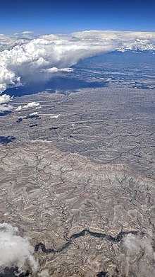
Ninemile Canyon (the dark green area at the bottom) at North Franks Canyon. An array of natural gas wells is visible in the distance, May 2019.
1145:
105:
1459:
1377:
1436:
158:
1394:
686:
517:
465:
313:
194:
1318:
1289:
591:, which is accelerated by touching and airborne dust. The dust is a special concern as heavy industrial traffic in the canyon increases.
1474:
1409:
813:
682:
1057:
1469:
551:
The freight trade led to the settlement of the canyon itself. One of the main stagecoach stops developed into a town of sorts. Called
1025:
994:
890:
854:
790:
677:
In 2004, due to concerns about energy development and increasing recreational and tourist traffic, Ninemile Canyon was named on the
956:
877:
738:
58:
1192:
583:
are largely a thing of the past. Ninemile Canyon's rock art, however, is still at risk. Carved and painted mainly on weathered
689:, with another 164 added in 2012 and 101 in 2014, and the BLM has announced plans to nominate some 600 more in years to come.
486:
284:
deep beneath the West
Tavaputs Plateau has brought an influx of industrial truck traffic since 2002. The large amounts of
1420:
341:
on the east. A number of tributary canyons branch off
Ninemile Cayon itself, including Argyle Canyon, Cottonwood Canyon,
1494:
1107:
598:
until 2013. In fact, it was considered the poorest of the four old military roads in
Duchesne County. In 1990, the U.S.
345:, and Dry Canyon. Significant rock art sites are frequently located near the junctions where they meet the main canyon.
334:
151:
394:
has been carried out. Many of these structures are located high above the canyon floor on cliff ledges, pinnacles, and
981:
841:
296:
422:, which must be boiled for hours to become edible, were not an important part of the local diet. The Fremont left
599:
1464:
1078:
631:
575:
Rock art and other ancient artifacts are now protected by law and, although enforcement is difficult, outright
468:, 36 in Carbon County and 27 in Duchesne County. Most are named in the National Register listing only by their
391:
90:
722:
779:
Horned Snakes and Axle Grease: A Roadside Guide to the
Archaeology, History and Rock Art of Nine Mile Canyon
630:
and other geological resources have also been discovered, further complicating the issues. Since 2002, the
304:
Ninemile Canyon runs roughly southwest to northeast, with numerous winding turns, just to the north of the
808:
610:
443:
309:
1424:
947:
917:
849:. Utah Centennial County History Series. Salt Lake City: Utah State Historical Society. pp. 14–16.
640:
469:
238:
215:
82:
536:. This was the main transportation route in eastern Utah until well into the 20th century. Most of the
245:, United States. Promoted as "the world's longest art gallery", the canyon is known for its extensive
782:
456:
595:
234:
78:
512:
Nine Mile Canyon Road (also 9 Mile Canyon Road) was constructed through the canyon in 1886 by the
743:
666:
626:
and private property. Archaeological sites are found on both. Commercially important deposits of
614:
Bill
Barrett Corporation's natural gas compressor station, at the Dry Canyon junction, March 2008
498:
269:
1373:
1265:
1257:
1236:
1200:
1021:
990:
886:
850:
817:
786:
505:
expedition camped at the mouth of the canyon in 1871, and the earliest appearance of the name
338:
1249:
952:
622:. As in many rural areas of the Western United States, land in the canyon is a patchwork of
513:
317:
1049:
827:
544:
traffic into the Uinta Basin passed through
Ninemile Canyon until after the arrival of the
1404:
399:
250:
989:. Utah Centennial County History Series. Salt Lake City: Utah State Historical Society.
942:
446:
found in Nine Mile, there is no archaeological evidence of any Ute camps or residences.
1228:
670:
646:
545:
502:
411:
1340:"Announcements and actions on properties for the National Register of Historic Places"
1339:
910:"Announcements and actions on properties for the National Register of Historic Places"
909:
1448:
521:
371:
285:
1140:
1112:
552:
277:
210:
1253:
734:
654:
643:
groups that not enough is being done to protect natural and cultural resources.
623:
533:
525:
494:
403:
342:
321:
305:
281:
262:
17:
1384:
A memoir of a young man's experiences on a Nine Mile Canyon ranch in the 1960s.
481:
556:
537:
423:
379:
375:
1261:
1204:
821:
173:
160:
618:
Nine Mile's unique archaeological resources have led to intense debate over
584:
580:
541:
529:
414:
along the canyon bottom. Compared to other Fremont areas, relatively little
383:
330:
254:
1269:
723:
U.S. Geological Survey Geographic Names Information System: Nilemile Canyon
594:
Nine Mile Canyon Road, once such an important route, was almost completely
41:
1415:
353:
619:
246:
567:
627:
588:
576:
464:
In 2009, 63 archaeological sites in the canyon were listed on the U.S.
415:
387:
258:
704:
National Register of Historic Places listings in Duchesne County, Utah
429:
325:
230:
699:
National Register of Historic Places listings in Carbon County, Utah
1500:
National Register of Historic Places Multiple Property Submissions
1020:(3rd ed.). Salt Lake City, Utah: Western Epics. p. 168.
653:
645:
609:
566:
480:
455:
434:
428:
407:
352:
295:
273:
261:
left behind by the Fremont make Ninemile Canyon a destination for
209:
272:
in the region during the 1880s. Settlers established a number of
1370:
The Split Sky: A Journey of Discovery in Utah's Nine Mile Canyon
419:
395:
242:
86:
1437:
Action Alert from the National Trust for Historic Preservation
1400:
1433:, a group dedicated to the preservation of Ninemile Canyon
1229:"Dust Storm Rising Over Threat to Famed Rock Art in Utah"
674:
art panel created "a very serious conservation problem."
1079:"Nine Mile Canyon Road • Duchesne & Carbon Counties"
777:
Spangler, Jerry D.; Spangler, Donna K. (November 2003).
528:. Use of the road surged in 1889 after the discovery of
312:. The full 78-mile (126 km) canyon route, formerly
233:, approximately 40 miles (60 km) long, located in
46:
The Daddy Canyon area of Ninemile Canyon, November 2007
739:"Drillers in Utah Have a Friend in a U.S. Land Agency"
382:
as well. Researchers have also identified hundreds of
276:
in Ninemile Canyon, and even a short-lived town named
402:
cultures that surrounded them, the Fremont practiced
806:
Kloor, Keith (September–October 2007). "Dirtraker".
685:. In 2009, 63 sites in the canyon were added to the
1246:
American Association for the Advancement of Science
1193:"When the Bush Energy Policy Confronts Ancient Art"
1168:"When the Bush Energy Policy Confronts Ancient Art"
200:
190:
150:
145:
137:
34:
1430:
943:"Utah rock art canyon up for historic designation"
885:. Utah State Historical Society. pp. 14–16.
1296:. National Trust for Historic Preservation. 2004
571:Defaced rock art in Rasmussen Cave, April 2007
437:'s hooves indicate Ute origin, November 2007.
8:
1294:America's 11 Most Endangered Historic Places
1136:"Canyon oversight questioned | Deseret News"
1101:
1099:
1346:. National Park Service. September 28, 2012
650:Road dust drifts up the canyon, March 2008.
460:Stone shelter at Redman Village, April 2007
316:through Gate Canyon, connects the towns of
975:
973:
772:
770:
768:
766:
764:
762:
760:
31:
1018:The Historical Guide to Utah Ghost Towns
679:National Trust for Historic Preservation
1490:Bureau of Land Management areas in Utah
1222:
1220:
1043:
1041:
1039:
1037:
904:
902:
715:
418:is found in Nine Mile, suggesting that
112:
65:
1416:Nine Mile Canyon Guide and Information
1403:), brochure with a map and guide (via
587:panels, the images are susceptible to
1410:Nine Mile Canyon - Know Before You Go
1191:Barringer, Felicity (June 13, 2004).
1166:Barringer, Felicity (June 13, 2004).
936:
934:
493:There is some evidence that American
7:
876:Watt, Ronald G. (January 27, 1997).
687:National Register of Historic Places
524:to the railroad through the city of
466:National Register of Historic Places
390:, although only a limited amount of
257:people. The rock art, shelters, and
1048:Henetz, Patty (February 16, 2008).
814:Archaeological Institute of America
125:Ninemile Canyon (the United States)
1485:Landforms of Duchesne County, Utah
25:
1227:Kloor, Keith (January 25, 2008).
941:Stark, Mike (November 11, 2009).
509:is in records of the expedition.
1480:Landforms of Carbon County, Utah
1134:Thalman, James (March 3, 2016).
980:Barton, John D. (January 1998).
840:Watt, Ronald G. (January 1997).
683:America's Most Endangered Places
374:. Much is in the form of pecked
111:
104:
64:
57:
40:
1455:Native American history of Utah
1106:Thalman, James (June 2, 2008).
1083:Jones & DeMille Engineering
1060:from the original on 2023-11-04
959:from the original on 2023-11-04
1317:. May 25, 2012. Archived from
1:
1108:"Canyon oversight questioned"
378:, and there are many painted
214:Map of Ninemile Canyon, from
128:Show map of the United States
1460:Archaeological sites in Utah
1254:10.1126/science.319.5862.394
983:A History of Duchesne County
812:. Vol. 60, no. 5.
249:, most of it created by the
1516:
1475:Canyons and gorges of Utah
1431:Nine Mile Canyon Coalition
1396:Exploring Nine Mile Canyon
1050:"Nine Mile Canyon at risk"
1016:Carr, Stephen L. (1986) .
879:A History of Carbon County
843:A History of Carbon County
1470:Rock art in North America
1372:. Southpaw Publications.
658:Dust-covered petroglyphs,
600:Bureau of Land Management
268:The canyon became a main
51:
39:
632:Bill Barrett Corporation
489:to modern, November 2007
308:, and south and east of
1421:Ninemile Canyon Backway
606:Natural gas development
324:. Nine Mile Creek, the
1425:National Scenic Byways
661:
651:
615:
572:
490:
461:
438:
433:The prints under this
366:
310:Ashley National Forest
301:
219:
216:National Scenic Byways
174:39.77639°N 110.50000°W
1368:McCourt, Tom (2003).
1054:The Salt Lake Tribune
948:The Salt Lake Tribune
918:National Park Service
657:
649:
613:
570:
540:, mail, freight, and
484:
470:Smithsonian trinomial
459:
432:
386:, rock shelters, and
356:
299:
213:
141:40 miles (64 km)
785:: Uinta Publishing.
783:Salt Lake City, Utah
518:9th Cavalry Regiment
452:Archaeological sites
265:and tourists alike.
241:counties in eastern
179:39.77639; -110.50000
1495:Petroglyphs in Utah
920:. December 11, 2009
665:the application of
195:Utah State Route 53
170: /
1315:"Nine Mile Canyon"
1290:"Nine Mile Canyon"
1197:The New York Times
1172:The New York Times
1085:. October 26, 2021
816:. pp. 40–45.
744:The New York Times
667:magnesium chloride
662:
652:
616:
573:
499:John Wesley Powell
491:
462:
439:
367:
302:
270:transport corridor
220:
1379:978-0-9741568-1-1
737:(July 27, 2012).
669:on the road as a
339:Desolation Canyon
208:
207:
16:(Redirected from
1507:
1383:
1355:
1354:
1352:
1351:
1336:
1330:
1329:
1327:
1326:
1311:
1305:
1304:
1302:
1301:
1286:
1280:
1279:
1277:
1276:
1233:
1224:
1215:
1214:
1212:
1211:
1188:
1182:
1181:
1179:
1178:
1163:
1157:
1156:
1154:
1153:
1144:. Archived from
1131:
1125:
1124:
1122:
1121:
1103:
1094:
1093:
1091:
1090:
1075:
1069:
1068:
1066:
1065:
1045:
1032:
1031:
1013:
1007:
1006:
1004:
1003:
988:
977:
968:
967:
965:
964:
953:Associated Press
938:
929:
928:
926:
925:
906:
897:
896:
884:
873:
867:
866:
864:
863:
848:
837:
831:
825:
803:
797:
796:
774:
755:
754:
752:
751:
731:
725:
720:
637:
514:Buffalo Soldiers
507:Nine Mile Canyon
359:Cottonwood Panel
337:, emptying into
227:Nine Mile Canyon
185:
184:
182:
181:
180:
175:
171:
168:
167:
166:
163:
129:
115:
114:
108:
96:
95:Show map of Utah
68:
67:
61:
44:
32:
21:
18:Nine Mile Canyon
1515:
1514:
1510:
1509:
1508:
1506:
1505:
1504:
1465:Fremont culture
1445:
1444:
1442:
1405:Wayback Machine
1391:
1380:
1367:
1364:
1362:Further reading
1359:
1358:
1349:
1347:
1344:Weekly Listings
1338:
1337:
1333:
1324:
1322:
1313:
1312:
1308:
1299:
1297:
1288:
1287:
1283:
1274:
1272:
1231:
1226:
1225:
1218:
1209:
1207:
1190:
1189:
1185:
1176:
1174:
1165:
1164:
1160:
1151:
1149:
1133:
1132:
1128:
1119:
1117:
1105:
1104:
1097:
1088:
1086:
1077:
1076:
1072:
1063:
1061:
1047:
1046:
1035:
1028:
1015:
1014:
1010:
1001:
999:
997:
986:
979:
978:
971:
962:
960:
940:
939:
932:
923:
921:
914:Weekly Listings
908:
907:
900:
893:
882:
875:
874:
870:
861:
859:
857:
846:
839:
838:
834:
805:
804:
800:
793:
776:
775:
758:
749:
747:
733:
732:
728:
721:
717:
712:
695:
659:
635:
608:
565:
479:
454:
400:hunter-gatherer
351:
294:
251:Fremont culture
223:Ninemile Canyon
204:Nine Mile Creek
178:
176:
172:
169:
164:
161:
159:
157:
156:
133:
132:
131:
130:
127:
126:
123:
122:
121:
120:
119:Ninemile Canyon
116:
99:
98:
97:
94:
93:
76:
75:
74:
73:
72:Ninemile Canyon
69:
47:
35:Ninemile Canyon
28:
23:
22:
15:
12:
11:
5:
1513:
1511:
1503:
1502:
1497:
1492:
1487:
1482:
1477:
1472:
1467:
1462:
1457:
1447:
1446:
1440:
1439:
1434:
1428:
1418:
1413:
1407:
1390:
1389:External links
1387:
1386:
1385:
1378:
1363:
1360:
1357:
1356:
1331:
1306:
1281:
1216:
1183:
1158:
1126:
1095:
1070:
1033:
1026:
1008:
995:
969:
930:
898:
891:
868:
855:
832:
798:
791:
756:
726:
714:
713:
711:
708:
707:
706:
701:
694:
691:
671:dust abatement
607:
604:
579:and malicious
564:
563:Current issues
561:
546:Uintah Railway
503:Colorado River
485:Rock art from
478:
475:
453:
450:
363:The Great Hunt
361:, also called
350:
347:
293:
290:
263:archaeologists
206:
205:
202:
198:
197:
192:
188:
187:
154:
148:
147:
143:
142:
139:
135:
134:
124:
118:
117:
110:
109:
103:
102:
101:
100:
77:
71:
70:
63:
62:
56:
55:
54:
53:
52:
49:
48:
45:
37:
36:
27:Canyon in Utah
26:
24:
14:
13:
10:
9:
6:
4:
3:
2:
1512:
1501:
1498:
1496:
1493:
1491:
1488:
1486:
1483:
1481:
1478:
1476:
1473:
1471:
1468:
1466:
1463:
1461:
1458:
1456:
1453:
1452:
1450:
1443:
1438:
1435:
1432:
1429:
1426:
1422:
1419:
1417:
1414:
1411:
1408:
1406:
1402:
1398:
1397:
1393:
1392:
1388:
1381:
1375:
1371:
1366:
1365:
1361:
1345:
1341:
1335:
1332:
1321:on 2012-05-25
1320:
1316:
1310:
1307:
1295:
1291:
1285:
1282:
1271:
1267:
1263:
1259:
1255:
1251:
1247:
1243:
1239:
1238:
1230:
1223:
1221:
1217:
1206:
1202:
1198:
1194:
1187:
1184:
1173:
1169:
1162:
1159:
1148:on 2016-03-03
1147:
1143:
1142:
1137:
1130:
1127:
1116:. p. B01
1115:
1114:
1109:
1102:
1100:
1096:
1084:
1080:
1074:
1071:
1059:
1055:
1051:
1044:
1042:
1040:
1038:
1034:
1029:
1027:0-914740-30-X
1023:
1019:
1012:
1009:
998:
996:0-913738-41-7
992:
985:
984:
976:
974:
970:
958:
954:
950:
949:
944:
937:
935:
931:
919:
915:
911:
905:
903:
899:
894:
892:0-913738-15-8
888:
881:
880:
872:
869:
858:
856:0-913738-15-8
852:
845:
844:
836:
833:
829:
823:
819:
815:
811:
810:
802:
799:
794:
792:0-9746090-0-5
788:
784:
780:
773:
771:
769:
767:
765:
763:
761:
757:
746:
745:
740:
736:
730:
727:
724:
719:
716:
709:
705:
702:
700:
697:
696:
692:
690:
688:
684:
680:
675:
672:
668:
656:
648:
644:
642:
633:
629:
625:
621:
612:
605:
603:
601:
597:
592:
590:
586:
582:
578:
569:
562:
560:
558:
554:
549:
548:around 1905.
547:
543:
539:
535:
531:
527:
523:
522:Fort Duchesne
519:
515:
510:
508:
504:
500:
496:
488:
483:
476:
474:
471:
467:
458:
451:
449:
447:
445:
436:
431:
427:
425:
421:
417:
413:
409:
405:
401:
397:
393:
389:
385:
381:
377:
373:
372:North America
364:
360:
355:
348:
346:
344:
340:
336:
332:
327:
323:
319:
315:
311:
307:
298:
291:
289:
287:
286:fugitive dust
283:
279:
275:
271:
266:
264:
260:
256:
252:
248:
244:
240:
236:
232:
228:
224:
217:
212:
203:
199:
196:
193:
189:
183:
155:
153:
149:
144:
140:
136:
107:
92:
91:United States
88:
84:
80:
60:
50:
43:
38:
33:
30:
19:
1441:
1395:
1369:
1348:. Retrieved
1343:
1334:
1323:. Retrieved
1319:the original
1309:
1298:. Retrieved
1293:
1284:
1273:. Retrieved
1241:
1235:
1208:. Retrieved
1196:
1186:
1175:. Retrieved
1171:
1161:
1150:. Retrieved
1146:the original
1141:Deseret News
1139:
1129:
1118:. Retrieved
1113:Deseret News
1111:
1087:. Retrieved
1082:
1073:
1062:. Retrieved
1053:
1017:
1011:
1000:. Retrieved
982:
961:. Retrieved
946:
922:. Retrieved
913:
878:
871:
860:. Retrieved
842:
835:
807:
801:
778:
748:. Retrieved
742:
735:Lipton, Eric
729:
718:
676:
663:
641:conservation
617:
593:
574:
550:
511:
506:
495:fur trappers
492:
463:
448:
440:
368:
362:
358:
303:
267:
226:
222:
221:
191:Traversed by
29:
809:Archaeology
681:'s list of
534:Uinta Basin
404:agriculture
380:pictographs
376:petroglyphs
357:The famous
349:Archaeology
343:Minnie Maud
335:Green River
306:Book Cliffs
282:natural gas
177: /
152:Coordinates
1449:Categories
1350:2012-09-28
1325:2019-05-23
1300:2009-05-08
1275:2008-07-25
1210:2019-05-23
1177:2007-11-23
1152:2019-05-23
1120:2008-08-02
1089:2023-11-04
1064:2023-11-04
1002:2012-07-16
963:2023-11-04
924:2009-12-11
862:2012-07-16
750:2012-07-28
710:References
660:March 2008
557:ghost town
538:stagecoach
520:, linking
501:'s second
424:irrigation
406:, growing
392:excavation
384:pit-houses
365:, May 2006
318:Wellington
165:110°30′0″W
162:39°46′35″N
85:counties,
1262:0036-8075
1205:0362-4331
822:0003-8113
585:sandstone
581:vandalism
542:telegraph
530:Gilsonite
444:artifacts
388:granaries
331:tributary
292:Geography
259:granaries
146:Geography
1270:18218867
1244:(5862).
1058:Archived
957:Archived
828:Abstract
693:See also
628:minerals
620:land use
253:and the
247:rock art
239:Duchesne
83:Duchesne
1427:Program
1248:: 394.
1237:Science
596:unpaved
589:erosion
577:looting
532:in the
516:of the
487:Archaic
477:History
416:pottery
333:of the
274:ranches
229:) is a
218:Program
186:
1412:at BLM
1376:
1268:
1260:
1203:
1024:
993:
889:
853:
820:
789:
624:public
553:Harper
412:squash
326:stream
278:Harper
235:Carbon
231:canyon
225:(also
138:Length
79:Carbon
1232:(PDF)
987:(PDF)
883:(PDF)
847:(PDF)
526:Price
435:bison
420:beans
396:mesas
322:Myton
314:SR-53
201:River
1374:ISBN
1266:PMID
1258:ISSN
1201:ISSN
1022:ISBN
991:ISBN
887:ISBN
851:ISBN
818:ISSN
787:ISBN
410:and
408:corn
320:and
243:Utah
237:and
87:Utah
81:and
1423:at
1401:PDF
1250:doi
1242:319
255:Ute
1451::
1342:.
1292:.
1264:.
1256:.
1240:.
1234:.
1219:^
1199:.
1195:.
1170:.
1138:.
1110:.
1098:^
1081:.
1056:.
1052:.
1036:^
972:^
955:.
951:.
945:.
933:^
916:.
912:.
901:^
781:.
759:^
741:.
559:.
89:,
1399:(
1382:.
1353:.
1328:.
1303:.
1278:.
1252::
1213:.
1180:.
1155:.
1123:.
1092:.
1067:.
1030:.
1005:.
966:.
927:.
895:.
865:.
830:)
826:(
824:.
795:.
753:.
636:×
20:)
Text is available under the Creative Commons Attribution-ShareAlike License. Additional terms may apply.