26:
102:
109:
809:
207:, thanks to generous donations from Alfred and Martha Shorter. In 1910, the college moved from Shelton Hill to its current location outside of downtown Rome. The hill's name was changed to Old Shorter Hill upon the death of Martha Shorter. There is currently a
202:
named after the main landowner in the area. The
Cherokee Baptist Female College was originally housed in facilities located on the hill when it was founded in 1873. In 1877, Cherokee Baptist Female College was renamed
402:
271:
850:
395:
716:
869:
874:
388:
411:
101:
884:
763:
487:
843:
768:
58:
325:
342:
836:
267:
150:
442:
617:
51:
25:
371:
562:
680:
665:
502:
497:
741:
607:
437:
255:
711:
597:
587:
542:
879:
675:
660:
630:
432:
816:
602:
517:
419:
192:
138:
773:
721:
187:. With an elevation of 676 feet (206 m), Old Shorter Hill is the 910th highest summit in the
685:
547:
527:
482:
477:
204:
808:
758:
736:
726:
635:
582:
552:
467:
427:
321:
208:
820:
731:
640:
532:
462:
778:
753:
746:
706:
701:
145:
788:
783:
670:
650:
625:
592:
512:
492:
472:
452:
447:
863:
567:
557:
188:
184:
134:
645:
507:
163:
231:
572:
537:
522:
457:
73:
60:
577:
285:
256:
U.S. Geological Survey
Geographic Names Information System: Old Shorter Hill
304:
380:
180:
41:
195:. It is considered to be one of the Seven Hills of Rome, Georgia.
384:
276:(Topographic map). Reston, VA: United States Geological Survey
307:. RomeGeorgia.com. 23 February 2002. Retrieved 17 March 2018.
299:
297:
295:
824:
694:
616:
418:
162:
157:
144:
130:
89:
50:
40:
35:
30:
College Avenue, near the summit of Old
Shorter Hill
18:
366:
364:
337:
335:
333:
844:
396:
8:
851:
837:
403:
389:
381:
15:
226:
224:
108:
374:. Shorter.edu. Retrieved 19 March 2018.
220:
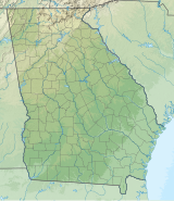
121:Location of Old Shorter Hill in Georgia
251:
249:
7:
805:
803:
870:Mountains of Floyd County, Georgia
823:. You can help Knowledge (XXG) by
14:
875:Mountains of Georgia (U.S. state)
198:The hill was originally known as
807:
107:
100:
24:
349:. September 1, 2004. p. 79
318:The Enchanted Land Eighth Hill.
268:United States Geological Survey
1:
885:North Georgia geography stubs
764:Pine Mountain (Bartow County)
819:state location article is a
769:Pine Mountain (Cobb County)
901:
802:
273:North Rome, GA quadrangle
94:
74:34.2514827°N 85.1693949°W
23:
742:Little Kennesaw Mountain
46:676 ft (206 m)
370:Taylor-Colbert, Alice.
305:The Seven Hills of Rome
79:34.2514827; -85.1693949
433:Big John Dick Mountain
817:Floyd County, Georgia
518:Horsetrough Mountain
420:Blue Ridge Mountains
412:Mountains of Georgia
774:Pine Mountain Range
722:Chenocetah Mountain
443:Black Rock Mountain
70: /
717:Blackjack Mountain
686:White Oak Mountain
548:Slaughter Mountain
528:Levelland Mountain
478:Double Spring Knob
372:History of Shorter
270:(March 18, 2018).
232:"Old Shorter Hill"
36:Highest point
832:
831:
797:
796:
759:Pine Log Mountain
737:Kennesaw Mountain
636:Horseleg Mountain
583:Screamer Mountain
553:Springer Mountain
468:Currahee Mountain
428:Big Bald Mountain
316:Denmon, Shirley.
174:
173:
892:
853:
846:
839:
811:
804:
656:Old Shorter Hill
641:Lookout Mountain
618:Ridge-and-Valley
563:Wildcat Mountain
533:Mount Oglethorpe
463:Cowrock Mountain
405:
398:
391:
382:
375:
368:
359:
358:
356:
354:
339:
328:
314:
308:
301:
290:
289:
283:
281:
264:
258:
253:
244:
243:
241:
239:
228:
177:Old Shorter Hill
166:
115:Old Shorter Hill
111:
110:
104:
85:
84:
82:
81:
80:
75:
71:
68:
67:
66:
63:
28:
19:Old Shorter Hill
16:
900:
899:
895:
894:
893:
891:
890:
889:
860:
859:
858:
857:
800:
798:
793:
779:Sawnee Mountain
754:Panola Mountain
747:Mount Wilkinson
707:Arabia Mountain
702:Alcovy Mountain
690:
681:Turkey Mountain
666:Pigeon Mountain
612:
503:Grassy Mountain
498:Glassy Mountain
414:
409:
379:
378:
369:
362:
352:
350:
341:
340:
331:
320:(2012). pp. 5.
315:
311:
302:
293:
279:
277:
266:
265:
261:
254:
247:
237:
235:
230:
229:
222:
217:
211:on the summit.
205:Shorter College
164:
126:
125:
124:
123:
122:
119:
118:
117:
116:
112:
78:
76:
72:
69:
64:
61:
59:
57:
56:
31:
12:
11:
5:
898:
896:
888:
887:
882:
877:
872:
862:
861:
856:
855:
848:
841:
833:
830:
829:
812:
795:
794:
792:
791:
789:Sweat Mountain
786:
784:Stone Mountain
781:
776:
771:
766:
761:
756:
750:
749:
744:
739:
734:
729:
727:Dowdell's Knob
724:
719:
714:
709:
704:
698:
696:
692:
691:
689:
688:
683:
678:
673:
671:Snodgrass Hill
668:
663:
658:
653:
651:Johns Mountain
648:
643:
638:
633:
628:
626:Baugh Mountain
622:
620:
614:
613:
611:
610:
608:Rocky Mountain
605:
600:
595:
593:Yonah Mountain
590:
585:
580:
575:
570:
565:
560:
555:
550:
545:
540:
535:
530:
525:
520:
515:
513:Hightower Bald
510:
505:
500:
495:
493:Glade Mountain
490:
485:
480:
475:
470:
465:
460:
455:
453:Brasstown Bald
450:
448:Blood Mountain
445:
440:
438:Black Mountain
435:
430:
424:
422:
416:
415:
410:
408:
407:
400:
393:
385:
377:
376:
360:
343:"Floyd County"
329:
309:
291:
259:
245:
219:
218:
216:
213:
172:
171:
168:
160:
159:
155:
154:
153:Rome North, GA
148:
142:
141:
132:
128:
127:
120:
114:
113:
106:
105:
99:
98:
97:
96:
95:
92:
91:
87:
86:
54:
48:
47:
44:
38:
37:
33:
32:
29:
21:
20:
13:
10:
9:
6:
4:
3:
2:
897:
886:
883:
881:
880:Rome, Georgia
878:
876:
873:
871:
868:
867:
865:
854:
849:
847:
842:
840:
835:
834:
828:
826:
822:
818:
813:
810:
806:
801:
790:
787:
785:
782:
780:
777:
775:
772:
770:
767:
765:
762:
760:
757:
755:
752:
751:
748:
745:
743:
740:
738:
735:
733:
732:Heggie's Rock
730:
728:
725:
723:
720:
718:
715:
713:
712:Bear Mountain
710:
708:
705:
703:
700:
699:
697:
693:
687:
684:
682:
679:
677:
674:
672:
669:
667:
664:
662:
659:
657:
654:
652:
649:
647:
644:
642:
639:
637:
634:
632:
629:
627:
624:
623:
621:
619:
615:
609:
606:
604:
601:
599:
598:Rock Mountain
596:
594:
591:
589:
588:Three Sisters
586:
584:
581:
579:
576:
574:
571:
569:
568:Wolfpen Ridge
566:
564:
561:
559:
558:Tray Mountain
556:
554:
551:
549:
546:
544:
543:Rich Mountain
541:
539:
536:
534:
531:
529:
526:
524:
521:
519:
516:
514:
511:
509:
506:
504:
501:
499:
496:
494:
491:
489:
488:Fort Mountain
486:
484:
481:
479:
476:
474:
471:
469:
466:
464:
461:
459:
456:
454:
451:
449:
446:
444:
441:
439:
436:
434:
431:
429:
426:
425:
423:
421:
417:
413:
406:
401:
399:
394:
392:
387:
386:
383:
373:
367:
365:
361:
348:
347:Calhoun Times
344:
338:
336:
334:
330:
327:
326:9781452089553
323:
319:
313:
310:
306:
300:
298:
296:
292:
287:
275:
274:
269:
263:
260:
257:
252:
250:
246:
234:. Peakery.com
233:
227:
225:
221:
214:
212:
210:
206:
201:
200:Shelton Hill,
196:
194:
190:
186:
185:Rome, Georgia
182:
178:
169:
167:
165:Easiest route
161:
156:
152:
149:
147:
143:
140:
139:Georgia, U.S.
136:
133:
129:
103:
93:
88:
83:
55:
53:
49:
45:
43:
39:
34:
27:
22:
17:
825:expanding it
814:
799:
676:Taylor Ridge
661:Jackson Hill
655:
646:Lumpkin Hill
631:Blossom Hill
508:Grassy Ridge
351:. Retrieved
346:
317:
312:
303:Wilson, CC.
284:– via
278:. Retrieved
272:
262:
236:. Retrieved
199:
197:
176:
175:
473:Dick's Knob
77: /
52:Coordinates
864:Categories
603:Rocky Knob
573:Young Lick
538:Rabun Bald
523:Jacks Knob
458:Coosa Bald
215:References
209:cul-de-sac
65:85°10′10″W
62:34°15′05″N
578:Rich Knob
286:TopoQuest
280:March 18,
191:state of
90:Geography
42:Elevation
483:Flat Top
353:24 April
238:25 April
158:Climbing
146:Topo map
131:Location
193:Georgia
695:Others
324:
181:summit
815:This
179:is a
170:Drive
821:stub
355:2015
322:ISBN
282:2018
240:2015
151:USGS
135:Rome
183:in
866::
363:^
345:.
332:^
294:^
248:^
223:^
189:US
137:,
852:e
845:t
838:v
827:.
404:e
397:t
390:v
357:.
288:.
242:.
Text is available under the Creative Commons Attribution-ShareAlike License. Additional terms may apply.