1096:
611:
457:
362:
291:
132:
35:
148:
2088:
2019:
1994:
1962:
1885:
1858:
1795:
1767:
1740:
1673:
1612:
1581:
1556:
1473:
1406:
1333:
1262:
1233:
1204:
1137:
1108:
1056:
1025:
996:
971:
942:
911:
878:
847:
817:
788:
763:
695:
623:
528:
469:
374:
303:
208:
2956:
2834:
page 44 DEPARTMENT OF INFRASTRUCTURE HIGHWAY SERVICES PUBLIC NOTICES Isle of Man
Newspapers Ltd (2018) Tindle Newspaper Group – Newsprint (Knowlsey) Ltd Friday 27 July 2018 "Richmond Hill (Braddan) Temporary Closure to vehicle and pedestrian traffic from Richmond Hill, Braddan between its junction
2120:
Note: Many of these roads in rural areas do not lead to or from anywhere remotely notable, while many of the roads within towns and villages are very short indeed. This makes it problematic to include "to" or "from" destinations.
646:) roundabout and the (A6) Cooil Road, Braddan. Travelling eastwards, the A6 Vicarage Road/Saddle Road, Douglas joins the A1 Peel Road at Braddan Bridge. The A6 Braddan Bridge Road/Ballafletcher Road joins the A6
2981:
900:
to
Derbyhaven where it turns north towards the airport runway. Formerly it continued on the other side of the airport runway to Ballasalla, but that section is now designated as the B53.
2806:
1159:, after the small settlement of Poortown through which it passes. Connects Peel on the west coast of the Island with the A3 Castletown to Ramsey road at a point just north of
52:
960:
From Jurby the road runs south, crossing the A13 at
Sandygate and the A3 at Sulby. It continues up Sulby Glen, skirting Snaefell, and meets the A18 at the Bungalow.
1520:
579:
425:
2052:
1926:
1822:
1637:
1437:
1370:
1297:
1168:
727:
492:
259:
1704:
659:
330:
1983:. Used to extend along the shore into Douglas but had to be re-routed because of bad road conditions. The northern section of Marine Drive is now B80.
1874:
A35 Royal Avenue and Royal Avenue West, Onchan with the 'Port Jack'/Imperial
Terrace/Royal Terrace junction with the A11 King Edward VIII road.
99:
2008:
Summerhill, Queen's
Promenade and Summerhill Road, Douglas with the junction of the A2 Governor's Road, Onchan.(less than 1,200 yards long).
71:
1495:. Connects Colby with Peel. Between its junction with the A7 road in Colby and its terminus in the centre of Peel, the road passes through
1085:
races and sometimes closed due to bad weather at other times. The majority of the road outside of developed areas has no speed limit. See
1424:
Connects
Ballasalla with Glen Vine where it meets the A1 Douglas to Peel road. Between Ballasalla and Glen Vine, the road passes through
78:
2971:
642:
The Old
Castletown Road, Douglas from South Quay to the A25 Old Castletown Road at Kewaigue. Continuing west to the A5/A6 Cooil Road (
836:
Branches off A9 on outskirts of Ramsey; runs north to Bride, then west to Jurby via The Lhen, then south to meet the A3 at
Ballaugh.
2976:
118:
714:
Connects
Ballasalla with Port Erin in the south of the Island. The A7 crosses the A3 Castletown to Ramsey road and passes through
85:
2811:
67:
56:
155:
2801:
927:
A13 Jurby Road from the A9 Bowring Road junction, Ramsey to the A10 Jurby Coast Road and B9 Ballacrye Road junction at
571:
227:
45:
2030:
1620:
1217:
1160:
1081:
and crosses the hilliest parts of the Island, reaching 422 m (1,385 ft). The road is closed for TT and
397:
251:
1425:
1500:
413:
136:
92:
985:
Branches off A2 at Port
Lewaigue and forms a loop through Maughold before rejoining the A2 at The Hibernian.
886:
559:
382:
321:
Connects Douglas with Ramsey in the north. The road follows the east coast of the Island and passes through
777:
Connects the northern entrance to Douglas' Seaport with North Quay and the Douglas Harbour Lifting Bridge
650:
at Cronkbourne Village, continuing to the C10 Scollag Road junction with the A18 Snaefell Mountain Road at
234:. Connects A8 and Douglas on the east of the Island with Peel on the west. In Douglas the road is known as
1893:
1748:
1095:
1086:
1059:
709:
1901:
Connects the A7 Ballasalla to Port Erin road near Port Erin to the A3 Castletown to Ramsey road south of
1358:
1078:
955:
610:
456:
361:
290:
1782:
1341:
1275:
1270:
1119:
1064:
1042:
864:
855:
801:
631:
536:
311:
216:
2923:
2898:
2884:
2859:
1246:
1241:
1069:
919:
831:
796:
551:
387:
316:
247:
2845:
1910:
1504:
1481:
1033:
1004:
719:
405:
563:
1285:
1486:
1145:
477:
221:
1625:
1512:
2100:
1082:
131:
2105:
Connects A6 and A33 Bridge Road with South Quay, Douglas Head Road and the Battery Pier.
1284:
with the A5 Port Erin to Douglas road. Between Foxdale and Douglas, the road passes the
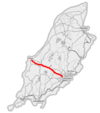
550:; connects Douglas with Port Erin in the south via Richmond Hill. The A5 passes through
417:
2965:
1974:
1918:
1009:
651:
636:
17:
1681:
1598:
1589:
567:
482:
401:
392:
Connects Castletown in the south with Ramsey in the north. The A3 passes through
2044:
1212:
409:
243:
231:
34:
1814:
1686:
1496:
1414:
1354:
897:
891:
703:
555:
2067:
2054:
1941:
1928:
1837:
1824:
1719:
1706:
1652:
1639:
1535:
1522:
1452:
1439:
1385:
1372:
1312:
1299:
1183:
1170:
742:
729:
674:
661:
594:
581:
507:
494:
440:
427:
345:
332:
274:
261:
1696:
1419:
1362:
541:
2039:
Road from the junction of the A3 Curragh Road and C33 Archallagan Road at (
2043:) with the A40 Station Road junction with the A1 Douglas to Peel road at
1508:
825:
715:
2835:
with Fort North roundabout and its junction with Ballacutchel Road....."
2087:
2018:
1993:
1961:
1884:
1857:
1794:
1766:
1739:
1672:
1611:
1580:
1555:
1472:
1405:
1332:
1261:
1232:
1203:
1136:
1107:
1055:
1024:
995:
970:
941:
910:
896:
Starts at Janet's Corner, Castletown (junction with A5), runs east past
877:
846:
816:
2040:
1902:
1281:
867:(Liverpool Arms) road junction on the A2 Douglas to Ramsey Coast Road.
787:
762:
694:
622:
527:
468:
393:
373:
302:
207:
1866:
1429:
1289:
1150:
1695:. Connects Port St Mary with the Calf Sound, passing the village of
1357:, and historically with Castletown. The road is now bypassed by the
863:
A11 King Edward VIII Road from Summerhill, Queen's Promenade to the
2752:
B61 to B82 (except B72 and B80) are various town streets in Douglas
1094:
950:
609:
455:
360:
322:
289:
130:
142:
28:
2951:
1909:
as it bends through the Sloc, a pass on the southern side of
570:. Between Santon and Ballasalla, the road passes over the
2957:
Department of Transport Public Notices relating to roads
226:
Including the A1 Peel Road joining the A2 and A5 at the
159:
2924:"A41 (Isle of Man) – Roader's Digest: The SABRE Wiki"
2899:"A35 (Isle of Man) – Roader's Digest: The SABRE Wiki"
2885:"A35 (Isle of Man) - Roader's Digest: The SABRE Wiki"
2860:"A33 (Isle of Man) – Roader's Digest: The SABRE Wiki"
2807:
List of named corners of the Snaefell Mountain Course
2982:
Lists of buildings and structures in the Isle of Man
2846:"A8 (Isle of Man) - Roader's Digest: The SABRE Wiki"
487:Connects Peel with Kirk Michael on the west coast.
182:
59:. Unsourced material may be challenged and removed.
2262:Creg-ny-Baa Back Road (Ballacannell-Creg-ny-Baa)
1365:route which allows for faster traffic movement.
1222:Loop via Strang, Nobles Hospital and Ballanard
1280:Connects the A3 Castletown to Ramsey road in
8:
1570:Forms the W side of the Southern 100 Course
2567:Ronague Road/Solomons Corner to Corlea road
1917:as it passes over the northern shoulder of
1014:Cul-de-sac from Bride to the Point of Ayre
2460:Ballamodha to St Marks road (The Bayrauyr)
2952:Department of Transport Highways Division
119:Learn how and when to remove this message
2123:
1597:Connects the village of Ballagawne with
2823:
1817:with the A3 Castletown to Ramsey road.
412:and Ramsey, the road forms part of the
2047:in St John's. About 1,000 yards long.
7:
2339:Dreemskerry road, Lewaigue-Ballajora
1077:. The entire road forms part of the
57:adding citations to reliable sources
68:"List of roads in the Isle of Man"
25:
2558:not Orrisdale in Michael sheading
2493:Croit-e-Caley/Kentraugh Mill road
566:and passing the northern side of
2086:
2017:
1992:
1960:
1883:
1856:
1793:
1765:
1738:
1671:
1610:
1579:
1554:
1471:
1404:
1331:
1260:
1231:
1202:
1135:
1106:
1054:
1023:
994:
969:
940:
909:
876:
845:
815:
786:
761:
693:
621:
526:
467:
372:
301:
206:
146:
33:
2812:Speed limits in the Isle of Man
2317:Lezayre Church road, Churchtown
1781:Connects A1 with A6 and A41 in
774:Douglas Harbour Lifting Bridge
154:This transport-related list is
44:needs additional citations for
2710:Balthane, Ballasalla (see A12)
1:
2273:East Bretney Road, Jurby East
1778:Intersection with A6 and A41
1691:The eastern part is known as
2802:Transport in the Isle of Man
2578:Ballamaddrell / Grenaby road
2185:Ballavarran road, Jurby West
2174:Ballaheaney road, Jurby East
2589:Grenaby to Kerrowkeill Road
2002:Queen's Promenade, Douglas
1905:. The road is known as the
194:
191:
188:
2998:
1913:. It is also known as the
1089:for more about this road.
979:Port Lewaigue (Belle Vue)
197:
2972:Lists of roads by country
2750:
2555:
2229:Ballacrye road, The Cronk
1564:Ballakaighan, Castletown
420:races are run each year.
2977:Roads in the Isle of Man
2243:Lezayre/Braddan/Michael
1775:Douglas Railway Station
1353:. Connects Douglas with
414:Snaefell Mountain Course
242:. The A1 passes through
137:roads in the Isle of Man
2284:Bernahara road, Andreas
2096:A6 Old Castletown Road
1753:Ballachurry, Port Erin
860:Balladromma Beg, Lonan
648:Johnny Watterson's Lane
2928:www.sabre-roads.org.uk
2903:www.sabre-roads.org.uk
2864:www.sabre-roads.org.uk
2830:Isle of Man Courier –
2207:Kerrowgarrow to Regaby
1218:St Ninian's Crossroads
1100:
1075:Snaefell Mountain Road
615:
461:
366:
295:
140:
2482:Lhergy Cripperty road
1099:Route of the A18 road
1098:
1079:Isle of Man TT Course
771:Douglas Sea Terminal
613:
459:
364:
293:
134:
18:A9 road (Isle of Man)
2832:Roieder Ellan Vannin
2196:Smeale Road, Andreas
2068:54.19895°N 4.64018°W
1942:54.13096°N 4.71545°W
1838:54.10959°N 4.63005°W
1653:54.20317°N 4.66481°W
1536:54.15595°N 4.70875°W
1453:54.14544°N 4.59142°W
1386:54.12875°N 4.54113°W
1313:54.15746°N 4.58524°W
1251:Loop via Mount Rule
1184:54.21607°N 4.66344°W
924:The Cronk, Ballaugh
865:Balladromma Beg Halt
743:54.09902°N 4.68506°W
614:Route of the A5 road
595:54.12015°N 4.58353°W
508:54.25429°N 4.63039°W
460:Route of the A3 road
441:54.24421°N 4.60147°W
365:Route of the A2 road
294:Route of the A1 road
275:54.19232°N 4.58637°W
160:adding missing items
53:improve this article
2666:Royal Avenue (part)
2622:Ballakilpheric road
2218:Sulby Claddagh road
2141:Minorca Hill, Laxey
2064: /
2027:The Hope, Patrick.
1938: /
1834: /
1720:54.07349°N 4.7594°W
1716: /
1649: /
1532: /
1449: /
1382: /
1351:Old Castletown Road
1309: /
1180: /
739: /
675:54.12372°N 4.5486°W
671: /
591: /
548:New Castletown Road
504: /
437: /
346:54.24542°N 4.3729°W
342: /
271: /
2383:Port Soderick Road
2240:Beinn-y-Phott Road
2073:54.19895; -4.64018
1947:54.13096; -4.71545
1911:Cronk ny Arrey Laa
1871:Port Jack, Onchan
1843:54.10959; -4.63005
1806:Mount Rule, Malew
1658:54.20317; -4.66481
1631:Bayr Keill Pherick
1541:54.15595; -4.70875
1458:54.14544; -4.59142
1391:54.12875; -4.54113
1318:54.15746; -4.58524
1189:54.21607; -4.66344
1125:Bayr Kione Droghad
1101:
748:54.09902; -4.68506
616:
600:54.12015; -4.58353
513:54.25429; -4.63039
462:
446:54.24421; -4.60147
367:
296:
280:54.19232; -4.58637
158:; you can help by
141:
2790:
2789:
2772:Westmoreland Road
2721:Sunningdale Drive
2372:West Baldwin Road
2361:East Baldwin road
2113:
2112:
1803:Ballanank, Malew
1725:54.07349; -4.7594
1567:Ballabeg, Arbory
680:54.12372; -4.5486
351:54.24542; -4.3729
325:at the midpoint.
176:
175:
129:
128:
121:
103:
16:(Redirected from
2989:
2939:
2938:
2936:
2934:
2920:
2914:
2913:
2911:
2909:
2895:
2889:
2888:
2881:
2875:
2874:
2872:
2870:
2856:
2850:
2849:
2842:
2836:
2828:
2786:Douglas/Braddan
2633:Mount Gawne road
2449:Ballachurry road
2287:Andreas/Lezayre
2124:
2090:
2079:
2078:
2076:
2075:
2074:
2069:
2065:
2062:
2061:
2060:
2057:
2021:
2005:Onchan (centre)
1996:
1970:B52 in Keristal
1964:
1953:
1952:
1950:
1949:
1948:
1943:
1939:
1936:
1935:
1934:
1931:
1887:
1860:
1849:
1848:
1846:
1845:
1844:
1839:
1835:
1832:
1831:
1830:
1827:
1797:
1769:
1756:Loop via Bradda
1742:
1731:
1730:
1728:
1727:
1726:
1721:
1717:
1714:
1713:
1712:
1709:
1693:Raad yn Cheyllys
1675:
1664:
1663:
1661:
1660:
1659:
1654:
1650:
1647:
1646:
1645:
1642:
1614:
1583:
1558:
1547:
1546:
1544:
1543:
1542:
1537:
1533:
1530:
1529:
1528:
1525:
1475:
1464:
1463:
1461:
1460:
1459:
1454:
1450:
1447:
1446:
1445:
1442:
1408:
1397:
1396:
1394:
1393:
1392:
1387:
1383:
1380:
1379:
1378:
1375:
1335:
1324:
1323:
1321:
1320:
1319:
1314:
1310:
1307:
1306:
1305:
1302:
1264:
1235:
1206:
1195:
1194:
1192:
1191:
1190:
1185:
1181:
1178:
1177:
1176:
1173:
1139:
1110:
1058:
1027:
998:
973:
944:
913:
880:
849:
819:
790:
765:
754:
753:
751:
750:
749:
744:
740:
737:
736:
735:
732:
697:
686:
685:
683:
682:
681:
676:
672:
669:
668:
667:
664:
625:
606:
605:
603:
602:
601:
596:
592:
589:
588:
587:
584:
562:before skirting
530:
519:
518:
516:
515:
514:
509:
505:
502:
501:
500:
497:
471:
452:
451:
449:
448:
447:
442:
438:
435:
434:
433:
430:
376:
357:
356:
354:
353:
352:
347:
343:
340:
339:
338:
335:
305:
286:
285:
283:
282:
281:
276:
272:
269:
268:
267:
264:
210:
183:
171:
168:
150:
149:
143:
135:Overview map of
124:
117:
113:
110:
104:
102:
61:
37:
29:
21:
2997:
2996:
2992:
2991:
2990:
2988:
2987:
2986:
2962:
2961:
2948:
2943:
2942:
2932:
2930:
2922:
2921:
2917:
2907:
2905:
2897:
2896:
2892:
2883:
2882:
2878:
2868:
2866:
2858:
2857:
2853:
2844:
2843:
2839:
2829:
2825:
2820:
2798:
2792:
2743:Alexander Drive
2688:Silverdale road
2677:Laxey Promenade
2611:Ballagawne road
2504:Blackberry Lane
2118:
2101:Douglas Harbour
2072:
2070:
2066:
2063:
2058:
2055:
2053:
2051:
2050:
1946:
1944:
1940:
1937:
1932:
1929:
1927:
1925:
1924:
1842:
1840:
1836:
1833:
1828:
1825:
1823:
1821:
1820:
1724:
1722:
1718:
1715:
1710:
1707:
1705:
1703:
1702:
1657:
1655:
1651:
1648:
1643:
1640:
1638:
1636:
1635:
1601:via Four Roads
1540:
1538:
1534:
1531:
1526:
1523:
1521:
1519:
1518:
1493:Colby Glen Road
1457:
1455:
1451:
1448:
1443:
1440:
1438:
1436:
1435:
1390:
1388:
1384:
1381:
1376:
1373:
1371:
1369:
1368:
1317:
1315:
1311:
1308:
1303:
1300:
1298:
1296:
1295:
1188:
1186:
1182:
1179:
1174:
1171:
1169:
1167:
1166:
1083:Manx Grand Prix
828:
747:
745:
741:
738:
733:
730:
728:
726:
725:
706:
679:
677:
673:
670:
665:
662:
660:
658:
657:
599:
597:
593:
590:
585:
582:
580:
578:
577:
512:
510:
506:
503:
498:
495:
493:
491:
490:
445:
443:
439:
436:
431:
428:
426:
424:
423:
416:over which the
350:
348:
344:
341:
336:
333:
331:
329:
328:
279:
277:
273:
270:
265:
262:
260:
258:
257:
238:and in Peel as
181:
172:
166:
163:
147:
125:
114:
108:
105:
62:
60:
50:
38:
23:
22:
15:
12:
11:
5:
2995:
2993:
2985:
2984:
2979:
2974:
2964:
2963:
2960:
2959:
2954:
2947:
2946:External links
2944:
2941:
2940:
2915:
2890:
2876:
2851:
2837:
2822:
2821:
2819:
2816:
2815:
2814:
2809:
2804:
2797:
2794:
2788:
2787:
2784:
2781:
2777:
2776:
2773:
2770:
2766:
2765:
2762:
2759:
2755:
2754:
2748:
2747:
2744:
2741:
2737:
2736:
2733:
2732:Falkland Drive
2730:
2726:
2725:
2722:
2719:
2715:
2714:
2711:
2708:
2704:
2703:
2700:
2697:
2693:
2692:
2689:
2686:
2682:
2681:
2678:
2675:
2671:
2670:
2667:
2664:
2660:
2659:
2656:
2653:
2649:
2648:
2645:
2642:
2638:
2637:
2634:
2631:
2627:
2626:
2623:
2620:
2616:
2615:
2612:
2609:
2605:
2604:
2601:
2598:
2594:
2593:
2590:
2587:
2583:
2582:
2579:
2576:
2572:
2571:
2568:
2565:
2561:
2560:
2553:
2552:
2549:
2548:Orrisdale road
2546:
2542:
2541:
2538:
2535:
2531:
2530:
2527:
2524:
2520:
2519:
2516:
2513:
2509:
2508:
2505:
2502:
2498:
2497:
2494:
2491:
2487:
2486:
2483:
2480:
2476:
2475:
2472:
2469:
2465:
2464:
2461:
2458:
2454:
2453:
2450:
2447:
2443:
2442:
2439:
2436:
2432:
2431:
2428:
2425:
2421:
2420:
2417:
2416:Ballavale road
2414:
2410:
2409:
2406:
2403:
2399:
2398:
2395:
2392:
2388:
2387:
2384:
2381:
2377:
2376:
2373:
2370:
2366:
2365:
2362:
2359:
2355:
2354:
2351:
2348:
2344:
2343:
2340:
2337:
2333:
2332:
2329:
2326:
2322:
2321:
2318:
2315:
2311:
2310:
2307:
2304:
2300:
2299:
2296:
2293:
2289:
2288:
2285:
2282:
2278:
2277:
2274:
2271:
2267:
2266:
2263:
2260:
2256:
2255:
2252:
2251:Ballaragh road
2249:
2245:
2244:
2241:
2238:
2234:
2233:
2230:
2227:
2223:
2222:
2219:
2216:
2212:
2211:
2208:
2205:
2201:
2200:
2197:
2194:
2190:
2189:
2186:
2183:
2179:
2178:
2175:
2172:
2168:
2167:
2166:Andreas/Jurby
2164:
2161:
2157:
2156:
2153:
2150:
2146:
2145:
2142:
2139:
2135:
2134:
2131:
2128:
2117:
2114:
2111:
2110:
2108:
2106:
2103:
2099:Battery Pier,
2097:
2094:
2083:
2082:
2080:
2048:
2033:
2028:
2025:
2014:
2013:
2011:
2009:
2006:
2003:
2000:
1989:
1988:
1986:
1984:
1979:Also known as
1977:
1971:
1968:
1957:
1956:
1954:
1922:
1899:
1898:South Barrule
1896:
1891:
1880:
1879:
1877:
1875:
1872:
1869:
1864:
1853:
1852:
1850:
1818:
1809:Also known as
1807:
1804:
1801:
1790:
1789:
1787:
1785:
1779:
1776:
1773:
1762:
1761:
1759:
1757:
1754:
1751:
1746:
1735:
1734:
1732:
1700:
1689:
1684:
1679:
1668:
1667:
1665:
1633:
1628:
1623:
1618:
1607:
1606:
1604:
1602:
1595:
1592:
1587:
1576:
1575:
1573:
1571:
1568:
1565:
1562:
1551:
1550:
1548:
1516:
1491:Also known as
1489:
1484:
1479:
1468:
1467:
1465:
1433:
1422:
1417:
1412:
1401:
1400:
1398:
1366:
1349:Also known as
1347:
1344:
1339:
1328:
1327:
1325:
1293:
1278:
1273:
1268:
1257:
1256:
1254:
1252:
1249:
1244:
1239:
1228:
1227:
1225:
1223:
1220:
1215:
1210:
1199:
1198:
1196:
1164:
1155:Also known as
1153:
1148:
1143:
1132:
1131:
1129:
1127:
1122:
1117:
1114:
1103:
1102:
1092:
1090:
1072:
1067:
1062:
1051:
1050:
1048:
1046:
1039:
1036:
1031:
1020:
1019:
1017:
1015:
1012:
1007:
1002:
991:
990:
988:
986:
983:
982:The Hibernian
980:
977:
966:
965:
963:
961:
958:
953:
948:
937:
936:
934:
932:
925:
922:
917:
906:
905:
903:
901:
894:
889:
884:
873:
872:
870:
868:
861:
858:
853:
842:
841:
839:
837:
834:
829:
823:
812:
811:
809:
807:
804:
799:
794:
783:
782:
780:
778:
775:
772:
769:
758:
757:
755:
723:
712:
707:
701:
690:
689:
687:
655:
640:
634:
629:
618:
617:
607:
575:
544:
539:
534:
523:
522:
520:
488:
485:
480:
475:
464:
463:
453:
421:
418:Isle of Man TT
390:
385:
380:
369:
368:
358:
326:
319:
314:
309:
298:
297:
287:
255:
230:and the A3 at
224:
219:
214:
203:
202:
199:
196:
193:
190:
187:
180:
177:
174:
173:
153:
151:
127:
126:
41:
39:
32:
24:
14:
13:
10:
9:
6:
4:
3:
2:
2994:
2983:
2980:
2978:
2975:
2973:
2970:
2969:
2967:
2958:
2955:
2953:
2950:
2949:
2945:
2929:
2925:
2919:
2916:
2904:
2900:
2894:
2891:
2886:
2880:
2877:
2865:
2861:
2855:
2852:
2847:
2841:
2838:
2833:
2827:
2824:
2817:
2813:
2810:
2808:
2805:
2803:
2800:
2799:
2795:
2793:
2785:
2782:
2779:
2778:
2774:
2771:
2768:
2767:
2763:
2760:
2757:
2756:
2753:
2749:
2745:
2742:
2739:
2738:
2734:
2731:
2728:
2727:
2723:
2720:
2717:
2716:
2712:
2709:
2706:
2705:
2701:
2699:Keristal road
2698:
2695:
2694:
2690:
2687:
2684:
2683:
2679:
2676:
2673:
2672:
2668:
2665:
2662:
2661:
2657:
2654:
2651:
2650:
2646:
2644:Barracks road
2643:
2640:
2639:
2635:
2632:
2629:
2628:
2624:
2621:
2618:
2617:
2613:
2610:
2607:
2606:
2602:
2599:
2596:
2595:
2591:
2588:
2585:
2584:
2581:Malew/Arbory
2580:
2577:
2574:
2573:
2570:Arbory/Malew
2569:
2566:
2563:
2562:
2559:
2554:
2550:
2547:
2544:
2543:
2539:
2537:Clannagh road
2536:
2533:
2532:
2529:Malew/Marown
2528:
2525:
2522:
2521:
2518:Malew/Marown
2517:
2514:
2511:
2510:
2506:
2503:
2500:
2499:
2495:
2492:
2489:
2488:
2484:
2481:
2478:
2477:
2473:
2470:
2467:
2466:
2462:
2459:
2456:
2455:
2451:
2448:
2445:
2444:
2441:Port St Mary
2440:
2437:
2434:
2433:
2429:
2426:
2423:
2422:
2418:
2415:
2412:
2411:
2407:
2404:
2401:
2400:
2396:
2393:
2390:
2389:
2385:
2382:
2379:
2378:
2374:
2371:
2368:
2367:
2363:
2360:
2357:
2356:
2353:Lonan/Onchan
2352:
2349:
2346:
2345:
2341:
2338:
2335:
2334:
2331:Port St Mary
2330:
2327:
2324:
2323:
2319:
2316:
2313:
2312:
2308:
2305:
2302:
2301:
2297:
2295:Richmond Road
2294:
2291:
2290:
2286:
2283:
2280:
2279:
2275:
2272:
2269:
2268:
2265:Lonan/Onchan
2264:
2261:
2258:
2257:
2253:
2250:
2247:
2246:
2242:
2239:
2236:
2235:
2231:
2228:
2225:
2224:
2220:
2217:
2214:
2213:
2209:
2206:
2203:
2202:
2198:
2195:
2192:
2191:
2187:
2184:
2181:
2180:
2176:
2173:
2170:
2169:
2165:
2163:Andreas-Jurby
2162:
2159:
2158:
2154:
2151:
2148:
2147:
2143:
2140:
2137:
2136:
2132:
2129:
2126:
2125:
2122:
2115:
2109:
2107:
2104:
2102:
2098:
2095:
2093:
2089:
2085:
2084:
2081:
2077:
2049:
2046:
2042:
2041:Lower Foxdale
2038:
2034:
2032:
2029:
2026:
2024:
2020:
2016:
2015:
2012:
2010:
2007:
2004:
2001:
1999:
1995:
1991:
1990:
1987:
1985:
1982:
1978:
1976:
1975:Port Soderick
1972:
1969:
1967:
1963:
1959:
1958:
1955:
1951:
1923:
1920:
1919:South Barrule
1916:
1915:Shoulder road
1912:
1908:
1904:
1900:
1897:
1895:
1892:
1890:
1886:
1882:
1881:
1878:
1876:
1873:
1870:
1868:
1865:
1863:
1859:
1855:
1854:
1851:
1847:
1819:
1816:
1812:
1811:Phildraw Road
1808:
1805:
1802:
1800:
1796:
1792:
1791:
1788:
1786:
1784:
1780:
1777:
1774:
1772:
1768:
1764:
1763:
1760:
1758:
1755:
1752:
1750:
1747:
1745:
1741:
1737:
1736:
1733:
1729:
1701:
1698:
1694:
1690:
1688:
1685:
1683:
1680:
1678:
1674:
1670:
1669:
1666:
1662:
1634:
1632:
1629:
1627:
1624:
1622:
1619:
1617:
1613:
1609:
1608:
1605:
1603:
1600:
1596:
1593:
1591:
1588:
1586:
1582:
1578:
1577:
1574:
1572:
1569:
1566:
1563:
1561:
1557:
1553:
1552:
1549:
1545:
1517:
1514:
1510:
1506:
1502:
1498:
1494:
1490:
1488:
1485:
1483:
1480:
1478:
1474:
1470:
1469:
1466:
1462:
1434:
1431:
1427:
1423:
1421:
1418:
1416:
1413:
1411:
1407:
1403:
1402:
1399:
1395:
1367:
1364:
1360:
1356:
1352:
1348:
1345:
1343:
1340:
1338:
1334:
1330:
1329:
1326:
1322:
1294:
1291:
1287:
1283:
1279:
1277:
1274:
1272:
1269:
1267:
1263:
1259:
1258:
1255:
1253:
1250:
1248:
1245:
1243:
1240:
1238:
1234:
1230:
1229:
1226:
1224:
1221:
1219:
1216:
1214:
1211:
1209:
1205:
1201:
1200:
1197:
1193:
1165:
1162:
1158:
1157:Poortown Road
1154:
1152:
1149:
1147:
1144:
1142:
1138:
1134:
1133:
1130:
1128:
1126:
1123:
1121:
1118:
1115:
1113:
1109:
1105:
1104:
1097:
1093:
1091:
1088:
1084:
1080:
1076:
1073:
1071:
1068:
1066:
1063:
1061:
1057:
1053:
1052:
1049:
1047:
1045:and St Judes
1044:
1040:
1038:Sulby Bridge
1037:
1035:
1032:
1030:
1026:
1022:
1021:
1018:
1016:
1013:
1011:
1010:Point of Ayre
1008:
1006:
1003:
1001:
997:
993:
992:
989:
987:
984:
981:
978:
976:
972:
968:
967:
964:
962:
959:
957:
954:
952:
949:
947:
943:
939:
938:
935:
933:
930:
926:
923:
921:
918:
916:
912:
908:
907:
904:
902:
899:
895:
893:
890:
888:
885:
883:
879:
875:
874:
871:
869:
866:
862:
859:
857:
854:
852:
848:
844:
843:
840:
838:
835:
833:
830:
827:
824:
822:
818:
814:
813:
810:
808:
805:
803:
800:
798:
795:
793:
789:
785:
784:
781:
779:
776:
773:
770:
768:
764:
760:
759:
756:
752:
724:
721:
717:
713:
711:
708:
705:
702:
700:
696:
692:
691:
688:
684:
656:
653:
652:Cronk-ny-Mona
649:
645:
641:
638:
637:Cronk-ny-Mona
635:
633:
630:
628:
624:
620:
619:
612:
608:
604:
576:
573:
569:
565:
561:
557:
553:
549:
545:
543:
540:
538:
535:
533:
529:
525:
524:
521:
517:
489:
486:
484:
481:
479:
476:
474:
470:
466:
465:
458:
454:
450:
422:
419:
415:
411:
407:
403:
399:
395:
391:
389:
386:
384:
381:
379:
375:
371:
370:
363:
359:
355:
327:
324:
320:
318:
315:
313:
310:
308:
304:
300:
299:
292:
288:
284:
256:
253:
249:
245:
241:
237:
233:
229:
228:Quarterbridge
225:
223:
220:
218:
215:
213:
209:
205:
204:
200:
185:
184:
178:
170:
161:
157:
152:
145:
144:
138:
133:
123:
120:
112:
109:December 2018
101:
98:
94:
91:
87:
84:
80:
77:
73:
70: –
69:
65:
64:Find sources:
58:
54:
48:
47:
42:This article
40:
36:
31:
30:
27:
19:
2931:. Retrieved
2927:
2918:
2906:. Retrieved
2902:
2893:
2879:
2867:. Retrieved
2863:
2854:
2840:
2831:
2826:
2791:
2783:Marine Drive
2751:
2600:Ronague Road
2557:
2471:Harbour Road
2394:Oatland road
2350:Begoade road
2328:Port St Mary
2152:Leodest Road
2133:Parish etc.
2119:
2091:
2045:Tynwald Hill
2036:
2022:
1997:
1981:Marine Drive
1980:
1965:
1914:
1906:
1888:
1861:
1810:
1798:
1770:
1743:
1692:
1682:Port St Mary
1676:
1630:
1615:
1599:Port St Mary
1590:Port St Mary
1584:
1559:
1492:
1476:
1409:
1350:
1346:Blackboards
1336:
1265:
1236:
1207:
1156:
1140:
1124:
1116:Lhen Bridge
1111:
1074:
1028:
999:
974:
945:
928:
914:
881:
850:
820:
791:
766:
698:
647:
643:
626:
572:Fairy Bridge
568:Port St Mary
547:
546:Also called
531:
483:Kirk Michael
472:
402:Kirk Michael
377:
306:
240:Douglas road
239:
235:
211:
198:Coordinates
167:October 2021
164:
115:
106:
96:
89:
82:
75:
63:
51:Please help
46:verification
43:
26:
2526:Tosaby road
2427:Saddle Road
2306:Glen Auldyn
2071: /
1945: /
1841: /
1813:; connects
1723: /
1656: /
1594:Ballagawne
1539: /
1501:Round Table
1456: /
1389: /
1361:Douglas to
1316: /
1213:Union Mills
1187: /
806:Via Regaby
746: /
678: /
598: /
511: /
444: /
410:Ballacraine
349: /
278: /
244:Union Mills
232:Ballacraine
2966:Categories
2818:References
2761:Derby Road
2515:Garth road
2405:Glentraugh
2056:54°11′56″N
1930:54°07′51″N
1826:54°06′35″N
1815:Ballasalla
1708:54°04′25″N
1687:Calf Sound
1641:54°12′11″N
1524:54°09′21″N
1497:Colby Glen
1441:54°08′44″N
1415:Ballasalla
1374:54°07′44″N
1355:Ballasalla
1301:54°09′27″N
1172:54°12′58″N
931:Ballaugh.
929:The Cronk,
898:Hango Hill
892:Derbyhaven
887:Castletown
731:54°05′56″N
704:Ballasalla
663:54°07′25″N
654:, Onchan.
644:Fort North
583:54°07′13″N
564:Gansey Bay
560:Castletown
556:Ballasalla
496:54°15′15″N
429:54°14′39″N
408:. Between
383:Castletown
334:54°14′44″N
263:54°11′32″N
201:Route Map
156:incomplete
79:newspapers
2655:Fleshwick
2438:Park Road
2342:Maughold
2232:Ballaugh
2116:"B" roads
2059:4°38′25″W
2031:St John's
1933:4°42′56″W
1907:Sloc Road
1894:Port Erin
1829:4°37′48″W
1749:Port Erin
1711:4°45′34″W
1697:Cregneash
1644:4°39′53″W
1621:St John's
1527:4°42′32″W
1444:4°35′29″W
1426:St Mark's
1420:Glen Vine
1377:4°32′28″W
1363:Port Erin
1304:4°35′07″W
1286:Eairy Dam
1175:4°39′48″W
1161:St John's
734:4°41′06″W
710:Port Erin
666:4°32′55″W
639:, Onchan
586:4°35′01″W
542:Port Erin
499:4°37′49″W
432:4°36′05″W
398:St John's
337:4°22′22″W
266:4°35′11″W
252:St John's
236:Peel road
179:"A" roads
2796:See also
2775:Douglas
2764:Douglas
2746:Douglas
2702:Braddan
2485:Braddan
2430:Douglas
2386:Braddan
2375:Braddan
2364:Braddan
2320:Lezayre
2309:Lezayre
2221:Lezayre
2210:Andreas
2199:Andreas
2155:Andreas
2037:The Hope
1509:Glenmaye
956:Bungalow
826:Ballaugh
716:Ballabeg
2933:27 June
2908:27 June
2869:27 June
2735:Onchan
2724:Onchan
2669:Onchan
2658:Rushen
2647:Rushen
2636:Rushen
2625:Rushen
2614:Arbory
2603:Arbory
2540:Santon
2507:Onchan
2496:Rushen
2474:Onchan
2419:Santon
2408:Santon
2298:Ramsey
2130:Details
1973:B23 in
1903:Foxdale
1783:Douglas
1626:Patrick
1513:Patrick
1342:Douglas
1282:Foxdale
1276:Foxdale
1271:Douglas
1120:Andreas
1065:Douglas
1043:Andreas
856:Douglas
802:Andreas
632:Douglas
537:Douglas
394:Foxdale
312:Douglas
217:Douglas
93:scholar
2713:Malew
2691:Malew
2680:Laxey
2592:Malew
2551:Malew
2463:Malew
2452:Malew
2397:Malew
2276:Jurby
2254:Lonan
2188:Jurby
2177:Jurby
2144:Laxey
1867:Onchan
1499:, the
1430:Braaid
1290:Braaid
1247:Crosby
1242:Strang
1151:Ballig
1070:Ramsey
920:Ramsey
832:Ramsey
797:Ramsey
552:Santon
388:Ramsey
317:Ramsey
248:Crosby
195:Notes
95:
88:
81:
74:
66:
1505:Dalby
1482:Colby
1034:Bride
1005:Bride
951:Jurby
720:Colby
406:Sulby
323:Laxey
189:From
186:Road
100:JSTOR
86:books
2935:2018
2910:2018
2871:2018
2035:A40
1511:and
1487:Peel
1428:and
1288:and
1146:Peel
1041:Via
718:and
558:and
478:Peel
404:and
250:and
222:Peel
72:news
2780:B80
2769:B74
2758:B63
2740:B61
2729:B55
2718:B54
2707:B53
2696:B52
2685:B50
2674:B49
2663:B48
2652:B47
2641:B46
2630:B45
2619:B44
2608:B43
2597:B42
2586:B41
2575:B40
2564:B39
2556:NB
2545:B38
2534:B37
2523:B36
2512:B35
2501:B34
2490:B33
2479:B32
2468:B31
2457:B30
2446:B29
2435:B28
2424:B27
2413:B26
2402:B25
2391:B24
2380:B23
2369:B22
2358:B21
2347:B20
2336:B19
2325:B18
2314:B17
2303:B16
2292:B15
2281:B14
2270:B13
2259:B12
2248:B11
2237:B10
2127:No.
2092:A41
2023:A40
1998:A38
1966:A37
1889:A36
1862:A35
1799:A34
1771:A33
1744:A32
1677:A31
1616:A30
1585:A29
1560:A28
1477:A27
1410:A26
1337:A25
1266:A24
1237:A23
1208:A22
1141:A20
1112:A19
1087:A18
1060:A18
1029:A17
1000:A16
975:A15
946:A14
915:A13
882:A12
851:A11
821:A10
192:To
162:.
55:by
2968::
2926:.
2901:.
2862:.
2226:B9
2215:B8
2204:B7
2193:B6
2182:B5
2171:B4
2160:B3
2149:B2
2138:B1
1921:.
1699:.
1515:.
1507:,
1503:,
1432:.
1359:A5
1292:.
1163:.
792:A9
767:A8
722:.
699:A7
627:A6
574:.
554:,
532:A5
473:A4
400:,
396:,
378:A3
307:A2
254:.
246:,
212:A1
2937:.
2912:.
2887:.
2873:.
2848:.
169:)
165:(
139:.
122:)
116:(
111:)
107:(
97:·
90:·
83:·
76:·
49:.
20:)
Text is available under the Creative Commons Attribution-ShareAlike License. Additional terms may apply.